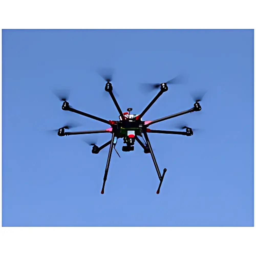
EcoDrone Lightweight Airborne LiDAR System
| Origin | Shaanxi, China |
|---|---|
| Manufacturer Type | Distributor |
| Origin Category | Domestic |
| Model | EcoDrone |
| Price | USD 42,000 (FOB) |
Overview
The EcoDrone Lightweight Airborne LiDAR System is an integrated unmanned aerial survey platform engineered for high-precision, field-deployable topographic and ecological remote sensing. Built upon the proprietary EcoDrone UAS-8 multirotor UAV platform, it integrates industrial-grade LiDAR sensors—either the Velodyne Puck Lite (SCOUT configuration) or Riegl miniVUX (miniRANGER configuration)—with synchronized GNSS/IMU navigation, enabling direct georeferenced point cloud acquisition without ground control points in many operational scenarios. Unlike traditional airborne LiDAR systems requiring manned aircraft, heavy payloads (>100 kg), and multimillion-dollar capital investment, the EcoDrone system operates on a lightweight, modular architecture compliant with Class I laser safety standards (905 nm, eye-safe), delivering sub-decimeter vertical accuracy and scalable point density across variable terrain and vegetation structures. Its core measurement principle relies on time-of-flight (ToF) laser ranging coupled with real-time kinematic (RTK) GNSS positioning and inertial measurement unit (IMU) attitude compensation—ensuring robust performance in forested, mountainous, and low-visibility environments typical of ecological monitoring and environmental assessment missions.
Key Features
- Modular UAV platform (EcoDrone UAS-8): max takeoff weight ≥15 kg, payload capacity ≥5 kg, symmetrical wheelbase 1200 mm, foldable landing gear, and vibration-isolated sensor mounting interface
- Dual-sensor compatibility: supports concurrent integration of LiDAR + multispectral, hyperspectral, thermal infrared, or RGB imaging payloads
- Flight endurance: ≥50 min hover time (no payload), ≥30 min effective mission duration with multispectral camera; cruise speed 10 m/s
- Navigation: dual-frequency GPS/BeiDou RTK module with 1 cm + 1 ppm horizontal accuracy; barometric + ultrasonic altimetry (1 cm precision within 10 m AGL)
- Real-time telemetry & FPV: dual-path (analog + digital) 5.8 GHz HD video transmission up to 5 km; 4K RGB camera (16 MP, f/2.8, 120° HFOV) with optional Sony A6000 mount
- Ground station: ruggedized laptop-based control software supporting Google/Bing/AMap basemaps, automated flight planning, live telemetry overlay (position, altitude, temperature, solar radiation, surface temp), and follow-me mode
- Power system: 22,000 mAh smart battery pack, dual-channel 1400 W charger, 12 A max charging current
Sample Compatibility & Compliance
The EcoDrone LiDAR system is designed for operational compliance with international geospatial data acquisition standards. It supports post-processing kinematic (PPK) and real-time kinematic (RTK) workflows aligned with ISO 19115 metadata requirements and ASTM E2847-21 (Standard Practice for Geospatial Data Quality Assessment). Sensor configurations meet IEC 60825-1:2014 Class 1 laser safety certification. The system enables rapid deployment in ecologically sensitive zones—including protected forests, wetlands, and archaeological sites—without requiring runway infrastructure or FAA Part 107 or EASA Open Category exemptions for sub-25 kg operations in most jurisdictions. All collected point clouds are compatible with LAS/LAZ 1.4 format and conform to ASPRS LiDAR data exchange specifications. Calibration procedures follow NIST-traceable protocols for range, angular resolution, and IMU bias estimation.
Software & Data Management
The system ships with a validated workflow suite including proprietary UAV mission planning software and third-party interoperable tools for LiDAR data processing. Raw GNSS/IMU logs and LiDAR point streams are time-synchronized via internal hardware timestamping (microsecond resolution) and exported in standard formats (e.g., .ubx, .imu, .csv, .las). Point cloud classification, filtering, and DSM/DTM generation are supported through open APIs compatible with CloudCompare, LAStools, and ArcGIS Pro. For regulatory traceability, all processing steps—including coordinate transformation, noise removal, and ground classification—can be logged with audit-ready metadata per ISO/IEC 17025:2017 clause 7.7. Optional modules support FDA 21 CFR Part 11-compliant electronic signatures and GLP/GMP-aligned data integrity controls for environmental impact assessment reports submitted to EPA, EU EEA, or national environmental agencies.
Applications
- Terrain mapping at scales up to 1:500, validated against RTK ground truth with vertical RMSE ≤3.7 cm
- Urban 3D modeling: building façade extraction, roofline reconstruction, and volumetric change detection over time
- Forestry inventory: canopy height model (CHM) derivation, biomass estimation, and understory penetration analysis using multi-echo returns
- Agricultural monitoring: crop height profiling, drainage pattern identification, and precision irrigation zone delineation
- Glaciology and snowpack characterization: seasonal elevation change detection (dH/dt) with millimeter-level repeatability
- Landslide and slope instability monitoring: differential point cloud comparison (DEM differencing) with sub-pixel registration accuracy
- Cultural heritage documentation: non-invasive 3D recording of archaeological sites, rock art, and historic structures under dense vegetation
FAQ
What is the maximum operational altitude above ground level (AGL) for optimal point cloud density?
For SCOUT (Velodyne Puck Lite), recommended AGL is 20–60 m; for miniRANGER (Riegl miniVUX), optimal AGL ranges from 30–100 m depending on required point spacing and terrain complexity.
Does the system support direct georeferencing without ground control points (GCPs)?
Yes—when equipped with RTK GNSS and calibrated IMU, the system achieves <5 cm horizontal and <10 cm vertical absolute accuracy in open-sky conditions, meeting ASPRS accuracy class 1 specifications for topographic mapping.
Can the UAV carry both LiDAR and thermal infrared sensors simultaneously?
Yes—the UAS-8 platform features dual-mount interfaces and independent power/data routing, enabling synchronous acquisition of LiDAR point clouds and radiometric thermal imagery for integrated eco-physiological analysis.
Is raw LiDAR data export compatible with industry-standard processing pipelines?
All raw sensor outputs (LiDAR hits, GNSS epochs, IMU quaternions) are timestamped and exported in ASCII, binary, or LAS/LAZ formats, fully interoperable with OPALS, TerraScan, PDAL, and QGIS-based open-source toolchains.
What maintenance and recalibration intervals are recommended for field-deployed units?
Annual IMU and GNSS antenna phase center calibration is advised; laser rangefinder zero-offset verification every 200 flight hours; full system validation against known control targets every 6 months per ISO/IEC 17025 quality management guidelines.
Related Products