HUANKONG GHK-510U UAV-Mounted Greenhouse Gas Monitor with TDLAS Technology
| Brand | HUANKONG |
|---|---|
| Origin | Shandong, China |
| Manufacturer Type | Original Equipment Manufacturer (OEM) |
| Country of Manufacture | China |
| Model | GHK-510U |
| Pricing | Available Upon Request |
| Detection Principle | Tunable Diode Laser Absorption Spectroscopy (TDLAS) |
| Target Gases | CO₂, CH₄, N₂O (customizable multi-gas configurations available) |
| Operating Temperature | −20 °C to +60 °C |
| Relative Humidity | <90% RH (non-condensing) |
| Ambient Pressure Range | 80–116 kPa |
Overview
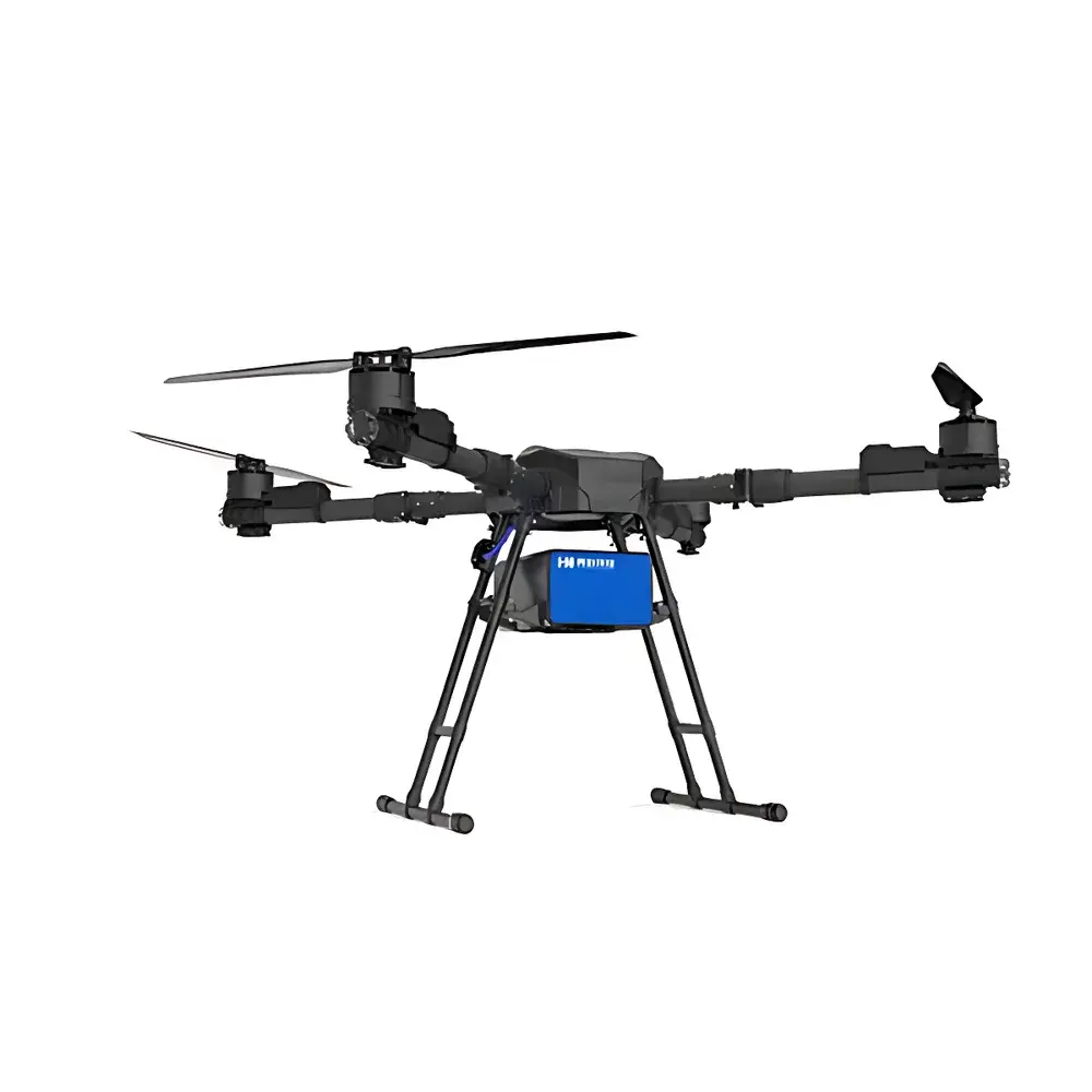
The HUANKONG GHK-510U UAV-Mounted Greenhouse Gas Monitor is an integrated airborne remote sensing platform engineered for quantitative, in-situ atmospheric trace gas measurement using Tunable Diode Laser Absorption Spectroscopy (TDLAS). Unlike passive optical sensors or broad-band IR analyzers, the GHK-510U employs wavelength-scanned narrow-linewidth distributed feedback (DFB) semiconductor lasers to target rovibrational absorption lines of greenhouse gases—specifically CO₂ (near 2.004 µm), CH₄ (near 1.653 µm or 2.309 µm), and N₂O (near 4.5 µm)—with sub-ppb detection sensitivity and high spectral resolution (<0.001 cm⁻¹). The system operates on the Beer–Lambert law, deriving column density and mixing ratio through direct absorption fitting of calibrated line shapes under variable pressure and temperature conditions. Designed for deployment on medium-class multirotor or fixed-wing UAVs (payload capacity ≥2.5 kg), it delivers spatially resolved vertical and horizontal concentration profiles across heterogeneous terrain—including landfills, agricultural fields, industrial perimeters, and riparian zones—without ground-based infrastructure.
Key Features
- Real-time, dual-channel TDLAS detection architecture supporting simultaneous CO₂, CH₄, and N₂O quantification with <1-second response time and <±2% full-scale repeatability
- Ruggedized carbon-fiber airframe with IP54-rated environmental enclosure, optimized for vibration damping and thermal stability during flight
- Integrated high-precision GNSS/INS navigation module (RTK-capable, ≤10 cm horizontal positional accuracy) synchronized with laser acquisition timing at 10 Hz
- Dual-mode telemetry: low-latency analog video + digital sensor data stream via 900 MHz spread-spectrum radio (up to 15 km LOS range) and optional 4G/LTE fallback
- Onboard edge-processing unit running embedded Linux, enabling real-time spectral baseline correction, water vapor cross-interference compensation, and plume centroid localization
- Modular laser source design: field-swappable DFB laser cartridges allow rapid reconfiguration for additional target species (e.g., NH₃, CO, H₂S) without hardware redesign
Sample Compatibility & Compliance
The GHK-510U is validated for open-path atmospheric sampling in ambient air matrices under ISO 14644-1 Class 8 cleanroom-equivalent particulate conditions. It complies with ASTM D6522–22 (Standard Test Method for Determination of Nitrogen Oxides, Carbon Monoxide, and Oxygen in Emissions from Stationary Sources by Continuous Emission Monitoring Systems) for calibration traceability and meets functional requirements outlined in EPA Method TO-11A for methane monitoring. While not certified for regulatory compliance reporting under 40 CFR Part 60 or EN 15267, its measurement uncertainty budget (k=2) is characterized per ISO/IEC 17025:2017 Annex A.3 guidelines and supports GLP-aligned field validation protocols including co-located reference analyzer intercomparison and zero/span drift verification every 72 operational hours.
Software & Data Management
Data acquisition and post-processing are managed via HUANKONG’s proprietary AeroGas Suite v3.2—a desktop application compatible with Windows 10/11 and Ubuntu 22.04 LTS. The software provides automated flight mission planning (KML import/export), synchronized georeferencing of spectral datasets, and batch processing of differential absorption line intensities using Voigt profile fitting algorithms. All raw interferograms, calibrated concentration time-series, and metadata (GPS timestamp, attitude quaternion, barometric pressure, ambient temperature) are stored in HDF5 format with embedded CF-1.8 conventions. Audit trails, user authentication, and electronic signature support comply with FDA 21 CFR Part 11 requirements when deployed in regulated environmental monitoring programs.
Applications
- Point-source emission quantification from oil & gas infrastructure (well pads, compressor stations, flares)
- Diffuse flux mapping over rice paddies, manure lagoons, and municipal solid waste landfills
- Urban background gradient analysis and boundary-layer transport modeling
- Emergency response to accidental releases (e.g., pipeline ruptures, biogas facility leaks)
- Validation of satellite-based greenhouse gas retrievals (e.g., OCO-2/3, Sentinel-5P TROPOMI)
- Long-term trend monitoring in ecological observatories and national atmospheric monitoring networks
FAQ
What is the minimum detectable concentration for CH₄ using the GHK-510U?
The system achieves a 1σ noise-equivalent concentration of ≤0.5 ppb for CH₄ over a 1-Hz integration time under standard atmospheric conditions (101.3 kPa, 25 °C, 40% RH).
Can the GHK-510U operate autonomously beyond visual line of sight (BVLOS)?
Yes—when integrated with certified UAS traffic management (UTM) systems and operated under national BVLOS regulatory frameworks (e.g., EASA STS-02, FAA Part 107.315), the platform supports pre-programmed grid missions up to 50 km radius with redundant comms fail-safes.
Is factory calibration traceable to NIST standards?
All laser wavelength references are calibrated against NIST-traceable hollow-cathode lamp emission lines; gas-phase calibrations use CRM-certified permeation tubes (NIST SRM 1662a for CH₄, SRM 1661b for CO₂) with uncertainty ≤1.2%.
Does the system support third-party GIS integration?
Yes—GeoJSON, Shapefile, and WMS/WFS export modules enable seamless ingestion into ArcGIS Pro, QGIS, and ENVI for spatial statistics, plume dispersion modeling (e.g., CALPUFF coupling), and regulatory reporting dashboards.
Related Products


