MSP3 OM-EC-pH Mobile Soil Mapping System
| Origin | USA |
|---|---|
| Manufacturer Type | Authorized Distributor |
| Origin Category | Imported |
| Model | MSP3 OM-EC-pH |
| Price | USD 70,000 |
| Instrument Type | Multifunctional In-Situ Soil Analyzer |
Overview
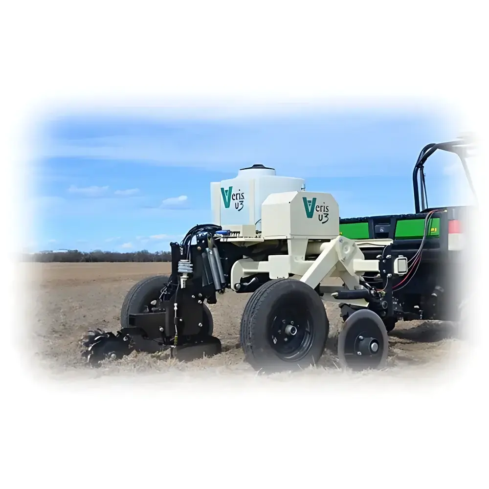
The MSP3 OM-EC-pH Mobile Soil Mapping System is an integrated, vehicle-mounted geospatial soil characterization platform engineered for high-resolution, real-time in-situ measurement of three critical soil physicochemical parameters: electrical conductivity (EC), pH, and organic matter (OM) content. Unlike conventional lab-based or handheld point-sampling instruments, the MSP3 employs a synchronized multi-sensor architecture mounted on a ruggedized Mobile Sensor Platform (MSP), enabling continuous, centimeter-accurate spatial profiling across agricultural fields, rangelands, and ecological restoration sites. Its core measurement methodology combines visible-near infrared (VIS-NIR) reflectance spectroscopy (400–1000 nm) for rapid OM estimation, galvanic-contact EC sensing via four-electrode array for bulk soil conductivity (0–200 mS/m range), and solid-state ISFET-based pH sensing with temperature compensation (pH 3.5–9.5). All measurements are time-stamped and georeferenced using a sub-meter RTK-GNSS receiver (optional PPK upgrade available), ensuring traceable, GIS-ready data acquisition aligned with ISO 11277 and ASTM D4292 standards for field soil characterization.
Key Features
- Integrated tri-sensor fusion: VIS-NIR spectrometer (256-channel, 1 nm resolution), dual-depth EC probe (0–30 cm and 0–60 cm configurable), and drift-compensated ISFET pH sensor
- Real-time GPS-aided mapping: Built-in RTK-GNSS module delivers ≤10 cm horizontal positional accuracy under open-sky conditions; supports NMEA 0183 and RTCM 3.3 protocols
- Field-deployable architecture: IP67-rated sensor housing, hydraulic downforce control (10–50 kg adjustable), and vibration-dampened mounting compatible with ATVs, UTVs, and compact tractors
- Onboard edge processing: ARM Cortex-A72 processor runs embedded Linux OS; performs real-time spectral calibration, EC temperature correction (based on ASTM D2777), and pH buffer validation
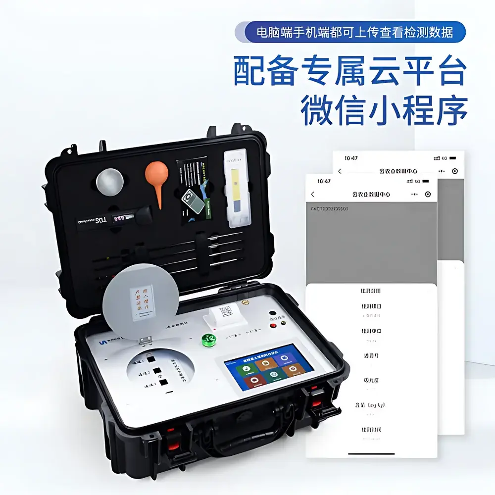
- Modular data logging: Internal 128 GB SSD + optional 4G LTE/Wi-Fi 6 telemetry; supports CSV, GeoJSON, and ESRI Shapefile export formats
- Calibration traceability: Factory-calibrated against NIST-traceable EC standards (KCl solutions) and IUPAC-recommended pH buffers; includes onboard verification routines per ISO/IEC 17025 guidelines
Sample Compatibility & Compliance
The MSP3 OM-EC-pH is validated for direct contact measurement in mineral soils (sand to clay loam), volcanic ash soils, and amended organic substrates (e.g., compost-amended fields), with operational limits defined by USDA Soil Survey Handbook criteria. It excludes frozen, waterlogged (>30% volumetric moisture), or highly rocky surfaces (>15% stone cover >2 cm diameter). The system complies with electromagnetic compatibility requirements per FCC Part 15 Class B and CE EN 61326-1 for industrial environments. Data integrity adheres to ALCOA+ principles (Attributable, Legible, Contemporaneous, Original, Accurate, Complete, Consistent, Enduring, Available) as required under GLP and GMP-aligned environmental monitoring frameworks. All firmware and software updates follow FDA 21 CFR Part 11-compliant audit trail protocols.
Software & Data Management
The proprietary FieldMap Studio v4.2 software suite provides end-to-end workflow support—from mission planning and sensor configuration to geostatistical interpolation (ordinary kriging, inverse distance weighting) and thematic map generation. Raw spectra undergo Savitzky-Golay smoothing and multiplicative scatter correction prior to partial least squares regression (PLSR) modeling for OM quantification (R² ≥ 0.89 vs. loss-on-ignition reference). EC and pH datasets are automatically corrected for soil temperature (using van’t Hoff equation implementation per ISO 11265) and electrode aging drift. Export modules generate ISO 19115-compliant metadata records and support direct integration with Farm Management Information Systems (FMIS) via AgGateway ADAPT API. Audit logs record all user actions, parameter changes, and calibration events with digital signatures.
Applications
- Precision agriculture: Variable-rate application (VRA) prescription mapping for lime, gypsum, and organic amendments based on spatial pH and EC gradients
- Soil carbon monitoring: High-density OM mapping for baseline establishment and annual change detection in SOC sequestration projects compliant with Verra VM0042 and Plan Vivo methodologies
- Salinity management: Identification of saline intrusion zones and irrigation-induced sodicity risk assessment in coastal and arid-zone agriculture
- Environmental site assessment: Rapid reconnaissance of contaminated land (e.g., metal-impacted soils where EC anomalies correlate with ionic load)
- Land use planning: Integration with digital elevation models (DEMs) and soil taxonomy layers to support USDA NRCS SSURGO correlation and land capability classification
- Research validation: Ground-truthing of satellite-derived soil property estimates (e.g., Sentinel-2 NDVI/NDWI composites) at field scale
FAQ
What depth ranges do the EC and pH sensors measure?
The standard configuration measures EC at two depths: 0–30 cm (shallow root zone) and 0–60 cm (deep profile), while pH is measured at 0–20 cm depth using a retractable ISFET probe.
Can the system operate in wet or muddy conditions?
Yes—IP67-rated electronics and sealed optical windows permit operation in light rain and damp soil; however, sustained immersion or operation in standing water >5 cm depth is not recommended.
Is spectral calibration required before each survey?
No—factory-installed white reference tile enables automatic dark/light calibration at startup; field recalibration is only necessary after sensor cleaning or extreme thermal cycling (>40°C ambient shift).
How does the system handle soil heterogeneity during motion-based sampling?
The MSP3 uses adaptive sampling logic: data points are acquired at 1 Hz minimum, with positional interpolation applied between GNSS fixes to maintain ≤1 m spatial resolution even at 15 km/h vehicle speed.
Does the software support third-party GIS platforms?
Yes—exported GeoTIFF, Shapefile, and GeoJSON layers are fully compatible with QGIS, ArcGIS Pro, and Google Earth Engine; coordinate systems include WGS84, NAD83, and local UTM zones.
Related Products