SNOWFOX Regional Snow Water Equivalent and Snow Depth Analyzer
| Origin | USA |
|---|---|
| Manufacturer Type | Distributor |
| Origin Category | Imported |
| Model | SNOWFOX |
| Price | Upon Request |
Overview
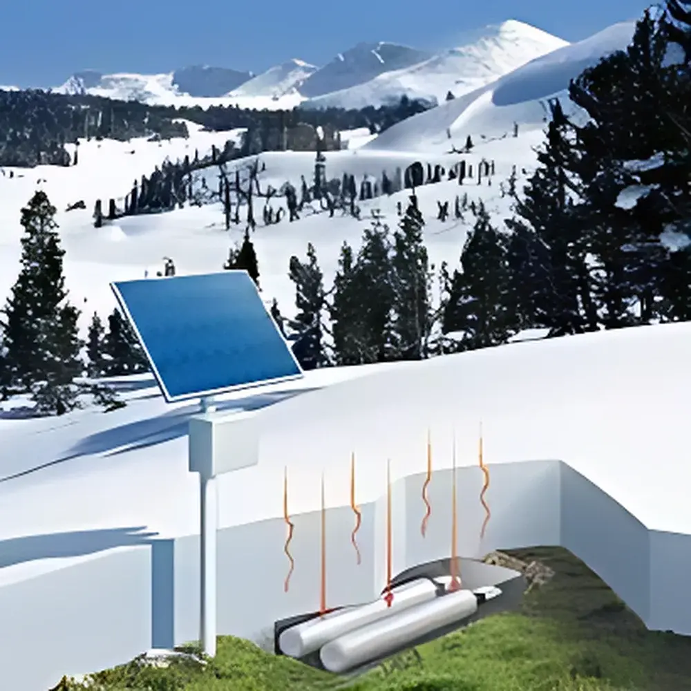
The SNOWFOX Regional Snow Water Equivalent (SWE) and Snow Depth Analyzer is a field-deployable, passive cosmic-ray neutron sensing system engineered for high-accuracy, non-invasive measurement of integrated snowpack water content across intermediate spatial scales (typically 100–500 m radius). It operates on the well-established principle of cosmic-ray neutron sensing (CRNS), leveraging naturally occurring secondary neutrons generated by galactic cosmic rays interacting with Earth’s atmosphere. As these epithermal and thermal neutrons traverse the atmosphere and near-surface environment, they undergo elastic scattering—primarily with hydrogen nuclei—resulting in energy loss and directional change. The intensity of downward-directed low-energy neutrons measured at the sensor location exhibits an inverse exponential relationship with the total hydrogen mass in the footprint, dominated by snowpack liquid water equivalent. This physical basis enables robust, continuous SWE estimation without physical intrusion, calibration drift, or dependence on snow crystal structure, density gradients, or surface albedo—factors that limit traditional point-scale methods such as snow pillows, ultrasonic depth sensors, or manual snow cores.
Key Features
- Passive, radiation-free detection: No radioactive sources or active emitters; fully compliant with IAEA safety guidelines for unattended field deployment.
- Non-contact, non-destructive operation: Sensor remains above snow surface; no mechanical penetration, no disturbance to snow stratigraphy or melt dynamics.
- Topography-agnostic deployment: Validated performance on slopes up to 45°, within dense coniferous canopies (>80% canopy closure), and on rocky or uneven terrain where conventional instrumentation fails.
- Low-power architecture: Nominal operating current of 95 mA at 12 VDC; compatible with off-grid solar-charged battery systems (e.g., 20–50 W panel + 50 Ah LiFePO₄).
- Flexible temporal resolution: Configurable data acquisition intervals from 1 minute to 1 year; default operational mode: hourly SWE/depth estimation with atmospheric correction.
- Integrated environmental compensation: Onboard barometric pressure, air temperature, and relative humidity sensors enable real-time correction for atmospheric neutron modulation effects per standard CRNS protocols (e.g., Desilets et al., 2010; Zreda et al., 2012).
Sample Compatibility & Compliance
The SNOWFOX analyzer is designed for continuous, unattended operation in remote alpine, subarctic, and boreal environments. It complies with IEC 60529 IP67 enclosure rating for dust/water ingress protection and operates across –30 °C to +50 °C ambient temperature ranges. Its passive neutron detection methodology satisfies ISO 17025 traceability requirements when paired with certified reference neutron monitors and calibrated atmospheric correction models. Data outputs adhere to FAO-UNESCO Soil Moisture Monitoring Network metadata standards and are interoperable with NASA’s SMAP and ESA’s Sentinel-3 snow products for validation workflows. The system supports GLP-compliant audit trails via timestamped SD card logging and optional GSM/Iridium transmission with TLS 1.2 encryption.
Software & Data Management
Data acquisition and preprocessing are handled by embedded firmware compliant with the COSMOS-EP (Cosmic-ray Soil Moisture Observing System – Enhanced Processing) v3.2 framework. Raw neutron counts, corrected SWE (kg/m²), effective snow depth (cm), and ancillary meteorological variables are output in NetCDF-4 format with CF-1.8 metadata conventions. Local storage uses industrial-grade microSD cards (up to 128 GB); remote retrieval is supported via configurable HTTP POST, MQTT, or FTPS protocols. Optional cloud integration includes compatibility with NOAA’s NWIS Web Services and the CUAHSI HydroShare repository. All firmware updates and configuration changes require digital signature verification to meet FDA 21 CFR Part 11 electronic record integrity requirements.
Applications
- Hydrological modeling input: High-temporal-resolution SWE time series for calibration/validation of SWAT, VIC, and PRMS basin-scale runoff simulations.
- Climate reanalysis assimilation: Ground-truth constraints for ECMWF ERA5-Land and NASA MERRA-2 snow state variables.
- Remote watershed monitoring: Long-term SWE trends in data-sparse regions (e.g., Himalayas, Andes, Arctic tundra) supporting IPCC AR6 cryosphere assessments.
- Operational avalanche forecasting: Integration with regional avalanche centers’ decision support systems via standardized OGC SensorThings API endpoints.
- Validation of satellite snow products: Direct comparison against MODIS Snow Cover Area and Grain Size (MODSCAG), Sentinel-2 NDSI, and ICESat-2 ATL06 elevation-derived snow depth.
FAQ
How does SNOWFOX differentiate between snow water equivalent and soil moisture contributions?
It applies altitude- and vegetation-corrected footprint weighting functions derived from Monte Carlo N-Particle (MCNP) neutron transport simulations, isolating the snow-dominated signal layer (typically 0–1.5 m vertical extent) while attenuating deeper soil moisture influence.
Is site-specific calibration required?
No factory calibration is needed; however, initial site characterization—including effective hydrogen pool inventory (soil organic carbon, bedrock moisture, vegetation water content)—is performed during installation using the built-in calibration wizard and referenced to local neutron monitor baselines.
Can the system operate during heavy snowfall or blizzard conditions?
Yes—its passive detection is unaffected by precipitation phase, wind-driven snow transport, or cloud cover; onboard tilt and vibration sensors flag periods of potential sensor displacement for data quality flagging.
What is the typical spatial integration scale?
The measurement footprint radius ranges from ~150 m in deep snowpacks (>2 m SWE) to ~400 m in shallow, dry snow conditions, following the universal CRNS radius–hydrogen-mass relationship described in Rosolem et al. (2018).
Does SNOWFOX support co-location with other environmental sensor networks?
Yes—it provides synchronized UTC timestamps and supports NTP client mode; analog/digital I/O ports allow daisy-chaining with Campbell Scientific CR1000X or Onset HOBO microstations for unified metadata management.
Related Products


