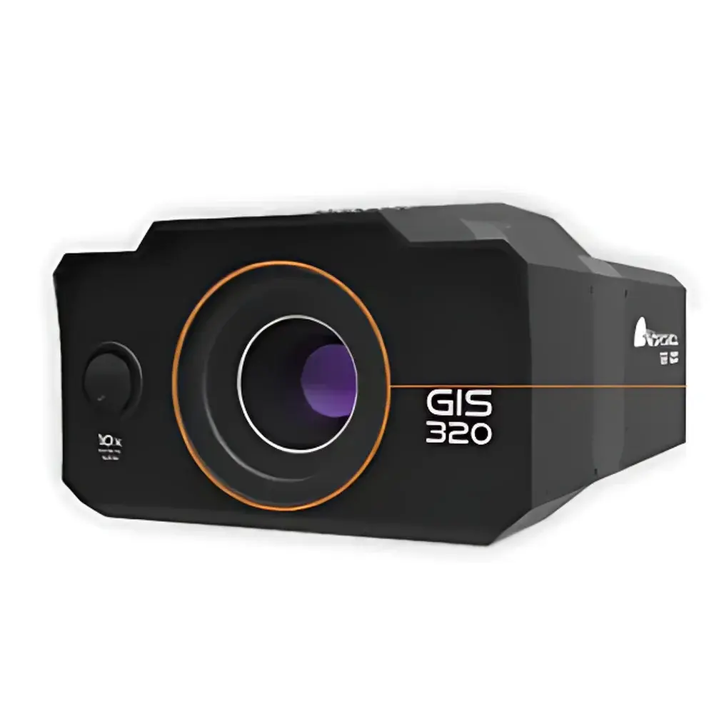
Workswell GIS-320 Gas Imaging Infrared Thermal Camera
| Brand | Workswell |
|---|---|
| Origin | Czech Republic |
| Model | GIS-320 |
| Detector Type | Cooled InSb Focal Plane Array (FPA) |
| Spectral Range | 3.2–3.4 µm |
| Thermal Sensitivity (NETD) | ≤15 mK @ 30 Hz |
| Temperature Range | –20 °C to +350 °C (configurable) |
| Spatial Resolution | 320 × 240 pixels |
| Frame Rate | 30 Hz |
| FOV Options | 24° × 18° or 14.5° × 10.8° |
| Autofocus Minimum Distance | 0.5 m |
| Digital Zoom | 1–14× |
| RGB Camera Resolution | 1920 × 1080 px |
| Video Output | HDMI 720p (1280 × 720) |
| Image Formats | JPEG/TIFF (IR), JPEG (RGB) |
| Data Interfaces | CAN bus, PWM, S.BUS, USB 2.0 |
| GPS Triggering | MavLink-compatible, external GPS support via CAN |
| Onboard Storage | 64 GB SSD |
| Power Input | 10–28 VDC, 18 W |
| Dimensions | 201 × 150 × 105 mm |
| Weight | <1.6 kg |
| Operating Temperature | –15 °C to +50 °C |
Overview
The Workswell GIS-320 is a purpose-built, cooled mid-wave infrared (MWIR) thermal imaging camera engineered for optical gas imaging (OGI) and quantitative leak detection in industrial, environmental, and security applications. Unlike broadband thermal cameras, the GIS-320 operates within a narrow spectral band (3.2–3.4 µm), optimized to detect absorption signatures of volatile organic compounds (VOCs) and hydrocarbon gases—including methane, propane, ethylene, benzene, toluene, and butane—based on their characteristic molecular vibrational transitions. Its core sensing element is a high-stability, thermoelectrically cooled indium antimonide (InSb) focal plane array, delivering exceptional thermal contrast resolution (NETD ≤15 mK at 30 Hz) and enabling reliable visualization of subtle radiometric anomalies induced by gas plumes against ambient backgrounds. Designed for integration into unmanned aerial systems (UAS), the GIS-320 meets stringent size, weight, and power (SWaP) constraints while maintaining laboratory-grade radiometric fidelity. Its real-time full-frame thermal video output (320 × 240 px, 30 Hz), synchronized with visible-light imaging and georeferenced metadata, supports traceable, auditable inspection workflows compliant with EPA OOOOa, LDAR, and ISO 17776 requirements.
Key Features
- Cooled InSb FPA detector with spectral bandpass centered at 3.3 µm—optimized for hydrocarbon gas absorbance peaks
- Thermal sensitivity of ≤15 mK enables detection of sub-ppm·m gas column densities under field conditions
- Dual-sensor architecture: co-registered 320 × 240 IR and 1920 × 1080 RGB imaging with pixel-level alignment
- Configurable temperature measurement range (–20 °C to +350 °C) with linear radiometric calibration traceable to NIST standards
- Auto-focus optics with 0.5 m minimum working distance and 1–14× digital zoom for targeted plume analysis
- Robust embedded interface suite: CAN bus (J1939/ISO 11898), PWM, S.BUS, USB 2.0, and HDMI 720p real-time video streaming
- Integrated GPS triggering via MavLink protocol; compatible with DJI A2/A3 flight controllers and third-party UAS autopilots
- Onboard 64 GB SSD for lossless storage of synchronized IR/RGB video, metadata, and geotagged thermal frames (JPEG/TIFF)
- Operating envelope validated from –15 °C to +50 °C, with shock/vibration resistance per MIL-STD-810G for airborne deployment
Sample Compatibility & Compliance
The GIS-320 is validated for qualitative and semi-quantitative detection of over 20 industrially relevant gases, including alkanes (methane, propane, butane, pentane, hexane, heptane, octane), alkenes (ethylene, propylene, 1-pentene), aromatics (benzene, toluene, xylenes, ethylbenzene), oxygenates (methanol, ethanol, acetone, MEK, MIBK), and isoprene. It does not require tracer gases or background subtraction algorithms—detection relies solely on passive MWIR absorption contrast. The system complies with IEC 62906-5-2 (laser-based gas detection interoperability), meets electromagnetic compatibility (EMC) requirements per EN 61326-1, and supports audit-ready data logging aligned with ISO/IEC 17025 documentation practices. While not certified as intrinsically safe, its design facilitates integration into Class I, Division 2 hazardous area inspection platforms when mounted externally with appropriate UAV shielding and isolation protocols.
Software & Data Management
Data acquisition and post-processing are supported through Workswell’s proprietary ThermoGIS desktop application (Windows 10/11), which provides time-synchronized playback of IR/RGB video, dynamic region-of-interest (ROI) temperature profiling, gas plume trajectory overlay using GPS telemetry, and export of calibrated radiometric datasets in HDF5 and CSV formats. All onboard recordings include embedded EXIF metadata: timestamp (UTC), GPS coordinates (WGS84), altitude, heading, pitch/roll, sensor temperature, and lens focus position. For enterprise deployment, the GIS-320 supports secure remote firmware updates and configuration management via encrypted USB or CAN bus. Audit trails—including user login, parameter changes, and image export events—are logged in accordance with GLP principles and may be configured to satisfy FDA 21 CFR Part 11 electronic record requirements when used in regulated environmental monitoring programs.
Applications
- Unmanned aerial vehicle (UAV)-based LDAR (leak detection and repair) surveys across oil & gas production sites, refineries, and petrochemical facilities
- Real-time fugitive emission monitoring during flaring, venting, and compressor station operations
- Perimeter security screening for concealed volatile substance transport or illicit chemical synthesis activities
- Environmental compliance verification for landfill gas migration and biogas plant integrity assessment
- R&D validation of gas dispersion models using georeferenced thermal plume mapping
- Emergency response situational awareness during chemical spills or pipeline ruptures
FAQ
What gases can the GIS-320 detect?
The GIS-320 detects gases with strong absorption features in the 3.2–3.4 µm band, including methane, propane, ethylene, benzene, toluene, methanol, acetone, and over 20 additional VOCs and hydrocarbons.
Is the GIS-320 suitable for quantitative concentration measurement?
It is primarily designed for qualitative and semi-quantitative plume visualization. Absolute concentration quantification requires supplementary calibration with known gas sources and atmospheric modeling.
Can it operate independently without a UAV?
Yes—the GIS-320 functions as a standalone thermal imager with tripod mounting capability, HDMI output, and onboard recording; however, its SWaP-optimized design maximizes utility in aerial deployments.
Does it support real-time video transmission to ground control stations?
Yes—via HDMI 720p output or digitized IR stream over USB 2.0; low-latency telemetry integration is enabled through CAN bus and MavLink-compatible GPS triggering.
How is radiometric calibration maintained in the field?
The cooled InSb detector undergoes automatic non-uniformity correction (NUC) at startup and during operation; factory calibration is traceable to NIST, and users may perform optional two-point blackbody verification using portable reference sources.