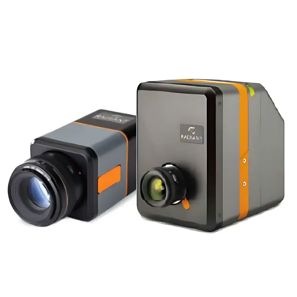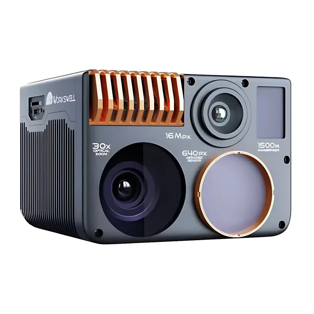
Workswell WIRIS Enterprise Airborne Multispectral Thermal Imaging System
| Brand | Workswell |
|---|---|
| Origin | Czech Republic |
| Model | WIRIS Enterprise |
| Operating Principle | Uncooled Microbolometer-Based Infrared Thermography |
| Measurement Method | Non-Contact Radiometric Imaging |
| Primary Application | High-Accuracy Aerial Temperature Mapping & Multispectral Surveillance |
| Detector Type | VOx Microbolometer FPA |
| Spectral Response Range | 7.5–13.5 µm (LWIR) |
| Thermal Sensitivity (NETD) | ≤30 mK @ 30°C |
| Infrared Resolution | 640 × 512 (native), up to 1266 × 1010 via Super-Resolution Mode |
| Visual Camera | 16 MP Fixed-Focus RGB + Full HD 30× Optical Zoom |
| Laser Rangefinder | 1500 m Class 1 Eye-Safe |
| Temperature Ranges | –40°C to +550°C (standard), optional ranges: –25°C to +150°C, +50°C to +1000°C, +400°C to +1500°C |
| Accuracy | ±2% of reading or ±2°C (whichever is greater) |
| Digital Zoom | 12× continuous |
| Field-of-View Options | Interchangeable lenses (e.g., 24°, 45°, 90° HFOV) |
| Real-Time Preview | Yes, via integrated HDMI/SDI and GigE Vision interface |
| Mounting Compatibility | Universal gimbal integration for multirotor & fixed-wing UAVs |
Overview
The Workswell WIRIS Enterprise is a high-performance, airborne multispectral thermal imaging system engineered for precision radiometric thermography in demanding aerial survey environments. Built around an uncooled vanadium oxide (VOx) microbolometer focal plane array operating in the long-wave infrared (LWIR) spectrum (7.5–13.5 µm), it delivers calibrated, quantitative surface temperature data without cryogenic cooling—ensuring low power consumption, mechanical robustness, and operational readiness across extended flight durations. Its core architecture integrates three synchronized imaging modalities: a radiometric thermal sensor (640 × 512 native resolution), a 16 MP high-fidelity RGB camera with fixed focus and global shutter, and a full HD 30× optical zoom camera with electronic image stabilization. Complementing these is a Class 1 eye-safe laser rangefinder (1500 m range) enabling georeferenced temperature annotation and distance-aware emissivity compensation. Designed explicitly for integration into unmanned aerial platforms—including both rotary-wing and fixed-wing UAVs—the WIRIS Enterprise supports real-time telemetry streaming, onboard metadata tagging (GPS, IMU, altitude, pitch/roll/yaw), and seamless synchronization with third-party flight control systems via MAVLink or custom serial protocols.
Key Features
- Radiometric accuracy certified to ±2% of reading or ±2°C (whichever is greater), traceable to NIST-traceable blackbody references during factory calibration.
- Thermal sensitivity (NETD) as low as 30 mK at 30°C ambient, enabling detection of subtle thermal gradients in structural integrity assessments or ecological monitoring.
- Super-resolution imaging mode enhances native 640 × 512 thermal data to 1266 × 1010 pixels using sub-pixel motion registration—ideal for post-flight forensic analysis of small targets or fine thermal anomalies.
- Multi-sensor time-synchronized capture: All three cameras (thermal, RGB, zoom) record timestamp-aligned frames at up to 30 Hz, preserving spatial and temporal fidelity for pixel-level fusion and AI-driven anomaly classification.
- Modular lens system supporting interchangeable wide-angle (90° HFOV), standard (45° HFOV), and telephoto (24° HFOV) optics—each calibrated for radiometric uniformity and geometric distortion correction.
- GigE Vision and HDMI 2.0 outputs enable direct connection to ground station PCs or embedded edge processors; supports GenICam-compliant configuration for automated deployment in industrial inspection workflows.
Sample Compatibility & Compliance
The WIRIS Enterprise is optimized for non-contact surface temperature measurement of diverse materials—including metals, composites, concrete, vegetation, and insulating surfaces—across variable emissivity conditions (ε = 0.1–0.99 adjustable). It complies with IEC 62906-5-2:2019 (laser safety), EN 62471 (photobiological safety), and CE marking requirements for airborne electromagnetic compatibility (EMC Directive 2014/30/EU). While not a medical device, its radiometric output meets ASTM E1933-19 standards for infrared thermography system performance verification. Data acquisition workflows support GLP/GMP-aligned audit trails when used with compliant software platforms (e.g., Workswell’s ThermoViewer Pro with configurable user roles, electronic signatures, and 21 CFR Part 11–compatible logging).
Software & Data Management
ThermoViewer Pro, the official desktop application, provides full radiometric analysis, emissivity mapping, ROI-based statistical reporting (min/max/mean/std dev), isotherm overlay, and dynamic temperature profiling across video sequences. Raw thermal data is stored in standardized 16-bit TIFF format with embedded EXIF metadata (including GPS coordinates, altitude, sensor gain, shutter time, and calibration coefficients), ensuring interoperability with GIS platforms (QGIS, ArcGIS), MATLAB, Python (OpenCV, scikit-image), and machine learning pipelines. Batch processing scripts support automated calibration drift correction, orthorectification (when paired with RTK-GNSS and SfM photogrammetry), and thermal mosaic generation. Firmware updates are delivered via secure HTTPS channel with SHA-256 signature verification.
Applications
- Industrial Infrastructure Monitoring: Detection of overheating joints in power transmission lines, thermal bridging in building envelopes, insulation degradation in refineries, and refractory wear in kilns/furnaces (up to +1500°C).
- Environmental & Ecological Research: Canopy temperature mapping for drought stress assessment, wetland evapotranspiration modeling, volcanic fumarole activity tracking, and wildlife thermoregulation studies.
- Firefighting & Emergency Response: Real-time hotspot identification through smoke, structural integrity evaluation during active suppression, and post-fire residual heat mapping for overhaul operations.
- Archaeological Prospection: Subsurface feature detection via differential thermal inertia—especially effective after sunrise/sunset transitions in arid climates.
- Forestry & Agriculture: Early detection of pest infestation (e.g., bark beetle), irrigation efficiency auditing, and precision burn severity classification following controlled burns.
FAQ
Is the WIRIS Enterprise compatible with DJI Matrice 300 RTK and Autel EVO Max series drones?
Yes—it features standardized Mavlink v2.0 integration and mechanical/electrical interfaces aligned with common UAV gimbal mounting standards (e.g., CAN bus, UART, PWM). Workswell provides documented SDKs and pre-validated integration packages for leading commercial drone platforms.
Can radiometric data be exported in CSV or JSON format for automated QA/QC pipelines?
Yes. ThermoViewer Pro supports export of per-frame temperature matrices, ROI statistics, and geotagged metadata in CSV, JSON, and HDF5 formats—enabling direct ingestion into CI/CD validation frameworks or cloud-based analytics engines.
Does the system support automatic emissivity correction based on material databases?
While emissivity must be manually set per scene for highest accuracy, ThermoViewer Pro includes a curated reference library (ASTM E1933, ISO 18434-1) with over 200 material-specific ε-values and spectral reflectance curves, along with guided emissivity estimation tools using reflected apparent temperature measurements.
What is the typical battery life when operating continuously on a UAV payload?
Power draw is ≤12 W at 12 V DC. When integrated with typical UAV power systems (e.g., 6S LiPo), operational endurance aligns with airframe flight time—typically 35–45 minutes depending on environmental conditions and sensor configuration.