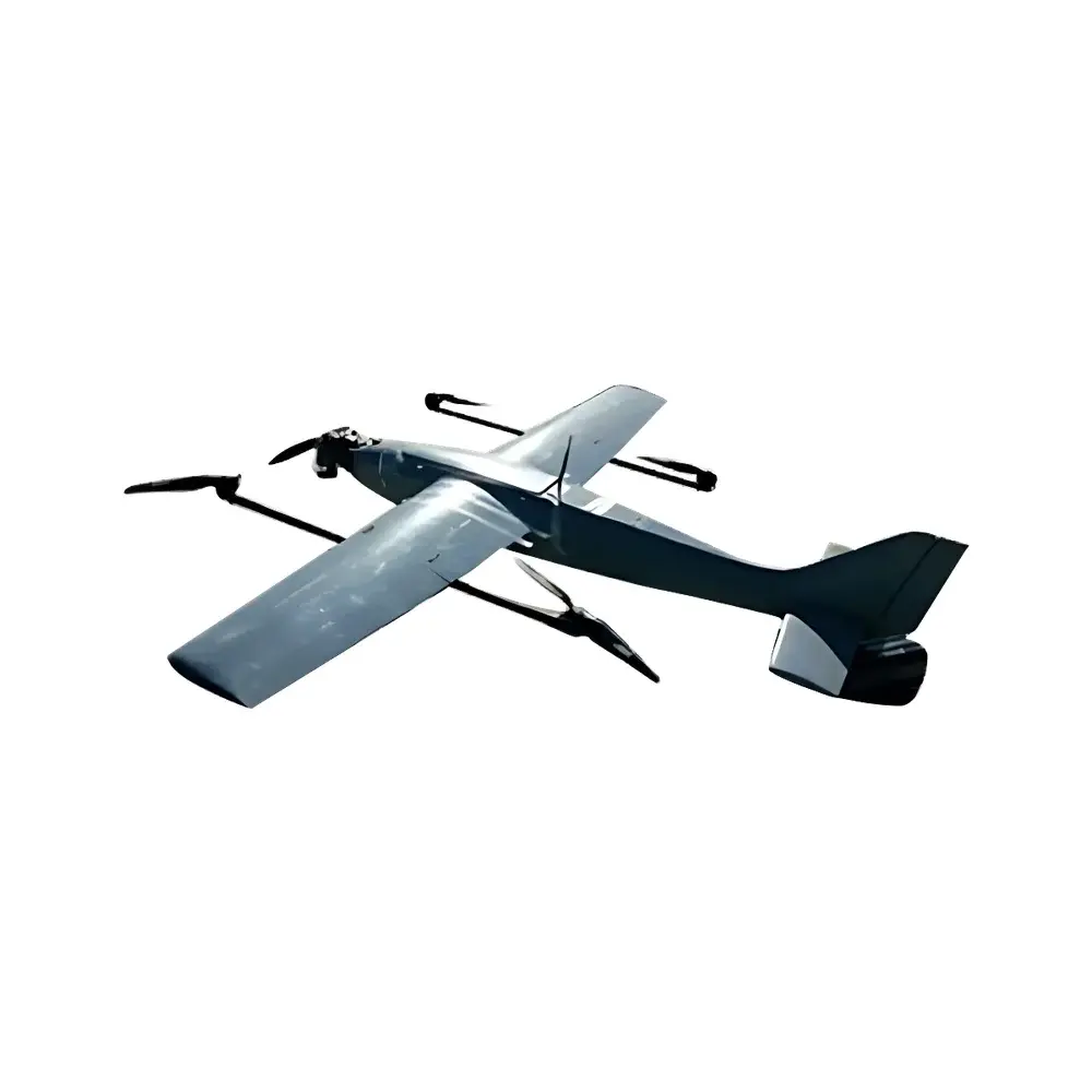
Pergam LMF Fixed-Wing Airborne Laser Methane Detection System
| Brand | Pergam |
|---|---|
| Origin | Switzerland |
| Model | LMF |
| Detection Range | 100 m |
| Measurement Range | 1–50,000 ppm·m |
| Sensitivity (at 30 m) | 10 ppm·m |
| Sensitivity (at 50 m) | 20 ppm·m |
| Sensitivity (at 70 m) | 80 ppm·m |
| Sensitivity (at 100 m) | 150 ppm·m |
| Real-Time Data Transmission | Yes |
| Onboard Data Storage | Yes |
| Integrated GPS | Yes |
| Laser Wavelength | 1.65 µm (eye-safe) |
| Dimensions | 130 × 95 × 140 mm |
| Weight | 1.7 kg |
Overview
The Pergam LMF Fixed-Wing Airborne Laser Methane Detection System is an integrated, eye-safe tunable diode laser absorption spectroscopy (TDLAS) instrument engineered for quantitative, path-integrated methane concentration mapping from fixed-wing unmanned aerial vehicles (UAVs). Operating at a precisely stabilized 1.65 µm wavelength—within the strong methane absorption band and compliant with IEC 60825-1 Class 1 laser safety requirements—the LMF system measures column-integrated methane concentration in units of ppm·m (parts-per-million-meter), enabling robust quantification of fugitive emissions across linear infrastructure. Designed for deployment on fixed-wing platforms achieving minimum airspeeds of 100 km/h, the LMF delivers continuous, georeferenced detection along pre-programmed flight paths, supporting large-scale pipeline integrity verification, landfill perimeter monitoring, and upstream oil & gas facility surveys.
Key Features
- Eye-safe 1.65 µm distributed feedback (DFB) laser source with narrow linewidth (<0.001 nm) and high wavelength stability over temperature and vibration
- Path-integrated methane measurement with calibrated sensitivity down to 10 ppm·m at 30 m standoff distance, scaling predictably with range per ISO 13864:2022 guidance for optical gas imaging systems
- Integrated high-precision GPS module (GNSS multi-constellation support) delivering sub-3 m CEP (Circular Error Probable) position tagging for each methane plume intercept
- Onboard microSD data logging with time-synchronized sensor telemetry, GPS coordinates, attitude metadata, and raw absorption spectra
- Real-time telemetry interface via RS-422 or Ethernet (optional) for integration with UAV autopilot systems and ground control stations
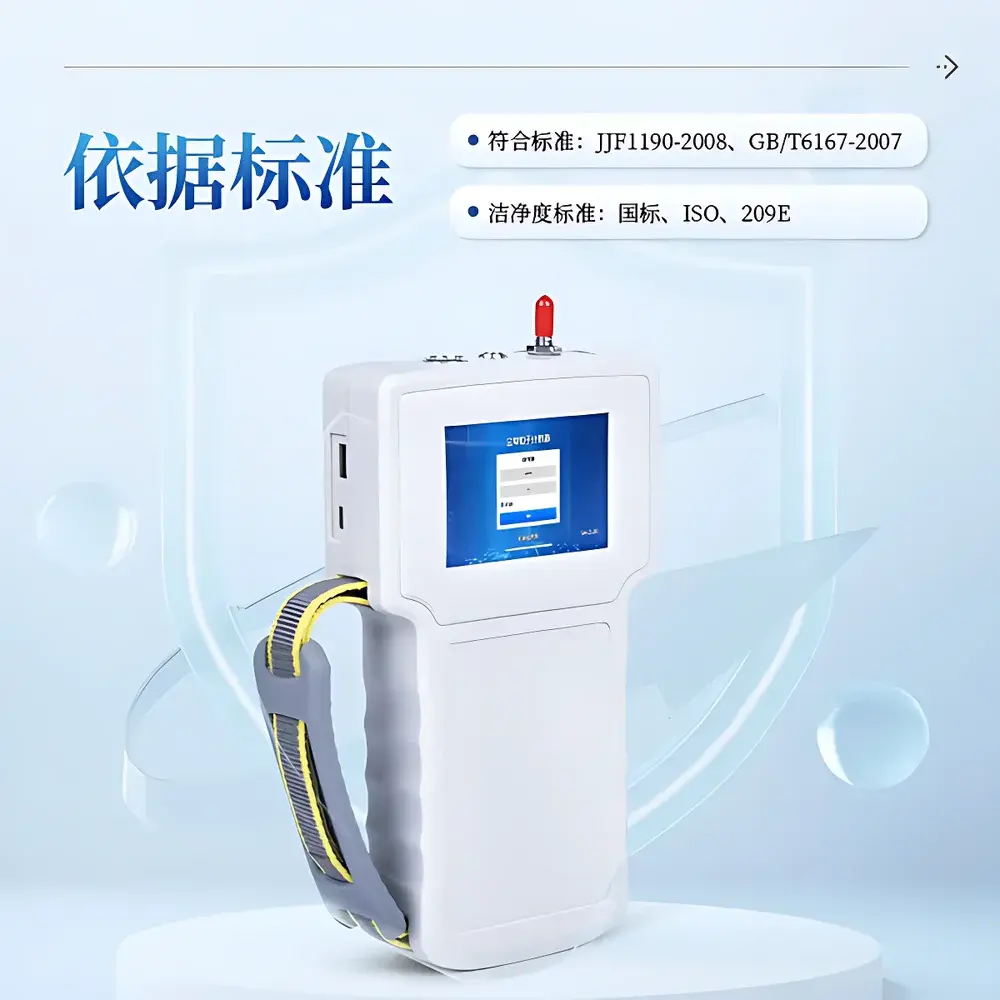
- Compact, ruggedized enclosure (130 × 95 × 140 mm; 1.7 kg) rated IP54 for operation in ambient temperatures from −20 °C to +55 °C
- Automated flight mode compatibility: supports waypoint-triggered acquisition, speed-gated sampling, and altitude-compensated concentration normalization
Sample Compatibility & Compliance
The LMF system detects methane (CH₄) selectively in open-air environments without sample extraction or conditioning. It is insensitive to water vapor interference within typical atmospheric humidity ranges (0–95% RH) due to spectral discrimination at 1.65 µm. The system complies with EU Directive 2014/30/EU (EMC), IEC 61000-6-2/6-3, and meets mechanical shock/vibration requirements per DO-160 Section 7 (Category A, Level C). While not certified as intrinsically safe, its Class 1 laser classification eliminates operational hazard concerns under normal use conditions. Data output formats adhere to OGC SensorML and GeoJSON standards, facilitating ingestion into GIS platforms used in regulatory reporting frameworks such as EPA OOOOa Subpart W or EU MRV for methane emissions.
Software & Data Management
Pergam provides the LMF Control & Analysis Suite (LCAS), a Windows-based application supporting mission planning, real-time telemetry visualization, post-flight plume localization, and concentration-path length deconvolution. LCAS generates standardized emission rate estimates using the cross-wind integrated mass balance method (per ASTM D7520-22 Annex A1) when paired with concurrent meteorological data. All measurement sessions include full audit trails: timestamped configuration files, firmware version logs, GPS ephemeris records, and raw detector voltage waveforms. Software supports 21 CFR Part 11-compliant user access controls, electronic signatures, and immutable data archiving—meeting GLP/GMP-aligned QA/QC requirements for environmental compliance monitoring.
Applications
- Long-distance natural gas transmission pipeline leak screening (≥100 km per flight)
- Upstream production site fugitive emission quantification (well pads, compressor stations, storage tanks)
- Landfill boundary flux mapping and hotspot prioritization
- Biogas facility leak detection and abatement verification
- Regulatory compliance reporting for methane mitigation programs (e.g., US EPA LDAR enhancements, EU Methane Strategy 2030)
- Academic research on atmospheric methane transport dynamics and source attribution modeling
FAQ
Does the LMF system require calibration gas during operation?
No. The LMF uses absolute spectroscopic calibration traceable to NIST-standard reference cells. Field zero checks are performed automatically using clean-air background measurements during flight.
Can the LMF distinguish methane from other hydrocarbons?
Yes. Its 1.65 µm wavelength targets a fundamental C–H stretch absorption line unique to methane, providing >100:1 selectivity over ethane, propane, and non-methane hydrocarbons per ISO 19732:2021 test methodology.
Is the system compatible with third-party flight controllers like Pixhawk or DJI A3?
Yes. Standard MAVLink-compatible telemetry protocols are supported via optional adapter modules; OEM integration kits include hardware abstraction layers for ArduPilot and PX4 firmware.
What is the minimum detectable emission rate (MDER) under typical survey conditions?
At 60 m altitude, 100 km/h ground speed, and 2 m/s cross-wind, the MDER is ≤1.2 g CH₄/h for continuous point sources, validated per EPA OTM-33A field testing protocol.
Does Pergam provide technical support for regulatory submission documentation?
Yes. Application engineers assist in generating validation reports, uncertainty budgets (GUM-compliant), and platform-specific installation qualification (IQ) documentation required for EPA, EEA, or national environmental agency submissions.
Related Products