Corning 410-Vis Hyperspectral Imaging System
| Brand | Corning |
|---|---|
| Origin | USA |
| Manufacturer Type | Authorized Distributor |
| Import Status | Imported |
| Model | 410-Vis |
| Spectral Range | 400–1000 nm |
| Spectral Resolution | 2 nm (with optional 2× binning) |
| Spatial Resolution | 682 × 80,000 pixels per hyperspectral cube (sub-cube extraction supported) |
| Instantaneous Field of View (IFOV) | ≤0.5 mrad (typical at 100 m altitude) |
| Total Field of View (TFOV) | 29.5° |
| Frame Rate | 100–300 Hz (user-selectable |
| Imaging Modality | Dispersive (Offner imaging spectrometer architecture) |
| Platform Compatibility | Ground-based and airborne (UAV/UAS, manned aircraft, tripod-mountable) |
| Detector | High-QE back-illuminated CMOS focal plane array |
| Optical Architecture | Patented solid-state Offner spectrometer with diamond-turned diffraction grating |
| Onboard Processing | Embedded real-time control, radiometric calibration pipeline, MEMS-based tightly coupled GPS/INS |
| Data Output Formats | Raw DN, radiometrically calibrated reflectance/Lρ, ENVI-compatible .hdr/.bil, GeoTIFF with embedded geotags |
Overview
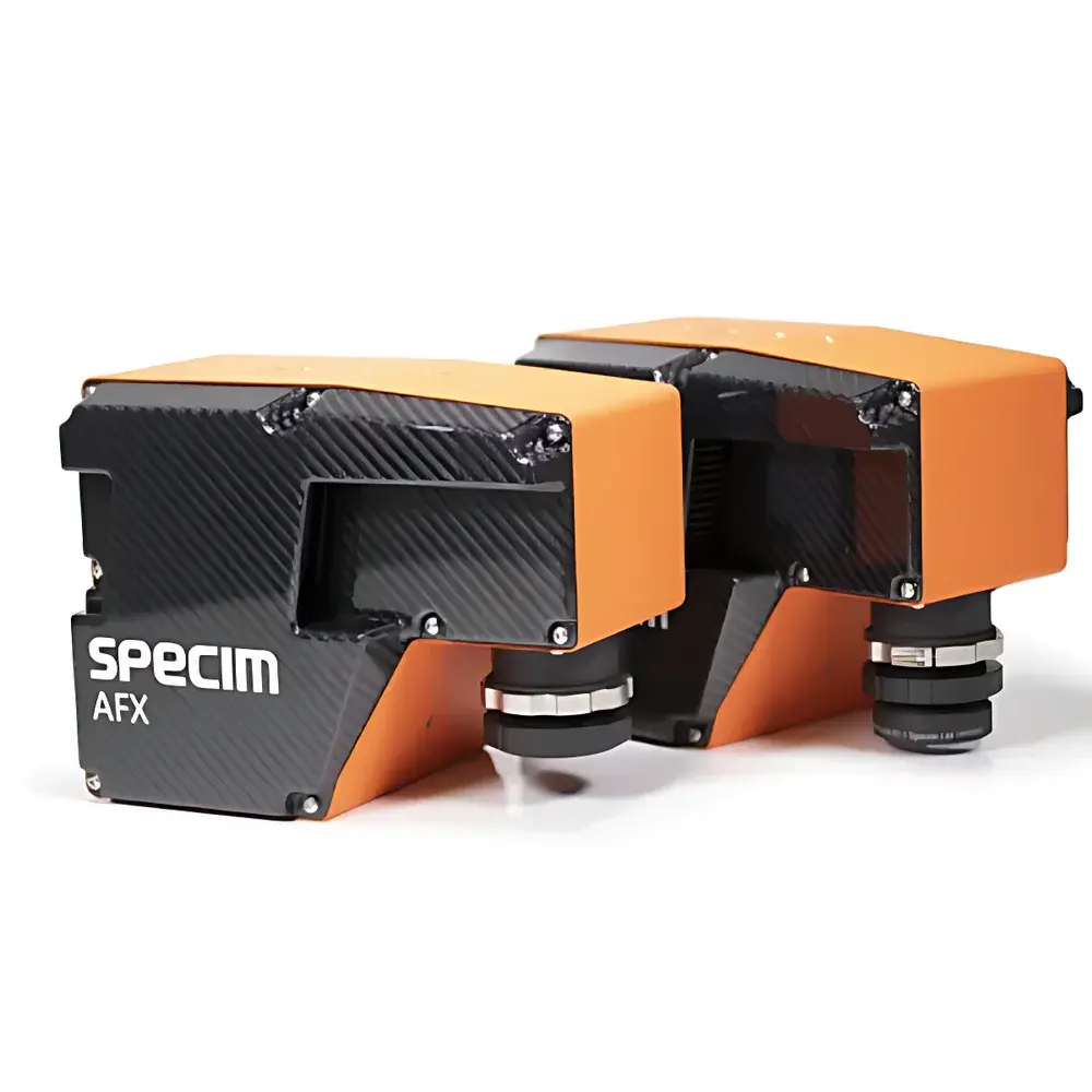
The Corning 410-Vis Hyperspectral Imaging System is a field-deployable, turnkey airborne and ground-based hyperspectral sensor engineered for scientific-grade spectral data acquisition across the visible to near-infrared (VNIR) spectrum (400–1000 nm). Built upon a dispersive Offner imaging spectrometer architecture, the system integrates a high-quantum-efficiency (QE > 85% at 550 nm), back-illuminated CMOS focal plane array with a precision diamond-turned diffraction grating — enabling high optical throughput, minimal stray light, and exceptional spectral fidelity. Unlike scanning or filter-wheel systems, the 410-Vis captures full hyperspectral cubes (682 spatial × 80,000 spectral elements per frame) in a single push-broom acquisition, ensuring pixel-aligned spatial-spectral registration without motion-induced misregistration artifacts. Its compact, ruggedized enclosure supports operation on UAVs (including Class I–III platforms), fixed-wing aircraft, terrestrial tripods, and mobile vehicle mounts — making it suitable for both operational remote sensing campaigns and controlled laboratory validation studies.
Key Features
- Dispersive Offner spectrometer with patented solid-state optical module and diamond-turned diffraction grating for high transmission efficiency (>75% avg. across 400–1000 nm) and low polarization sensitivity
- High-resolution push-broom detector: 682 spatial pixels × 80,000 spectral sampling points per cube; sub-cube region-of-interest (ROI) extraction supported in real time
- Spectral resolution of 2 nm (FWHM), with hardware-enabled 2× spectral binning for improved SNR in low-light or high-speed scenarios
- Real-time onboard radiometric calibration using integrated non-uniformity correction (NUC), dark current subtraction, and flat-field compensation
- Tightly coupled MEMS-based inertial navigation system (INS) with GNSS receiver, delivering <10 cm horizontal and <5 cm vertical positional accuracy (RTK-enabled), plus attitude data at 200 Hz
- Embedded microcontroller running deterministic real-time OS for synchronized frame triggering, metadata stamping (GPS time, IMU quaternions, exposure settings), and lossless data streaming to dual NVMe SSDs
- Configurable frame rates from 100 to 300 Hz — automatically matched to platform speed and desired ground sample distance (GSD) via onboard flight parameter estimation
Sample Compatibility & Compliance
The 410-Vis is designed for non-contact, passive reflectance spectroscopy of natural and anthropogenic surfaces under ambient illumination (sunlight or calibrated artificial sources). It complies with ASTM E2738–20 (Standard Practice for Calibration of Hyperspectral Imaging Sensors) and supports traceable radiometric calibration workflows aligned with ISO/IEC 17025 requirements when used with NIST-traceable reference panels (e.g., Spectralon® 99% diffuse reflectance standards). The system’s metadata structure conforms to the NASA HDF5-based Hierarchical Data Format for Earth Observation (HDF-EOS5) conventions and includes embedded EXIF-compliant geotags compliant with OGC SensorML and ISO 19115-2 metadata schemas. For regulated environments, raw and calibrated data streams support audit-ready logging per FDA 21 CFR Part 11 requirements when deployed with validated software configurations.
Software & Data Management
Corning provides the 410-Vis Control Suite — a cross-platform (Windows/Linux) application for mission planning, real-time telemetry monitoring, live spectral preview, and automated radiometric correction. Data are written in ENVI-compatible BIL format with accompanying .hdr files containing full spectral response function (SRF), geometric distortion coefficients, and INS/GNSS synchronization timestamps. The suite includes batch processing modules for atmospheric correction (using MODTRAN-based look-up tables), spectral unmixing (constrained least squares, vertex component analysis), and vegetation index derivation (NDVI, PRI, MCARI, etc.). All processed outputs are exportable as GeoTIFF with embedded projection metadata (EPSG:4326 or user-defined UTM zones), supporting direct ingestion into QGIS, ArcGIS Pro, ENVI, and Python-based analytical pipelines (e.g., scikit-learn, hylite, spectral).
Applications
- Precision Agriculture: Crop health assessment, nutrient deficiency mapping (N, P, K), water stress detection, and yield prediction via time-series spectral indices
- Environmental Monitoring: Wetland delineation, invasive species detection, chlorophyll-a concentration estimation in inland waters, and post-fire vegetation recovery tracking
- Forestry & Ecology: Species classification, canopy structural parameter retrieval (LAI, fAPAR), and biomass estimation using red-edge and NIR spectral features
- Geological Surveying: Mineral identification (e.g., clays, carbonates, iron oxides) through diagnostic absorption features in the 700–1000 nm range
- Urban Remote Sensing: Material classification (roof types, pavement conditions), solar reflectance mapping (albedo), and heat island effect analysis
- Defense & Security: Camouflage detection, concealed object identification, and change detection in wide-area surveillance missions
FAQ
What spectral calibration standards are supported?
The 410-Vis is factory-calibrated using NIST-traceable tungsten-halogen and deuterium lamps. Users may perform field recalibration using Spectralon® or BaSO₄ reference panels; calibration coefficients are stored in non-volatile memory and applied automatically during acquisition.
Can the system operate without GNSS signal?
Yes — the MEMS-INS maintains attitude and position dead reckoning for up to 60 seconds without GNSS lock. However, georeferencing accuracy degrades linearly beyond that interval; RTK-GNSS is recommended for survey-grade applications.
Is radiometric calibration performed onboard or post-acquisition?
Both: real-time non-uniformity correction and dark subtraction occur during acquisition; absolute radiometric calibration (DN → Lρ) is applied either onboard (for preview) or during post-processing using pre-measured system SRF and irradiance data.
What is the maximum sustainable data rate?
At full resolution (682 × 80,000) and 300 Hz, the sustained write bandwidth is 2.4 GB/s — handled by dual RAID-0 NVMe SSDs with thermal throttling protection and SMART monitoring.
Does the system support external trigger synchronization?
Yes — via TTL-compatible GPIO port supporting hardware-triggered acquisition, external strobe synchronization, and PPS input for precise temporal alignment with LiDAR or other co-mounted sensors.