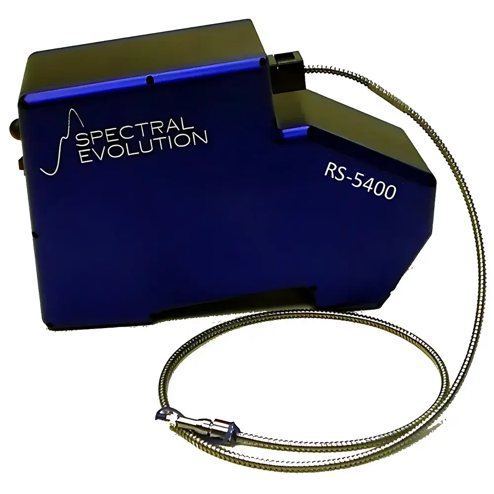
Spectral Evolution RS-5400 High-Resolution Field Spectroradiometer
| Brand | Spectral Evolution |
|---|---|
| Model | RS-5400 |
| Origin | USA |
| Spectral Range | 350–2500 nm |
| Spectral Resolution | 2.5 nm @ 700 nm |
| Detector Configuration | TE-cooled UV-enhanced Si (1024 px), TE-cooled InGaAs (512 px, SWIR1), TE-cooled extended InGaAs (512 px, SWIR2) |
| NEΔL (1.2 m fiber) | 0.5×10⁻⁹ W/cm²/nm/sr @ 400 nm |
| Data Interface | USB + Bluetooth |
| Integrated GPS | Yes (PDA-mounted, geotagged storage for 100,000 spectra) |
| Power Supply | 7.4 V DC battery or 220 V AC |
| Weight | 4.5 kg |
| Dimensions | 31.5 × 22.9 × 38.7 cm |
Overview
The Spectral Evolution RS-5400 is a high-fidelity, field-deployable spectroradiometer engineered for quantitative spectral measurements across the ultraviolet–visible–shortwave infrared (UV-VIS-SWIR) domain (350–2500 nm). Unlike scanning or Fourier-transform instruments, the RS-5400 employs a filter-based optical architecture with three synchronized, thermoelectrically (TE) cooled detector arrays—enabling simultaneous, high-stability acquisition without moving parts. Its core design principle centers on radiometric accuracy, spectral fidelity, and operational robustness in variable environmental conditions. The instrument delivers calibrated spectral radiance, reflectance, transmittance, and CIE colorimetric data—traceable to NIST standards via factory calibration and onboard dark-current compensation. It is expressly designed for applications requiring high signal-to-noise ratio (SNR) and fine spectral feature discrimination—such as mineralogical identification, precision vegetation biophysical parameter retrieval, atmospheric correction validation, and laboratory-grade material characterization under ambient or controlled settings.
Key Features
- Triple-detector architecture: 1024-pixel TE-cooled UV-enhanced silicon array (350–1000 nm), dual 512-pixel TE-cooled InGaAs arrays (1000–1700 nm and 1700–2500 nm), ensuring uniform sensitivity and minimized thermal drift across full spectral range
- No moving optics: Fixed grating and slit design eliminates mechanical wear, enabling long-term measurement repeatability and field reliability
- Integrated PDA controller with touchscreen interface: Supports one-button auto-exposure, auto-shutter control, real-time dark current subtraction, and on-device spectral preview
- Onboard GPS geotagging: Records latitude, longitude, altitude, and timestamp for every spectrum; supports WGS84 coordinate system and optional differential correction
- Modular optical interface: Interchangeable fore-optics (1°, 5°, 8° field-of-view lenses), fiber-optic probes, contact leaf clamps, integrating spheres, and calibrated halogen/tungsten-halogen light sources
- Low-noise electronics: NEΔL values of ≤0.5×10⁻⁹ W/cm²/nm/sr at 400 nm and ≤0.2×10⁻⁹ W/cm²/nm/sr at 1500 nm ensure high-fidelity detection of subtle absorption features (e.g., OH, Al-OH, Fe³⁺, cellulose, lignin)
Sample Compatibility & Compliance
The RS-5400 accommodates diverse sample geometries and measurement configurations—including contact reflectance (via leaf clip or integrating sphere), non-contact radiance (via lens or fiber), and irradiance (with cosine corrector). It complies with ASTM E275, ISO 9001:2015 (calibration traceability), and USGS Spectral Library metadata standards. Factory calibrations are performed under ISO/IEC 17025-accredited conditions and include spectral responsivity, linearity, and stray-light characterization. For regulated environments, the system supports audit-ready data logging (time-stamped, user-ID tagged, GPS-verified), aligning with GLP documentation requirements. While not FDA 21 CFR Part 11–certified out-of-the-box, raw data export formats (ASCII, CSV, ENVI BIL) enable integration into validated LIMS or ELN platforms.
Software & Data Management
Data acquisition and post-processing are managed through Spectral Evolution’s proprietary Windows-compatible software suite, deployable on PDA, tablet, or laptop. The interface provides real-time spectral visualization, batch processing, spectral library matching (including embedded USGS mineral database), and automated calculation of over 12 vegetation indices (NDVI, GRVI, SR, NDWI, PRI, etc.). Export options include ENVI, HDF5, and ASCII for interoperability with ENVI, ArcGIS, Python (NumPy/SciPy), MATLAB, and R. Optional EZ-ID software enables supervised mineral classification using spectral angle mapper (SAM) and spectral feature fitting (SFF) algorithms. All raw and processed files retain embedded metadata (GPS, exposure time, integration time, detector temperature, calibration ID), ensuring full experimental provenance.
Applications
- Remote sensing validation: Ground-truthing of AVIRIS-NG, PRISMA, EnMAP, and Sentinel-2/3 hyperspectral data products
- Mineral exploration: Identification of clay species, carbonates, sulfates, and hydroxides via diagnostic absorption features in SWIR
- Agricultural monitoring: Quantification of chlorophyll content, water stress (NDWI), nitrogen status (Red Edge position), and canopy structure
- Environmental science: Soil organic carbon estimation, wetland mapping, coastal water quality assessment (CDOM, chlorophyll-a)
- Material science: Spectral characterization of pigments, coatings, solar absorbers, and photovoltaic materials under solar-simulated illumination
- Forensic and industrial QA/QC: Non-destructive identification of polymers, textiles, and counterfeit pharmaceuticals via spectral fingerprinting
FAQ
What spectral calibration standards are used for the RS-5400?
Factory calibration is performed using NIST-traceable tungsten halogen lamps and calibrated diffuse reflectance standards (Spectralon®), with spectral responsivity verified across the full 350–2500 nm range.
Can the RS-5400 be mounted on UAV platforms?
Yes—the compact form factor (4.5 kg), low power draw (7.4 V DC), and modular mounting interface support integration with fixed-wing or multirotor UAVs; vibration isolation and thermal stabilization must be implemented per platform specifications.
Is dark current correction performed automatically during measurement?
Yes—integrated shutter and firmware-controlled dark frame acquisition occur prior to each measurement cycle, with user-selectable dark integration time.
Does the system support external triggering or synchronization with other sensors?
The RS-5400 accepts TTL-level external trigger signals via its accessory port, enabling hardware-synchronized operation with LiDAR, GPS-IMU units, or camera systems.
How is radiometric uncertainty quantified for field measurements?
Total spectral radiometric uncertainty is ±5% (k=2) across VIS-NIR and ±8% (k=2) in SWIR, derived from combined contributions of calibration uncertainty, detector noise, temperature stability, and optical throughput variability.