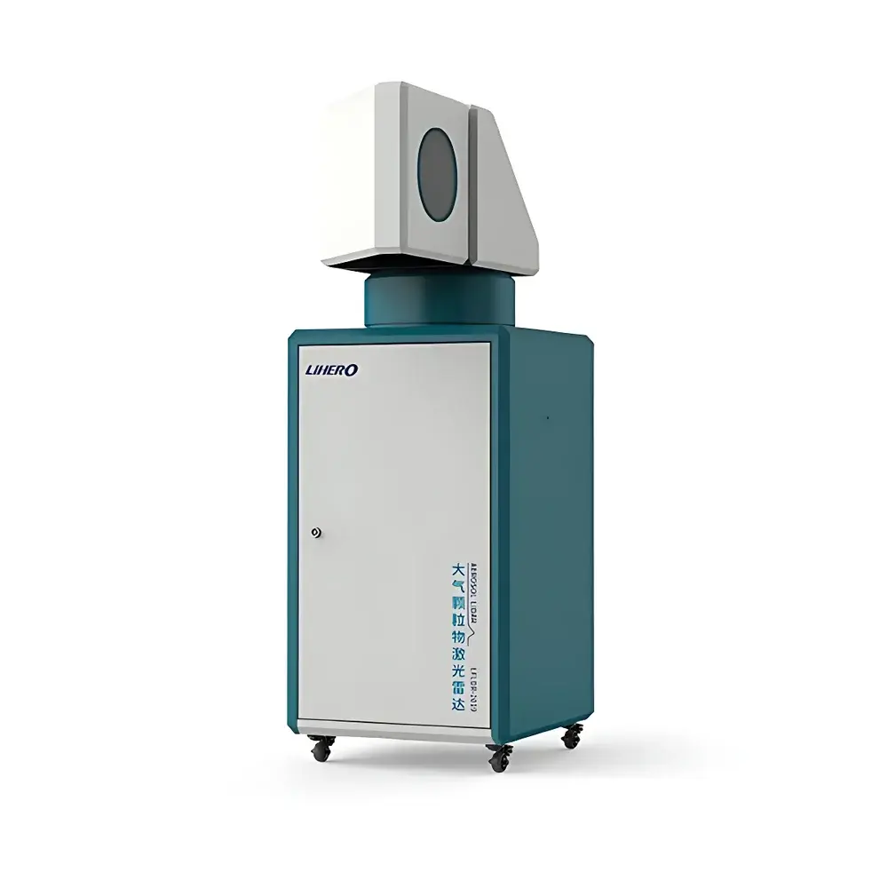
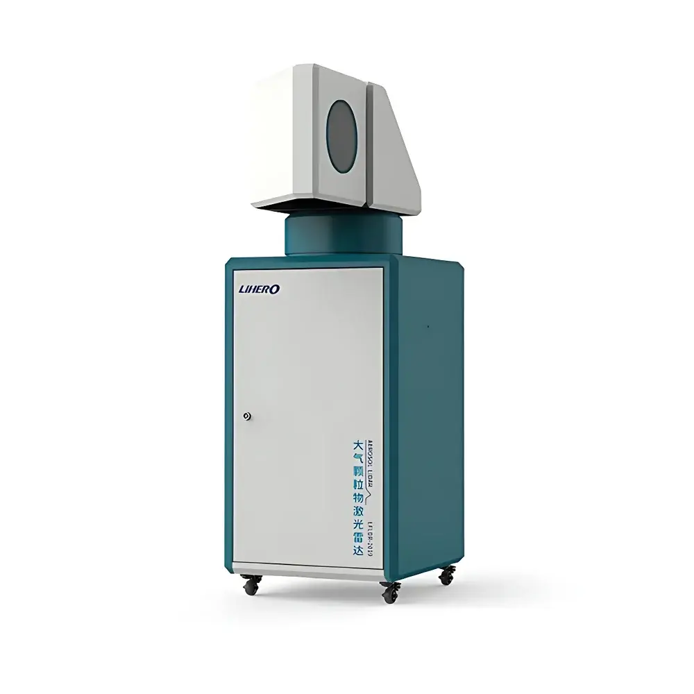
Lihero LFLDR-2019 Dual-Wavelength Polarization-Sensitive Aerosol Lidar
| Brand | Lihero |
|---|---|
| Model | LFLDR-2019 |
| Detection Principle | Elastic Backscatter & Polarization Discrimination at 355 nm and 532 nm |
| Laser Pulse Energy | Millijoule-level (≥10 mJ per pulse) |
| Maximum Effective Detection Range | ≥10 km under High-Aerosol-Load Conditions |
| Particle Morphology Discrimination | Spherical vs. Non-spherical (e.g., Dust, Pollen, Soot, Secondary Aerosols) |
| Compliance | Designed for Atmospheric Research & Environmental Monitoring Applications in Accordance with ISO 21508:2020 (Lidar Performance Requirements) and EPA Guidance for Remote Sensing of Particulate Matter |
Overview
The Lihero LFLDR-2019 is a ground-based, dual-wavelength, polarization-sensitive elastic backscatter lidar engineered for high-resolution vertical and horizontal profiling of atmospheric aerosols. It operates on the fundamental principle of time-resolved laser backscatter detection: short-duration millijoule-class pulses at 355 nm and 532 nm are transmitted into the atmosphere; returned signals are collected through co-aligned telescopes and spectrally separated into three detection channels—two parallel-polarized (at both wavelengths) and one cross-polarized (at 532 nm). This configuration enables quantitative retrieval of key optical parameters including the particle backscatter coefficient, extinction coefficient, depolarization ratio, and lidar ratio. These derived products support unambiguous discrimination between spherical particles (e.g., sulfate, nitrate, sea salt, and liquid-phase secondary organic aerosols) and non-spherical particles (e.g., mineral dust, volcanic ash, pollen, and soot aggregates), facilitating robust source attribution and transport analysis.
Key Features
- Dual-wavelength (355 nm / 532 nm) elastic backscatter architecture with triple-channel polarization detection—enabling simultaneous acquisition of co- and cross-polarized signals at 532 nm plus co-polarized signal at 355 nm.
- Millijoule-level pulsed Nd:YAG laser transmitter (≥10 mJ/pulse at 532 nm, frequency-doubled from 1064 nm), optimized for high signal-to-noise ratio (SNR) under elevated aerosol loading conditions—including heavy haze, dust storms, and biomass burning plumes.
- Full azimuth-elevation scanning capability: supports both vertically pointing mode (for boundary layer structure, residual layer identification, and long-range transport assessment) and horizontal sector scanning (for plume mapping, emission source localization, and industrial stack characterization).
- Real-time depolarization ratio calculation (δ532) with <0.5% uncertainty—critical for identifying non-spherical particle dominance, particularly during Asian dust events or Saharan dust intrusions.
- Modular optical bench design with thermally stabilized detectors and low-noise photon-counting electronics, ensuring long-term measurement stability and inter-comparison readiness.
Sample Compatibility & Compliance
The LFLDR-2019 is not a sample-based instrument but a remote-sensing platform operating on ambient atmospheric volume scattering. It requires no consumables, calibration standards, or sample preparation. Its measurement protocol aligns with internationally recognized methodologies for aerosol profiling, including the EARLINET (European Aerosol Research Lidar Network) standard operating procedures and the WMO GAW (Global Atmosphere Watch) lidar guidelines. Data output formats comply with NASA’s CALIPSO-compatible NetCDF conventions and support ingestion into EEA AirBase and China’s National Environmental Monitoring Centre (NEMC) data pipelines. The system architecture adheres to IEC 61000-6-2/6-4 for electromagnetic compatibility and meets IP54 environmental protection rating for outdoor deployment.
Software & Data Management
The integrated control and analysis suite includes real-time acquisition software (Lihero LidarView™), automated inversion algorithms (Fernald-Klett with constrained regularization), and post-processing tools for vertical profile visualization, time-height cross-sections, and trajectory-weighted source apportionment. All raw and processed datasets are timestamped with GPS-synchronized UTC, include full metadata headers (instrument configuration, atmospheric conditions, background subtraction parameters), and support audit trails compliant with GLP principles. Export options include ASCII, HDF5, and NetCDF-4 formats. Optional integration with third-party platforms (e.g., HYSPLIT, FLEXPART) enables backward trajectory analysis and receptor modeling for regulatory reporting.
Applications
- Long-term monitoring of planetary boundary layer (PBL) height dynamics and diurnal evolution in urban, rural, and coastal environments.
- Identification and quantification of transboundary dust transport events—particularly for early warning of sandstorm impacts across East Asia and the Mediterranean.
- Source apportionment of industrial emissions via horizontal scanning: precise angular localization of point sources (e.g., power plants, cement kilns, smelters) within ±0.5° azimuthal resolution.
- Validation of satellite aerosol products (e.g., MODIS, VIIRS, TROPOMI) through collocated ground-truth vertical profiles.
- Support for health-related exposure studies by correlating elevated coarse-mode aerosol layers (PM10-dominated) with respiratory morbidity records.
FAQ
What atmospheric parameters does the LFLDR-2019 directly measure?
It directly measures range-corrected photon counts in three optical channels; derived geophysical products include particle backscatter coefficient (m⁻¹·sr⁻¹), extinction coefficient (m⁻¹), depolarization ratio (dimensionless), and lidar ratio (sr).
Can the system operate unattended for extended periods?
Yes—designed for continuous 24/7 operation with integrated environmental monitoring (temperature, humidity, rain sensor), automatic shutter control, and remote diagnostics via Ethernet or 4G LTE.
Is calibration traceable to international standards?
Absolute calibration is performed using Rayleigh molecular scattering models validated against radiosonde profiles; relative channel calibration is verified using internal reference targets and cross-checks with co-located sun photometers (AERONET).
Does it meet regulatory requirements for air quality network deployment?
While not certified as a reference method under EU Directive 2008/50/EC or US EPA PS-11, it fulfills the technical criteria for indicative monitoring and supplementary assessment per Annex XII of the EU Ambient Air Quality Directive and is widely deployed in national lidar networks for trend analysis and event characterization.
Related Products