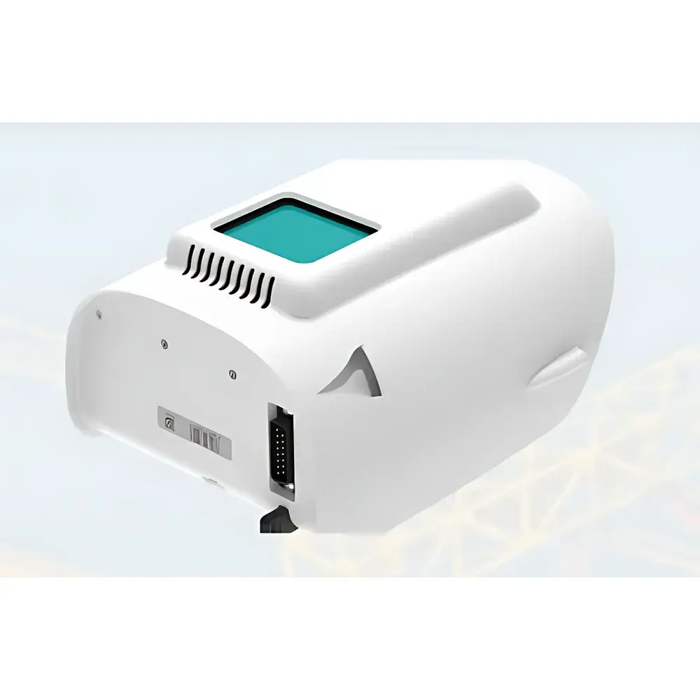
Auniontech Qube240 Survey-Grade Airborne LiDAR System
| Brand | Auniontech |
|---|---|
| Model | Qube240 |
| Wavelength | 905 nm (Class 1 Eye-Safe) |
| Max Operating Altitude | 140 m AGL |
| Vertical Accuracy | 1.8–2.5 cm |
| Absolute Positional Accuracy | < 3 cm (with PPK post-processing) |
| FOV | 70° |
| Point Rate | 240,000 pts/sec |
| Point Density @ 100 m | 50–100 pts/m² |
| Multi-Echo Capability | Up to 3 returns per pulse |
| Integrated IMU/GNSS | Applanix APX-15 with POSPac™ PPK software |
| Data Output Format | Survey-grade LAS/LAZ |
| Compatible Platform | Quantum Systems Trinity F90+ VTOL UAV |
| Max Flight Time | 60 min |
| Max Coverage per Flight | 500 ha |
| Operating Temperature | −12°C to +50°C |
| Weight | ≤5.4 kg (system + UAV) |
Overview
The Auniontech Qube240 Survey-Grade Airborne LiDAR System is a compact, high-performance time-of-flight (ToF) laser scanning solution engineered for precision topographic mapping, corridor surveying, forestry inventory, and infrastructure monitoring from vertical take-off and landing (VTOL) unmanned aerial vehicles. Built upon the proven optical architecture of the YellowScan Ultra Surveyor platform and co-developed with Quantum Systems, the Qube240 integrates a Class 1 eye-safe 905 nm pulsed laser scanner with a tightly coupled Applanix APX-15 inertial navigation system (INS) and dual-frequency GNSS receiver. This fusion enables direct georeferencing with sub-3 cm absolute vertical accuracy under post-processed kinematic (PPK) workflows—performance previously attainable only in high-end airborne systems costing several times more. The system operates at 240,000 measurements per second across a 70° field of view, delivering dense, geometrically coherent point clouds without reliance on external lighting or atmospheric conditions. Its active sensing principle ensures consistent data acquisition day or night, independent of solar illumination—critical for mission flexibility in time-sensitive or low-light operational environments.
Key Features
- Survey-grade vertical accuracy of 1.8–2.5 cm and absolute positional accuracy better than 3 cm (PPK-corrected), validated against ground control points per ISO 19157 and ASPRS LiDAR accuracy standards
- Class 1 eye-safe 905 nm laser source compliant with IEC 60825-1:2014 and FDA 21 CFR 1040.10, enabling unrestricted operation over populated areas without special permits
- Triple-echo detection capability (up to 3 returns per pulse) optimized for vegetation penetration—enabling robust ground surface extraction beneath forest canopies and shrub layers
- Fully integrated Applanix APX-15 GNSS/INS unit with real-time onboard attitude estimation and support for PPK processing via POSPac™ MMS software
- Lightweight, modular payload design (<5.4 kg total system mass) certified for seamless integration into the Quantum Systems Trinity F90+ VTOL fixed-wing UAV
- Onboard intensity values calibrated per pulse, enabling material classification (e.g., asphalt vs. concrete vs. PV panels) without spectral ambiguity or sunlight dependency
Sample Compatibility & Compliance
The Qube240 is designed for deployment on certified commercial UAV platforms meeting EASA STS-02 or FAA Part 107 operational requirements. Its mechanical and electrical interfaces comply with the STANAG 4671 UAV payload interface standard and support MIL-STD-810G environmental ruggedization (vibration, shock, thermal cycling). All firmware and data handling protocols adhere to ISO/IEC 27001 information security controls. Raw point cloud outputs conform to ASPRS LAS 1.4 specification with mandatory GPS time stamps, intensity, return number, and classification flags. When used with YellowScan CloudStation and Applanix POSPac™, the full workflow supports audit-ready metadata logging required under GLP and ISO 17025-accredited surveying laboratories.
Software & Data Management
Data acquisition, georeferencing, and export are managed through a dual-software ecosystem: YellowScan CloudStation provides intuitive cloud-based point cloud visualization, noise filtering, ground classification (using progressive morphological filter and slope-based algorithms), and automated LAS/LAZ export compliant with national mapping agencies’ delivery specifications (e.g., USGS NGP, UK OS MasterMap). For high-precision applications requiring centimeter-level tie-point consistency, raw GNSS observables and IMU logs are processed offline using Applanix POSPac™ MMS v9.5+, generating trajectory files that drive rigorous point cloud correction. All software modules maintain full traceability—including user actions, parameter settings, and version-controlled processing chains—to satisfy 21 CFR Part 11 electronic record and signature requirements where applicable.
Applications
- Topographic mapping for engineering design and cadastral surveys at 1:500 scale
- Forestry biomass estimation and canopy height modeling using multi-echo penetration metrics
- Corridor mapping of power lines, pipelines, and railways with automated clearance analysis
- Quarry volume calculation and stockpile monitoring with repeat-scan change detection
- Urban digital twin development including roof-plane segmentation and solar potential assessment via intensity-derived albedo inference
- Disaster response rapid terrain modeling following floods or landslides, leveraging all-weather operational capability
FAQ
What GNSS correction method does the Qube240 support?
It natively records raw dual-frequency GNSS observables (L1/L2) and leverages PPK processing via Applanix POSPac™—eliminating dependency on real-time NTRIP networks and ensuring consistent accuracy in remote or signal-degraded environments.
Is the system compatible with third-party UAV platforms beyond Trinity F90+?
Mechanical and electrical integration kits are available for select OEM UAVs meeting minimum payload capacity (≥4.5 kg), power budget (24 V DC, ≥120 W peak), and vibration envelope compliance (per ISO 5344). Custom integration requires formal validation by Auniontech engineering.
How is radiometric calibration of intensity values performed?
Intensity is normalized per-pulse using internal photodiode feedback and range-squared compensation; no external calibration targets are required. Values reflect relative surface reflectance at 905 nm and remain stable across diurnal cycles and ambient light conditions.
Does the system meet regulatory requirements for survey-grade deliverables?
Yes—when operated with ≥4 ground control points (GCPs) per 100 ha and processed via PPK + CloudStation, final LAS files meet ASPRS ALTM Level 1 accuracy thresholds and are accepted by national mapping authorities including USGS, Ordnance Survey, and Geospatial Information Authority of Japan.
What is the recommended maintenance interval for field calibration?
Boresight calibration (IMU-to-scanner alignment) is recommended every 200 flight hours or after any physical impact; temperature-dependent bias drift is automatically compensated during flight via embedded thermal sensors and factory-characterized lookup tables.