AZ AIM-WiFi Multi-Parameter Soil Monitoring System
| Brand | AZ (Beijing Aozuo) |
|---|---|
| Origin | Beijing, China |
| Manufacturer Type | Direct Manufacturer |
| Country of Origin | China |
| Model | AIM-WiFi |
| Price Range | USD 1,400 – 4,200 (FOB) |
| Instrument Type | Soil Moisture & Electrical Conductivity Analyzer |
| Measurement Principle | Time-Domain Reflectometry (TDR) |
| Wireless Protocol | Bluetooth 4.2 (Class 1), up to 10 m range |
| GPS Integration | Built-in GNSS (GPS + GLONASS + BeiDou) for georeferenced logging |
| Sensor Capacity | Up to 29 TDR probes per data logger |
| Data Storage | 300,000 records internal (expandable via microSD up to 64 GB, subject to host smartphone support) |
| Operating Temperature | −15 °C to +50 °C (custom ranges available) |
| IP Rating | IP68 (probe and housing) |
| Power Supply | 7–24 V DC |
| Typical Current Draw | 1 mA (standby, B-mode), 8 mA (idle), 100 mA × 2–3 s (per measurement) |
Overview
The AZ AIM-WiFi Multi-Parameter Soil Monitoring System is a field-deployable, TDR-based instrumentation platform engineered for high-fidelity, in-situ quantification of volumetric water content (θv) and bulk electrical conductivity (ECb) in soils. It implements the time-domain reflectometry principle—where a 1 GHz electromagnetic pulse propagates along a calibrated waveguide (probe rod), reflects at the terminus, and returns to the source. The transit time difference between incident and reflected signals is directly correlated with the soil’s dielectric permittivity (εr), which exhibits a well-characterized empirical relationship with θv across diverse soil textures. Simultaneously, the system derives ECb from the attenuation and phase shift of the reflected waveform, enabling dual-parameter assessment without sensor cross-interference. Designed for long-term unattended operation or rapid mobile surveying, the AIM-WiFi integrates GNSS geotagging, modular probe architecture, and smartphone-native data acquisition—making it suitable for precision agriculture, hydrological monitoring, ecological research, and land rehabilitation projects where spatially resolved, traceable soil hydric and ionic status is critical.
Key Features
- TDR-based dual-parameter measurement (volumetric water content and bulk electrical conductivity) with no moving parts or consumables
- Integrated GNSS module providing sub-meter positional accuracy (GPS + GLONASS + BeiDou) for georeferenced data logging
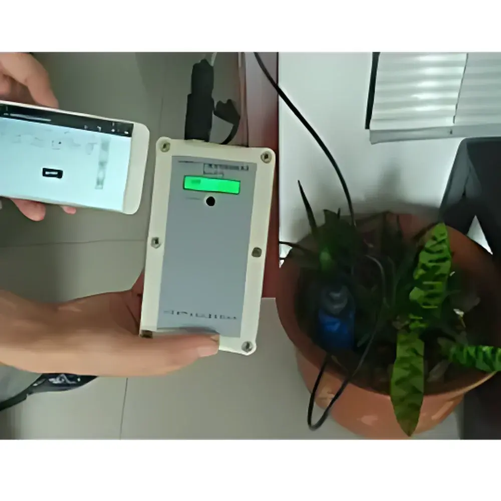
- Wireless Bluetooth 4.2 (Class 1) interface enabling secure, low-power communication with Android smartphones (no cables required)
- Scalable sensor network architecture supporting up to 29 TRIME-PICO TDR probes per deployment—ideal for fixed station networks or transect mapping
- Field-configurable calibration: supports up to 15 user-defined εr–θv and ECb–σ relationships stored onboard; compatible with TrimeTool software for soil-specific curve generation
- Ruggedized IP68-rated probe housings and electronics, rated for continuous burial in saturated, saline, or freeze-thaw environments
- Low-power design optimized for solar-rechargeable battery systems: typical duty cycle draws <1 mA in standby, <8 mA in idle, and 100 mA only during 2–3 s measurement bursts
Sample Compatibility & Compliance
The AIM-WiFi system accommodates heterogeneous soil matrices—including coarse sands, loams, clays, volcanic ash, and organic-rich substrates—via its configurable probe geometries and multi-range ECb sensing (0–6 dS/m, 6–12 dS/m, 12–50 dS/m). All TRIME-PICO probes (PICO64, PICO32, and IPH2) are factory-calibrated against mineral soils per ISO 11272:2017 (soil physical analysis — determination of particle size distribution) and ASTM D5598-17 (standard test method for determining soil moisture using TDR). Field recalibration is supported under GLP-compliant workflows: raw time-domain waveforms and metadata (timestamp, position, temperature, battery voltage) are preserved for auditability. While not FDA 21 CFR Part 11-certified as a standalone system, its data export format (CSV/JSON with embedded SHA-256 hash metadata) enables integration into validated LIMS or ELN platforms compliant with ISO/IEC 17025:2017 and EU Annex 11 requirements.
Software & Data Management
Data acquisition, visualization, and export are managed via the dedicated AZ SoilScan mobile application (Android only, v8.1+). The app performs real-time signal processing—including baseline correction, reflection peak detection, and dielectric constant inversion—and applies active calibration curves prior to display. All measurements are timestamped, geotagged, and logged with probe ID, battery level, ambient temperature, and diagnostic flags (e.g., air-gap detection, signal-to-noise ratio). Raw waveform data (time-amplitude arrays) and processed parameters are stored locally on the smartphone and optionally synced to cloud storage via encrypted HTTPS POST. Export formats include ISO 8601-compliant CSV (with header metadata), GeoJSON for GIS interoperability, and XML for legacy SCADA ingestion. Firmware updates are delivered OTA and digitally signed to ensure integrity.
Applications
- Precision irrigation scheduling in orchards, vineyards, and row-crop systems via real-time root-zone θv thresholds
- Salinity mapping and leaching requirement modeling in coastal or reclaimed agricultural land
- Soil moisture–temperature–conductivity coupling studies in permafrost-affected tundra or arid-zone ecohydrology
- Validation of satellite-derived soil moisture products (e.g., SMAP, Sentinel-1) through ground-truth networks
- Long-term vadose zone monitoring in landfill cap performance assessment and mine reclamation sites
- Calibration and verification of neutron probe or capacitance-based soil sensors in intercomparison trials
FAQ
What TDR probe models are compatible with the AIM-WiFi system?
The system natively supports TRIME-PICO64, TRIME-PICO32, and TRIME-PICO IPH2 probes. Each model offers distinct measurement volumes and ECb ranges to match soil heterogeneity and salinity conditions.
Does the system meet international standards for soil moisture measurement?
Yes—probe designs and factory calibrations conform to ISO 11272:2017 and ASTM D5598-17. Field recalibration tools and metadata logging support adherence to ISO/IEC 17025:2017 quality management requirements.
Can the AIM-WiFi operate without a smartphone in autonomous mode?
No—the system requires an Android smartphone running SoilScan to initiate measurements, process waveforms, and store data. However, once configured, it supports fully unattended scheduled logging with no manual intervention.
Is the GNSS positioning accurate enough for plot-level agronomic mapping?
With concurrent GPS/GLONASS/BeiDou reception, horizontal accuracy is typically ≤1.2 m CEP (95% confidence) under open-sky conditions—sufficient for field-scale zoning but not sub-meter precision applications without RTK augmentation.
How is sensor drift mitigated over extended deployments?
Drift is minimized through temperature-compensated waveform analysis, periodic zero-reference checks (using dry-air or known-dielectric reference media), and the ability to reapply updated calibration curves remotely via the mobile app.
Related Products


