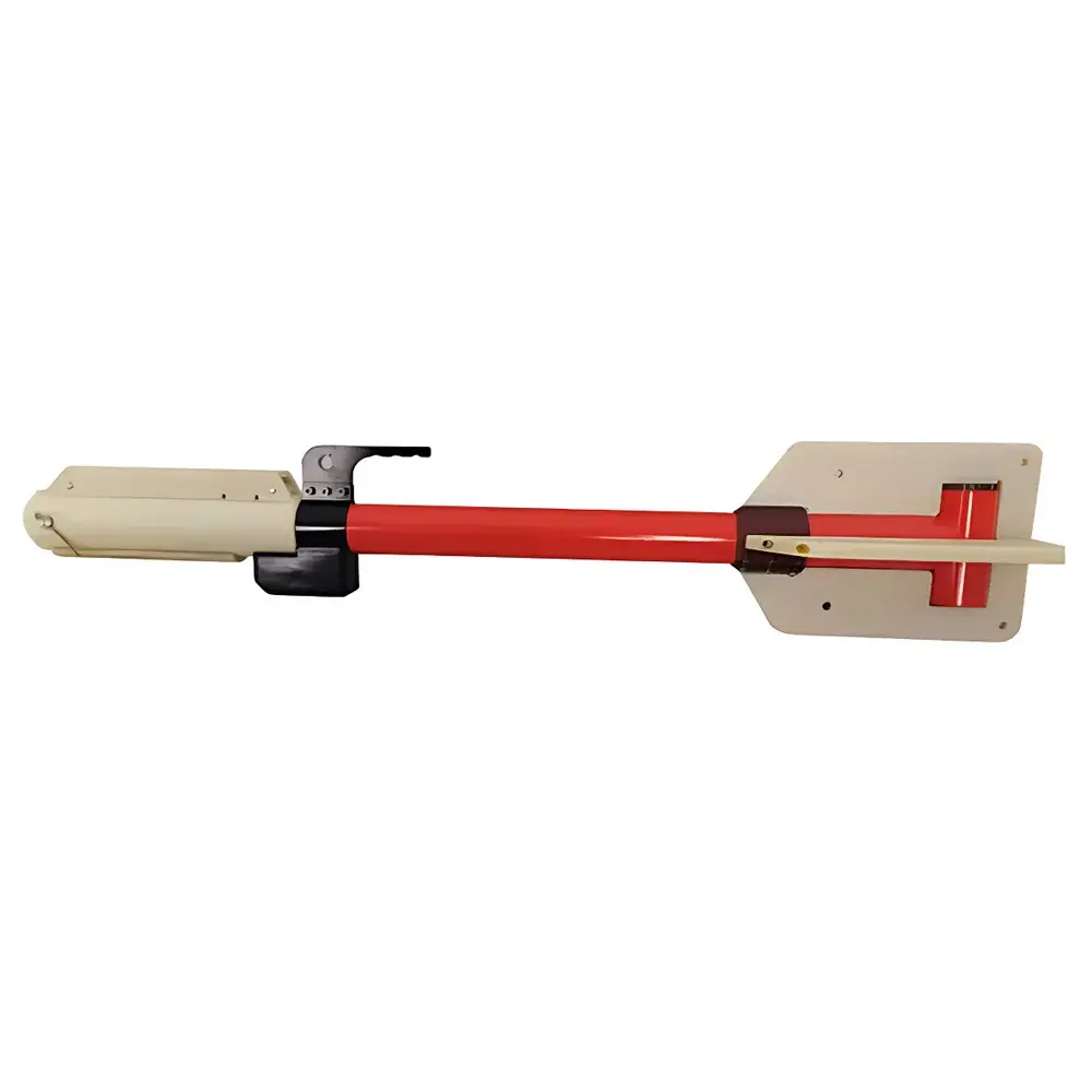
Auniontech CAM-01U Marine Magnetometer (Subsea Fluxgate-Free Cesium Vapor Magnetometer)
| Brand | Auniontech |
|---|---|
| Origin | Shanghai, China |
| Model | CAM-01U |
| Measurement Principle | Self-Oscillating Cesium Vapor Optically Pumped Magnetometry |
| Operating Depth | 400 m |
| Magnetic Field Range | 20,000–100,000 nT |
| Sensitivity | ≥4 pT/√Hz |
| Sampling Rate | Up to 10 Hz |
| Absolute Accuracy | <2 nT |
| Heading Error (Auto-Hemisphere Switching) | <2 nT |
| Minimum Field Angle for Stable Operation | >10° from sensor axis relative to geomagnetic vector |
| Output Interface | RS-232 (600–9600 baud) |
| Power Supply | 24–32 VDC, <1 A |
| Operating Temperature | 0°C to +50°C |
| Storage Temperature | −45°C to +70°C |
| Towed Fish Dimensions | 1.48 m length, 18.9 kg (incl. housing, sensor, electronics, primary ballast) |
| Tether Cable | Kevlar-reinforced multilayer, 12 mm OD, 1.6 t tensile strength, standard 60 m length |
| Waterproof Rating | Dual O-ring sealed interface, IP68 equivalent |
Overview
The Auniontech CAM-01U Marine Magnetometer is a towed, subsea-capable optically pumped magnetometer engineered for high-sensitivity, real-time detection and mapping of ferromagnetic anomalies in marine environments. Unlike fluxgate or proton precession systems, the CAM-01U employs a self-oscillating cesium vapor atomic magnetometer as its primary sensing element. This quantum-based measurement principle relies on optical pumping of cesium atoms in a vapor cell, where the Larmor precession frequency of spin-polarized electrons is directly proportional to the ambient magnetic field magnitude. The system digitizes this frequency signal with high temporal resolution—up to 10 Hz—and transmits calibrated nanotesla-level data via RS-232 serial output synchronized with GPS position metadata. Designed for operation at depths up to 400 meters, the CAM-01U maintains stable performance across Earth’s full geomagnetic range (20–100 µT), with intrinsic sensitivity exceeding 4 pT/√Hz and absolute accuracy better than ±2 nT. Its compact towfish architecture—1.48 m in length and 18.9 kg total mass including integrated ballast—enables rapid deployment from small research vessels or dive support platforms without crane assistance.
Key Features
- Optically pumped cesium vapor magnetometer core with no moving parts or cryogenic requirements
- Self-oscillating design eliminates external RF excitation, reducing power demand and electromagnetic interference susceptibility
- Automatic hemispheric switching ensures continuous operation regardless of magnetic inclination angle, with heading-induced error <2 nT
- Wide dynamic range: 20,000–100,000 nT, suitable for global deployment without recalibration
- High-resolution timing: 10 Hz maximum sampling rate, configurable via host software for optimized signal-to-noise trade-offs
- Robust pressure housing rated to 400 m water depth, featuring dual elastomeric O-ring seals compliant with ISO 11612 Class 2 sealing standards
- Kevlar-reinforced tether cable (12 mm OD, 1.6 t breaking strength) minimizes stretch and torsional drift during long-line towing
- Low-power DC operation (24–32 VDC, <1 A), compatible with standard marine battery banks and power management systems
Sample Compatibility & Compliance
The CAM-01U is designed for non-invasive, passive detection of magnetic susceptibility contrasts in submerged environments. It responds to spatial gradients in the Earth’s magnetic field induced by ferrous objects—including UXO, shipwrecks, pipelines, anchor chains, and unexploded ordnance—as small as a 5-inch screwdriver at typical survey altitudes (<5 m above seabed). No sample preparation or physical contact is required. The system complies with IEC 60068-2 environmental testing protocols for shock, vibration, and thermal cycling. Its analog-to-digital conversion chain and firmware architecture support audit-ready data logging in accordance with GLP principles. While not certified to FDA 21 CFR Part 11, raw binary telemetry streams include embedded timestamps, sensor health flags, and checksummed packets—enabling traceable post-processing workflows required for geophysical reporting under ASTM D6429 and ISO 19901-7 standards.
Software & Data Management
Data acquisition is managed via a Windows-compatible host application that provides real-time visualization of magnetic field magnitude, differential gradient plots, and GPS-referenced track overlays. The software supports configurable averaging windows, digital low-pass filtering (cutoff: 0.1–5 Hz), and automatic gain scaling. All measurements are saved in ASCII CSV format with UTC timestamps, latitude/longitude (WGS84), altitude, and auxiliary status bits. Export options include GeoTIFF gridded magnetic anomaly maps compatible with QGIS and ArcGIS. The RS-232 interface operates at user-selectable baud rates (600–9600), allowing integration into third-party navigation or AUV control stacks using standard NMEA 0183 framing conventions. Firmware updates are performed over the same serial link, preserving calibration coefficients stored in non-volatile memory.
Applications
- Marine UXO (unexploded ordnance) clearance surveys in coastal zones and port approaches
- Archaeological site prospection for submerged shipwrecks and anthropogenic ferrous artifacts
- Offshore pipeline and cable route verification and integrity monitoring
- Geological mapping of magnetic basement structures and volcanic intrusions
- Environmental assessment of dredged material disposal sites for ferrous contamination
- Support for autonomous underwater vehicle (AUV) and remotely operated vehicle (ROV) magnetometer payloads
- Academic research in marine geophysics, paleomagnetism, and sedimentary basin analysis
FAQ
What magnetic field units does the CAM-01U output?
The system reports total field intensity in nanotesla (nT), referenced to the International Geomagnetic Reference Field (IGRF) model.
Can the CAM-01U operate in polar regions with high magnetic inclination?
Yes—the auto-hemisphere switching algorithm ensures stable lock-on and linear response for inclination angles >10°, covering latitudes from ±85°.
Is the tether cable length customizable beyond the standard 60 m?
Yes; extended lengths up to 500 m are available with voltage compensation recommendations to maintain signal integrity and power delivery.
Does the system require periodic recalibration in the field?
No—factory calibration is retained in EEPROM; only annual verification against a known reference field (e.g., Helmholtz coil) is recommended per ISO/IEC 17025 guidelines.
How is GPS synchronization achieved?
The towfish integrates a dedicated GPS receiver module; position data is time-stamped and multiplexed with magnetometer readings in the serial stream using PPS-aligned microsecond timing.