Ecodrone® UAS-8 Pro Integrated Hyperspectral–Thermal Infrared UAV Remote Sensing System
| Brand | SPECIM |
|---|---|
| Origin | Czech Republic |
| Model | Ecodrone® UAS-8 Pro |
| Sensor Configuration | Specim AFX10 (400–1000 nm) or AFX17 (900–1700 nm) + WIRIS Thermo-RGB (640×512 IR resolution, up to 1266×1010 in high-res mode, thermal sensitivity ≤0.03 °C) |
| Platform | UAS-8 Pro professional UAV platform (high-payload, extended endurance) |
| Optional Integration | YellowScan Mapper+ LiDAR (for EcoDrone-LiHT configuration) |
| Compliance | Designed for ASTM E2923, ISO 18434-1, and FAO/UNEP remote sensing protocol alignment |
| Software | Ecodrone Flight & Processing Suite v4.x with embedded FLAASH atmospheric correction, FLD-based SIF retrieval, and GLP-compliant metadata logging |
Overview
The Ecodrone® UAS-8 Pro Integrated Hyperspectral–Thermal Infrared UAV Remote Sensing System is a turnkey, research-grade aerial platform engineered for multi-modal ecological and environmental monitoring at canopy-to-landscape scales. It operates on the principle of synchronized passive optical spectroscopy and radiometric thermography: the Specim AFX series push-broom hyperspectral imager captures continuous spectral reflectance across visible–near-infrared (VNIR) or shortwave-infrared (SWIR) bands with high signal-to-noise ratio (SNR > 600:1) and frame rates up to 300 Hz; concurrently, the WIRIS Thermo-RGB sensor acquires calibrated thermal infrared (TIR) radiance data at spatial resolutions up to 1266×1010 pixels, enabling sub-0.03 °C thermal sensitivity under field conditions. This dual-sensor architecture enables physically consistent, temporally aligned acquisition of surface reflectance spectra (350–1700 nm), emissivity-corrected land surface temperature (LST), and RGB texture — all georeferenced to <5 cm horizontal accuracy via integrated RTK-GNSS and IMU. The system is not a generic survey tool but a metrologically traceable remote sensing instrument designed for quantitative biophysical parameter inversion, compliant with FAO’s CropWatch framework and aligned with CEOS Land Product Validation Subgroup best practices.
Key Features
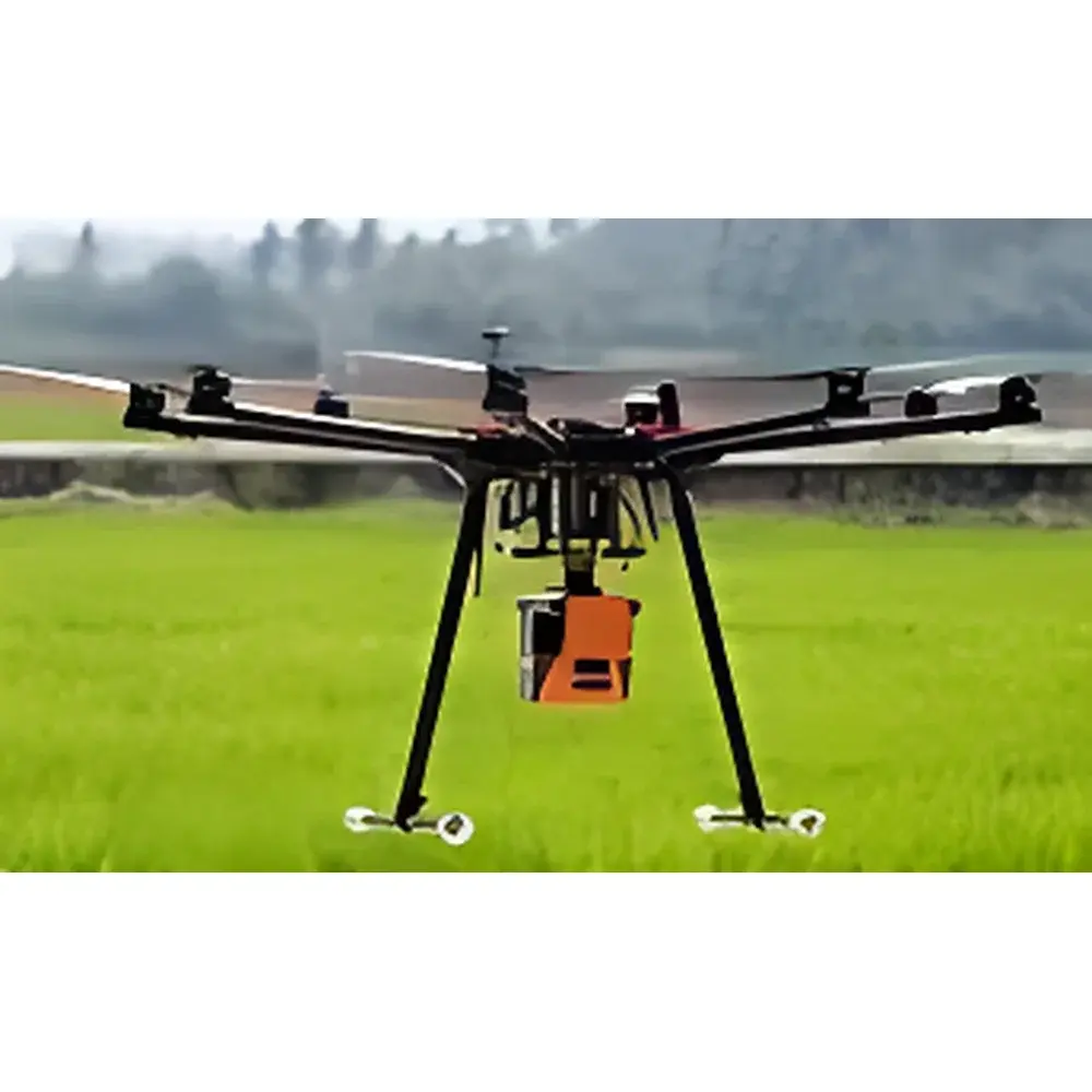
- UAS-8 Pro airframe: Certified Class II UAV platform with 8 kg maximum takeoff weight (MTOW), 45+ minute endurance at 5 m/s cruise speed, and IP43 environmental rating for operation in variable ambient conditions (5–35 °C, RH ≤85%).
- Specim AFX hyperspectral sensors: Factory-calibrated radiometric response with NIST-traceable calibration certificates; AFX10 covers 400–1000 nm (2.2 nm spectral sampling); AFX17 covers 900–1700 nm (3.7 nm sampling), both supporting on-board dark-current subtraction and real-time line-by-line radiometric correction.
- WIRIS Thermo-RGB module: Uncooled microbolometer array with non-uniformity correction (NUC) performed every 30 seconds; factory-calibrated against blackbody references (±0.5 °C absolute accuracy from −10 to +65 °C); outputs calibrated radiance (W·sr⁻¹·m⁻²) and emissivity-compensated temperature maps.
- Synchronized acquisition: Hardware-triggered dual-sensor capture with <10 ms inter-sensor time skew; onboard GPS timestamping (PPS-synchronized) ensures sub-pixel spatial co-registration of hyperspectral cubes and thermal rasters.
- Modular expandability: Standardized payload interface supports seamless integration of YellowScan Mapper+ LiDAR (150 kHz pulse rate, 5 cm vertical accuracy) to form the EcoDrone-LiHT configuration — enabling simultaneous acquisition of 3D structural metrics (CHM, LAI, canopy height), spectral signatures, and thermal gradients.
Sample Compatibility & Compliance
The system is validated for non-contact, non-destructive measurement of vegetated surfaces including agricultural crops (rice, wheat, maize), forest canopies (broadleaf/conifer), grassland swards, wetland emergent macrophytes, and semi-arid shrublands. It complies with ISO 18434-1 (condition monitoring — infrared thermography) for thermal data integrity and adheres to ASTM E2923-23 (Standard Guide for Remote Sensing of Vegetation Health) for spectral index derivation. All raw data products include embedded EXIF and XMP metadata conforming to ISO 19115-2:2019 for geospatial data quality documentation. Thermal radiance data are processed using Planck’s law inversion with site-specific emissivity assumptions (default ε = 0.97 ± 0.01 for green vegetation). Hyperspectral data undergo FLAASH atmospheric correction and geometric orthorectification using rational polynomial coefficients (RPCs) derived from onboard GNSS/IMU trajectories.
Software & Data Management
The Ecodrone Flight & Processing Suite v4.x provides end-to-end workflow control: mission planning with terrain-following flight lines, real-time telemetry visualization, automated sensor synchronization, and post-flight batch processing. Key modules include:
- Hyperspectral cube processing: Radiometric calibration, atmospheric correction (FLAASH), spectral resampling, and pixel-wise spectral index computation (e.g., NDVI, PRI, CCCI, SIF via Fraunhofer Line Depth model).
- Thermal analytics: Pixel-level CWSI (Crop Water Stress Index) calculation using reference wet/dry baselines; Ts–Ta differential mapping; emissivity-aware LST retrieval.
- Multi-sensor fusion engine: Co-registration of hyperspectral, thermal, and optional LiDAR point clouds using iterative closest point (ICP) algorithms; generation of fused feature layers (e.g., chlorophyll content × stomatal conductance proxy × canopy temperature anomaly).
- Data export: GeoTIFF, ENVI .hdr/.dat, NetCDF4, and HDF5 formats with CF-1.8 metadata conventions; audit trail logs compliant with FDA 21 CFR Part 11 requirements for electronic records and signatures.
Applications
This system supports quantitative ecological and agronomic investigations requiring concurrent structural, spectral, and thermal observables. Primary use cases include:
- High-throughput phenotyping: Extraction of >50 biophysically interpretable indices — including Vcmax proxies (via coupled LCpro-T ground truthing), water stress indicators (CWSI, MSI), pigment ratios (PRI, xanthophyll cycle indices), and structural parameters (from LiDAR-derived CHM).
- Ecosystem functional monitoring: Solar-induced chlorophyll fluorescence (SIF) mapping at landscape scale for gross ecosystem productivity (GEP) estimation; validation against eddy covariance tower CO₂/H₂O flux measurements.
- Disturbance detection: Early identification of biotic (pest infestation, pathogen spread) and abiotic (drought, salinity, frost) stress through divergence in thermal inertia, spectral absorption features (e.g., water band depth at 970 nm), and fluorescence yield anomalies.
- Restoration assessment: Temporal tracking of vegetation recovery metrics — fractional vegetation cover (FVC), leaf area index (LAI), and canopy temperature depression — across post-fire, post-mining, or degraded wetland sites.
- Biodiversity surrogate mapping: Spectral heterogeneity analysis (using Shannon entropy of reflectance variance across 200+ bands) correlated with species richness surveys.
FAQ
What spectral ranges are supported by the AFX sensors?
The AFX10 covers 400–1000 nm (VNIR) with 2.2 nm sampling; the AFX17 covers 900–1700 nm (SWIR) with 3.7 nm sampling. Both provide contiguous, calibrated reflectance data without spectral gaps.
Is thermal data radiometrically calibrated out-of-the-box?
Yes — each WIRIS unit ships with NIST-traceable blackbody calibration certificates; onboard NUC and ambient temperature compensation ensure stable radiance output across operational temperature ranges.
Can SIF be extracted without ground-based reference measurements?
The FLD-based SIF retrieval algorithm is fully embedded and requires only the raw hyperspectral cube and solar zenith angle input; however, validation against active fluorometers (e.g., Walz Imaging-PAM) is recommended for publication-grade uncertainty quantification.
What level of georeferencing accuracy is achievable?
With integrated RTK-GNSS (u-blox F9P) and dual-antenna heading determination, horizontal positional accuracy is ≤3 cm RMS; vertical accuracy is ≤5 cm RMS under open-sky conditions.
Does the system support automated flight pattern generation for repeated monitoring?
Yes — the mission planner includes repeat-pass mode with centimeter-level waypoint reproducibility, enabling time-series analysis of phenological dynamics or stress progression.
Related Products


