Ecograph-HyP Biodiversity Monitoring System
| Brand | AZ (Beijing Aozuo) |
|---|---|
| Model | Ecograph-HyP |
| Origin | Beijing, China |
| Manufacturer Type | Direct Manufacturer |
| Regional Classification | Domestic (China) |
| Price | USD 140 (approx. based on ¥1000 at 1:7.14 exchange rate) |
Overview
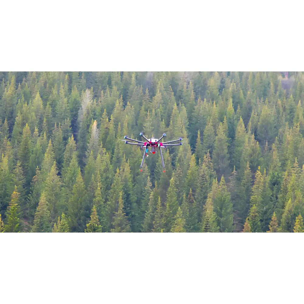
The Ecograph-HyP Biodiversity Monitoring System is a turnkey unmanned aerial survey platform engineered for high-fidelity, quantitative ecological monitoring. It integrates calibrated multispectral imaging with precise georeferenced flight control to deliver spatially resolved vegetation indices at centimeter-scale ground sampling distance (GSD). Unlike conventional RGB-only UAVs or uncalibrated snapshot systems, the Ecograph-HyP employs a radiometrically stable, five-band multispectral sensor array—comprising discrete optical lenses, interference filters, and scientific-grade CCD detectors—to capture reflectance values per pixel across defined spectral bands (e.g., blue, green, red, red edge, near-infrared). This enables traceable, repeatable derivation of biophysical parameters without motion-induced artifacts, geometric distortion, or radiometric drift commonly observed in consumer-grade drone imagery. The system operates on the principle of passive optical remote sensing grounded in spectral reflectance theory, where surface vegetation responses are quantified via normalized ratio indices derived from band-specific radiance measurements. Its design targets long-term ecological observatories, protected area management units, and restoration project monitoring teams requiring GLP-aligned data provenance and audit-ready acquisition metadata.
Key Features
- Radiometrically calibrated 5-channel multispectral imager with narrowband interference filters (typical FWHM ≤ 10 nm) and scientific CCD detector for stable reflectance measurement
- Ground Sampling Distance (GSD) of 8 cm at 120 m AGL flight altitude, enabling species-level canopy texture analysis in homogeneous stands
- Integrated POS (Position and Orientation System) with dual-frequency GNSS and MEMS IMU for sub-decimeter geolocation accuracy and rigorous orthorectification
- Stabilized gimbal-mounted high-resolution RGB camera for visual context registration and image-to-spectral co-alignment
- Onboard energy management system with four custom LiPo batteries supporting ≥ 35 min nominal flight time under standard payload configuration
- Real-time telemetry and image downlink capability via encrypted RF link; black-box logging of all flight and sensor parameters compliant with ISO 19115 metadata schema
- Portable 4-rotor UAS airframe designed for field deployment in rugged terrain; includes IP54-rated transport case with shock-absorbing foam inserts
Sample Compatibility & Compliance
The Ecograph-HyP is optimized for vegetated terrestrial ecosystems including forest understories, grassland mosaics, wetland margins, and post-disturbance restoration sites. It supports standardized ecological sampling protocols aligned with national biodiversity monitoring frameworks (e.g., China’s National Ecological Monitoring Network). All acquired imagery conforms to ENVI-compatible GeoTIFF format with embedded projection, coordinate system (WGS84 UTM), and radiometric calibration coefficients. Data outputs meet minimum requirements for submission to international repositories such as GBIF when accompanied by Darwin Core-compliant metadata. While not certified to FDA 21 CFR Part 11 or ISO/IEC 17025, the system supports audit-trail generation through timestamped logs, sensor ID tagging, and firmware-signed acquisition records—facilitating internal QA/QC workflows under GLP or ISO 14001 environmental management systems.
Software & Data Management
Data processing follows a validated workflow beginning with raw image ingestion into ENVI 5.6+ (or equivalent open-source alternatives such as QGIS + Orfeo Toolbox). Radiometric correction applies dark current subtraction and flat-field normalization using onboard calibration frames. Orthomosaic generation leverages bundle adjustment with tie-point matching and DEM-assisted terrain correction. Vegetation index computation—including NDVI, NDRE, GNDVI, and RENDVI—is performed via band math expressions with pixel-wise masking to exclude non-vegetated pixels (e.g., water, rock, shadow). Index rasters are exported in floating-point GeoTIFF with geospatial referencing preserved. The included ground station software provides mission planning, real-time telemetry visualization, automatic flight log export (CSV/JSON), and pre-flight sensor health diagnostics. All software modules operate offline and store no user data externally.
Applications
- Long-term biodiversity trend analysis across protected areas using NDVI temporal stacks to detect phenological shifts and habitat fragmentation
- Differentiation of coniferous vs. broadleaf forest stands via NDRE–NDVI scatter-space clustering at 8-cm resolution
- Quantitative assessment of ecological restoration progress through leaf area index (LAI) proxy mapping derived from NDRE and red-edge slope metrics
- Early detection of biotic stressors—including insect infestation and drought-induced chlorophyll degradation—using NDRE anomaly thresholds calibrated against ground truth spectrometer readings
- Supporting nitrogen-use efficiency modeling in agroecological zones via NDRE–chlorophyll correlation curves validated against destructive foliar N assays
- Baseline habitat mapping for Environmental Impact Assessments (EIA) under IUCN Red List habitat classification guidelines
FAQ
What spectral bands does the Ecograph-HyP sensor cover?
The system captures five discrete bands: blue (475 ± 15 nm), green (560 ± 15 nm), red (660 ± 15 nm), red edge (730 ± 15 nm), and near-infrared (850 ± 20 nm). Band centers and widths are verified during factory calibration.
Is radiometric calibration traceable to NIST standards?
Calibration is performed using certified reflectance panels (Labsphere Spectralon® SR-99) under controlled illumination; full calibration reports—including spectral responsivity curves and uncertainty budgets—are provided with each unit.
Can the system be integrated with third-party GIS platforms?
Yes. All outputs are standard GeoTIFF files with embedded EPSG codes and GDAL-readable metadata; compatible with ArcGIS Pro, QGIS, Google Earth Engine, and ERDAS IMAGINE.
Does the software support automated flight path generation for transect-based monitoring?
Yes. The ground station software includes grid, corridor, and polygon-based mission planners with adjustable overlap (60–90%), heading angle, and altitude constraints.
What is the maximum operational range and regulatory compliance status?
Maximum line-of-sight range is 5 km (subject to local CAAC or EASA regulations); the platform complies with China’s CAAC Part 92 UAV operation rules and carries CE marking for EMC and radio equipment directives.
Related Products


