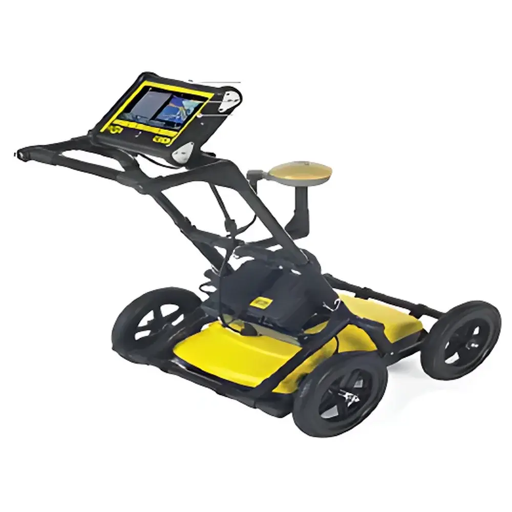
GPR LMX200 Ground Penetrating Radar System by MAE
| Brand | MAE |
|---|---|
| Country of Origin | Italy |
| Model | GPR LMX200 |
| Power Supply | 12 V DC, 1.25 A |
| Battery | Sealed Lead-Acid Gel, 9 Ah |
| Dimensions (L×W×H) | 100 cm × 70 cm × 115 cm |
| Weight | 22 kg |
| Ingress Protection | IP66 |
| Operating Temperature (Sensor) | –40 °C to +50 °C |
| Operating Temperature (DVL Unit) | –10 °C to +50 °C |
| Spatial Sampling Interval | 5 cm |
| Maximum Investigation Depth | 8 m (real-time display range: 1–8 m) |
| Signal Enhancement | Dyna Q technology |
| Data Acquisition Mode | Real-time depth estimation and visualization |
Overview
The GPR LMX200 is a high-performance, cart-based ground penetrating radar (GPR) system engineered by MAE in Italy for non-destructive subsurface investigation. It operates on the principle of ultra-wideband electromagnetic wave propagation: short-pulse radio frequency energy (typically in the 100–1000 MHz bandwidth range) is transmitted into the ground via a shielded antenna array; reflections from dielectric contrasts—such as those at interfaces between soil layers, voids, metallic utilities, plastic pipes, concrete structures, or buried tanks—are captured and processed to generate depth-resolved cross-sectional profiles (radargrams). The LMX200 is designed for rapid deployment in field environments where real-time decision-making is critical—civil infrastructure assessment, utility mapping, forensic geophysics, archaeological prospection, and post-construction verification of slab integrity or cavity detection beneath foundations.
Key Features
- Integrated real-time depth estimation engine with dynamic depth prediction—enabling immediate interpretation of subsurface features without post-processing delay.
- Dyna Q adaptive signal enhancement algorithm, which automatically optimizes signal-to-noise ratio across varying soil conditions (e.g., clay-rich, sandy, or saline substrates) without manual gain adjustment.
- IP66-rated ruggedized enclosure ensuring operational reliability under rain, dust, and temperature extremes—validated for sensor operation from –40 °C to +50 °C.
- Ergonomic push-cart platform with fixed 5 cm spatial sampling interval, guaranteeing consistent trace spacing and positional repeatability during linear surveys.
- Onboard color LCD monitor with intuitive menu navigation—allowing full control over acquisition parameters (time window, stack count, trigger mode), data saving, and instant radargram review in the field.
- Modular architecture supporting optional GPS integration (via external GNSS receiver kit) for georeferenced data collection compliant with ISO 17853:2013 and ASTM D6432-19 standards for GPR survey reporting.
Sample Compatibility & Compliance
The LMX200 is compatible with heterogeneous near-surface media including asphalt, concrete, compacted soil, gravel, and weathered rock. Its shielded antenna design minimizes surface clutter and mitigates interference from overhead power lines or adjacent RF sources. The system meets CE marking requirements for electromagnetic compatibility (EMC Directive 2014/30/EU) and low-voltage safety (LVD Directive 2014/35/EU). Data acquisition workflows support GLP-aligned documentation practices, including timestamped metadata logging, operator ID tagging, and audit-ready file export (SEG-Y, CSV, and proprietary .GPR binary formats). While not FDA-regulated, its operational protocols align with ISO/IEC 17025:2017 principles for measurement traceability in geotechnical testing laboratories.
Software & Data Management
The LMX200 ships with MAE’s proprietary instrument control software, pre-installed in Italian with localized UI elements and context-sensitive help. Software functionality includes real-time gain control, time-zero calibration, migration preview, hyperbola fitting assistance, and layer-thickness estimation tools. Raw data files are stored on internal SD card (supplied) with automatic folder structuring by date and project ID. Export options include ASCII-compatible CSV for spreadsheet-based analysis and SEG-Y format for interoperability with industry-standard processing platforms such as ReflexW, GPR-Slice, or MATLAB-based custom scripts. All software modules comply with ISO/IEC 17025 clause 5.9 regarding software validation—version history, update logs, and configuration control records are maintained per user-defined retention policy.
Applications
- Utility detection and mapping—including non-metallic conduits (PVC, HDPE), reinforced concrete duct banks, and abandoned cast-iron pipes.
- Structural integrity assessment of bridge decks, airport runways, and parking slabs—identifying delamination, rebar corrosion zones, and honeycombing.
- Cavity and void detection beneath roadways, embankments, and building foundations—critical for sinkhole risk evaluation and post-earthquake damage assessment.
- Archaeological feature delineation—locating buried walls, tombs, and foundation remnants with centimeter-scale lateral resolution.
- Environmental site characterization—mapping landfill boundaries, leachate plumes (indirectly via moisture contrast), and underground storage tank locations.
- Construction QA/QC—verifying depth of embedment for post-tension cables, conduit placement accuracy, and backfill compaction uniformity.
FAQ
What is the maximum achievable depth resolution in typical soil conditions?
Depth resolution depends on antenna center frequency and material properties; with the standard LMX200 antenna configuration, vertical resolution ranges from ~5–15 cm in dry sand to ~10–30 cm in saturated clay—consistent with theoretical limits defined by the Rayleigh criterion for pulse-based GPR systems.
Does the system support multi-frequency antenna swapping?
No—the LMX200 integrates a fixed-frequency shielded antenna optimized for broad-depth profiling (1–8 m); it is not modular for antenna exchange. For multi-frequency surveys, MAE recommends complementary use of its GPR LMX100 (higher-frequency) or LMX300 (lower-frequency) variants.
Is the GPS option factory-calibrated for sub-meter accuracy?
The optional GPS kit supports external RTK-capable GNSS receivers; raw NMEA 0183 output is recorded alongside GPR traces. Sub-meter horizontal accuracy requires post-processed kinematic (PPK) correction or real-time network RTK subscription—not included with base hardware.
Can data be exported directly to GIS platforms?
Yes—georeferenced exports in ESRI Shapefile (.shp) and GeoJSON formats are supported via optional MAE Geoviewer Pro license, enabling direct import into ArcGIS, QGIS, or Bentley MicroStation for spatial analysis and reporting.
What battery runtime can be expected during continuous operation?
With the supplied 9 Ah sealed gel battery, continuous acquisition at nominal power draw yields approximately 6–7 hours of field operation—subject to ambient temperature, screen brightness, and GPS usage. An external 12 V vehicle adapter is available for extended deployments.
Related Products