IMKO TRIME-Logging TDR Soil Moisture Profiling & Continuous Monitoring System
| Origin | Germany |
|---|---|
| Manufacturer Type | Authorized Distributor |
| Origin Category | Imported |
| Model | TRIME-Logging |
| Pricing | Available Upon Request |
Overview
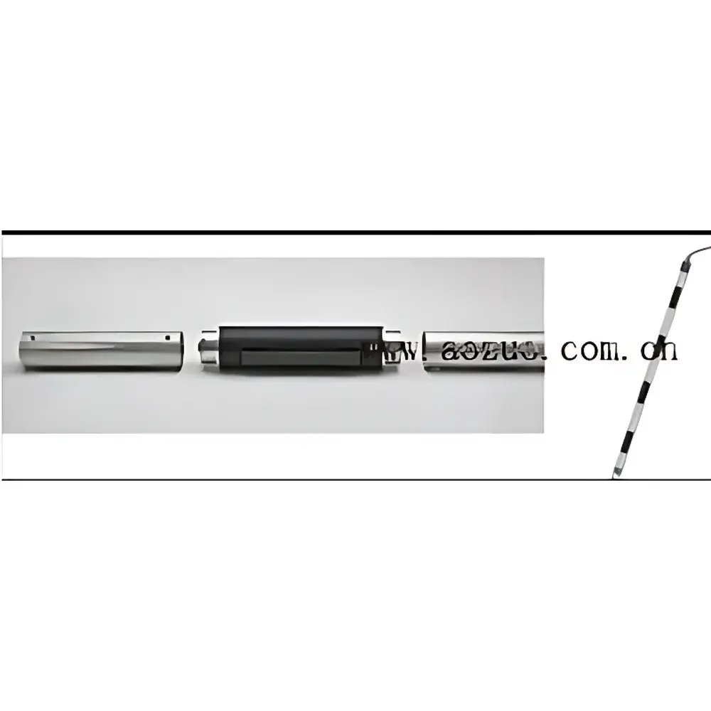
The IMKO TRIME-Logging TDR Soil Moisture Profiling & Continuous Monitoring System is an engineered field-deployable solution for long-term, high-reproducibility volumetric water content (θv) measurement in soil and porous media. It operates on the principle of Time Domain Reflectometry (TDR) enhanced by Intelligent MicroElements (IMKO’s proprietary signal processing architecture), enabling sub-nanosecond time-of-flight resolution—down to 3 ps—to precisely quantify the dielectric permittivity (εr) of the surrounding medium. Since εr exhibits a strong, empirically validated correlation with θv across a wide range of soil textures and salinities, the system delivers direct, calibration-aware moisture quantification without reliance on indirect proxies. Unlike conventional TDR systems constrained by fixed pulse width or limited sampling density, TRIME-Logging employs adaptive waveform digitization and intelligent echo interpretation to mitigate signal distortion from high-conductivity soils (up to 50 dS/m), ensuring robust performance in saline, clay-rich, or organic-rich environments typical of agricultural, hydrological, and geotechnical monitoring applications.
Key Features
- Patented IMKO TDR+IM (Intelligent MicroElements) technology for ultra-high temporal resolution (≤3 ps detection limit) and stable dielectric profiling under variable electrical conductivity conditions
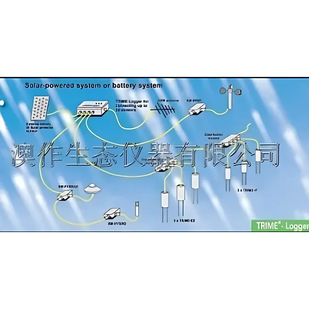
- Modular sensor architecture supporting simultaneous deployment of surface (TRIME-PICO64/32) and profile (TRIME-T3P) sensors on a single IMP-BUS/RS485 backbone
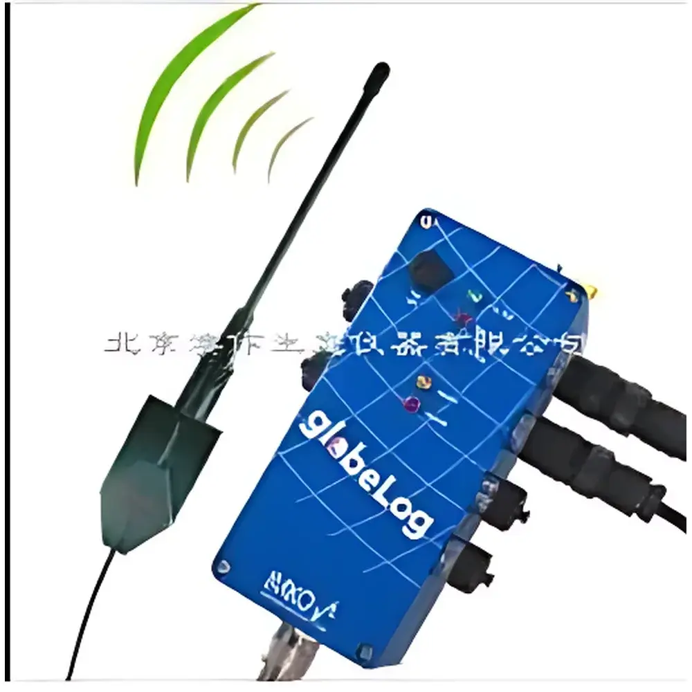
- GlobeLog-Logger data acquisition unit with IP67-rated enclosure, -30°C to +70°C operational range, and dual power options (solar-rechargeable battery or DC input)
- Onboard 2 MB non-volatile memory storing up to 500,000 timestamped records; configurable logging intervals from 1 minute to 24 hours
- Integrated GSM/GPRS modem for encrypted, scheduled data transmission; optional CDMA or satellite telemetry modules available for remote/off-grid sites
- ASCII-formatted output compatible with ISO/IEC 11172-3 compliant data ingestion pipelines and legacy laboratory information management systems (LIMS)
- Pre-loaded factory calibrations for common mineral soils (e.g., FAO Textural Classes); support for up to 15 user-defined calibration curves stored onboard
- IP68-rated TRIME-PICO sensors and IP67-rated TRIME-T3P probes, validated for continuous burial in saturated, freeze-thaw, and mechanically stressed soil profiles
Sample Compatibility & Compliance
The TRIME-Logging system is validated for use in mineral soils (sand to heavy clay), peat, volcanic ash, mine tailings, and engineered backfill materials. Its TDR-based measurement principle remains insensitive to soil particle size distribution, bulk density variations, or redox state—provided the medium exhibits measurable dielectric contrast between water (εr ≈ 80) and solid matrix (εr ≈ 3–5). The system complies with ASTM D5778 (Standard Test Method for Determining the Dielectric Constant of Soils by Time-Domain Reflectometry), ISO 11272:2017 (Soil quality — Determination of dry matter and water content), and supports GLP-aligned data integrity through audit-trail-capable firmware (timestamped configuration changes, sensor ID logging, and error-code reporting). All hardware meets IEC 60529 (IP67/IP68 ingress protection) and EN 61000-6-2/6-4 (EMC immunity/emission) standards for unattended field operation.
Software & Data Management
Data acquisition and configuration are managed via IMKO’s GlobeLog Configuration Suite—a Windows-based application supporting firmware updates, sensor mapping, alarm threshold definition (e.g., θv deviation > ±5%), and automated export to CSV/Excel-compatible ASCII files. Raw waveform data (time-domain reflection traces) are accessible for advanced post-processing using third-party tools (MATLAB, Python SciPy). The system supports secure remote access via TLS-encrypted GPRS sessions, with configurable data retention policies aligned with ISO/IEC 27001 information security frameworks. All timestamps are synchronized to UTC via NTP when Internet connectivity is available, and fallback to internal RTC (±2 s/month drift) during offline periods ensures traceability in disconnected deployments.
Applications
- Long-term vadose zone monitoring in watershed-scale hydrological models (e.g., SWAT, HYDRUS-1D validation)
- Real-time irrigation scheduling and deficit irrigation optimization in precision agriculture
- Soil moisture–temperature coupling studies for land–atmosphere interaction research (e.g., Tibetan Plateau observatories)
- Geotechnical stability assessment in landslide-prone slopes and embankments (TDR-based strain inference via wave velocity shifts)
- Archaeological site preservation monitoring—detecting subsurface moisture anomalies linked to buried structures
- Validation of satellite-derived soil moisture products (e.g., SMAP, Sentinel-1 SAR) at in situ reference stations
- Salinity–moisture co-monitoring in coastal aquifer recharge zones and reclaimed farmland
FAQ
What is the maximum cable length supported between the GlobeLog-Logger and TRIME-PICO sensors?
Standard configurations support up to 100 m per channel using shielded twisted-pair cabling; extended runs (>100 m) require impedance-matched termination and may necessitate signal repeaters.
Can TRIME-Logging operate in frozen soil conditions?
Yes—the TRIME-PICO and TRIME-T3P sensors maintain IP68/IP67 integrity down to -30°C, and the GlobeLog-Logger functions continuously at -30°C; however, liquid water phase detection ceases below 0°C unless unfrozen pore water persists (e.g., in saline soils).
Is the system compliant with FDA 21 CFR Part 11 for regulated environmental monitoring?
While not certified for pharmaceutical manufacturing, the GlobeLog-Logger’s audit trail, electronic signature support, and data immutability features align with Part 11 Annex 11 principles for environmental data integrity in GLP-compliant field studies.
How frequently must calibration curves be updated for long-term deployments?
Factory calibrations remain stable for ≥24 months in stable soil matrices; re-validation is recommended after major soil disturbance (e.g., tillage, compaction) or if electrical conductivity exceeds 10 dS/m for >30 consecutive days.
Does the system support integration with SCADA or cloud-based IoT platforms?
Yes—ASCII output over RS232/V.24 or GPRS enables seamless ingestion into Modbus TCP gateways, AWS IoT Core, or Azure IoT Hub via custom middleware; IMKO provides documented API endpoints for JSON payload conversion.