LICA LR1601 IRIS Integrated Airborne LiDAR-Hyperspectral Imaging System
| Brand | LICA |
|---|---|
| Origin | Beijing, China |
| Model | LR1601 |
| Operating Principle | Push-broom |
| Platform Compatibility | Airborne & Ground-based |
| Spectral Range | 400–1000 nm |
| Spectral Resolution | 2.7 nm |
| Spectral Sampling Interval | 2.1 nm |
| Number of Spectral Bands | 561 (binning option: 281) |
| Spatial Pixels per Line | 1364 |
| Max Frame Rate | 249 fps |
| LiDAR Scan Rate | 320,000 pts/sec |
| Maximum Range | 150 m |
| Horizontal Accuracy | ±2 cm (1σ) |
| Vertical Accuracy | ±1 cm (1σ) |
| IMU Attitude RMS (Pitch/Roll) | 0.04° (PPK-aided) |
| GNSS Support | GPS, GLONASS, BeiDou, RTK |
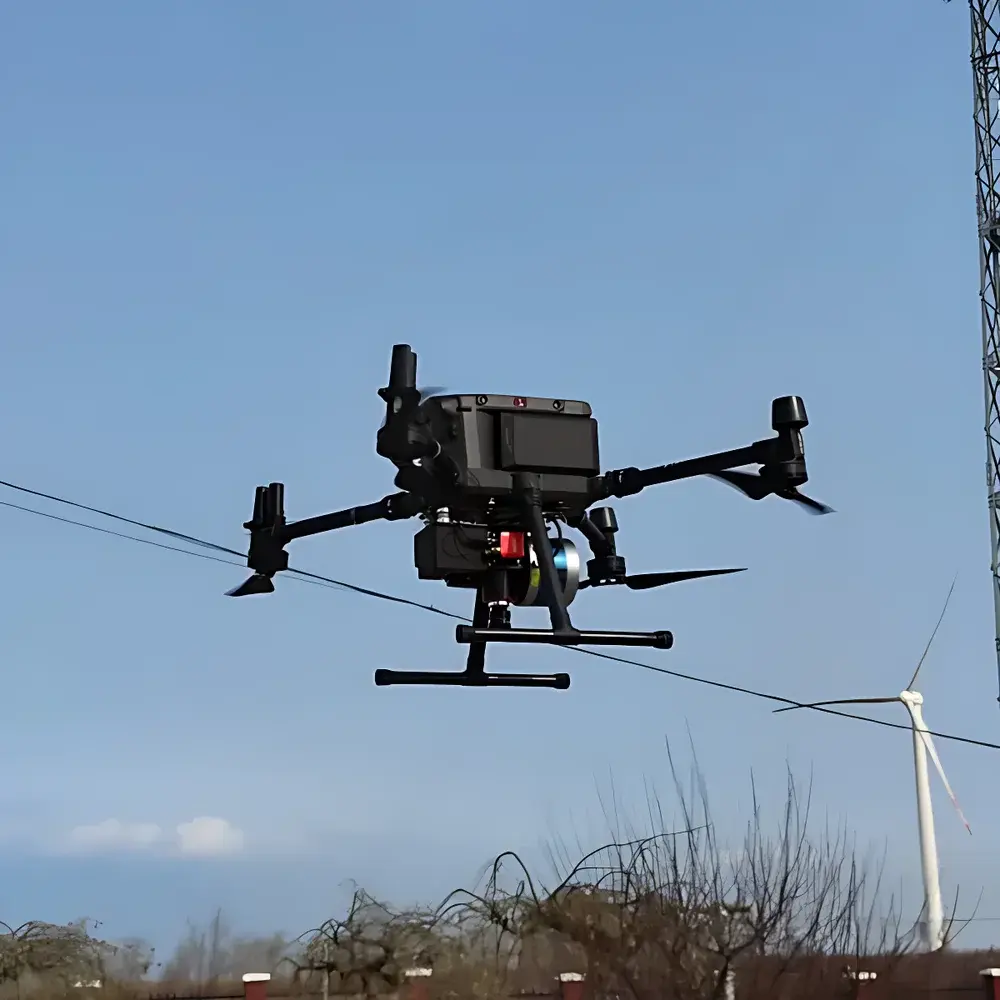
| System Weight | 2.4 kg |
| Optional Sensors | RGB Camera, Thermal Imaging Camera |
Overview
The LICA LR1601 IRIS Integrated Airborne LiDAR-Hyperspectral Imaging System is an engineered solution for synchronized acquisition of georeferenced hyperspectral reflectance data and high-fidelity topographic point clouds. Unlike frame-based or snapshot hyperspectral systems—whose spectral fidelity is compromised by temporal misregistration and spatial interpolation—the IRIS employs a true push-broom architecture, capturing contiguous spectral bands across the visible to near-infrared (VNIR) spectrum (400–1000 nm) with a native spectral resolution of 2.7 nm and sampling interval of 2.1 nm. Concurrently, its integrated time-of-flight (ToF) LiDAR subsystem operates at 320,000 points per second, delivering sub-centimeter vertical accuracy (±1 cm, 1σ) and ±2 cm horizontal accuracy under PPK-aided GNSS/IMU navigation. Critically, both sensors share a rigid mechanical mount and a common inertial measurement unit (IMU) and dual-frequency GNSS receiver, eliminating coordinate transformation errors inherent in post-processed DEM-driven orthorectification workflows. This co-aligned architecture ensures pixel-level geometric congruence between spectral radiance values and 3D surface normals—enabling physically consistent radiometric correction, terrain-aware spectral unmixing, and voxel-based feature extraction.
Key Features
- True push-broom hyperspectral imaging with 561 contiguous spectral bands (400–1000 nm), supporting binning to 281 bands for SNR optimization without spectral aliasing
- Co-mounted ToF LiDAR and VNIR spectrometer on a thermally stable aluminum alloy frame, calibrated via factory-established boresight parameters traceable to NIST-traceable references
- Integrated PPK-aided GNSS/IMU (0.04° RMS pitch/roll) enabling direct georeferencing without ground control points (GCPs) for rapid deployment in remote or infrastructure-limited regions
- Multi-constellation GNSS support (GPS, GLONASS, BeiDou) with real-time kinematic (RTK) capability for centimeter-level trajectory reconstruction
- Modular sensor expansion: optional RGB camera and uncooled microbolometer thermal imager (640 × 512, 50 mK NETD) share the same mounting interface and time-synchronized trigger logic
- Lightweight airborne configuration (2.4 kg total mass) compatible with Class I and II UAV platforms (e.g., DJI Matrice 300 RTK, Freefly Alta X), certified per DO-160 Section 21 environmental stress requirements
Sample Compatibility & Compliance
The IRIS system is designed for non-contact, passive remote sensing of natural and anthropogenic surfaces—including vegetation canopies, soil substrates, urban materials, and aquatic boundaries—under ambient daylight illumination. Its spectral coverage aligns with key biochemical absorption features (e.g., chlorophyll-a at 680 nm, water vapor at 940 nm) and supports quantitative retrieval of vegetation indices (NDVI, PRI, MCARI), mineralogical indicators (iron oxide, clay hydroxyl), and stress biomarkers. Data acquisition and metadata generation comply with ISO 19115-2:2019 (geospatial metadata) and ASTM E2798-21 (standard guide for airborne hyperspectral data collection). Raw sensor outputs are stored in ENVI-compatible BIL format with embedded GDAL-compliant geotags; LiDAR point clouds adhere to ASPRS LAS 1.4 specification with extended waveform and intensity attributes.
Software & Data Management
LICA’s proprietary IRIS Suite v3.2 provides end-to-end processing: from raw IMU/GNSS log fusion and LiDAR point cloud classification (using unsupervised region-growing and height-threshold segmentation) to hyperspectral atmospheric correction (QUAC and FLAASH modules), geometric orthorectification using direct sensor orientation (DSO), and co-registration of spectral rasters to LiDAR-derived digital surface models (DSMs). All processing steps maintain full audit trails compliant with FDA 21 CFR Part 11 requirements, including user authentication, electronic signatures, and immutable version-controlled project logs. Export formats include GeoTIFF, Cloud Optimized GeoTIFF (COG), and OGC SensorThings API-compliant JSON-LD for integration into enterprise GIS platforms (ArcGIS Enterprise, QGIS Server) and cloud analytics environments (Google Earth Engine, Microsoft Planetary Computer).
Applications
- Precision agriculture: canopy-height-normalized NDVI mapping, early detection of nitrogen deficiency via red-edge slope analysis, and yield prediction using 3D structure–function modeling
- Forestry inventory: species classification via spectral–structural joint features (e.g., bark texture + lignin absorption at 700 nm), biomass estimation through voxelized crown volume integration
- Environmental monitoring: detection of heavy metal contamination in soils using iron/manganese spectral shifts, quantification of cyanobacterial blooms via phycocyanin fluorescence peak deconvolution
- Urban planning: material identification (asphalt, concrete, roofing membranes) using spectral library matching against USGS Spectral Library v7, combined with façade inclination analysis from LiDAR normals
- Geological survey: lithological mapping in exposed bedrock using diagnostic absorption features (e.g., Al–OH at 2200 nm, though outside IRIS range—supported via spectral extrapolation algorithms trained on adjacent bands)
FAQ
Does the IRIS system require ground control points (GCPs) for georeferencing?
No—direct georeferencing is achieved via tightly coupled PPK-processed GNSS/IMU data. GCPs are optional for validation or refinement in high-accuracy survey applications.
Can hyperspectral and LiDAR data be acquired simultaneously on separate platforms and fused post-mission?
While technically feasible, such an approach introduces systematic co-registration errors exceeding ±10 cm due to platform dynamics, timing jitter, and independent boresight uncertainty. The IRIS’s monolithic design eliminates these error sources.
Is the system compatible with third-party flight planning software?
Yes—IRIS supports standard MAVLink telemetry protocols and exports mission waypoints in KML and GPX formats. Integration with UgCS, DroneDeploy, and Pix4Dcapture is validated and documented.
What spectral calibration standards are applied during manufacturing?
Each unit undergoes laboratory calibration using NIST-traceable tungsten-halogen and deuterium lamps, with wavelength accuracy verified to ±0.1 nm and radiometric linearity validated over 3–95% reflectance range using Spectralon® reference panels.
How is thermal drift managed during extended airborne missions?
The optical bench incorporates passive thermal stabilization via low-CTE aluminum housing and internal temperature monitoring (±0.1°C resolution); spectral recalibration is automatically triggered if ΔT exceeds 2°C from baseline, using onboard dark-current and white-reference frames.
Related Products