SDL MCS-900V Mobile Atmospheric Composite Pollution Monitoring Vehicle
| Brand | SDL |
|---|---|
| Origin | Beijing, China |
| Manufacturer Type | Original Equipment Manufacturer (OEM) |
| Country of Origin | China |
| Model | MCS-900V |
| Price | USD 560,000 (indicative only) |
Overview
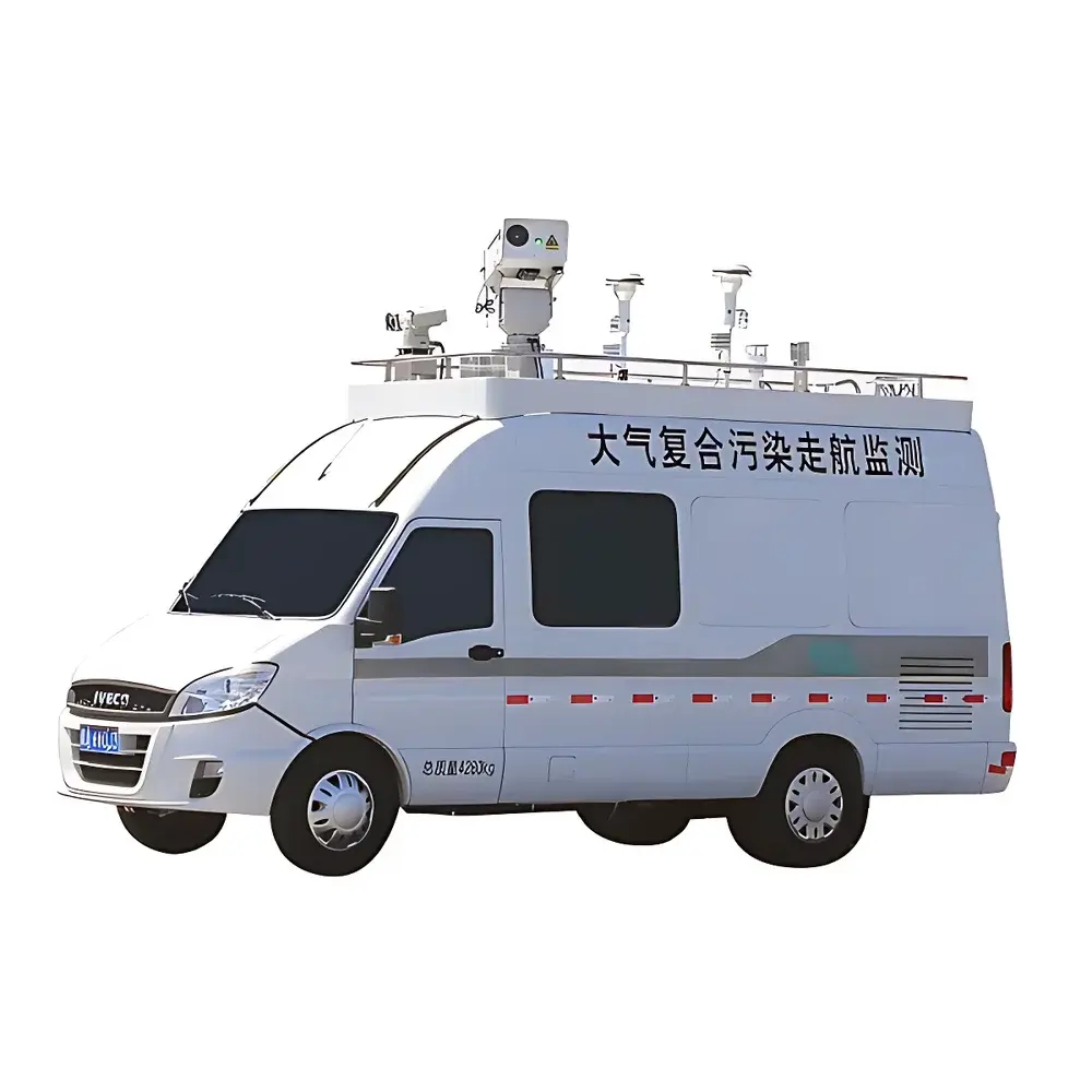
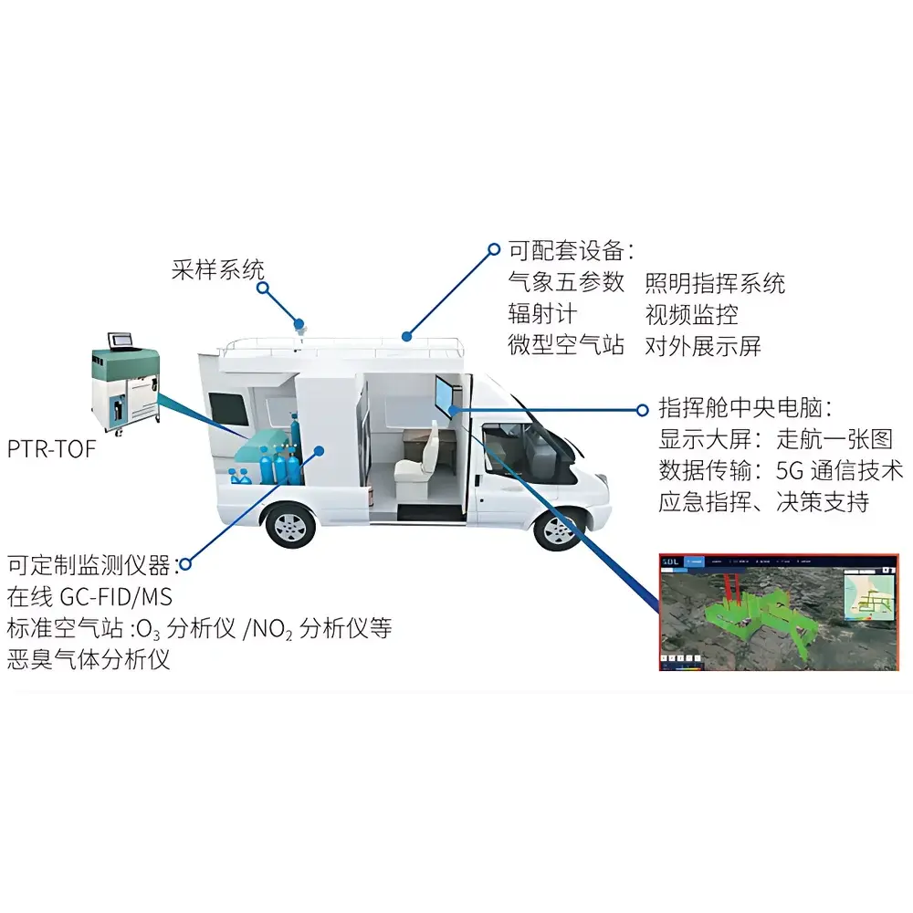
The SDL MCS-900V Mobile Atmospheric Composite Pollution Monitoring Vehicle is an integrated, vehicle-mounted environmental monitoring platform engineered for high-temporal-resolution, spatially resolved characterization of urban and regional air pollution. Built on a robust chassis-based architecture, the system implements real-time, in-situ measurement of gaseous pollutants, particulate matter, volatile organic compounds (VOCs), meteorological parameters, and atmospheric optical properties—enabling both mobile transect surveys (“sniffing mode”) and stationary observation (“park-and-measure mode”). Core analytical capabilities are anchored in proton-transfer-reaction time-of-flight mass spectrometry (PTR-TOF-MS) for sub-second VOC speciation, complemented by regulated-grade ambient air quality analyzers (e.g., chemiluminescence NOx, UV photometric O3, beta-attenuation PM2.5/PM10), scanning elastic lidar for vertical aerosol profiling, and synchronized meteorological sensing (wind speed/direction, temperature, humidity, pressure). This multi-sensor fusion design supports quantitative source apportionment, ozone formation potential (OFP) and secondary organic aerosol potential (SOAP) calculations, and dynamic plume tracking across heterogeneous landscapes.
Key Features
- Real-time VOC speciation: Simultaneous detection and quantification of >100 individual VOC species—including alkanes, alkenes, aromatics, oxygenated VOCs (OVOCs), and sulfur-containing compounds—at sub-second temporal resolution using PTR-TOF-MS
- Dual operational modes: Seamless transition between high-speed mobile mapping (up to 60 km/h with positional accuracy <5 m) and stationary high-precision monitoring with extended integration times
- Vertical profiling capability: Integrated scanning elastic lidar provides range-resolved backscatter coefficient profiles up to 10 km altitude, enabling boundary layer height estimation and aerosol layer identification
- Multi-layer sensor integration: Co-located measurements from EPA-equivalent gas analyzers (NOx, SO2, CO, O3), low-cost micro-sensors (for spatial interpolation), video surveillance (georeferenced visual context), and full meteorological suite
- Ruggedized vehicle platform: ISO 17025-aligned calibration infrastructure, climate-controlled instrument cabin (-10°C to +45°C operating range), shock-dampened mounting, and uninterruptible power supply (UPS) for field continuity
Sample Compatibility & Compliance
The MCS-900V is designed for ambient air sampling under variable environmental conditions (temperature: -20°C to +50°C; relative humidity: 10–95% RH non-condensing). All onboard analyzers comply with national and international reference methods: gas-phase instruments meet GB/T 3838–2018 and EPA TO-15/TO-17 equivalency requirements; PM monitors conform to ISO 10473 and EN 12341; lidar performance adheres to EARLINET technical guidelines. Data acquisition and storage support audit-ready traceability per GLP principles, including timestamped raw spectra, calibration logs, maintenance records, and GPS-synchronized trajectory metadata. The system architecture is compatible with regulatory reporting frameworks including China’s “Technical Specification for Ambient Air Quality Monitoring” (HJ 93–2013, HJ 653–2013) and supports cross-border data harmonization via AQICN and OpenAQ protocols.
Software & Data Management
The integrated Atmospheric Mobile Monitoring Analysis Platform (AMMAP) is a web-accessible GIS-based analytics engine supporting multi-source data ingestion (VOCs, fixed-site air stations, odor sensors, micro-stations, lidar profiles, and vehicle telemetry). It delivers real-time geospatial visualization of concentration gradients, time-resolved component ratio analysis (e.g., BTEX, isoprene/toluene), ozone sensitivity classification (NOx– vs. VOC-limited regimes), and receptor modeling outputs (e.g., PSCF, CWT). All processing workflows—including spectral deconvolution, mass calibration, humidity correction, and OFP/SOAP calculation—are fully documented and reproducible. System-generated reports comply with ISO/IEC 17025 documentation standards, and audit trails meet FDA 21 CFR Part 11 requirements for electronic records and signatures where deployed in regulated environments.
Applications
- Spatiotemporal mapping of urban air quality hotspots and industrial corridor emissions
- Dynamic source attribution for VOCs and odorous compounds using chemical fingerprinting (e.g., distinguishing traffic exhaust, petrochemical fugitives, solvent use, and biogenic emissions)
- Ozone episode investigation: Quantifying photochemical reactivity of local VOC mixtures and identifying precursor control priorities
- Evaluation of emission reduction policies: Pre- and post-intervention mobile surveys to assess effectiveness of VOC/NOx abatement measures
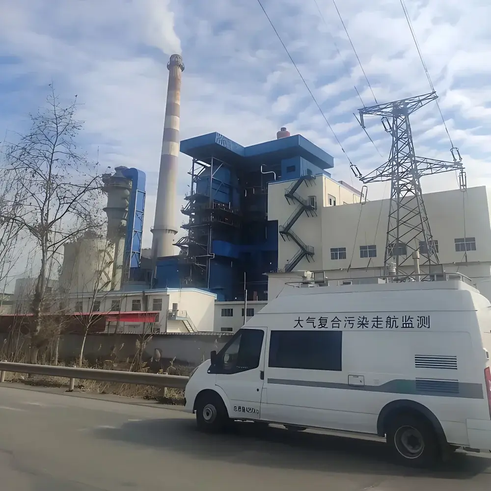
- Emergency response: Rapid deployment for fugitive emission events, chemical spills, or fire-related smoke plume characterization
- Scientific campaign support: Coordinated measurements with ground stations, aircraft, and satellite overpasses for model validation
FAQ
What VOC detection limits does the PTR-TOF-MS achieve in the MCS-900V configuration?
Detection limits vary by compound and matrix but typically range from 0.1–5 pptv (1σ, 1-second integration) for common aromatic and oxygenated VOCs under standard ambient conditions.
Can the system operate autonomously without on-board personnel?
Yes—the vehicle supports remote start-up, real-time telemetry, and unattended operation for up to 72 hours with auxiliary power and environmental stabilization active.
Is the lidar capable of quantitative aerosol extinction retrieval?
The elastic lidar provides qualitative and semi-quantitative backscatter profiles; quantitative extinction and lidar ratio derivation require co-location with Raman or HSRL systems not included in the base MCS-900V configuration.
How is data synchronization handled across disparate sensors and GPS?
All instruments feed into a central time server synchronized to GNSS PPS (pulse-per-second) signal, achieving sub-10 ms timestamp alignment across all data streams.
Does the system support third-party data export formats for modeling integration?
Yes—AMMAP exports NetCDF-4, CSV, and GeoJSON formats compliant with WRF-Chem, CAMx, and CMAQ preprocessor requirements, including mandatory metadata fields per CF-1.8 conventions.
Related Products