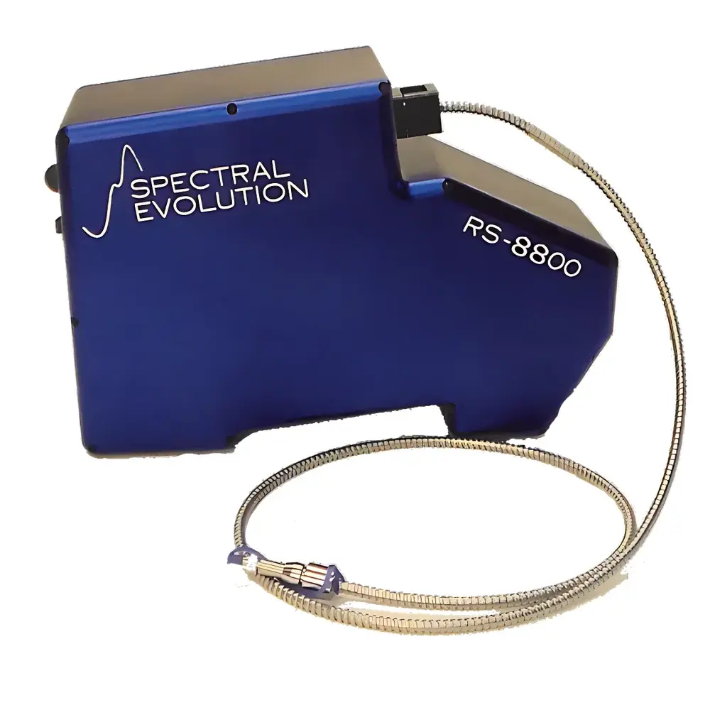
Spectral Evolution RS-8800 Field Spectroradiometer
| Brand | Spectral Evolution |
|---|---|
| Origin | USA |
| Model | RS-8800 |
| Spectral Range | 350–2500 nm |
| Spectral Resolution | 2.8 nm @ 700 nm, 8 nm @ 1500 nm, 6 nm @ 2100 nm |
| Detector Configuration | 512-pixel Si array (350–1000 nm) + dual-stage TE-cooled 256-pixel InGaAs arrays (970–2500 nm) |
| FOV Options | 1°–10° lenses, 25° fiber optic, cosine corrector, integrating sphere |
| NEDL | 0.8×10⁻⁹ W/cm²/nm/sr @ 400 nm, 1.2×10⁻⁹ W/cm²/nm/sr @ 1500 nm |
| Radiometric Accuracy | NIST-traceable calibration |
| Measurement Modes | Remote Wi-Fi/Bluetooth control via Android/iOS/Windows, autonomous unattended operation, external trigger |
| Scan Speed | 7.5–1000 ms (user-selectable or auto-optimized) |
| Wavelength Repeatability | ±0.1 nm |
| Wavelength Accuracy | ±0.5 nm |
| Weight | <5 kg |
| Housing | Anodized aluminum, thermally stable, IP54-rated for field deployment |
Overview
The Spectral Evolution RS-8800 Field Spectroradiometer is a high-fidelity, filter-based hyperspectral instrument engineered for quantitative radiometric, reflectance, and transmittance measurements across the ultraviolet–visible–near-infrared–shortwave infrared (UV–VIS–NIR–SWIR) spectrum (350–2500 nm). Unlike scanning or dispersive systems reliant on moving gratings or narrow slits, the RS-8800 employs a fixed holographic grating architecture coupled with three synchronized linear detector arrays: a 512-pixel silicon CCD for 350–1000 nm and two thermoelectrically cooled 256-pixel InGaAs arrays covering 970–1700 nm and 1700–2500 nm respectively. This all-solid-state optical design eliminates mechanical drift, ensures long-term calibration stability, and delivers high signal-to-noise ratio (SNR) performance under variable ambient conditions. The instrument conforms to ASTM E275, ISO 13406-2, and USP spectral measurement guidelines and supports traceability to NIST Standard Reference Materials (SRMs) via factory-applied, wavelength- and responsivity-calibrated coefficients embedded in each data file.
Key Features
- Triple-detector architecture with TE-cooled InGaAs arrays for extended SWIR sensitivity and thermal stability
- Integrated smart probe with MEMS inclinometer, ultrasonic distance sensor, 5-megapixel RGB imager, GPS module, and real-time solar elevation calculation
- Automatic exposure control, shuttered dark-current compensation, and adaptive integration time optimization per scan
- Wireless operation via IEEE 802.11n Wi-Fi or Bluetooth 5.0; compatible with Android, iOS, and Windows platforms using the DARWin SP acquisition software
- Modular optical interface supporting interchangeable fore-optics: narrow FOV telescopic lenses (1°–10°), cosine correctors, fiber bundles (up to 3 m), contact probes, and integrating spheres
- Anodized aluminum chassis rated IP54 for dust and water resistance; operational temperature range: −10 °C to +50 °C
- Built-in rechargeable Li-ion battery (8 hr typical runtime); total system mass <5 kg including probe and battery
- Support for GLP-compliant audit trails, electronic signatures, and FDA 21 CFR Part 11–ready metadata tagging in raw data files
Sample Compatibility & Compliance
The RS-8800 is designed for non-contact, non-destructive spectral characterization of heterogeneous natural and engineered surfaces—including vegetation canopies, soil profiles, mineral outcrops, painted materials, photovoltaic cells, and pharmaceutical tablets. Its wide spectral coverage and calibrated radiometric response enable compliance with remote sensing validation protocols defined by CEOS, NASA’s Land Product Validation Subgroup, and ESA’s Fiducial Reference Measurements (FRM) framework. All factory calibrations are performed under ISO/IEC 17025-accredited conditions and include uncertainty budgets per wavelength channel. The instrument meets IEC 61000-6-3 EMC emission standards and operates within Class 1 laser safety limits (IEC 60825-1). Data files embed EXIF-style metadata (GPS coordinates, timestamp, solar zenith angle, viewing geometry, integration time, detector temperature), satisfying FAIR (Findable, Accessible, Interoperable, Reusable) data principles.
Software & Data Management
DARWin SP v5.x serves as the primary acquisition and preprocessing environment, offering real-time spectral visualization, batch processing, BRDF modeling workflows, and automated vegetation index computation (NDVI, EVI, SAVI, PRI, WBI, GRVI, SR). The software includes built-in access to the USGS Digital Spectral Library, ASTER Mineral Library, and ENVI-compatible spectral libraries. Raw spectra are saved in HDF5 format with embedded calibration coefficients, enabling reproducible radiometric correction without proprietary dependencies. Optional LabVIEW™ drivers (NI-VISA compliant) support integration into automated test benches. All measurement sessions generate CSV and ENVI .hdr/.sli exports suitable for ingestion into QGIS, ENVI, Python (NumPy/Pandas/SpectroChemPy), or MATLAB®. Audit logs record user actions, parameter changes, and calibration events with timestamps and digital signatures.
Applications
- Ground-truthing of satellite and airborne sensors (e.g., Landsat-9, Sentinel-2, PRISMA, AVIRIS-NG)
- BRDF characterization of anisotropic surfaces for atmospheric correction and bidirectional reflectance distribution modeling
- In-field phenotyping and stress detection in precision agriculture using multi-index fusion algorithms
- Mineral identification and alteration mapping in exploration geology via spectral absorption feature analysis (e.g., OH, Al-OH, Fe³⁺ bands)
- Radiometric validation of solar simulators and LED lighting systems per IEC 62612 and CIE S 026
- Non-invasive quality assessment of food commodities (e.g., sugar content, moisture, bruising) and pharmaceutical tablet coating uniformity
- Coastal and inland water constituent retrieval (chlorophyll-a, CDOM, suspended sediments) using inversion models trained on RS-8800 reference spectra
- Calibration transfer between laboratory goniometers and field-deployable systems in metrology laboratories
FAQ
Is the RS-8800 suitable for UAV-based deployment?
Yes—its weight (<5 kg), low power consumption, and rigid aluminum housing make it compatible with medium-lift commercial UAVs. Optional vibration-damping mounts and custom gimbal interfaces are available through authorized integration partners.
Does the system support automated BRDF acquisition sequences?
Yes—DARWin SP includes programmable goniometric routines that coordinate probe orientation, GPS-triggered waypoints, and synchronized image capture for full hemisphere BRDF sampling.
Can raw data be processed without proprietary software?
Yes—HDF5-formatted output contains all calibration metadata and raw DN values; open-source Python libraries (e.g., h5py, pyspectral) enable full reproducibility of radiometric corrections.
What is the calibration validity period under field use conditions?
NIST-traceable calibration remains valid for 12 months under normal handling; annual verification against a stable quartz-halogen standard lamp is recommended per ISO/IEC 17025 QA protocols.
Are spectral libraries for minerals or vegetation included?
The base software includes the USGS spectral library; optional add-ons provide the ASTER, ECOSTRESS, and SPECCHIO-compatible mineral and plant trait databases.
Related Products