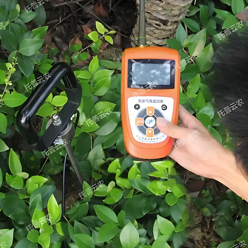
Top Cloud-agri TJSD-750-II Soil Compaction Tester
| Brand | Top Cloud-agri |
|---|---|
| Origin | Zhejiang, China |
| Manufacturer Type | Direct Manufacturer |
| Country of Origin | China |
| Model | TJSD-750-II |
| Measurement Accuracy | ±5% |
| Measuring Depth | 0–375 mm (400 mm probe length) |
| Penetration Force Range | 0–7922 kPa / 0–89 kgf/cm² / 0–890 N/cm² (unit-selectable) |
| Data Logging Interval | 5 min – 99 h |
| GPS Resolution | Latitude 0–90°, Longitude 0–180° |
| Internal Storage | ~30,000 records (Flash) + expandable microSD (up to 4 GB standard) |
| Power Supply | 7.4 V / 1.8 Ah Li-ion battery (with low-voltage warning & charge protection) |
| Communication | Dual-mode 2G/4G cellular uplink + USB data export |
| IP Rating (Extension Cable) | IP67 |
| Sensor Expansion Capacity | Up to 32 sensors via daisy-chained hub |
Overview
The Top Cloud-agri TJSD-750-II Soil Compaction Tester is a field-deployable, GPS-integrated penetrometer engineered for quantitative assessment of soil mechanical resistance—commonly referred to as soil compaction. It operates on the principle of dynamic cone penetration: a calibrated stainless-steel probe is driven vertically into undisturbed soil at a controlled rate, and the force required per unit depth (kPa/mm or N/cm²/mm) is measured in real time using a high-stability load cell. This measurement directly correlates with soil bulk density, root penetration resistance, water infiltration capacity, and long-term structural stability—parameters critical to agronomic planning, conservation tillage evaluation, and land reclamation monitoring. Unlike manual analog penetrometers, the TJSD-750-II delivers traceable, timestamped, georeferenced digital records compliant with FAO guidelines for soil physical characterization and supports longitudinal field studies under ISO 28580:2019 (Soil Quality — Determination of Penetration Resistance).
Key Features
- Integrated dual-mode GNSS receiver delivering sub-5-meter horizontal positional accuracy (CEP), automatically embedding WGS84 coordinates into every data packet.
- Tri-unit force display (kPa, kgf/cm², N/cm²) with real-time unit conversion and auto-scaling based on measured range (0–7922 kPa).
- Dual-storage architecture: onboard Flash memory (≥30,000 records) + hot-swappable microSD card (4 GB standard, user-expandable) enabling multi-season deployment without data offload.
- Low-power embedded system architecture with deep-sleep mode (3 mA standby current); intelligent power management extends field operation to ≥72 hours per full charge under typical sampling intervals (30-min logging).
- Modular sensor hub interface supporting up to 32 concurrent analog/digital sensors (e.g., soil moisture, temperature, EC, pH) with individual calibration retention and no cross-channel interference.
- Configurable audio feedback: voice-enabled threshold alerts (user-defined upper/lower limits), spoken coordinate readout, and status announcements (e.g., “GPS lock acquired”, “Storage full”)
- Ruggedized probe assembly with 400 mm anodized aluminum rod and hardened tip; rated for repeated insertion across clay loam, sandy loam, and silty soils per ASTM D1140-22 Annex A1 (Standard Test Methods for Penetration Resistance of Soils).
Sample Compatibility & Compliance
The TJSD-750-II is validated for use in mineral soils (USDA texture classes: sand to clay), organic-rich topsoil (up to 20% OM), and reclaimed mine spoils exhibiting cohesionless to moderately cohesive behavior. It excludes frozen, water-saturated (>saturation index >0.95), or gravel-rich (>15% particles >20 mm) profiles where probe deflection or slippage compromises measurement integrity. All firmware and data handling protocols conform to GLP-aligned metadata requirements: each record includes ISO 8601 timestamp, UTC/GPS-synced time source, probe serial number, operator ID (optional), and environmental context tags (e.g., “pre-irrigation”, “post-harvest”). Data export formats include CSV (UTF-8 encoded), GeoJSON (for GIS integration), and XML (compatible with ISO 11783-10 agricultural telemetry standards).
Software & Data Management
Data acquisition and remote supervision are managed via the Top Cloud-agri Instrument Cloud Platform—a secure, role-based SaaS environment accessible via web browser (Chrome/Firefox/Edge) or native Android/iOS applications. The platform implements audit-trail functionality per FDA 21 CFR Part 11 requirements: all user actions (data deletion, calibration edits, report generation) are immutably logged with timestamps, IP addresses, and digital signatures. Raw sensor streams are stored in encrypted AES-256 containers with daily automated backups to geo-redundant cloud infrastructure. Analytical tools include depth-profile visualization (force vs. depth curves), spatial heatmaps (Kriging interpolation), temporal trend analysis (seasonal compaction indices), and customizable alert rules (e.g., “trigger email if >6500 kPa at 20–30 cm depth”). Firmware updates are delivered over-the-air with SHA-256 signature verification.
Applications
- Agricultural research: Quantifying tillage-induced compaction gradients across rotation systems (e.g., no-till vs. conventional till) and validating subsoiling efficacy.
- Irrigation management: Correlating compaction layers with reduced infiltration rates and identifying preferential flow paths in drip-irrigated orchards.
- Environmental impact assessment: Monitoring soil structural recovery during post-construction remediation or forest floor restoration projects.
- Regulatory compliance: Generating auditable datasets for EU Soil Thematic Strategy reporting, USDA-NRCS Conservation Practice Standard Code 333 (Subsoil Compaction Control), and China’s GB/T 32725-2016 (Soil Physical Property Testing Methods).
- Educational fieldwork: Enabling undergraduate soil physics labs to collect statistically robust, georeferenced penetrometer datasets for regression modeling against lab-derived bulk density and porosity measurements.
FAQ
What is the recommended calibration frequency for field accuracy maintenance?
Calibration verification is advised before each seasonal campaign using NIST-traceable dead-weight test kits (supplied separately). Full recalibration by authorized service centers is recommended annually or after 5,000 probe insertions.
Can the device operate in fully offline mode without cellular coverage?
Yes—local data logging continues uninterrupted. GPS positioning remains functional; only remote upload is suspended until network connectivity resumes.
Is the probe compatible with existing soil coring or augering equipment?
The 400 mm probe features standardized 1/4″-20 UNC threads at the base, allowing direct mounting to commercial soil sampling rigs or custom brackets.
Does the cloud platform support third-party API integration for enterprise LIMS or farm management software?
Yes—RESTful JSON APIs with OAuth 2.0 authentication are available under commercial licensing agreements, including schema documentation and sandbox environments.
How is data security enforced during wireless transmission?
All 2G/4G transmissions use TLS 1.2+ encryption; device-to-server handshakes require mutual certificate validation. No credentials or raw sensor values are stored on edge devices beyond local session keys.


