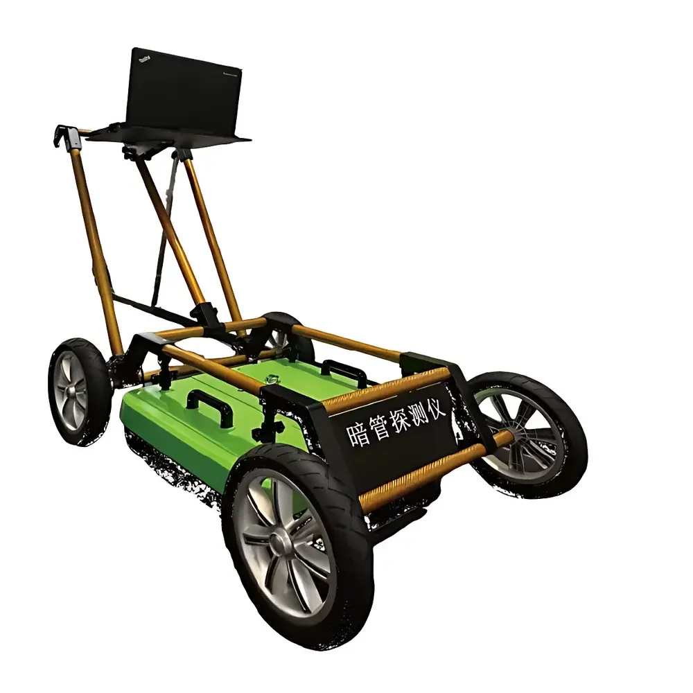
Ground Penetrating Radar (GPR) System SEN-RD3000 – Dual-Frequency Integrated Survey Instrument
| Brand | Senbe |
|---|---|
| Origin | Jiangsu, China |
| Manufacturer Type | OEM Manufacturer |
| Country of Origin | China |
| Model | SEN-RD3000 |
| Pricing | Upon Request |
Overview
The Senbe SEN-RD3000 is a fully digital, ultra-wideband (UWB) ground penetrating radar system engineered for non-destructive subsurface investigation in environmental monitoring, municipal infrastructure assessment, and regulatory enforcement applications. Operating on the principle of electromagnetic wave propagation and reflection at dielectric discontinuities, the SEN-RD3000 transmits short-duration, high-frequency pulses into the ground and records time-domain reflections from buried objects or stratigraphic interfaces. Its core architecture centers on a high-speed pulse generator and picosecond-level sampling technology, enabling precise time-of-flight measurement with sub-nanosecond resolution. Unlike conventional single-frequency GPR systems, the SEN-RD3000 integrates a proprietary dual-band antenna array—simultaneously emitting and receiving signals across two distinct center frequencies—allowing concurrent acquisition of shallow-high-resolution and deep-penetration data within a single scan pass. This architecture supports effective detection of subsurface anomalies—including non-metallic pipes, voids, utilities, and buried structures—within a depth range of 0–8 meters in typical soil conditions (e.g., dry sand, loam, or compacted fill), subject to site-specific conductivity and permittivity.
Key Features
- Dual-frequency integrated antenna array: Enables simultaneous shallow (e.g., 500–1000 MHz) and deep (e.g., 100–400 MHz) band operation without hardware switching or re-surveying.
- Fully digital signal processing architecture: Software-controlled gain adjustment, real-time filtering, and automatic time-zero calibration eliminate manual setup dependencies.
- Wireless data transmission capability: Supports IEEE 802.11n Wi-Fi for remote preview, live streaming, and field synchronization with tablet-based control units.
- Compact, ergonomic design: Host and antenna are mechanically integrated into a single unit; total mass < 8.5 kg, optimized for push-cart or handheld deployment.
- Intelligent real-time interpretation engine: Onboard algorithms highlight hyperbolic diffraction patterns, estimate burial depth via velocity calibration, and classify anomaly geometry based on amplitude-phase coherence.
- Battery-powered operation: Rechargeable Li-ion battery pack provides ≥6 hours of continuous scanning under standard duty cycle (100 kHz PRF, 2 GHz sampling).
Sample Compatibility & Compliance
The SEN-RD3000 is compatible with a broad range of near-surface geological and anthropogenic media, including asphalt, concrete, gravel, clay, sandy soils, and backfilled trenches. It detects both conductive (e.g., metallic conduits, rebar) and non-conductive targets (e.g., PVC, HDPE, PE gas pipes, ceramic sewer lines, voids, and buried concrete foundations) through contrast in relative permittivity (εr) and electrical conductivity (σ). While not certified to IEC 61000-6-2/6-4 for EMC immunity, its emissions comply with FCC Part 15 Subpart B Class B limits for industrial field equipment. The system supports audit-ready data logging compliant with GLP principles: all raw traces include embedded GPS timestamps (when paired with external GNSS module), operator ID, survey line metadata, and firmware version. Raw data export follows SEG-Y Rev 1.0 format for interoperability with third-party processing software (e.g., ReflexW, GPR-Slice, or SeisImager/GPR).
Software & Data Management
The SEN-RD3000 ships with Senbe GPR Studio v3.x—a Windows-based desktop application supporting real-time display, post-processing, and report generation. Core functionalities include background removal, migration (Kirchhoff and phase-shift), gain balancing, spectral analysis, and depth slicing. All processed profiles can be georeferenced using optional RTK-GNSS input and exported as GeoTIFF, KMZ, or CSV. The software maintains full trace-level audit trails: every processing step is logged with user action, timestamp, and parameter values. For regulated environments (e.g., EPA-led enforcement surveys or municipal asset inventories), the system supports optional 21 CFR Part 11-compliant electronic signature modules when deployed with domain-authenticated Windows accounts and encrypted database storage.
Applications
- Environmental compliance enforcement: Rapid identification of clandestine wastewater discharge pipes, illegal septic leach fields, and buried hazardous waste containers.
- Municipal utility mapping: Inventory and condition assessment of aging water mains (cast iron, ductile iron, PVC), district heating pipelines, and stormwater culverts.
- Transportation infrastructure: Pre-construction utility clearance along railway right-of-ways and highway corridors per ASTM D6432 and ISO 22476-11 standards.
- Archaeological and forensic investigations: Detection of buried vaults, unmarked graves, or concealed structural features without excavation.
- Industrial site characterization: Locating buried tanks, grounding grids, cable trays, and foundation footings prior to drilling or trenching.
FAQ
What types of non-metallic pipes can the SEN-RD3000 detect?
It reliably detects PE, PVC, HDPE, and concrete pipes in soils with moderate conductivity (< 15 mS/m); detection sensitivity decreases in highly conductive clays or saline saturated zones.
Does the system require calibration before each survey?
No—automatic time-zero correction and adaptive gain stabilization are applied in real time; velocity calibration is recommended only when estimating depth in heterogeneous media.
Can data be processed in the field without a laptop?
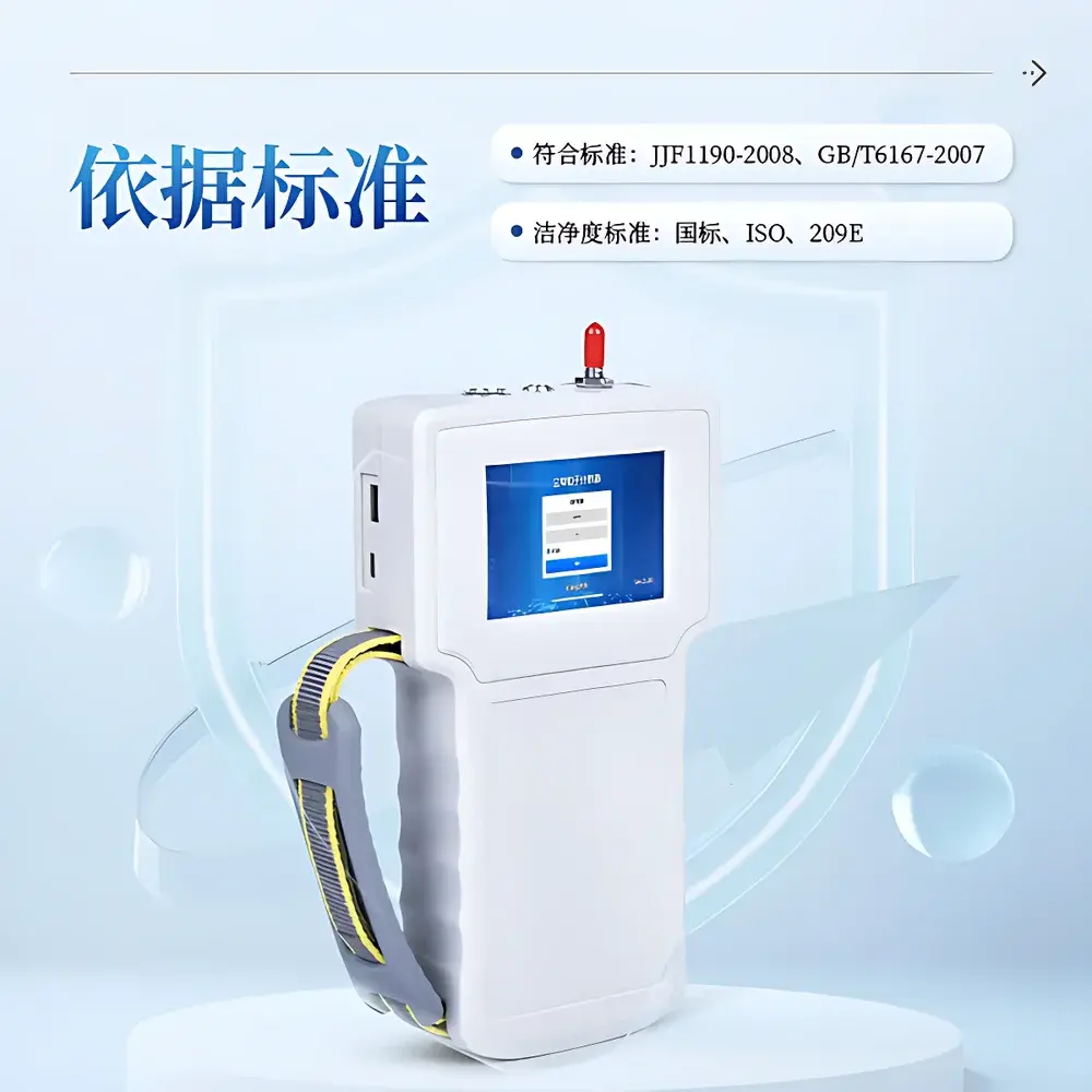
Yes—basic profile viewing, gain adjustment, and annotation are supported on the integrated 7-inch touchscreen; advanced processing requires GPR Studio on Windows.
Is the SEN-RD3000 suitable for use on paved surfaces?
Yes—its dual-frequency antenna achieves consistent coupling on asphalt and concrete; optional wheel encoder ensures accurate distance registration.
What is the maximum recommended scan speed for optimal resolution?
For 0.1-m lateral sampling interval and stable waveform fidelity, maintain ≤3 km/h on smooth surfaces; slower speeds (≤1.5 km/h) are advised for high-resolution shallow mapping.
Related Products