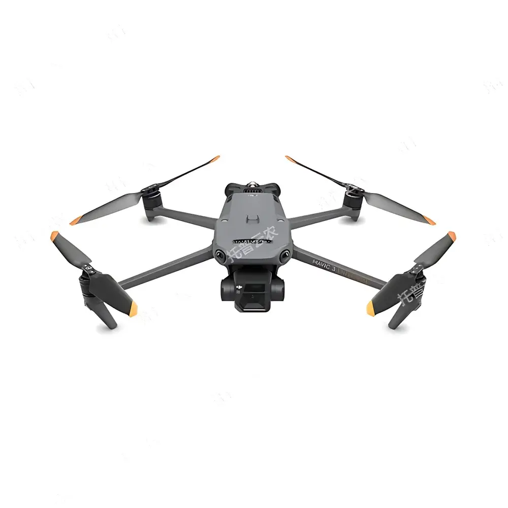
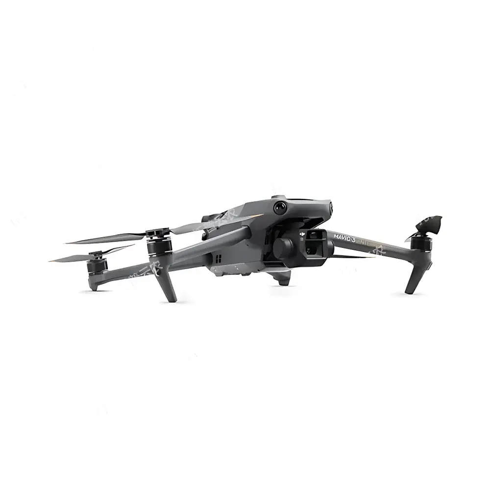
TopCloud-agri TP-KJG Low-Altitude Remote Sensing Plant Phenotyping System
| Brand | TopCloud-agri |
|---|---|
| Origin | Zhejiang, China |
| Manufacturer Type | OEM/ODM Manufacturer |
| Country of Origin | China |
| Model | TP-KJG |
| Pricing | Upon Request |
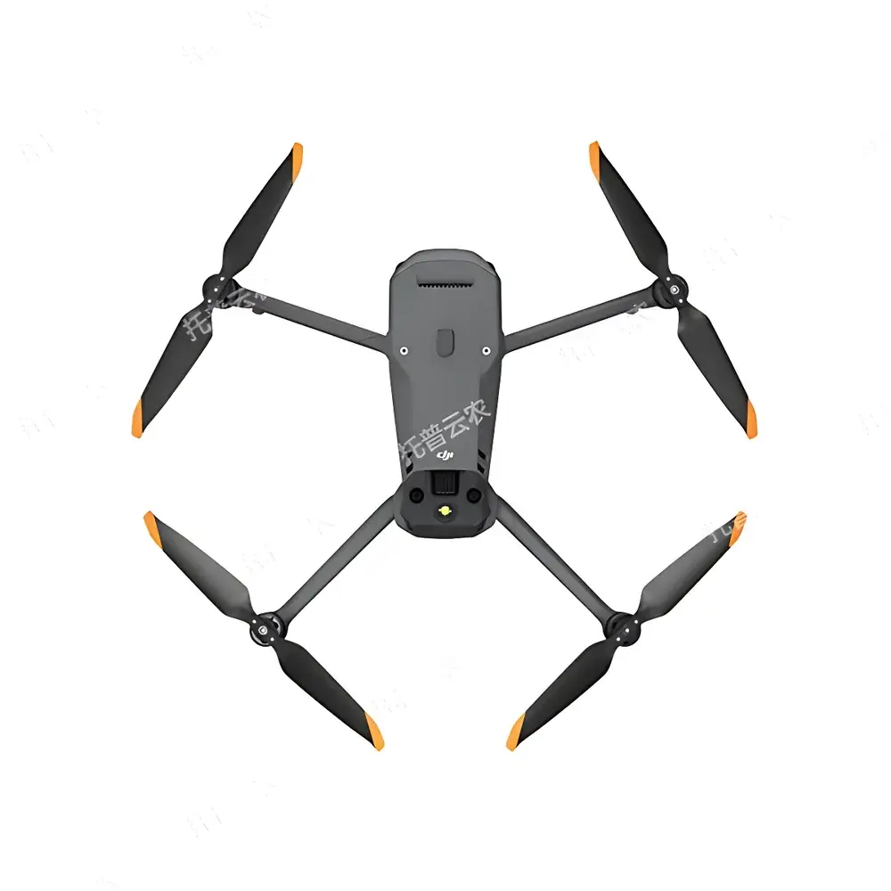
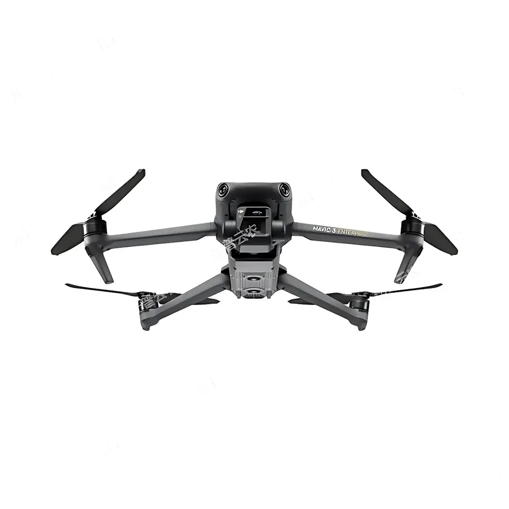
| UAV Platform | Foldable Quadcopter |
| Max Flight Time | 45 min (no wind) |
| Max Range | 32 km |
| Sensor Configuration | 4/3" CMOS Wide-Angle Camera (20 MP), 1/2" CMOS Telephoto Camera (12 MP) |
| Image Formats | JPEG, DNG (RAW) |
| Positioning Accuracy | ±0.1 m (RTK-enabled) vertical/horizontal |
| Operating Temperature | −10°C to 40°C |
| Wind Resistance | 12 m/s |
| Real-time Video Transmission | 1080p/30fps |
| RTK & Docking Station Support | Yes |
Overview
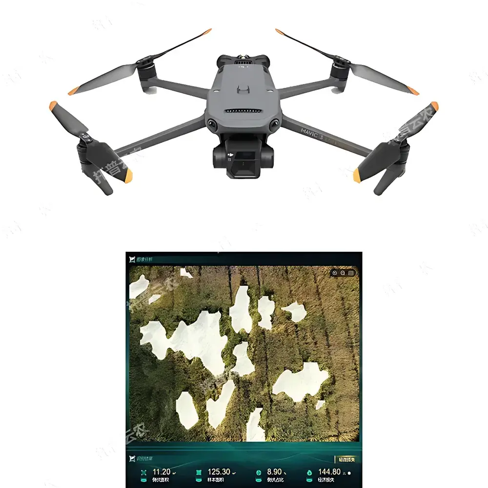
The TopCloud-agri TP-KJG Low-Altitude Remote Sensing Plant Phenotyping System is an integrated field-deployable platform engineered for high-throughput, non-destructive plant phenotypic trait quantification in agricultural and breeding environments. Built upon a certified industrial-grade UAV airframe, the system combines dual-spectrum visible-light imaging (wide-angle + telephoto), real-time GNSS/RTK georeferencing, and edge-optimized computer vision algorithms to capture spatially registered canopy-level data at sub-decimeter ground sampling distance (GSD). Unlike ground-based or greenhouse phenotyping rigs, this system operates within the low-altitude remote sensing regime (typically 20–120 m AGL), enabling rapid, repeatable, and scalable monitoring across hectares—without compromising resolution or geometric fidelity. Its core measurement principle relies on structure-from-motion (SfM) photogrammetry and pixel-level spectral analysis of RGB reflectance, calibrated against known reference targets and validated against in situ measurements per ISO 11727 and ASTM E2961 standards for agricultural remote sensing validation protocols.
Key Features
- Multi-Crop Phenotypic Intelligence: Pre-trained deep learning models support automated detection and quantification for rice, wheat, maize, soybean, and rapeseed—including emergence rate, phenological stage classification (BBCH scale), canopy cover fraction, plant height estimation via stereo reconstruction, lodging severity scoring, panicle/tassel counting, and yield proxy modeling.
- Maize Tassel Detection Module: Specialized convolutional neural network architecture optimized for tassel localization under variable lighting and canopy density; enables precise mapping of male inflorescence positions to support hybrid seed production workflows.
- Fully Autonomous Mission Execution: Supports pre-programmed grid, corridor, or polygon-based flight paths with adaptive altitude control; integrates obstacle avoidance (visual + ultrasonic) and failsafe RTH (Return-to-Home) logic compliant with ICAO Annex 2 guidance for uncrewed aircraft operations.
- High-Fidelity Geospatial Imaging: Dual-camera payload delivers synchronized RGB imagery with <0.02 m GSD at 30 m altitude; includes onboard radiometric calibration, lens distortion correction, and automated orthomosaic generation using OpenDroneMap-compatible processing pipelines.
- Integrated Field Management Dashboard: Web-based GIS interface overlays phenotypic outputs onto interactive base maps; supports dynamic parcel delineation, soil type annotation, parent-row masking (for maize breeding plots), and automatic area calculation using WGS84 geodetic projection.
- IoT Data Fusion Architecture: Native API integration with third-party environmental sensors (e.g., Campbell Scientific CR1000X, Decagon EM50) and agronomic devices (e.g., seed counters, portable photosynthesis systems); time-synchronized ingestion into a unified time-series database with ISO 8601 timestamping.
- Model Retraining Framework: Implements supervised fine-tuning capability—users may manually correct misclassified pixels or bounding boxes, triggering incremental retraining of local inference models without cloud dependency.
Sample Compatibility & Compliance
The TP-KJG system is validated for use across open-field row crops, paddy systems, and managed perennial systems (e.g., orchards, vineyards) where canopy structure permits reliable top-view optical access. It does not require physical contact with plants and introduces no mechanical stress—ensuring compliance with GLP-aligned experimental design principles for longitudinal studies. All image acquisition protocols adhere to FAO’s Guidelines for Remote Sensing-Based Crop Monitoring (2022) and align with USDA-NASS operational standards for aerial crop assessment. The UAV platform meets CE Class C1 marking requirements (EU 2019/947), carries IP43 ingress protection rating, and operates within national civil aviation authority-defined visual line-of-sight (VLOS) and extended VLOS (EVLOS) frameworks when paired with approved remote ID modules.
Software & Data Management
Data acquisition, processing, and visualization are unified through the proprietary TopPheno™ Cloud Platform—a secure, role-based SaaS environment supporting multi-user collaboration and audit-trail logging per FDA 21 CFR Part 11 Annex 11 requirements. Raw imagery is ingested via encrypted TLS 1.3 transfer; processed outputs include GeoTIFF orthomosaics, CSV-delimited trait tables (with uncertainty metrics), and interactive dashboards featuring temporal trend analysis, cross-plot statistical comparisons (ANOVA-ready), and customizable export templates. All metadata conforms to Darwin Core and MIAPPE v1.1 schemas. Export formats include Excel (.xlsx), PDF reports with embedded GIS layers, PNG heatmaps, and NetCDF4 for downstream integration with R/Python-based breeding analytics stacks (e.g., rrBLUP, BGLR).
Applications
- Quantitative genetics studies requiring high-temporal-resolution trait trajectories across breeding nurseries
- Field-scale validation of drought tolerance or nitrogen use efficiency QTLs under commercial growing conditions
- Operational decision support for irrigation scheduling, nutrient top-dressing, and pest scouting prioritization
- Regulatory submission packages for variety registration (e.g., UPOV Test Guidelines TG/1/5)
- Teaching modules in precision agriculture curricula—covering photogrammetry fundamentals, NDVI derivation, and machine learning applications in agronomy
- Smart farm management integration with ISO 11783 (ISOBUS) telematics gateways for closed-loop prescription map generation
FAQ
Does the TP-KJG system support multispectral or thermal imaging?
No—the current configuration is optimized exclusively for high-fidelity visible-light (RGB) phenotyping. Multispectral add-ons are available as separate hardware modules but require recalibration and are not part of the base TP-KJG certification.
Can raw DNG files be processed externally using Agisoft Metashape or Pix4Dmapper?
Yes—all captured images retain full EXIF and XMP metadata including GPS coordinates, camera pose, and sensor parameters; interoperability with industry-standard photogrammetry software is fully supported.
Is the system compatible with existing farm management information systems (FMIS)?
Yes—via RESTful API endpoints and OGC-compliant WFS/WMS services; integration has been demonstrated with Climate FieldView, Granular, and FarmLogs platforms using OAuth2.0 authentication.
What level of technical support is provided for algorithm customization?
TopCloud-agri offers optional Tier-3 engineering support contracts, including on-site model adaptation workshops, custom trait development (subject to data availability), and validation report generation aligned with ISO/IEC 17025 requirements.
How frequently is firmware updated, and how are updates deployed?
Firmware and AI model updates are released quarterly; over-the-air (OTA) deployment is performed via encrypted signed packages, with rollback capability and versioned changelogs traceable in the audit log.