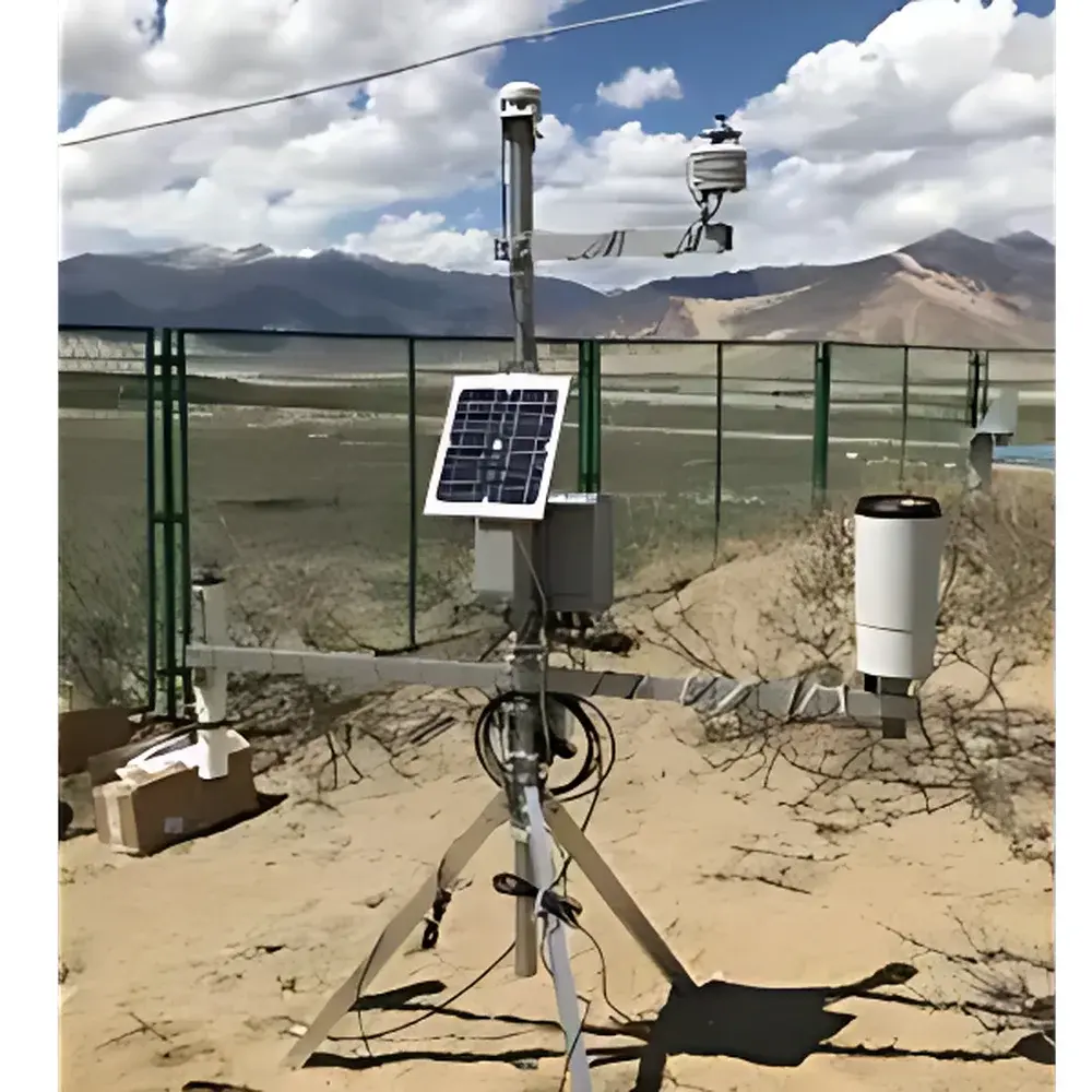
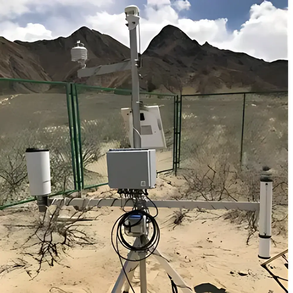
EMS Automatic Weather Station (EMS RailBox RB Series)
| Brand | EMS |
|---|---|
| Origin | Czech Republic |
| Type | Portable Weather Station |
| Data Logger | Modular RailBox RB System (16-channel standard, up to 64-channel expandable) |
| Power Supply | Solar panel + rechargeable battery (6.5–15 VDC, standby <1 mA) |
| Communication | GPRS/LAN/4G (backward-compatible with EDGE/GPRS) |
| GPS | Integrated geolocation tagging |
| Internal Memory | 220,000 timestamped records (expandable to 450,000) |
| MicroSD Storage | 8 GB (2–3 years of continuous logging) |
| Operating Temperature | −40 °C to +60 °C |
| Compliance | DIN rail mounting, SDI-12 & analog sensor support, IP67-rated enclosures for field deployment |
Overview
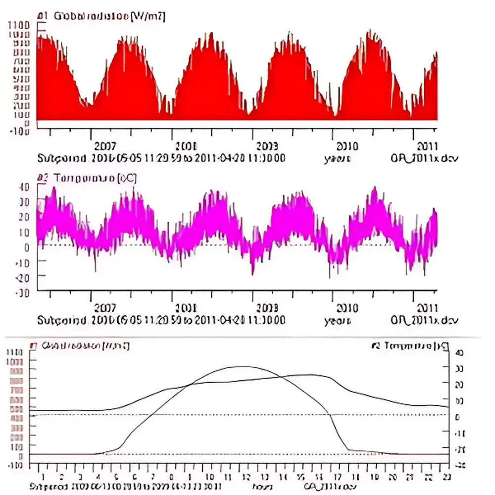
The EMS Automatic Weather Station (RailBox RB Series) is a modular, research-grade environmental monitoring system engineered for long-term, unattended microclimate observation in ecologically sensitive and operationally remote settings. Built upon the open-architecture EMS RailBox RB data acquisition platform, it employs precision analog-to-digital conversion (16-bit resolution, ±0.03% accuracy across ±20 mV to ±2.5 V input ranges) and time-synchronized sampling to ensure metrological integrity across heterogeneous sensor networks. Its core measurement paradigm integrates physical meteorological variables—air temperature, relative humidity, barometric pressure, global solar radiation, wind speed/direction, precipitation, and evapotranspiration—with optional biophysical extensions including soil moisture, heat flux, PAR, canopy temperature, and plant physiological sensors. Designed for compliance with FAO-56 Penman-Monteith reference evapotranspiration protocols and aligned with ISO 17025 traceability frameworks for environmental data acquisition, the system delivers calibrated, timestamped datasets suitable for regulatory reporting, climate modeling validation, and agronomic decision support.
Key Features
- Modular RailBox RB data logger with DIN-rail mounting compatibility, supporting up to 64 analog inputs and SDI-12 digital sensors via hot-swappable interface modules.
- Integrated GPS module for automatic georeferencing of all measurements; coordinates embedded in every data record per NMEA 0183 v4.10 standard.
- Dual-layer data resilience: internal flash memory (220,000 records, extendable), industrial-grade 8 GB MicroSD card (rated for −40 °C to +85 °C), and optional cloud synchronization via TLS 1.2-encrypted 4G LTE transmission.
- Ultra-low-power architecture: typical sleep current <1 mA; active measurement draw ≤30 mA; powered by maintenance-free solar-charged battery system with PSM14 overvoltage/overcurrent protection.
- Field-configurable sampling intervals (3 seconds to 4 hours) and averaging windows, enabling adaptive temporal resolution for transient event capture or seasonal trend analysis.
- Pre-calibrated sensor suite meeting WMO Guide to Instruments and Methods of Observation (CIMO Guide, 2022 edition) tolerances—including Class B temperature/humidity sensors (±0.15 K / ±2% RH), Class C pyranometer (20 mV/(1000 W/m²)), and tipping-bucket rain gauge (0.1 mm resolution, 200 cm² orifice).
Sample Compatibility & Compliance
The EMS station accommodates a broad spectrum of certified environmental sensors compliant with international interoperability standards. Analog sensors (0–5 V, 4–20 mA, pulse output) and SDI-12 protocol devices—including Campbell Scientific, Decagon (now METER Group), and Onset HOBO models—are natively supported without firmware modification. All factory-calibrated sensors are supplied with NIST-traceable calibration certificates. The system meets CE marking requirements under Directive 2014/30/EU (EMC) and 2014/35/EU (LVD), and its data handling architecture supports audit trails required for GLP-compliant field studies. Firmware adheres to IEC 62443-3-3 security levels for industrial control systems, and optional 4G module complies with ETSI EN 301 908-1 (LTE FDD) and EN 300 328 (SRD radio equipment).
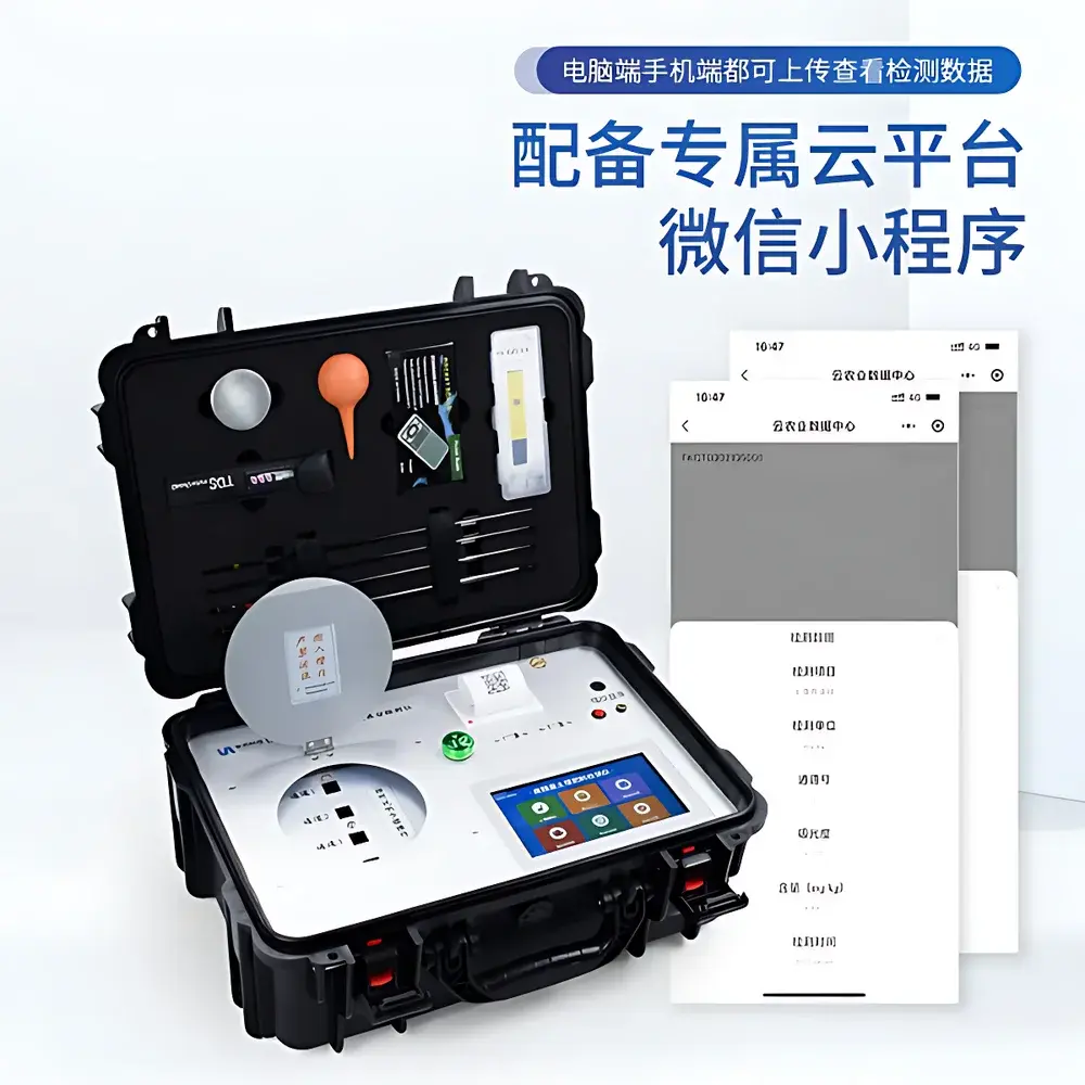
Software & Data Management
The included Windows-based EMS Data Manager software provides full lifecycle data handling: real-time telemetry visualization, batch download with CRC-32 validation, gap-filling interpolation (linear, spline), statistical aggregation (hourly/daily min/max/mean/sum), regression modeling (linear, polynomial), and export to CSV, NetCDF-4, or CF-compliant formats. Audit logs record all configuration changes, user logins, and data edits in accordance with FDA 21 CFR Part 11 electronic record requirements when enabled. Cloud integration supports role-based access control (RBAC), automated backup scheduling, and RESTful API access for integration into enterprise GIS or SCADA platforms.
Applications
- Agricultural water management: real-time ETo calculation, irrigation scheduling, deficit irrigation trials.
- Ecophysiology research: coupling atmospheric demand with soil-plant-atmosphere continuum (SPAC) measurements (e.g., sap flow, leaf wetness, stem dendrometry).
- Urban microclimate assessment: thermal comfort index derivation (UTCI), green infrastructure performance evaluation.
- Renewable energy site assessment: solar irradiance variability analysis, wind resource mapping.
- Environmental impact monitoring: baseline characterization for EIA, post-remediation tracking, and long-term ecological research (LTER) network deployments.
FAQ
What communication protocols does the EMS station support for remote data retrieval?
GPRS, Ethernet (LAN), and optional 4G LTE (with fallback to EDGE/GPRS); all transmissions use configurable HTTP(S) or MQTT endpoints with TLS 1.2 encryption.
Is the system suitable for deployment in extreme cold environments?
Yes—operational range extends to −40 °C, validated per IEC 60068-2-1 (cold test) and supported by low-temperature lithium-thionyl chloride backup battery (5+ year shelf life).
Can third-party sensors be integrated without custom firmware?
All SDI-12 and standard analog (0–5 V, 4–20 mA) sensors require no firmware modification; configuration is performed via EMS Data Manager’s sensor profile library.
How is data integrity ensured during extended offline periods?
Triple redundancy: on-board flash (220k records), removable 8 GB MicroSD (industrial temperature grade), and synchronized cloud upload upon reconnection—each layer includes SHA-256 hash verification.
Does the system comply with regulatory data submission requirements for EU agricultural subsidy programs?
Yes—data structure conforms to EU CAP (Common Agricultural Policy) Annex VI metadata schema; time stamps are UTC-synchronized via GPS, and sensor calibrations follow ISO/IEC 17025:2017 guidelines.