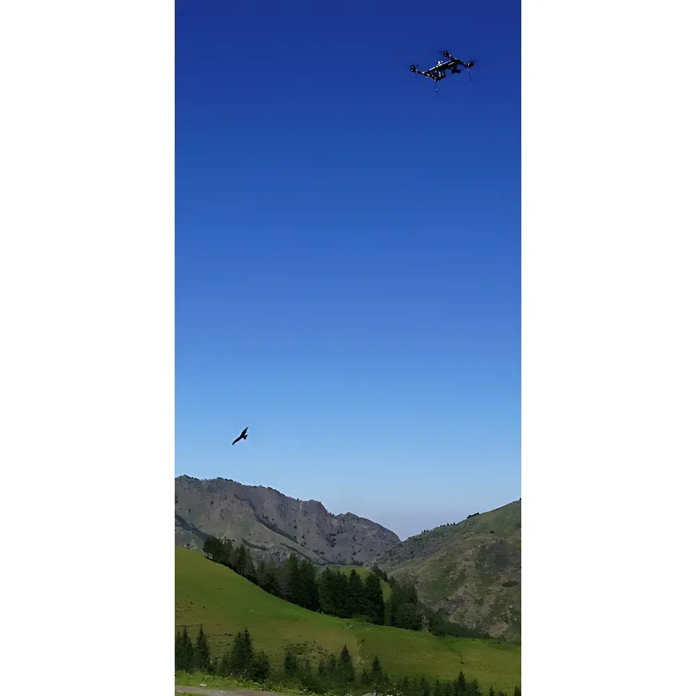
EcoDrone UAS-4 Professional Quadcopter-Based Infrared Thermal Imaging Remote Sensing System
| Origin | Beijing, China |
|---|---|
| Manufacturer Type | Authorized Distributor |
| Origin Category | Domestic (China) |
| Model | EcoDrone UAS-4 Thermal Imaging Remote Sensing System |
| Pricing | Upon Request |
Overview
The EcoDrone UAS-4 is a professional-grade, quadcopter-based unmanned aerial system (UAS) engineered for high-fidelity ecological and environmental remote sensing. Designed and integrated by Ecolab Technology Co., Ltd., it combines a lightweight, patent-protected airframe (Patent No. ZL 2016 2 1103365.8) with an industry-standard uncooled microbolometer thermal imaging sensor operating in the 8–14 µm long-wave infrared (LWIR) spectral band. The system adheres to fundamental principles of radiometric thermography and multispectral reflectance analysis, enabling quantitative surface temperature mapping and vegetation biophysical parameter derivation. Its modular payload architecture supports simultaneous or sequential deployment of thermal, RGB, and multispectral sensors—making it suitable for field-deployable, GLP-aligned environmental monitoring workflows across diverse terrestrial ecosystems.
Key Features
- Lightweight airframe: 1.85 kg dry weight; maximum takeoff weight (MTOW) up to 8.0 kg, supporting extended mission flexibility
- Endurance-optimized flight performance: ≥50 minutes hover time (no payload), ≥45 minutes effective operational time with dual-sensor payloads (e.g., thermal + RGB or thermal + RedEdge)
- Flight control robustness: GPS/BeiDou dual-mode GNSS module; barometric + GPS altitude hold; ultrasonic precision altimetry (±1 cm accuracy within 10 m AGL); failsafe protocols including low-voltage auto-return, signal-loss RTH, and onboard “black box” logging
- Intelligent navigation modes: Waypoint planning, orbit, follow-me (ground station dependent), region coverage, and position hold—all configurable via portable ground station software
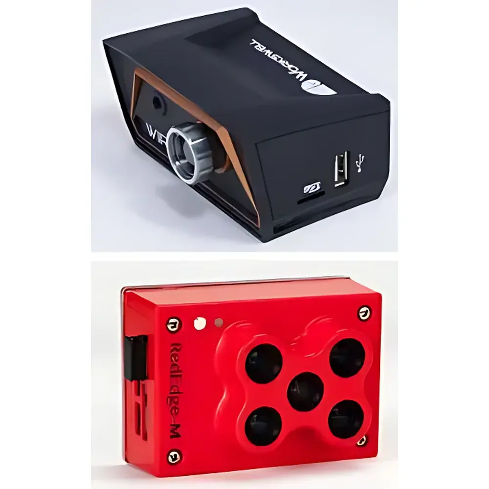
- Thermal imaging core: 384 × 288 pixel uncooled VOx microbolometer, NETD ≤50 mK, calibrated temperature range −10 °C to +250 °C, 35° horizontal FOV, real-time radiometric video output with embedded visible-light overlay (1600 × 1200 resolution, 16× digital zoom)
- RGB imaging subsystem: 4K UHD (3840 × 2160) @ 30 fps, 2.7K @ 50 fps, 12 MP still capture (4000 × 3000), f/2.8 lens, 22.6 mm equivalent focal length, 82° HFOV, minimal optical distortion
- Modular expansion: Compatible with MicaSense RedEdge-MX (5-band multispectral: Blue, Green, Red, Red Edge, NIR), PlantPen chlorophyll meters, SpectraPen handheld spectrometers, and third-party IoT sensor nodes
Sample Compatibility & Compliance
The UAS-4 is validated for non-contact, spatially explicit measurement of surface temperature gradients, canopy thermal heterogeneity, and vegetation spectral indices (e.g., NDVI, NDRE, CIred-edge). It supports repeatable, georeferenced data acquisition compliant with ASTM E1934-22 (Standard Guide for Examining Electrical/Electronic Equipment Using Infrared Thermography) and ISO 18434-1:2008 (Condition monitoring — Thermography — Part 1: General procedures). While not certified for FAA Part 107 or EASA STS-01 operations out-of-the-box, its flight logs, metadata tagging (EXIF/GPS/IMU), and raw thermal radiance files meet foundational requirements for audit-ready environmental reporting under ISO 14001 and national ecological survey protocols. All firmware and ground station software are designed for traceability, supporting timestamped mission logs and exportable CSV/GeoTIFF/SEQ formats required for regulatory submissions.
Software & Data Management
The integrated ground station comprises a ruggedized laptop preloaded with proprietary mission planning software compatible with Google Maps, Bing Maps, and Gaode Map baselayers. Users define waypoints, set flight altitude/speed, assign sensor triggers, and configure thermal ROI analysis parameters prior to autonomous execution. Real-time FPV telemetry (5.8 GHz, 800 × 480 display, DVR-enabled up to 32 GB microSD) ensures visual verification during data collection. Post-flight, thermal video streams are processed using calibrated radiometric tools to generate temperature matrices; RGB and multispectral imagery are orthorectified and atmospherically corrected via Pix4Dmapper or Agisoft Metashape integration. All datasets retain embedded EXIF tags—including GPS coordinates, IMU orientation, barometric pressure, ambient temperature, and sensor calibration coefficients—ensuring full provenance for scientific reproducibility and QA/QC review.
Applications
- Agricultural stress detection: Early identification of drought, heat, and pest-induced physiological anomalies via canopy temperature differentials and thermal time-series analysis
- Crop phenotyping and yield forecasting: Spatial quantification of NDVI, NDRE, and canopy temperature depression (CTD) at field scale
- Wildlife and habitat assessment: Nocturnal species detection, den site localization, and thermal microhabitat characterization
- Forestry management: Detection of latent fire ignition points, bark beetle infestation signatures, and post-fire regeneration mapping
- Wetland hydrology: Surface water extent delineation, evapotranspiration estimation, and seasonal inundation dynamics
- Soil erosion and land degradation monitoring: Identification of exposed soil surfaces, gully formation, and vegetation cover loss through multi-temporal thermal-vegetation index fusion
- Natural reserve surveillance: Illegal activity detection (e.g., poaching, encroachment), infrastructure impact assessment, and biodiversity corridor validation
- Ecotourism infrastructure planning: Microclimate suitability modeling, trail thermal comfort evaluation, and visitor footprint analysis
FAQ
Is the EcoDrone UAS-4 certified for commercial operation under FAA Part 107 or EASA regulations?
No—certification is operator- and jurisdiction-specific. Users must obtain local UAS operating authorization; the platform provides full telemetry logging and geotagged outputs required for compliance documentation.
What thermal resolution options are available beyond the standard 384 × 288 sensor?
A higher-resolution configuration is supported via integration with the EcoDrone UAS-8 platform, which accommodates a 640 × 512 LWIR sensor (sold separately).
Can thermal and multispectral data be acquired simultaneously in a single flight?
Yes—the modular gimbal interface allows synchronized triggering of both the thermal camera and RedEdge-MX sensor, with time-aligned metadata and georeferencing.
Does the system support radiometric calibration traceable to NIST standards?
The thermal sensor undergoes factory calibration against blackbody references; users may perform field-based non-uniformity correction (NUC) using built-in shutterless calibration routines.
What is the maximum operational range in environments with moderate RF interference?
With standard 2.4 GHz control link, reliable command-and-control extends to 2 km line-of-sight; extended-range mode (5 km) requires FCC-compliant antenna upgrades and clear LOS conditions.
Related Products


