EcoTech Ecodrone MWIR Unmanned Aerial Remote Sensing System
| Brand | EcoTech |
|---|---|
| Origin | Beijing, China |
| Manufacturer Type | Authorized Distributor |
| Country of Origin | China |
| Model | Ecodrone MWIR |
| Pricing | Available Upon Request |
Overview
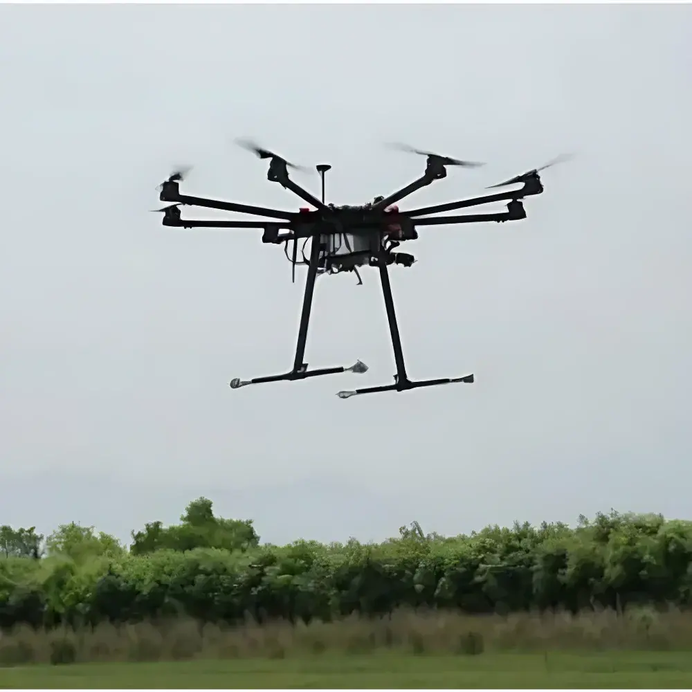
The EcoTech Ecodrone MWIR Unmanned Aerial Remote Sensing System is a purpose-built environmental monitoring platform integrating unmanned aerial systems (UAS) with high-sensitivity mid-wave infrared (MWIR) thermography and multi-parameter air quality sensing. Engineered for precision ecological surveillance, the system operates on the fundamental principle of spectral absorption imaging in the 3.2–3.4 µm atmospheric window—a region where numerous volatile organic compounds (VOCs), hydrocarbons, and combustion-related gases exhibit strong, distinguishable rotational-vibrational absorption features. Unlike broadband thermal cameras, this MWIR system employs a cooled indium antimonide (InSb) focal plane array (FPA) detector to deliver radiometrically calibrated imagery with thermal sensitivity down to 10 mK, enabling quantitative gas plume visualization and surface temperature mapping under ambient daylight or low-contrast conditions. The UAS-8 airframe provides stable, GPS-referenced flight performance with integrated inertial navigation, supporting both autonomous mission planning and real-time manual control—making it suitable for routine environmental compliance monitoring, emergency response assessment, and long-term ecological observatory deployments.
Key Features
- Integrated dual-sensor payload: Cooled MWIR imager (320 × 240 InSb FPA) + full-HD visible-light camera (1920 × 1080, 10× optical zoom with image stabilization)
- Optimized MWIR spectral band (3.2–3.4 µm) for selective detection of >200 gaseous species including methane, ethylene, benzene, toluene, propane, and formaldehyde
- Real-time radiometric temperature measurement: simultaneous extraction of maximum, minimum, and centroid temperatures per frame
- Ground- and air-deployable configuration: focus range from 0.5 m to infinity supports both UAV-based surveys and tripod-mounted stationary monitoring
- Modular ENVIS air quality monitoring suite with configurable sensor options (up to 150+ parameters), including PM₂.₅, PM₁₀, CO₂, VOC index, formaldehyde (HCHO), ambient T/RH, and GPS-tagged light intensity
- Dual-data acquisition architecture: synchronized MWIR radiometric video (H.264 + radiometric TIFF/JPEG), visible-light video, and time-stamped environmental telemetry
- Onboard storage: 256 GB internal SSD + expandable microSD slot; data export formats include radiometric TIFF (Pix4D/Agisoft-compatible), KMZ, and CSV/TXT
- Flight control interface: CAN bus and PWM input support for integration with standard RC transmitters or autopilot systems (e.g., Pixhawk)
Sample Compatibility & Compliance
The Ecodrone MWIR system is designed for non-contact, wide-area sampling of atmospheric emissions, surface thermal anomalies, and vegetation stress signatures. It complies with standard operational frameworks for environmental remote sensing under ISO 17025-accredited field measurement practices. While not certified as a primary reference instrument per ASTM D6281 or EPA Method 21, its MWIR imaging mode supports qualitative and semi-quantitative leak detection and emission source localization in accordance with EPA OOOOa guidance for fugitive VOC monitoring. Data provenance is maintained via embedded GPS timestamps, IMU metadata, and firmware-level audit logs—enabling traceability for GLP-aligned reporting. All onboard sensors meet CE and FCC Class B electromagnetic compatibility requirements for commercial UAV deployment.
Software & Data Management
Acquisition and post-processing are supported by EcoTech’s proprietary Ecodrone Flight & Analysis Suite, which includes mission planning (KML/KMZ import), real-time telemetry dashboard, radiometric calibration tools, and georeferenced orthomosaic generation. Exported radiometric TIFFs retain full pixel-wise temperature metadata and are natively compatible with photogrammetry platforms (Pix4Dmapper, Agisoft Metashape) and GIS environments (QGIS, ArcGIS Pro). Environmental sensor data is logged at user-configurable intervals (1–30 s) and stored in structured TXT or KMZ format with ISO 8601 timestamps and WGS84 coordinates. For regulated environments, optional software modules provide 21 CFR Part 11-compliant electronic signatures, user access controls, and immutable audit trails.
Applications
- Toxic and hazardous gas plume mapping across industrial perimeters, landfills, and chemical storage facilities
- Atmospheric pollution source identification and dispersion modeling support for municipal air quality management
- Early-stage forest fire detection via sub-pixel thermal anomaly recognition and hot-spot tracking
- Wetland and paddy field CH₄ and CO₂ flux estimation through spatially resolved surface temperature and moisture correlation analysis
- Concentrated animal feeding operation (CAFO) greenhouse gas emission inventory and mitigation verification
- Post-wildfire ecosystem recovery assessment using thermal inertia metrics and NDVI-MWIR fusion indices
FAQ
What gases can the MWIR sensor detect?
The system detects gases exhibiting absorption lines in the 3.2–3.4 µm band—including methane, ethylene, benzene, toluene, propane, butane, ethanol, formaldehyde, and over 200 additional VOCs and hydrocarbons—based on spectral signature matching and thermal contrast enhancement.
Is radiometric calibration traceable to NIST standards?
The MWIR camera undergoes factory calibration against blackbody references; field recalibration is supported using portable cavity sources. Full calibration certificates are provided with each unit, referencing ISO/IEC 17025-accredited procedures.
Can the system operate in rain or high humidity?
The payload is rated IP54 for dust and water splashes; sustained operation in precipitation is not recommended. Flight operations should follow local UAV weather safety guidelines (e.g., ≤85% RH, no active precipitation).
Does the system support third-party GIS integration?
Yes—geotagged radiometric rasters, KMZ overlays, and sensor telemetry CSV files are interoperable with Esri ArcGIS, QGIS, ENVI, and Python-based geospatial libraries (rasterio, GDAL, PyProj).
What is the typical flight endurance with the MWIR payload installed?
With the UAS-8 platform and standard battery configuration, nominal endurance is 32–38 minutes at 5–8 m/s cruise speed, depending on wind conditions and sensor power draw.
Related Products


