Corning 425-Shark Full-Spectrum Hyperspectral Imaging System
| Brand | Corning |
|---|---|
| Origin | USA |
| Manufacturer Type | Authorized Distributor |
| Import Status | Imported |
| Model | 425-Shark |
| Spectral Range | 400–2500 nm |
| Spectral Resolution | 4.1 nm (full-band) |
| Spatial Resolution | 640 × 512 pixels |
| Detector | Cooled High-Performance MCT FPA |
| Dynamic Range | 16-bit |
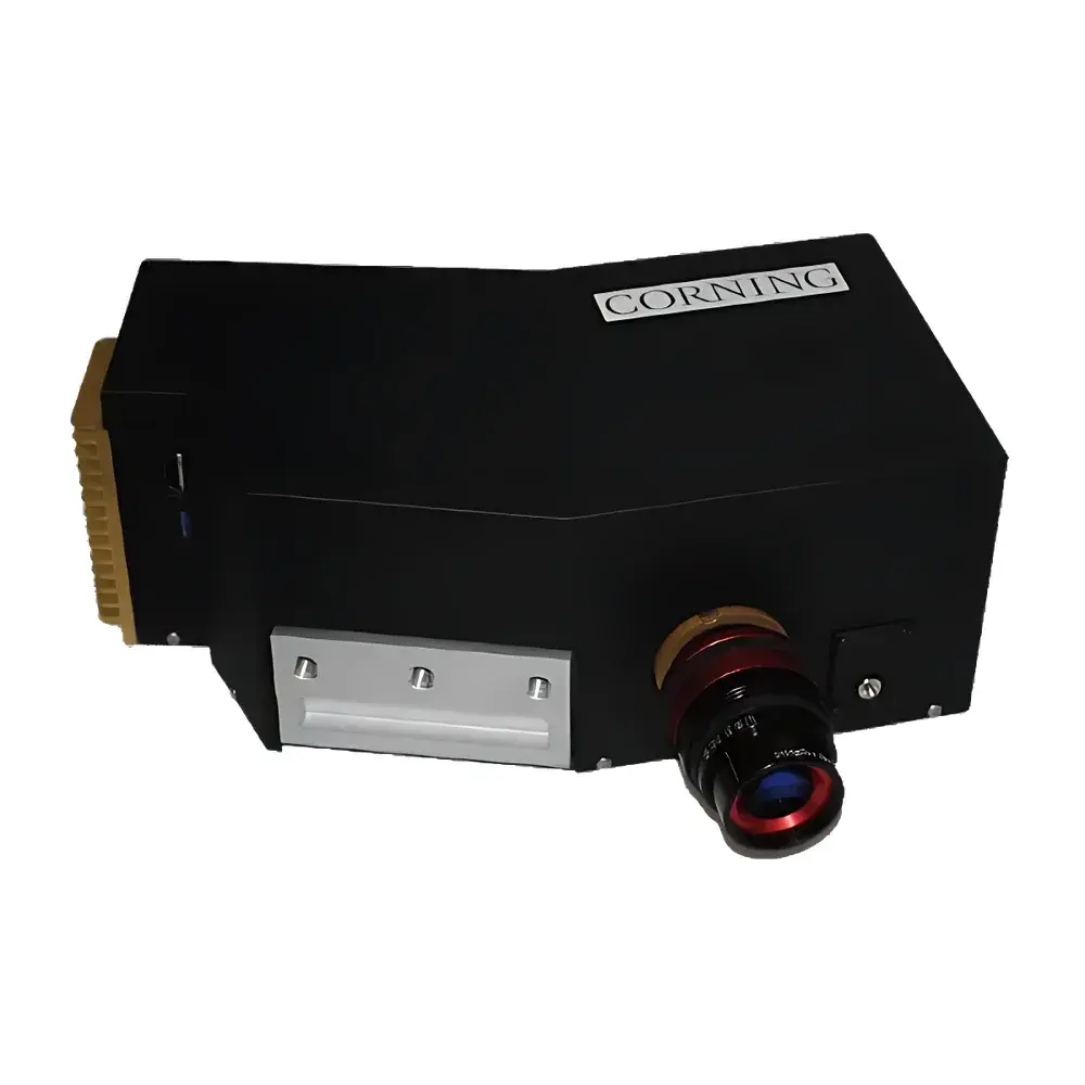
| Dimensions | 9.4 × 18 × 26.7 cm |
| Weight | 3.5 kg (core unit) |
| Power Consumption | 30 W @ 12 VDC |
| Imaging Configuration | Dispersive |
| Platform Compatibility | Ground-based and airborne deployment |
| Data Acquisition Modes | Full-band, feature-band subset, or user-defined spectral subsetting |
| Navigation Integration | Optional embedded INS/GPS + MEMS IMU |
| Onboard Storage | 1 TB SSD |
| Software Interface | Web-based GUI (cross-browser compatible, remote operation supported) |
| Georeferencing | Integrated INS, preloaded DEM/IGM support |
| Operational Modes | Continuous, Area, Flight-Line, and Triggered Start/Stop |
Overview
The Corning 425-Shark is a high-performance, full-spectrum hyperspectral imaging system engineered for rigorous scientific and operational remote sensing applications. Operating across the ultraviolet–visible–near-infrared–shortwave infrared (UV-VIS-NIR-SWIR) range from 400 to 2500 nm, it employs a dispersive optical architecture—specifically a prism-grating hybrid spectrometer—to achieve uniform spectral sampling with a consistent resolution of 4.1 nm across the entire band. This design ensures radiometric fidelity and minimizes spectral smile or keystone distortion, critical for quantitative pixel-level analysis. The system integrates a cooled 640 × 512-pixel mercury cadmium telluride (MCT) focal plane array, actively temperature-stabilized to maintain low dark current and maximize signal-to-noise ratio (SNR), particularly in the SWIR region where thermal noise dominates. Its compact, ruggedized enclosure (9.4 × 18 × 26.7 cm) and low mass (3.5 kg base unit) meet stringent size, weight, and power (SWaP) requirements for unmanned aerial systems (UAS), light aircraft, and ground-based mobile platforms.
Key Features
- Full-spectrum coverage from 400 to 2500 nm with constant 4.1 nm spectral resolution—enabling simultaneous detection of electronic transitions (VIS), vibrational overtones (NIR), and fundamental molecular absorptions (SWIR).
- Cooled MCT detector with 16-bit digitization, delivering high dynamic range and low temporal noise for reliable reflectance and emissivity quantification under variable illumination conditions.
- Dispersive imaging architecture optimized for minimal optical aberration and high spectral fidelity—validated against NIST-traceable calibration sources.
- Embedded 1 TB SSD enables autonomous, high-throughput data capture without real-time downlink dependency; supports lossless or visually lossless compression (e.g., JPEG2000 Part 2 with wavelet-based spectral decorrelation).
- Optional integrated inertial navigation system (INS) coupled with GPS and MEMS IMU provides georeferenced push-broom acquisition with sub-meter positional accuracy (CEP50) when combined with post-processed kinematic (PPK) corrections.
- Four programmable acquisition modes—continuous, area-defined, flight-line, and trigger-based start/stop—allow mission-specific optimization of data volume and spatial coverage.
Sample Compatibility & Compliance
The 425-Shark is not a contact-based analytical instrument; rather, it acquires spatially resolved spectral signatures from external scenes via passive solar reflectance or emitted radiance. As such, it complies with international standards governing airborne electro-optical sensor systems, including ASTM E2798 (Standard Practice for Airborne Hyperspectral Imaging Data Collection), ISO 18629 (Geospatial metadata for remote sensing products), and FAA AC 91-57C for UAS payload integration. All firmware and onboard processing modules are designed to support GLP-aligned data provenance: each acquired cube includes embedded timestamps, sensor telemetry (temperature, voltage, attitude), and calibration state flags. When used in regulated environments (e.g., environmental monitoring per EPA Method IO-3.3 or mineral exploration under ASTM D5792), raw data files retain unaltered radiometric headers compliant with HDF5 and ENVI BIL/BIP formats for third-party validation and audit trails.
Software & Data Management
The system is controlled via a browser-based graphical user interface (GUI), accessible from any modern desktop or tablet over Ethernet or Wi-Fi. No proprietary client installation is required—eliminating OS compatibility constraints and simplifying field-deployment logistics. The interface supports real-time preview, spectral library matching (using built-in USGS, JPL, and ECOSTRESS spectral databases), and on-the-fly region-of-interest (ROI) extraction. All metadata—including INS/GPS logs, platform attitude quaternions, and radiometric calibration coefficients—are embedded directly into the output hyperspectral data cubes (HDF5 or ENVI format). Export options include spectral angle mapper (SAM), normalized difference indices (e.g., NDVI, NDWI, NDSI), and PCA-transformed bands. For compliance-critical workflows, optional software modules provide 21 CFR Part 11–compliant electronic signatures, audit logging, and role-based access control—fully traceable to individual operator sessions and configuration changes.
Applications
- Aerospace & Defense: Wide-area persistent surveillance, camouflage detection, and material identification using spectral unmixing algorithms (e.g., VCA, N-FINDR) and endmember libraries.
- Precision Agriculture: Crop health assessment via chlorophyll-a/b, carotenoid, and water content indices; early stress detection at sub-field scale using narrowband vegetation indices (e.g., MCARI, TCARI).
- Mineral & Hydrocarbon Exploration: Identification of clay minerals (kaolinite, smectite), carbonates, sulfates, and hydrocarbon seeps through diagnostic absorption features near 2200 nm and 2350 nm.
- Environmental Monitoring: Wetland delineation, invasive species mapping, soil organic carbon estimation, and post-wildfire burn severity classification (dNBR, RdNBR).
- Urban Remote Sensing: Impervious surface mapping, roof material classification (asphalt, metal, tile), and thermal inertia modeling using SWIR-derived emissivity spectra.
FAQ
What calibration protocols are supported?
The 425-Shark supports two-point radiometric calibration (dark current + integrating sphere reference) and spatial uniformity correction. Factory calibration certificates include spectral linearity verification at ≥10 wavelengths across the full band and SNR characterization at multiple integration times.
Can the system be operated without GPS/INS?
Yes—the core imaging functionality remains fully operational in standalone mode. Georeferencing becomes post-mission only, requiring external GNSS-IMU log synchronization or ground control point (GCP) registration during orthorectification.
Is real-time onboard processing available?
Basic spectral indexing (e.g., NDVI, NDWI) and ROI statistics are computed in real time. Advanced processing (e.g., full endmember extraction, linear spectral unmixing) is performed offline using the provided Python SDK or third-party tools like ENVI, QGIS with SCP, or MATLAB HyperTools.
How is thermal stability maintained across ambient temperature swings?
The MCT detector is housed in a closed-cycle Stirling cooler with active feedback control, maintaining detector temperature within ±0.1 °C over −10 °C to +45 °C ambient. Optical path temperature is stabilized via passive thermal mass and low-emissivity coatings.
What file formats are natively exported?
Raw and calibrated data cubes are saved in HDF5 (with CF-1.7 metadata conventions) and ENVI BIL format. Auxiliary navigation data are stored as CSV and GeoJSON, synchronized via PPS-triggered timestamps.

")