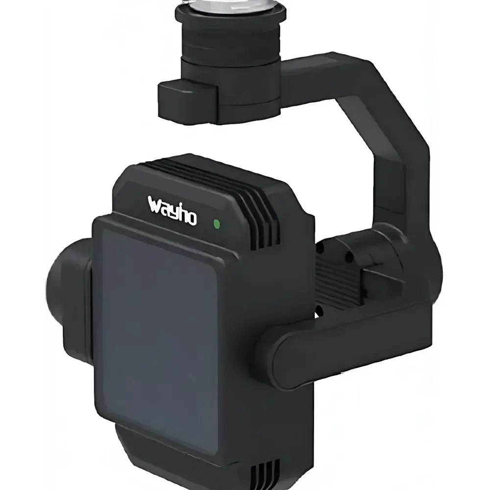
Auniontech AU-MS8-Aerial Multispectral Gimbal Camera
| Brand | Auniontech |
|---|---|
| Origin | Shanghai, China |
| Manufacturer Type | Authorized Distributor |
| Origin Category | Domestic (China) |
| Model | AU-MS8-Aerial |
| Price | Upon Request |
Overview
The Auniontech AU-MS8-Aerial Multispectral Gimbal Camera is an integrated airborne imaging system engineered for high-fidelity spectral data acquisition in dynamic field environments. Built upon a robust 3-axis stabilized gimbal platform, it combines synchronized multispectral and RGB imaging capabilities within a single compact payload. The system operates on the principle of spatially registered, time-synchronized spectral band separation using precision interference filters and a global-shutter CMOS sensor array—enabling simultaneous capture of eight discrete spectral bands across the 400–1000 nm range. This architecture supports quantitative reflectance analysis essential for vegetation indices (e.g., NDVI, NDRE, PRI), soil property mapping, and surface material discrimination. Designed specifically for integration with DJI Matrice and Mavic Enterprise-series UAVs, the AU-MS8-Aerial delivers calibrated radiometric output without requiring post-flight geometric registration or temporal interpolation—critical for mission-critical applications where decision latency must be minimized.
Key Features
- Eight-channel parallel acquisition: seven narrowband multispectral channels + one full-color RGB channel, all captured in a single exposure cycle
- Configurable spectral band selection: standard bands include 450 nm, 550 nm, 650 nm, 720 nm (narrow), 750 nm (narrow), 800 nm, and 850 nm; optional bands extend to 410 nm, 490 nm, 530 nm, 570 nm, 600 nm, 660 nm, 680 nm, 780 nm, and 900 nm
- Native 2048 × 1536 resolution per channel at 12-bit depth, ensuring sufficient spatial sampling for sub-meter GSD at operational altitudes up to 120 m (GSD ≈ 126.25 px/m at h = 120 m)
- Integrated radiometric calibration traceable to NIST-traceable standards, including factory-applied spectral response curves, absolute irradiance coefficients, and vignetting maps
- Real-time onboard radiometric correction: ambient illumination compensation via integrated silicon photodiode and temperature-stabilized reference source
- On-device lightweight inference engine supporting real-time index computation (e.g., NDVI, EVI, CIred-edge) and anomaly flagging with visual overlay
- Plug-and-play compatibility with DJI SkyPort interface; supports trigger synchronization via PWM, TTL, or MAVLink commands
Sample Compatibility & Compliance
The AU-MS8-Aerial is designed for outdoor airborne deployment under ISO 9022-18 environmental conditions (operating temperature: −10 °C to +50 °C; IP54 ingress protection). Its optical design conforms to ISO 12233 spatial frequency response requirements for imaging systems. Radiometric calibration procedures follow ASTM E2597-17 (Standard Practice for Calibration of Transmission Densitometers) and align with best practices outlined in ESA’s S2-Radiometry Handbook for Sentinel-2 validation. While not certified for FDA or aviation regulatory compliance as a standalone medical or airworthiness device, the system complies with CE electromagnetic compatibility (EMC) directives (2014/30/EU) and RoHS 2011/65/EU material restrictions. Data outputs are structured to support FAIR (Findable, Accessible, Interoperable, Reusable) principles and integrate natively with QGIS, ENVI, and Agisoft Metashape workflows.
Software & Data Management
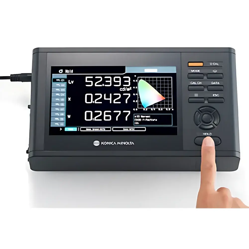
The AU-MS8-Aerial ships with Auniontech’s AU-MultiCapture Suite—a cross-platform application supporting Windows, Linux, and macOS. It provides mission planning, real-time telemetry overlay, live histogram monitoring, and embedded preview rendering of spectral indices. All raw image data are stored in uncompressed 16-bit TIFF format compliant with TIFF/EP (ISO 12234-2) standards. Metadata embedding follows EXIF 2.31 and XMP schema extensions for geotagging (GPS/GNSS), IMU orientation (pitch/roll/yaw), and radiometric context (exposure time, gain, filter ID, calibration timestamp). Audit trails for calibration updates and firmware revisions are maintained in SQLite-based local logs, satisfying basic GLP documentation requirements for academic and industrial field trials. Export modules generate ENVI-compatible .hdr/.bin bundles and GeoTIFF stacks with RPC (Rational Polynomial Coefficient) metadata for orthorectification pipelines.
Applications
- Precision agriculture: canopy health assessment, nitrogen status mapping, irrigation optimization, and yield prediction via time-series spectral trend analysis
- Environmental monitoring: wetland delineation, invasive species detection, post-fire regeneration tracking, and coastal algal bloom identification
- Geological surveying: mineralogical mapping using diagnostic absorption features in the visible-near-infrared (VNIR) region
- Forestry management: species classification, biomass estimation, and deforestation alerting through multi-temporal NDVI differencing
- Urban infrastructure inspection: solar panel efficiency screening, roof material degradation analysis, and thermal proxy derivation from NIR/SWIR contrast
FAQ
What spectral calibration standards are used during factory calibration?
Factory calibration employs NIST-traceable tungsten-halogen and deuterium lamp sources, with spectral responsivity characterized using a calibrated Ocean Insight QE Pro spectroradiometer. Each unit receives a unique calibration certificate listing wavelength accuracy (±0.5 nm), bandpass FWHM tolerance (±5%), and relative spectral response curves.
Is radiometric recalibration required after field deployment?
Yes—annual recalibration is recommended for quantitative applications. Field-level verification can be performed using calibrated reflectance panels (e.g., Labsphere Spectralon® 99% white) under uniform illumination conditions prior to each major campaign.
Can the camera operate autonomously without ground station telemetry?
Yes—the system supports fully autonomous missions via pre-programmed trigger logic (e.g., distance-based, time-interval, or overlap-rate triggering) and stores all data locally on microSDXC cards (UHS-I U3 rated, up to 512 GB).
Does the software support batch processing of large multispectral datasets?
AU-MultiCapture Suite includes a CLI mode for headless batch radiometric correction, band math, and index generation, compatible with GNU Parallel and Slurm job schedulers for HPC environments.
What is the maximum supported flight speed for accurate georeferencing?
For <1-pixel spatial misregistration at 120 m AGL, sustained forward velocity should remain ≤12 m/s when using integrated GNSS/IMU fusion with 10 Hz update rate and RTK-grade positioning.