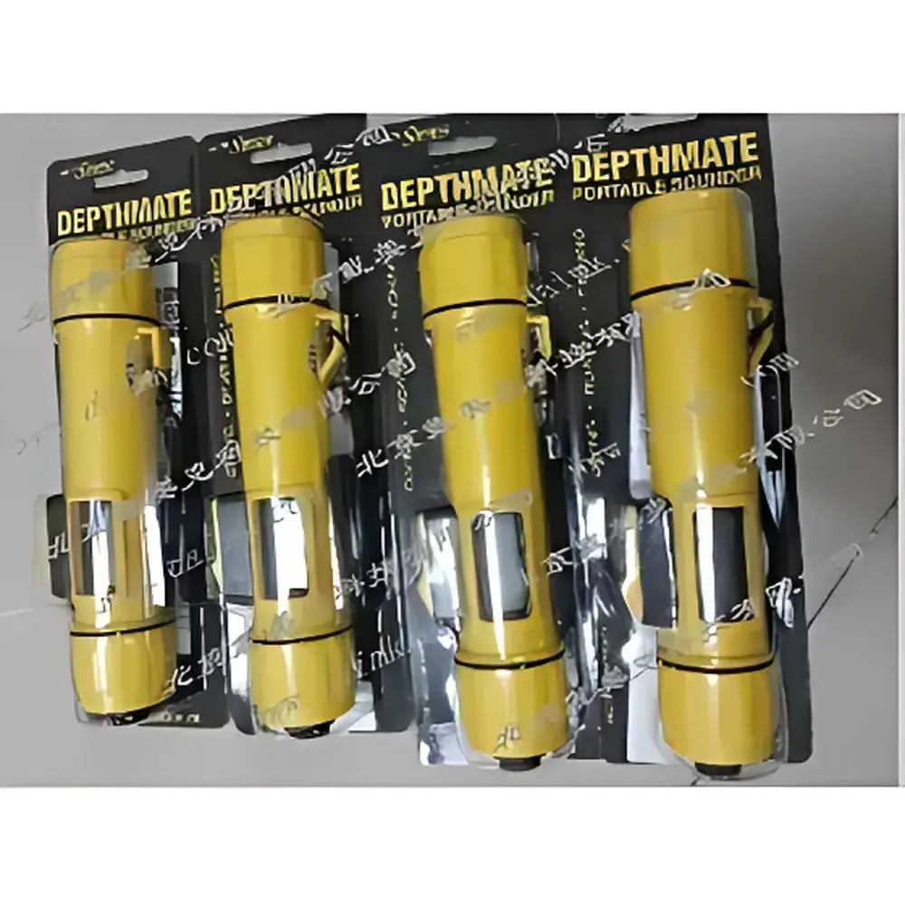
SPEEDTECH SM-5 Portable Sonar Depth Sounder
| Origin | USA |
|---|---|
| Manufacturer Type | Authorized Distributor |
| Origin Category | Imported |
| Model | SM-5 |
| Pricing | Upon Request |
Overview
The SPEEDTECH SM-5 Portable Sonar Depth Sounder is an engineered field instrument designed for real-time, high-resolution bathymetric measurement in shallow to moderate-depth aquatic environments. Operating on the principle of pulse-echo ultrasonics, the SM-5 transmits a 200 kHz acoustic signal from its external transducer and precisely calculates water depth by measuring the time-of-flight of the returned echo. Its narrow 24° beam angle ensures directional resolution and minimizes side-lobe interference—critical for distinguishing bottom contours in turbid or vegetated waters. The device delivers calibrated depth readings with a stated resolution of ±0.03 ft (±0.1 mm), traceable to NIST-traceable calibration standards applied during final factory verification. Designed for operational resilience, the SM-5 meets IP67 ingress protection specifications and is rated for submersion up to 50 meters—enabling reliable deployment from small craft, ice surfaces, or shore-based survey points without risk of housing failure.
Key Features
- High-precision digital depth display with dual-unit output (feet/meters), backlit for low-light conditions and configurable for either 10-second interval or continuous readout mode
- Externally mounted transducer with 3-meter shielded coaxial cable, optimized for broadband coupling through ice, silt-laden water, or aerated surfaces
- Robust ABS polymer housing (198 × 42 mm, 284 g), ergonomically shaped for one-hand operation and coated in high-visibility yellow for marine safety compliance
- Internal memory buffer retains the most recent depth reading for immediate playback and 10-second freeze-display—supporting manual logging and visual verification
- Power-efficient design utilizing a single 9 V alkaline battery; supports ≥500 discrete measurements at 10-second intervals per charge under standard temperature conditions (20 °C)
Sample Compatibility & Compliance
The SM-5 is validated for use across freshwater, brackish, and saltwater environments—including lakes, rivers, estuaries, coastal inlets, and ice-covered lakes. Its 200 kHz frequency provides optimal balance between penetration depth (up to 79 m) and vertical resolution in typical inland and nearshore settings. The unit complies with FCC Part 15 Class B emission limits for unintentional radiators and conforms to RoHS 2 (2011/65/EU) directive requirements for hazardous substance restriction. While not certified for GLP/GMP-regulated environmental monitoring programs, its repeatable performance aligns with ASTM D6472–22 (Standard Guide for Acoustic Depth Sounding in Shallow Water) for non-regulatory field reconnaissance and pre-survey scoping.
Software & Data Management
The SM-5 operates as a standalone, firmware-driven instrument with no onboard data export interface (e.g., USB, Bluetooth, or SD card). All depth values are displayed and retained transiently in volatile memory only—no persistent storage or timestamping is implemented. Users must manually record readings via field notebook, voice memo, or external GPS-enabled tablet application. This architecture intentionally avoids FDA 21 CFR Part 11 electronic record requirements, positioning the SM-5 as a field verification tool rather than a regulated data acquisition system. Firmware updates are not supported in-field; calibration adjustments require return to authorized service centers.
Applications
- Navigational safety assessment for small-vessel operators, including anchoring depth verification and shallow-water hazard detection
- Recreational and commercial fisheries management—mapping spawning zones, identifying submerged structure, and validating sonar fish-finder correlation
- Scientific limnology and hydrographic reconnaissance—rapid profiling of lake bathymetry, sediment accumulation trends, and seasonal ice thickness estimation
- Search-and-rescue (SAR) team deployment for underwater object localization in low-visibility river or reservoir environments
- Coastal zone management surveys supporting erosion monitoring, dredge planning, and habitat mapping at spatial scales ≤1 km²
FAQ
What is the maximum operational depth for the SM-5?
The SM-5 is rated for accurate depth measurement from 0.6 m (2 ft) to 79 m (260 ft), with optimal performance observed between 1–40 m in clear freshwater.
Can the SM-5 be used through ice?
Yes—the transducer maintains acoustic coupling through black ice up to 1.2 m thick when placed directly on the surface; accuracy degrades marginally beyond 0.9 m due to thermal attenuation.
Is the display readable in direct sunlight?
The high-contrast LCD features anti-glare coating and adjustable backlight intensity; readability remains acceptable under full solar irradiance (≥1000 W/m²) when viewed within 45° of normal incidence.
Does the SM-5 support data logging or PC connectivity?
No—this is a purpose-built analog-to-digital readout device with no serial, USB, or wireless communication capability. All data capture is manual.
What calibration documentation is provided?
Each unit ships with a Certificate of Conformance referencing factory hydrostatic test and acoustic timing verification against NIST-traceable reference targets at 5 m and 30 m depths.
Related Products