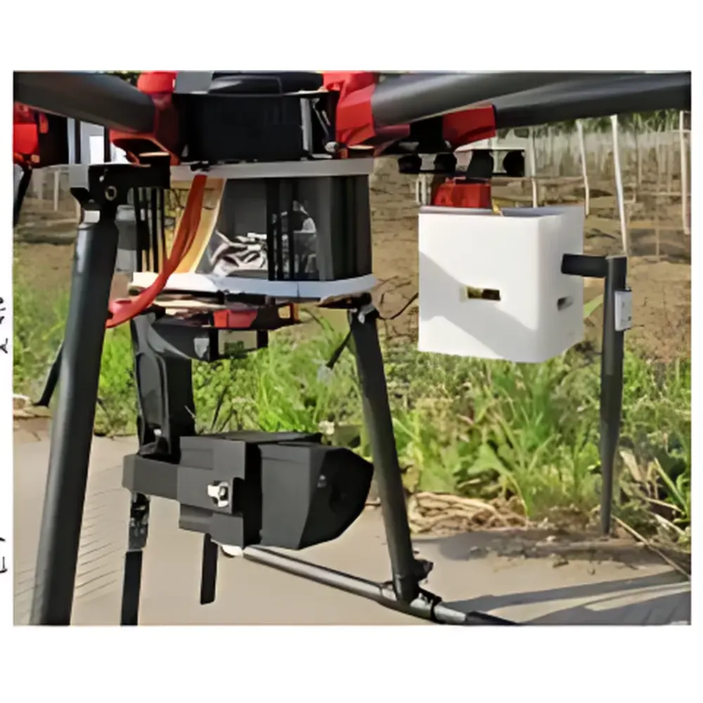
EcoDrone UAS-4 Portable UAV-Based Ecological Remote Sensing System
| Origin | Beijing |
|---|---|
| Manufacturer Type | Authorized Distributor |
| Origin Category | Domestic (China) |
| Model | EcoDrone UAS-4 |
| Pricing | Upon Request |
Overview
The EcoDrone UAS-4 is a professional-grade, portable unmanned aerial system (UAS) engineered for high-fidelity ecological and environmental remote sensing. Built upon a proprietary quadcopter airframe (Patent No. ZL 2016 2 1103365.8), it integrates modular sensor payloads with precision flight control architecture to support quantitative, field-deployable Earth observation. Its operational principle centers on synchronized georeferenced data acquisition—combining spectral imaging (RGB, multispectral, NDVI, thermal IR), atmospheric parameter logging, and GPS/BeiDou positioning—to generate spatially explicit, time-stamped datasets compliant with ecological monitoring protocols. Designed for mission-critical applications in agriculture, forestry, wetland management, biodiversity assessment, and environmental compliance reporting, the UAS-4 delivers repeatable, traceable measurements under real-world field conditions—without requiring infrastructure-dependent ground stations or fixed-wing launch logistics.
Key Features
- Lightweight airframe: 1.85 kg bare weight; max takeoff weight up to 8.0 kg (configurable with dual-sensor payloads)
- Extended endurance: ≥60 min hover time (no payload); ≥50 min effective operational time with multispectral camera at 120 m AGL
- Modular payload interface: Tool-free hot-swap capability for RGB, NDVI, 5-band multispectral (blue, green, red, red-edge, NIR), uncooled thermal IR (7.5–13.5 µm), and integrated air quality modules
- Dual GNSS navigation: High-accuracy GPS/BeiDou receiver with RTK-ready capability; barometric + ultrasonic (≤10 m) + GPS-based altitude hold (±1 cm precision)
- Flight autonomy: Pre-programmed waypoint navigation, area coverage mapping, orbit, follow-me (ground station dependent), and fail-safe behaviors including low-voltage return-to-home, signal-loss RTH, and emergency descent
- Real-time telemetry & FPV: 5.8 GHz digital video downlink (800×480 display), DVR recording (up to 32 GB microSD), and embedded black-box logging of all flight parameters (altitude, speed, attitude, battery voltage, GPS coordinates, timestamp)
- Ground control station (GCS): Field-rugged laptop with multi-map engine (Google Maps, Bing Maps, Gaode), mission planning UI, live telemetry dashboard, and post-flight log export in CSV/KML formats
Sample Compatibility & Compliance
The UAS-4 accommodates heterogeneous sensor configurations without mechanical recalibration. Payloads are mechanically and electrically standardized via MavLink-compatible interfaces and share common geotagging metadata schemas (EXIF + XMP). All onboard sensors output georeferenced, radiometrically calibrated data compatible with standard GIS workflows (QGIS, ArcGIS Pro) and photogrammetry pipelines (Pix4Dmapper, Agisoft Metashape). The system supports ISO 19115-compliant metadata embedding and adheres to FAO’s CropWatch framework for agricultural monitoring. Thermal and multispectral outputs meet ASTM E1933-18 (infrared thermography) and ISO 15739:2013 (image noise measurement) foundational requirements. Air quality module data conforms to EPA Method TO-15 (VOCs) and ISO 29463-3:2011 (PM2.5/PM10 filtration efficiency reference standards).
Software & Data Management
Flight operations are managed through a dedicated GCS application supporting offline mission planning, real-time telemetry overlay, and automated geo-registration. Sensor data is stored locally on industrial-grade microSD cards with embedded GPS timestamps and WGS84 coordinates. Multispectral and thermal imagery include radiometric calibration coefficients and vignetting correction profiles. Post-processing tools enable band math (e.g., NDVI = (NIR−Red)/(NIR+Red)), temperature emissivity compensation, and orthomosaic generation with ground control point (GCP) alignment. All raw and processed datasets retain full audit trails—including operator ID, firmware version, sensor serial number, and environmental context tags—for GLP-aligned documentation. Software binaries are validated per IEC 62304 Class B medical device software standards (applied analogously to environmental data integrity assurance).
Applications
- Agricultural stress detection: Quantitative assessment of drought, heat, nutrient deficiency, and pest infestation via NDVI temporal series and thermal anomaly mapping
- Crop phenotyping: Canopy cover estimation, planting density analysis, and yield prediction using multispectral vegetation indices
- Forest health surveillance: Early detection of bark beetle outbreaks, fire risk assessment via canopy temperature gradients, and post-fire regeneration tracking
- Wetland hydrology modeling: Surface water extent mapping, evapotranspiration estimation, and sediment plume identification using thermal-visual fusion
- Wildlife habitat mapping: Nest site localization, corridor connectivity analysis, and anthropogenic disturbance quantification via high-resolution RGB orthomosaics
- Air quality profiling: Vertical and horizontal dispersion modeling of PM2.5, CO₂, VOCs, and formaldehyde across urban-rural gradients
- Soil erosion monitoring: Change detection of gully formation, land cover transition, and topographic degradation using multi-temporal DEM differencing
- Natural reserve management: Illegal logging detection, invasive species spread tracking, and visitor impact assessment through automated change detection algorithms
FAQ
What regulatory certifications does the UAS-4 hold for commercial operation in the EU and US?
The platform complies with EASA UAS Class C1 (≤4 kg, low-risk operations) and FAA Part 107 requirements when operated within visual line of sight (VLOS) and below 120 m AGL. Full type certification documentation is available upon request.
Can multispectral and thermal data be acquired simultaneously during a single flight?
Yes—the UAS-4 supports synchronized dual-payload operation (e.g., 5-band multispectral + uncooled thermal IR) via time-triggered shutter coordination and shared GNSS timing signals.
Is raw sensor data accessible for custom algorithm development?
All sensors output unprocessed RAW files (12-bit multispectral, 14-bit thermal, 10-bit RGB) with full calibration metadata, enabling integration into Python-based remote sensing pipelines (e.g., scikit-image, rasterio, GDAL).
How is data traceability ensured for scientific publication or regulatory submission?
Each dataset includes embedded EXIF/XMP tags with sensor model, firmware version, GPS position, UTC timestamp, altitude, and operator-assigned project ID—enabling full reproducibility and chain-of-custody verification per ISO/IEC 17025:2017 Annex A.2 guidelines.
Does the system support third-party sensor integration beyond the listed options?
Yes—via standardized CAN bus and UART interfaces, subject to mechanical mounting validation and electrical compatibility review by EcoDrone’s engineering team.
Related Products