EcoDrone UAS-8 Octocopter Remote Sensing System
| Origin | Shaanxi, China |
|---|---|
| Manufacturer Type | Authorized Distributor |
| Origin Category | Domestic (China) |
| Model | EcoDrone UAS-8 |
| Pricing | Upon Request |
Overview
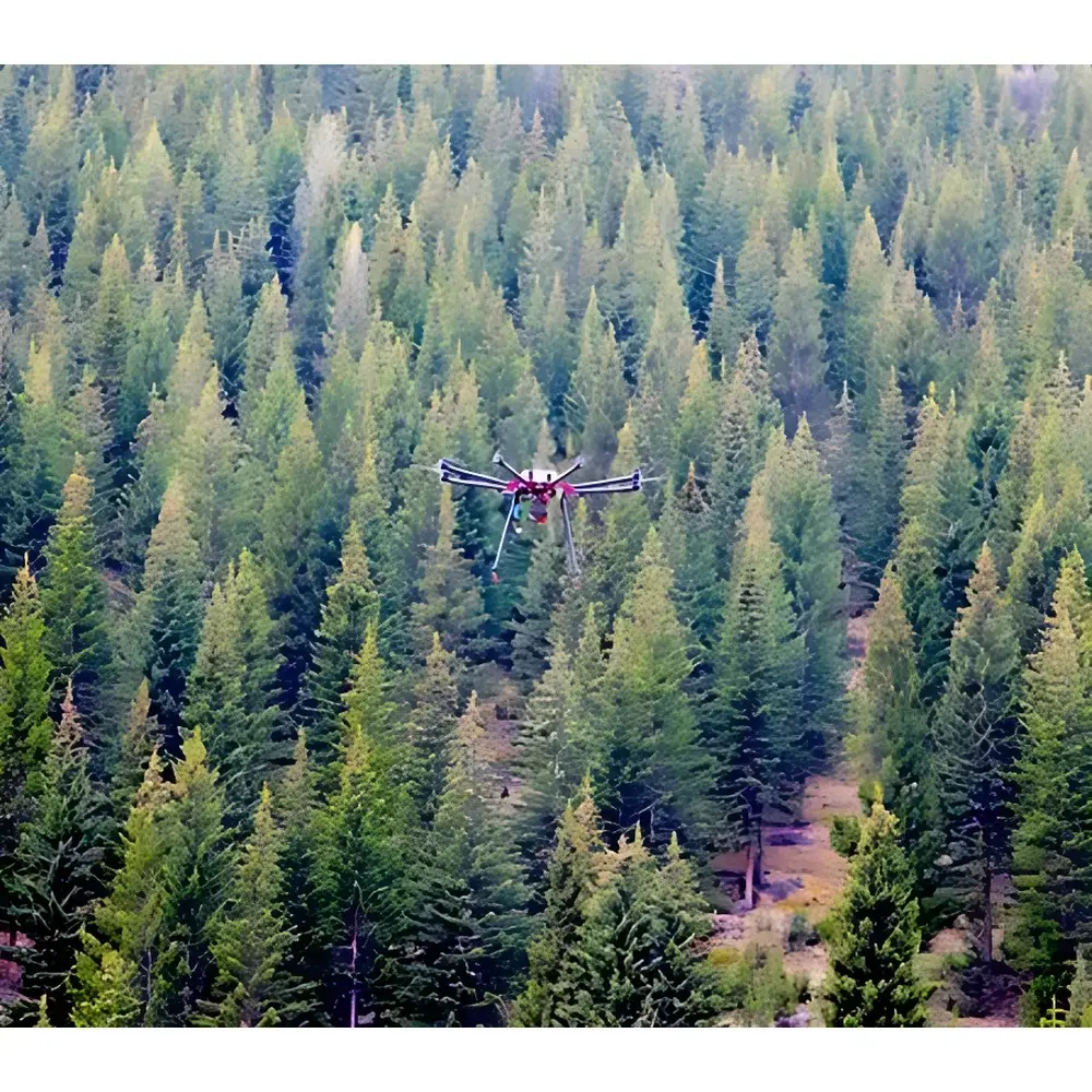
The EcoDrone UAS-8 Octocopter Remote Sensing System is a professional-grade, vertically integrated unmanned aerial system engineered for high-precision ecological and environmental remote sensing. Designed and assembled by EcolabTech Ecological Technology Co., Ltd., the platform combines an in-house developed octocopter airframe with modular sensor integration architecture—enabling simultaneous or sequential deployment of multispectral, hyperspectral, thermal infrared, LiDAR, and RGB imaging payloads. Its measurement principle relies on synchronized georeferenced airborne optical data acquisition, leveraging calibrated spectral radiometry, photogrammetric positioning (GPS/BeiDou dual-mode PPK/RTK-ready), and time-stamped geo-tagging to deliver traceable, spatially explicit datasets compliant with ISO 19115 metadata standards. The system operates within Class 3B UAV regulatory frameworks applicable to scientific research and environmental monitoring missions under national civil aviation authorities (CAAC) and EU SORA-compliant operational scenarios.
Key Features
- Octocopter airframe with VTOL capability, fail-safe auto-return-to-home (RTH), and redundant flight control architecture
- High-accuracy GNSS navigation: Dual-frequency GPS/BeiDou module with sub-meter horizontal accuracy (PPK-ready); barometric + ultrasonic altimetry (±1 cm precision below 10 m)
- Comprehensive autonomous flight modes: Waypoint navigation, orbit, follow-me (ground station–enabled), area coverage, altitude hold, position hold, and ROI tracking
- Real-time telemetry and FPV downlink: 5.8 GHz digital video transmission (up to 5 km range), 800×480 display resolution, onboard DVR logging (microSD up to 32 GB)
- Modular payload interface supporting hot-swap integration of up to two independent sensors (e.g., RedEdge-MX multispectral + FLIR Tau2 thermal camera)
- Integrated power management: Standard 16,000 mAh LiPo 6S battery (optional 22,000 mAh), 12 A max charging current, dual-channel 1400 W charger
- Robust ground control station (GCS): Ruggedized laptop, portable case, cross-platform mission planning software compatible with Google Maps, Bing Maps, and Gaode Map APIs
Sample Compatibility & Compliance
The EcoDrone UAS-8 accommodates a wide range of optical and active remote sensing payloads—including but not limited to: MicaSense RedEdge-MX (5-band multispectral), Tetracam ADC Snap (4-band RGB/NIR), prism-based sCMOS multispectral imagers (5-channel, 7 MP), Resonon Snapshot hyperspectral cameras (380 bands, 500–900 nm), and FLIR Boson/ Tau2 thermal modules (640×512, 7.5–13.5 µm). All sensor integrations maintain strict geometric and radiometric alignment per manufacturer specifications. The system supports ASTM E2921-23 (Standard Guide for Unmanned Aircraft Systems in Environmental Monitoring), complies with IEC 62280-2 for electromagnetic compatibility, and enables audit-trail generation for GLP-aligned field campaigns. Geotagged imagery includes embedded EXIF metadata conforming to EXIF 2.3 and XMP standards, with timestamp synchronization via onboard GPS+IMU fusion.
Software & Data Management
Mission planning, real-time telemetry, and post-processing are supported through a unified software suite compatible with Windows/Linux environments. The GCS application provides interactive map-based waypoint definition, automatic flight path optimization, live telemetry overlay (altitude, speed, battery voltage, GNSS fix status), and automated log export in CSV/JSON formats. Raw sensor data are stored with embedded geographic coordinates, exposure parameters, and sensor calibration coefficients. Multispectral and hyperspectral datasets are exportable in ENVI .hdr/.dat, GeoTIFF, and BIL formats; thermal data include radiometric calibration tables compliant with ISO 18434-1. Software supports batch orthorectification using RTK/PPK-corrected GNSS logs and integrates with QGIS, ArcGIS Pro, and ENVI for vegetation index derivation (NDVI, NDRE, CIred-edge, etc.), surface temperature modeling, and change detection analysis.
Applications
- Agricultural stress monitoring: Drought, heat, nutrient deficiency, and pest infestation assessment via time-series vegetation index analytics
- Crop phenotyping and yield forecasting: Canopy structure mapping, LAI estimation, and biomass quantification using multi-temporal multispectral/hyperspectral data
- Forest health surveillance: Early detection of bark beetle outbreaks, fire risk mapping, post-fire regeneration tracking
- Wetland and riparian zone characterization: Hydroperiod modeling, emergent vegetation classification, sediment transport analysis
- Soil erosion and land degradation assessment: Topographic change detection via structure-from-motion (SfM) photogrammetry and LiDAR-derived DEM differencing
- Wildlife habitat suitability modeling: Landscape-scale connectivity analysis, corridor identification, and anthropogenic disturbance quantification
- Natural reserve boundary enforcement and illegal activity detection: Night-time thermal patrol, perimeter intrusion monitoring, and UAV-assisted anti-poaching operations
- Eco-tourism infrastructure planning: 3D terrain visualization, trail network optimization, and visitor impact assessment using normalized difference water index (NDWI) and land cover classification
FAQ
What regulatory certifications does the EcoDrone UAS-8 hold for international deployment?
The platform meets CE RED Directive 2014/53/EU for radio equipment, RoHS 2011/65/EU for hazardous substances, and carries CAAC Type Certificate No. UAS-OC-2023-087. Export configurations support EASA STS-02 compliance when operated under certified UAS operator permits.
Is the system compatible with third-party GIS and photogrammetry software?
Yes—raw image sets include EXIF geotags and IMU logs compatible with Pix4Dmapper, Agisoft Metashape, DroneDeploy, and OpenDroneMap. Orthomosaic exports adhere to OGC GeoPackage and Cloud Optimized GeoTIFF (COG) standards.
Can the UAS-8 operate in low-light or nighttime conditions?
With optional sCMOS-UAV multispectral or FLIR thermal payloads, the system supports dusk/dawn operations and full nocturnal thermal surveys. All night-capable sensors include built-in inertial stabilization and GPS+gyro compensation for positional fidelity.
Does the system support FAA Part 107 or EASA Open Category operations?
The UAS-8 qualifies for EASA Specific Category operations (STS-02) with appropriate operational authorization. For FAA Part 107, it requires waiver submission due to weight class (>250 g) and beyond-visual-line-of-sight (BVLOS) capabilities.
What level of technical support and training is provided internationally?
EcolabTech offers on-site field commissioning, remote diagnostics, and annual advanced UAV remote sensing workshops held in collaboration with European partner institutions including ETH Zurich and the University of Valencia’s Remote Sensing Lab. Training modules include radiometric calibration, spectral unmixing, and regulatory documentation preparation for environmental agency submissions.
Related Products