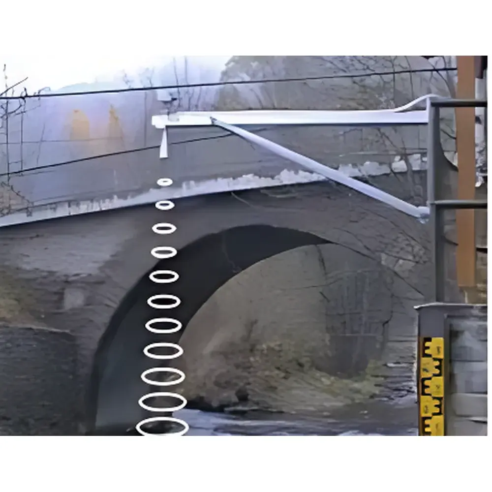
SEBAPULS Non-Contact Radar Water Level Sensor
| Origin | Germany |
|---|---|
| Manufacturer Type | Authorized Distributor |
| Origin Category | Imported |
| Model | SEBAPULS |
| Pricing | Upon Request |
Overview
The SEBAPULS Non-Contact Radar Water Level Sensor is an industrial-grade, 26 GHz pulse radar instrument engineered for high-accuracy, maintenance-free monitoring of surface water levels in open channels, rivers, irrigation canals, flood-prone gorges, and ecologically sensitive wetlands. Unlike ultrasonic or pressure-based systems, the SEBAPULS operates on time-of-flight (ToF) measurement principles: a narrow-beam radar pulse is emitted vertically toward the water surface; the reflected signal is captured by the integrated receiver, and the elapsed time between transmission and echo detection is converted into distance using the constant speed of electromagnetic wave propagation in air (~0.3 m/ns). This physics-based calculation ensures immunity to environmental variables including air temperature gradients, relative humidity fluctuations, atmospheric dust, and barometric pressure shifts—critical for long-term deployment in unsheltered field environments.
Key Features
- 26 GHz pulse radar technology with 10° beam divergence—optimized for focused targeting and minimal side-lobe interference in constrained or cluttered installations (e.g., vegetated banks, floating debris zones)
- No measurement blind zone: operational range begins at ≤20 cm from sensor face—enabling compact mounting on bridges, weirs, or low-profile structures
- IP68-rated housing (fully submersible up to 10 m for short durations), corrosion-resistant stainless steel and PTFE-coated antenna assembly suitable for saline, acidic, or sediment-laden water bodies
- Ultra-low power consumption: nominal operating current of 22.4 mA at 12 V DC—compatible with solar-battery hybrid systems for remote, off-grid monitoring stations
- Fixed vertical installation only—no calibration required after mounting; factory-trimmed zero offset eliminates field re-zeroing
- Short measurement cycle (<2 s typical) supports high-frequency hydrological event capture (e.g., flash flood onset, tidal surge dynamics)
- No mechanical wear, no contact with water—zero drift from biofouling, silt accumulation, or chemical scaling
Sample Compatibility & Compliance
The SEBAPULS is validated for continuous operation across heterogeneous surface water matrices—including turbid runoff, macrophyte-dense channels (e.g., Elodea, Phragmites), high-suspended-sediment flows (>5,000 mg/L), and saline estuaries (up to 35 ppt). It complies with IEC 60529 (IP68), EN 61326-1:2013 (EMC for industrial environments), and meets functional safety requirements per IEC 61508 SIL 2 for critical infrastructure monitoring. While not certified for direct regulatory reporting under EPA Method 1600 or ISO 14001 Annex A.4.2, its measurement traceability aligns with ISO/IEC 17025–accredited calibration practices when deployed with NIST-traceable reference gauges.
Software & Data Management
Internal non-volatile memory stores up to 12 months of timestamped level data (1-minute resolution default). Local retrieval is supported via RS-232 serial interface (ASCII protocol, configurable baud rate). For telemetry, the sensor integrates natively with ENVIdata’s GPRS-enabled gateway architecture—enabling secure, encrypted transmission (TLS 1.2) to centralized databases. The ENVIdata Environmental Information System (EIS) supports concurrent ingestion from ≥1,000 distributed nodes, provides audit-trail logging per FDA 21 CFR Part 11 requirements (user authentication, electronic signatures, immutable data history), and delivers web-based visualization tools: real-time dashboards, GIS-mapped station overlays, customizable alert thresholds (SMS/email), and export-ready CSV/NetCDF outputs for hydrodynamic modeling (e.g., HEC-RAS, MIKE SHE).
Applications
- Flood early-warning networks in mountainous catchments and urban drainage basins
- Irrigation district flow accounting and gate-level control feedback
- Ecological monitoring of wetland hydroperiods and groundwater-surface water exchange zones
- Regulatory compliance tracking for wastewater discharge outfalls and stormwater retention ponds
- Long-term climate observation networks requiring multi-decade stability (drift <0.1 mm/year, verified per DIN EN ISO 5725-2)
- Hydropower intake level supervision where ice formation or debris impact precludes submerged sensors
FAQ
What is the minimum measurable distance from the sensor face to water surface?
The SEBAPULS has no blind zone; reliable measurements begin at 20–30 mm below the antenna aperture.
Can it operate in freezing conditions with surface ice?
Yes—the 26 GHz signal penetrates thin ice layers (<5 cm); however, accuracy degrades if ice thickness exceeds radar penetration depth or induces significant signal attenuation.
Is field recalibration required after initial setup?
No—factory calibration is permanent and stable; only physical repositioning necessitates verification against a static reference point.
Does the sensor support Modbus RTU or SDI-12 protocols?
No—it uses proprietary ASCII serial framing over RS-232; protocol conversion requires external gateway firmware (e.g., Campbell Scientific CR1000X with custom script).
How is measurement uncertainty quantified across the full 0–15 m range?
Total system uncertainty is ±2 mm (k=2, 95% confidence) under standard atmospheric conditions (20°C, 65% RH); increases marginally to ±3 mm above 10 m due to atmospheric path delay compensation limits.