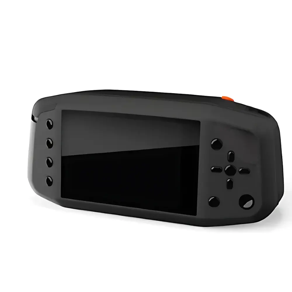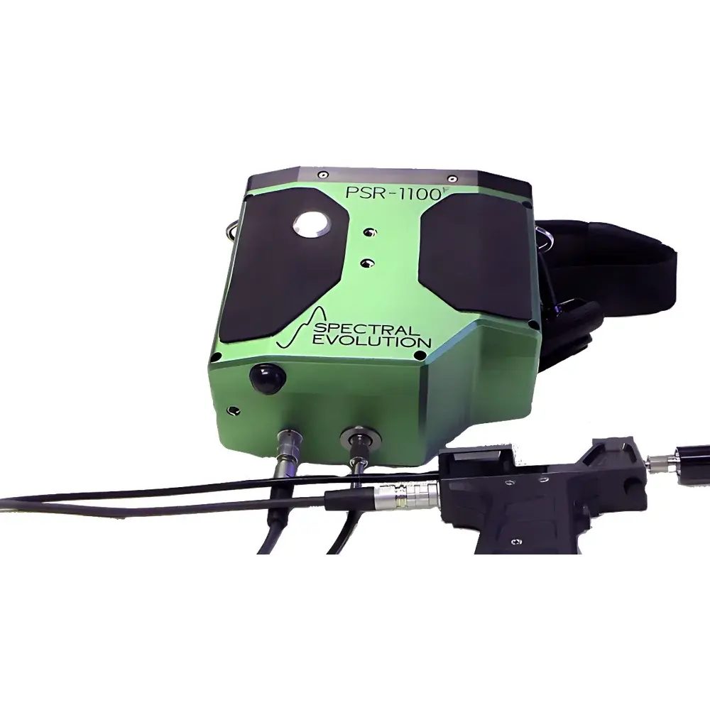
SEI PSR-1100f Handheld Field Spectroradiometer
| Brand | SEI |
|---|---|
| Origin | USA |
| Manufacturer Type | Authorized Distributor |
| Import Status | Imported |
| Model | PSR-1100f |
| Operating Principle | Push-broom Scanning |
| Imaging Method | Interferometric (Fourier-transform compatible optical architecture) |
| Deployment Mode | Ground-based |
| Wavelength Range | 320–1100 nm |
| Spectral Resolution | 3 nm @ 600 nm |
| Sampling Bandwidth | 1.5 nm |
| NEΔL (1 s integration) | 8.0×10⁻¹⁰ W/cm²/nm/sr @ 400 nm |
| Max Radiance | 1.5×10⁻⁴ W/cm²/nm/sr @ 700 nm |
| Slit Width | 50 µm |
| Detector | 512-element Si photodiode array, pixel size 25 µm × 2.5 mm |
| A/D Conversion | 16-bit |
| Wavelength Repeatability | ±0.1 nm |
| Wavelength Accuracy | ±0.5 nm |
| Integration Time | 8–2000 ms |
| Built-in Rechargeable Battery | 2800 mAh Li-ion |
| Onboard Storage | 2500 spectra (standalone mode) |
| Dimensions | 17.8 × 8.3 × 14.6 cm |
| Weight | 1.8 kg |
| Interface | USB 2.0, Bluetooth 4.2 |
Overview
The SEI PSR-1100f Handheld Field Spectroradiometer is a high-fidelity, portable spectroradiometric instrument engineered for quantitative ground-based reflectance and radiance measurements across the ultraviolet–visible–near-infrared (UV-VNIR) spectrum (320–1100 nm). Utilizing a push-broom scanning architecture with an interferometric-compatible optical design, the PSR-1100f delivers laboratory-grade spectral fidelity in field-deployable form. Its all-reflective optical path minimizes chromatic aberration and stray light, ensuring high signal-to-noise ratio (SNR) and long-term calibration stability—critical for time-series monitoring and cross-platform validation. Designed for rigorous environmental metrology, the system adheres to foundational principles of radiometric traceability, with factory calibration directly traceable to NIST standards under controlled blackbody and lamp-based reference conditions. The instrument operates independently of external computing infrastructure, enabling autonomous data acquisition in remote or bandwidth-constrained locations.
Key Features
- Standalone operation with integrated 2800 mAh rechargeable lithium-ion battery supporting >4 hours of continuous measurement at typical integration times (50–200 ms)
- Onboard LCD interface and tactile button panel permitting full spectral acquisition, preview, and storage without PC connectivity—up to 2500 spectra retained in internal memory
- Automated exposure control and shutter sequencing: single-button initiation triggers real-time optimization of integration time and dark current subtraction
- Modular optical interface: detachable 1-meter FC-terminated fiber optic cable; optional fore-optics include 1°, 2.5°, 5°, 8°, and 10° field-of-view lenses for spatially resolved sampling
- Low-stray-light reflective optics with 50 µm entrance slit and 512-pixel silicon photodiode array (25 µm × 2.5 mm active area), digitized via 16-bit analog-to-digital conversion
- Wireless data telemetry via Bluetooth 4.2 protocol; supports synchronized metadata tagging when paired with external PDA units (GPS coordinates, elevation, timestamped imagery, and voice annotations)
Sample Compatibility & Compliance
The PSR-1100f is optimized for non-contact, in situ measurement of bidirectional reflectance distribution functions (BRDF) and spectral radiance from heterogeneous natural surfaces—including soils, vegetation canopies, leaf litter, snowpacks, algal blooms, sediment-laden water columns, and mineral outcrops. Its 320–1100 nm range aligns with key atmospheric transmission windows and overlaps extensively with operational satellite sensors (e.g., Sentinel-2 MSI, Landsat 8/9 OLI, MODIS), enabling direct vicarious calibration and validation workflows. All radiometric calibrations are performed per ASTM E275, ISO 17123-8, and USGS Spectral Library protocols. The instrument’s firmware and DARWin SP software support audit-ready data logging compliant with GLP principles, including immutable timestamps, operator ID fields, and version-controlled calibration file binding.
Software & Data Management
DARWin SP is a dedicated Windows-based acquisition and analysis platform that provides real-time spectral visualization, multi-curve overlay, and batch processing capabilities. Data are exported natively in ASCII format (tab-delimited .txt), ensuring compatibility with MATLAB, Python (NumPy/Pandas), ENVI, and R environments. The software embeds the USGS Digital Spectral Library (Version 7) for material identification and includes built-in algorithms for computing over 35 vegetation indices (e.g., NDVI, EVI, SAVI, PRI, CIred-edge) and soil moisture proxies (e.g., NDWI, MNDWI). Spectral derivatives, Savitzky-Golay smoothing, and atmospheric correction modules (empirical line method, QUAC) are available for preprocessing prior to machine learning or inversion modeling. All calibration files, measurement logs, and user annotations are archived in a structured project hierarchy with SHA-256 checksum integrity verification.
Applications
- Remote sensing ground truthing and sensor intercomparison campaigns
- Phenological monitoring and precision agriculture (crop health, nitrogen status, water stress detection)
- Soil spectroscopy for organic carbon estimation, clay content mapping, and contamination screening
- Aquatic optics: chlorophyll-a retrieval, CDOM quantification, turbidity profiling in coastal and inland waters
- Ecological restoration assessment: species discrimination, invasive plant detection, post-fire recovery tracking
- Geological surveying: mineral identification (e.g., iron oxides, clays, carbonates) and lithological boundary delineation
FAQ
Is the PSR-1100f suitable for UAV-mounted deployment?
Yes—its compact form factor (1.8 kg), low power draw, and shock-resistant aluminum chassis make it compatible with stabilized gimbal platforms; optional lightweight mounting brackets and external trigger synchronization are supported.
Can DARWin SP export spectra in ENVI BIL or BSQ format?
No—native export is ASCII only; however, third-party Python scripts (provided in the SEI Developer Toolkit) enable automated conversion to ENVI, GeoTIFF, or HDF5 formats with georeferencing metadata injection.
What is the recommended recalibration interval?
Annual recalibration against NIST-traceable standards is advised for quantitative applications requiring <±1% radiometric uncertainty; field validation using calibrated reference panels (e.g., Labsphere Spectralon®) is recommended before each major campaign.
Does the system support dark current correction during acquisition?
Yes—automatic dark frame capture is executed prior to every measurement sequence, and temperature-stabilized detector operation ensures minimal drift across ambient ranges (−10°C to +45°C).
How is wavelength accuracy verified post-deployment?
Using mercury-argon emission line sources or solar Fraunhofer features (e.g., Ca II H&K, O₂-A band), users can perform in-field wavelength validation with sub-0.2 nm resolution using DARWin SP’s peak-fitting utility.