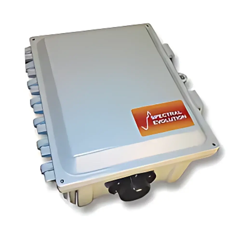
Spectral Evolution UDS-1100SA Dual-Channel Continuous Monitoring Spectroradiometer
| Brand | Spectral Evolution |
|---|---|
| Origin | USA |
| Model | UDS-1100SA |
| Operating Principle | Push-broom |
| Imaging Method | Interferometric |
| Deployment Mode | Ground-based |
| Spectral Range | 320–1100 nm |
| Spectral Resolution | 3.2 nm |
| Spectral Bandwidth | 1.5 nm |
| Wavelength Accuracy | ±0.5 nm |
| Wavelength Repeatability | 0.1 nm |
| Max Radiance | 1.5×10⁻⁴ W/cm²/nm/sr @ 700 nm |
| Detector | 512-element Si array |
| ADC | 16-bit |
| NEΔL (1 s integration) | 8.0×10⁻¹⁰ W/cm²/nm/sr @ 400 nm |
| Radiometric Calibration | NIST-traceable |
| Integration Time | 8–2000 ms |
| Data Acquisition Software | DARWin SP |
| Output Indices | NDVI, GRVI, SR, SAVI, EVI, PRI, WBI, and >10 others |
| Satellite Data Compatibility | AVHRR, Landsat, MODIS, SPOT |
| Communication | USB, optional Bluetooth |
| Power | 6–12 V DC, 0.5 W |
| Dimensions | 25.4 × 31.8 × 21.1 cm |
| Weight | 2 kg |
| Enclosure Rating | NEMA 4 |
| Autonomous Operation | Yes, with onboard storage and power management |
Overview
The Spectral Evolution UDS-1100SA is a dual-channel, ground-deployable spectroradiometer engineered for long-term, unattended spectral monitoring in environmental and Earth observation applications. Based on push-broom scanning and interferometric optical design, the instrument acquires synchronized upwelling (skyward) and downwelling (ground-reflected) radiance spectra across the full 320–1100 nm range—spanning the UV-A, visible, and near-infrared (VNIR) regions. Its core architecture enables high-fidelity, NIST-traceable radiometric measurements under variable ambient conditions, supporting quantitative retrieval of surface reflectance, atmospheric transmittance, and bidirectional reflectance distribution function (BRDF)-informed parameters. Designed for continuous operation in remote field settings—including flux towers, agricultural testbeds, coastal observatories, and forest eddy-covariance stations—the UDS-1100SA integrates hardware-level stability with software-driven automation to meet the rigorous demands of multi-year environmental time-series studies.
Key Features
- Dual-channel simultaneous acquisition: Independent optical paths and detectors for concurrent measurement of sky radiance and surface-reflected radiance—eliminating temporal misalignment errors inherent in sequential single-channel systems.
- NEMA 4-rated aluminum enclosure: Sealed, corrosion-resistant housing rated for outdoor deployment across temperature extremes (−25 °C to +50 °C) and high-humidity environments; compatible with mast, tripod, or vehicle mounting.
- Onboard autonomy: Integrated non-volatile memory (≥32 GB), regulated power management, and programmable wake/sleep cycles enable fully unattended operation for weeks without external intervention.
- High radiometric fidelity: 16-bit analog-to-digital conversion, low-noise Si photodiode array (512 pixels), and factory-applied NIST-traceable calibration coefficients ensure repeatability better than 0.1 nm in wavelength and <1% relative uncertainty in absolute radiance over 12 months.
- Flexible triggering and synchronization: Supports internal timer-based sampling, external TTL pulse triggering, and GPS-synchronized acquisition for alignment with satellite overpasses or coordinated sensor networks.
Sample Compatibility & Compliance
The UDS-1100SA is not sample-contacting; it performs non-invasive, passive optical sensing of natural and anthropogenic surfaces—including vegetation canopies, soil substrates, inland and coastal waters, snow/ice cover, and urban materials. Its spectral response and calibration protocol comply with ASTM E275, ISO 9050, and USGS Spectral Library reference standards. All radiometric outputs are traceable to NIST Standard Reference Materials (SRMs) via documented chain-of-custody calibration reports. The system supports GLP-compliant metadata logging—including GPS position, UTC timestamp, ambient temperature, humidity, and instrument status—and is compatible with FDA 21 CFR Part 11–enabled data audit trails when deployed with validated DARWin SP configurations.
Software & Data Management
DARWin SP v6.x serves as the primary acquisition and analysis platform, offering both real-time visualization and post-processing workflows. It provides automated calculation of >12 biophysically meaningful vegetation indices (e.g., NDVI, EVI, PRI, WBI), solar-induced fluorescence (SIF) proxies, CIE color space metrics (x,y,Y, u’,v’), and broadband irradiance integrals. Raw spectra are stored in HDF5 format with embedded geotags, calibration coefficients, and provenance metadata. Batch processing supports spectral resampling to match satellite sensor bandpasses (Landsat OLI, Sentinel-2 MSI, MODIS), enabling direct cross-platform validation. Optional API access permits integration into SCADA systems, IoT edge gateways, or cloud-based environmental data lakes (e.g., AWS Open Data Registry, NASA Earthdata Cloud).
Applications
- Long-term phenological monitoring: Tracking seasonal dynamics of canopy chlorophyll content, leaf area index (LAI), and water stress indicators across agroecosystems and natural forests.
- Water quality assessment: Quantifying CDOM absorption, suspended sediment concentration, and phytoplankton pigment signatures in lakes, rivers, and estuaries using hyperspectral reflectance inversion models.
- Soil spectroscopy: Supporting proximal soil carbon estimation and mineralogical classification through continuum-removed VNIR spectral features.
- Climate feedback studies: Capturing diurnal and interannual variability in surface albedo, aerosol optical depth proxies, and cloud radiative forcing at fixed terrestrial sites.
- Validation of Earth observation missions: Serving as a ground truth reference for vicarious calibration of airborne and spaceborne sensors including PRISMA, EnMAP, and upcoming SBG (Surface Biology and Geology) mission payloads.
FAQ
Is the UDS-1100SA suitable for marine or coastal deployments?
Yes—the NEMA 4 enclosure and conformal-coated electronics provide resistance to salt fog and intermittent submersion; supplemental marine-grade mounting hardware and anti-fouling lens caps are available upon request.
Can the instrument operate autonomously for more than 30 days?
Yes—when powered by a 12 V 20 Ah battery bank and configured with 5-minute sampling intervals, typical field endurance exceeds 45 days; solar charging kits are supported via the 6–12 V input interface.
Does DARWin SP support batch reprocessing of legacy datasets with updated calibration files?
Yes—calibration coefficients are applied at runtime; users may load revised NIST certificates or custom correction matrices to recompute radiance values without raw data loss.
What spectral resampling methods are implemented for satellite band matching?
DARWin SP applies convolution-based resampling using full-width-at-half-maximum (FWHM)-weighted Gaussian kernels, preserving radiometric integrity while aligning with published sensor spectral response functions (SRFs).
Is remote firmware update capability available?
Yes—via USB or Bluetooth, firmware updates are delivered as signed binary packages; version history and rollback functionality are logged in the onboard audit trail.