MSHyperSIS-VNIR Ground-Based Hyperspectral Imaging Spectrometer
| Origin | Finland |
|---|---|
| Manufacturer Type | Authorized Distributor |
| Origin Category | Imported |
| Model | MSHyperSIS-VNIR |
| Price Range | USD 14,000 – 43,000 (FOB) |
| Operating Principle | Push-broom scanning |
| Imaging Mode | 3D spatial-spectral data cube acquisition |
| Deployment Platform | Terrestrial (ground-based) |
| Spectral Range | 400–1000 nm |
| Spectral Resolution | 0.025 nm (FWHM) |
| Spatial Resolution | 1392 × 1040 pixels |
| Total Field of View (TFOV) | 5° |
| Instantaneous Field of View (IFOV) | 0.05° |
| Frame Rate | 25–120 fps |
| Standard Lens Focal Length | 17 mm |
| Vertical FOV | 40° |
| Horizontal FOV | 70° |
| Scan Speed | ≤100 images/s (CCD-dependent) |
Overview
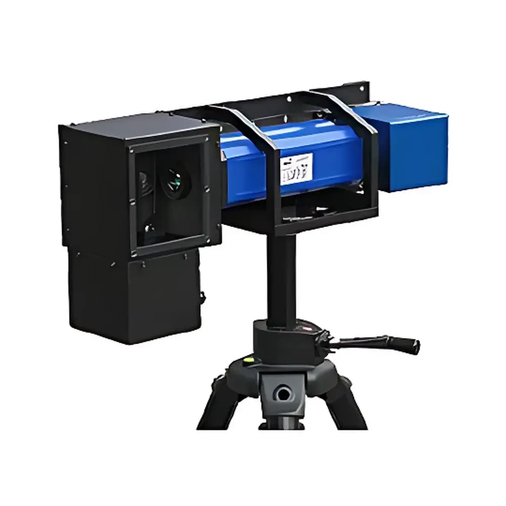
The MSHyperSIS-VNIR Ground-Based Hyperspectral Imaging Spectrometer is a precision-engineered push-broom hyperspectral imager designed for terrestrial remote sensing applications in environmental monitoring, geoscience, marine and limnological research, precision agriculture, and defense-related spectral reconnaissance. It integrates a high-throughput imaging spectrometer with an optical-mechanical mirror scanner and a scientific-grade CCD detector to acquire contiguous, high-fidelity spectral data across the visible to near-infrared (VNIR) range (400–1000 nm). Unlike snapshot or tunable-filter systems, the push-broom architecture ensures consistent illumination geometry and eliminates temporal misregistration between spectral bands—critical for quantitative reflectance modeling and spectral unmixing. Each acquired frame constitutes a full 3D hypercube (x, y, λ), where spatial dimensions are resolved at 1392 × 1040 pixels and spectral dimension is sampled at ≤0.025 nm resolution (FWHM), enabling robust identification of narrow absorption features associated with chlorophyll-a, suspended sediments, dissolved organic matter, mineralogical signatures, and anthropogenic contaminants.
Key Features
- Push-broom scanning architecture with galvanometric mirror scanner for stable, repeatable line-by-line spectral acquisition
- VNIR spectral coverage (400–1000 nm) optimized for water quality parameters (e.g., CDOM, Chl-a, turbidity), vegetation indices (NDVI, PRI), and soil mineral mapping
- High spectral fidelity: ≤0.025 nm spectral resolution supports detection of fine-scale absorption features in aqueous and terrestrial media
- Configurable frame rate (25–120 fps) synchronized with external GPS/IMU for geo-referenced data collection
- Modular optical design: Interchangeable lenses (standard 17 mm focal length) support variable ground sampling distances; vertical/horizontal FOV configurable up to 40° × 70°
- Integrated IFOV of 0.05° enables sub-meter spatial resolution at typical survey altitudes (e.g., 10–50 m AGL with tripod or vehicle mount)
- Robust, field-deployable enclosure rated IP54; powered by rechargeable Li-ion battery pack for >4 hours continuous operation
Sample Compatibility & Compliance
The MSHyperSIS-VNIR is calibrated for terrestrial and aquatic surface reflectance measurements under natural illumination conditions. It supports radiometric calibration via NIST-traceable reference panels (e.g., Spectralon® 99% white standard) and dark-current correction routines embedded in acquisition software. The system complies with ASTM E2798–21 (Standard Practice for Spectral Reflectance Measurements of Natural Surfaces) and ISO 17123-8:2021 (Optics and optical instruments — Field procedures for testing geodetic and surveying instruments — Part 8: Hyperspectral imaging systems). All raw data files adhere to ENVI-compatible BIL (Band Interleaved by Line) format with embedded metadata headers (wavelength, exposure time, GPS timestamp, lens ID), ensuring interoperability with GIS platforms (ArcGIS Pro, QGIS) and spectral analysis toolboxes (MATLAB HyperTools, Python scikit-image + spectral).
Software & Data Management
Acquisition and preprocessing are managed through proprietary MSHyperSIS Control Suite (Windows 10/11 x64), which provides real-time preview, auto-exposure optimization, spectral library matching (USGS, ECOSTRESS, SPECCHIO), and on-the-fly radiometric correction. The software supports FDA 21 CFR Part 11-compliant audit trails—including user login logs, parameter change history, and raw-to-reflectance processing lineage—for GLP/GMP-aligned environmental laboratories. Export formats include GeoTIFF (with embedded georeferencing tags), HDF5 (for large hypercube storage), and CSV (band-wise spectral profiles). Batch processing pipelines integrate with ENVI Classic and IDL for endmember extraction, linear spectral unmixing, and classification (SVM, Random Forest).
Applications
- Oceanographic and coastal monitoring: Quantification of phytoplankton biomass, colored dissolved organic matter (CDOM), and suspended particulate matter (SPM) in estuaries and shelf seas
- Freshwater ecosystem assessment: Detection of cyanobacterial blooms, macrophyte distribution, and sediment resuspension dynamics in lakes and reservoirs
- Geological field mapping: Discrimination of iron oxides, clay minerals, and hydrothermal alteration zones in outcrop-scale surveys
- Agricultural phenotyping: High-resolution stress detection (water deficit, nitrogen deficiency) via canopy-level spectral indices
- Forensic and defense applications: Camouflage detection, material identification, and concealed object screening under daylight conditions
FAQ
What calibration standards are required for field deployment?
A NIST-traceable 99% Spectralon® panel and a black-body shutter are mandatory for absolute reflectance calibration. Optional irradiance sensor integration enables solar-normalized measurements.
Can the system be mounted on UAVs or mobile platforms?
Yes—the compact form factor (≤3.2 kg) and vibration-damped mounting interface support integration with stabilized gimbal systems; IMU synchronization is supported via TTL trigger and PPS input.
Is spectral data compatible with USGS or ESA spectral libraries?
All exported spectra conform to SPECCHIO metadata schema and can be ingested directly into USGS Digital Spectral Library v7 and ESA’s SPECTRAL database without format conversion.
What is the recommended maintenance interval for optical alignment?
Factory recalibration is recommended every 18 months or after 500 operational hours, particularly following transport-induced shock events or thermal cycling beyond −10°C to +45°C.
Does the system support real-time spectral anomaly detection?
Yes—via optional FPGA-accelerated onboard processing module (sold separately), enabling pixel-level spectral angle mapper (SAM) classification at ≥30 fps with user-defined endmember libraries.
Related Products