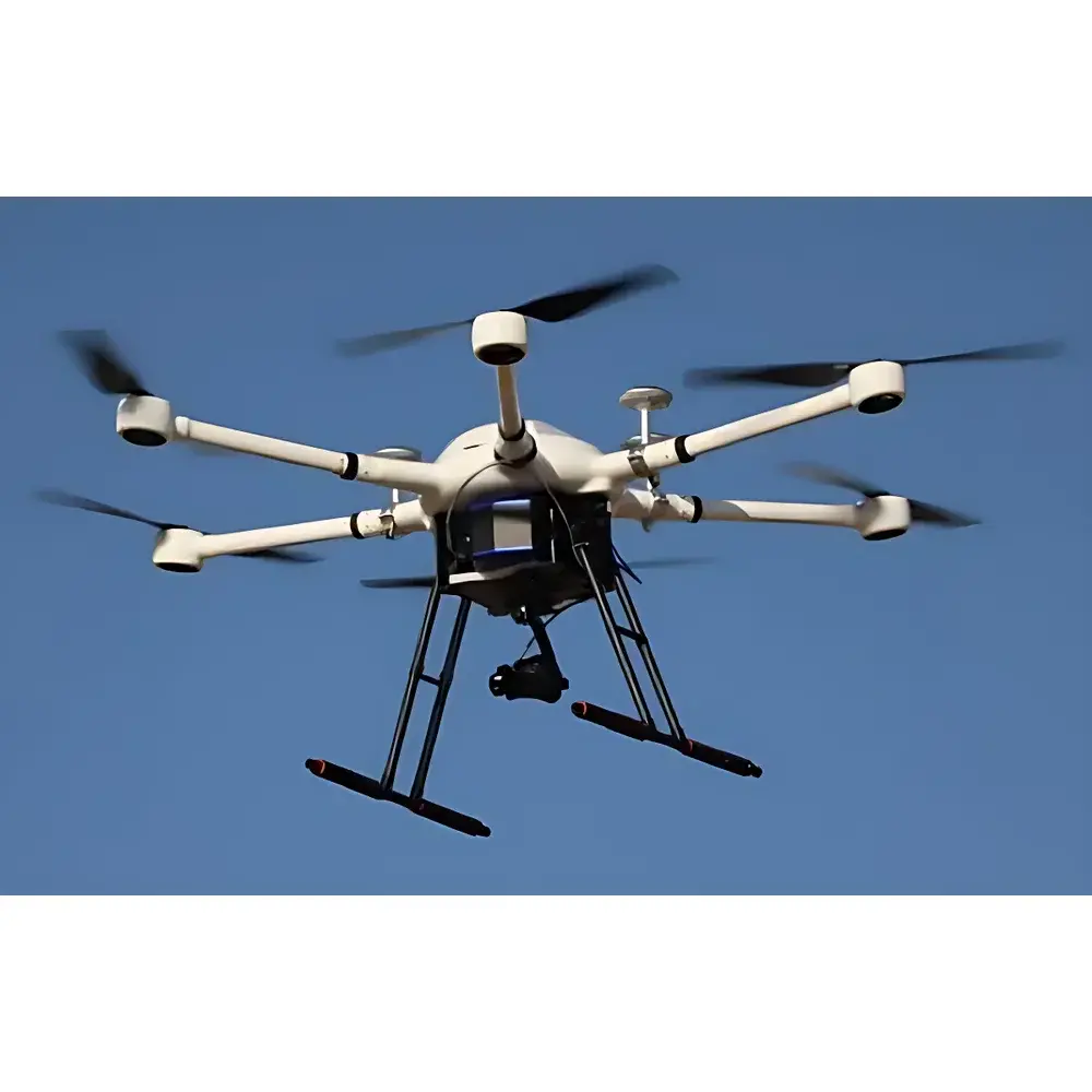
AERO A660-8800 Autonomous UAV-Based BRDF Measurement System
| Brand | AERO |
|---|---|
| Origin | Beijing, China |
| Manufacturer Type | Authorized Distributor |
| Country of Origin | China |
| Model | A660-8800 |
| Pricing | Upon Request |
| Spectral Range | 350–2500 nm |
| Integrated Camera Resolution | 26 MP |
| Payload Weight | <700 g |
| Control Architecture | Custom BRDF Flight Module + Ground Station Software Suite |
Overview
The AERO A660-8800 Autonomous UAV-Based BRDF Measurement System is an integrated remote sensing platform engineered for high-fidelity bidirectional reflectance distribution function (BRDF) characterization of natural and anthropogenic surfaces under real-world illumination conditions. Unlike traditional ground-based goniometers or tower-mounted spectroradiometers, the A660-8800 leverages autonomous unmanned aerial vehicle (UAV) navigation to acquire angularly resolved spectral reflectance data across user-defined hemispherical sampling geometries. Its core measurement principle relies on synchronized acquisition of radiance spectra (350–2500 nm) and georeferenced imagery at precisely controlled view-illumination configurations—enabling quantitative BRDF model inversion (e.g., Ross-Thick/Li-Sparse, Rahman-Pinty-Verstraete) compliant with ISO 18437-2 and CEOS BRDF/Albedo Product Validation Protocols. Designed for ecological monitoring, land surface modeling, and calibration/validation of satellite-derived reflectance products (e.g., Sentinel-2, Landsat 9, MODIS), the system operates without requiring permanent infrastructure or manual repositioning of optical sensors.
Key Features
- Autonomous BRDF flight planning via proprietary ground station software—supports one-click generation of optimized angular sampling trajectories aligned with solar geometry and target coordinates.
- Integrated BRDF observation module featuring a gimbal-stabilized spectroradiometer head with active attitude control (pitch/roll/yaw resolution ≤ 0.1°), enabling real-time tracking of sun-surface-sensor geometry during flight.
- Monolithic carbon-fiber airframe architecture optimized for payload efficiency and aerodynamic stability in variable wind conditions (tested up to 12 m/s).
- Dual-sensor co-registration: 26-megapixel RGB imager synchronized with VNIR-SWIR spectrometer (350–2500 nm) at frame-level temporal alignment (<10 ms jitter).
- Redundant flight control system incorporating triple IMU fusion, dual GNSS receivers (GPS + BeiDou), and fail-safe RTL (Return-to-Launch) logic meeting DO-178C Level B software assurance requirements.
- Modular quick-release gimbal interface (ISO 5355-compliant mechanical coupling) enabling sub-90-second payload swaps between BRDF, multispectral, or thermal configurations.
- Onboard data logging with timestamped metadata (UTC, GPS position, IMU quaternion, solar zenith/azimuth, sensor temperature) stored in netCDF-4 format for traceable post-processing.
Sample Compatibility & Compliance
The A660-8800 is validated for use over heterogeneous terrestrial surfaces including vegetation canopies (forest, cropland, grassland), bare soil, snow/ice, urban impervious surfaces, and water bodies. It complies with field measurement protocols defined in NASA’s CEOS Working Group on Calibration and Validation (WGCV) BRDF Good Practice Guidelines and supports data formatting for ingestion into ESA’s BRDF Processing Chain (BPC) and USGS Land Surface Reflectance Code (LaSRC). All firmware and ground software adhere to IEC 62443-3-3 cybersecurity standards for industrial control systems. The system meets electromagnetic compatibility (EMC) Class B per EN 55032 and environmental operating specifications (−10 °C to +45 °C, 10–90% RH non-condensing).
Software & Data Management
The AERO Ground Station Suite (v4.2+) provides mission planning, real-time telemetry visualization, and automated BRDF dataset assembly. Flight paths are generated using ray-tracing algorithms that constrain view angles relative to solar position and avoid occlusion by terrain or structures. Raw spectral data are processed using AERO’s BRDF Toolkit—a Python-based library supporting radiometric calibration (NIST-traceable lamp standards), atmospheric correction (6S engine integration), and BRDF parameter estimation via Levenberg-Marquardt optimization. All processing steps maintain full audit trails compliant with FDA 21 CFR Part 11 for regulated environmental monitoring applications. Export formats include CF-compliant NetCDF, ENVI header/BIP, and JSON-LD metadata bundles compatible with FAIR data principles.
Applications
- Validation of satellite-derived surface reflectance and albedo products across spatial scales (e.g., cross-sensor harmonization of Sentinel-3 OLCI and VIIRS).
- In situ characterization of anisotropic reflectance effects in precision agriculture for improved canopy structure modeling and chlorophyll estimation.
- Long-term ecological monitoring of phenological shifts through time-series BRDF metrics (e.g., hotspot intensity, scattering phase function asymmetry).
- Calibration support for airborne hyperspectral campaigns (e.g., AVIRIS-NG, HySpex) via spatially distributed angular reference targets.
- Urban heat island studies leveraging directional emissivity and reflectance coupling in thermal-infrared BRDF modeling.
- Climate model input generation—particularly for Earth system models requiring spectrally resolved, angularly explicit surface boundary conditions.
FAQ
What spectral bands does the A660-8800 support, and how is radiometric calibration maintained?
The system covers 350–2500 nm with configurable spectral sampling (1–5 nm FWHM). Radiometric calibration is performed pre- and post-flight using NIST-traceable halogen and deuterium lamps; onboard thermistor-stabilized detectors ensure drift compensation.
Can the A660-8800 operate beyond visual line of sight (BVLOS)?
Yes—when operated under national civil aviation authority approvals (e.g., CAAC BVLOS permits in China, FAA Part 107.31 waiver in the U.S.), the system supports pre-programmed beyond-line-of-sight missions with 4G/LTE telemetry fallback and ADS-B In collision avoidance.
Is raw data accessible for third-party BRDF modeling workflows?
Absolutely—all unprocessed radiance, geometry, and metadata are exported in open scientific formats (NetCDF, GeoTIFF) without vendor lock-in; no proprietary binary wrappers are applied.
How is geometric accuracy ensured during low-altitude BRDF flights?
RTK-GNSS (1 cm horizontal / 2 cm vertical accuracy) combined with photogrammetric tie-point refinement ensures sub-pixel geolocation fidelity across the entire angular sampling grid.
Does the system support multi-temporal BRDF acquisition over the same site?
Yes—the ground station enables repeat-pass mission replication with sub-centimeter spatial registration tolerance, facilitating change detection in BRDF shape parameters over seasonal or interannual timescales.