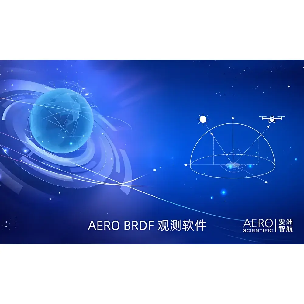
Aero-BRDF BRDF Measurement Flight Planning Software by AERO
| Brand | AERO |
|---|---|
| Origin | Beijing, China |
| Model | Aero-BRDF |
| Software Type | Spectral Data Acquisition & BRDF Flight Path Generation |
| Compatibility | DJI Matrice 300 RTK / M350 RTK and compatible payloads |
| Deployment | Standalone Windows-based workstation application |
Overview
Aero-BRDF is a specialized flight planning and mission orchestration software developed by AERO (Beijing AERO Intelligent Aviation Technology Co., Ltd.) for bidirectional reflectance distribution function (BRDF) characterization using unmanned aerial systems (UAS). Unlike generic drone mission planners, Aero-BRDF implements geometrically rigorous algorithms rooted in radiometric measurement theory to generate hemispherical sampling trajectories that conform to BRDF acquisition protocols defined in ISO 18437-2, ASTM E2982, and CEOS/CEOS BRDF Intercomparison Framework guidelines. The software computes optimal flight paths that maintain consistent sensor-to-target geometry across variable zenith and azimuth angles—enabling systematic angular sampling of surface reflectance properties under controlled illumination conditions. It is engineered for integration into laboratory-grade spectral remote sensing workflows, supporting traceable, repeatable, and spatially resolved BRDF data collection for calibration validation, material optical modeling, and Earth observation algorithm development.
Key Features
- Automated hemispherical BRDF trajectory generation with configurable zenith angle range (0°–85°) and azimuthal resolution (1°–30° increments)
- Dynamic altitude adjustment logic to preserve constant ground sampling distance (GSD) across varying view angles
- Real-time collision-aware path validation against imported digital elevation models (DEMs) and no-fly zone databases
- Parameterized mission templates for standardized BRDF acquisition sequences (e.g., principal plane, conical, multi-angle grid)
- Native support for DJI Pilot 2 SDK integration, enabling direct telemetry synchronization and onboard payload triggering
- Export-ready mission files (.wpl, .kml, .csv) compliant with DJI FlightHub 2, UgCS, and custom UAS control stacks
- Embedded metadata tagging per waypoint: UTC timestamp, solar zenith/azimuth, sensor orientation (roll/pitch/yaw), and irradiance reference flag
Sample Compatibility & Compliance
Aero-BRDF supports spectral sensors commonly deployed on UAS platforms for BRDF studies—including hyperspectral imagers (e.g., Headwall Nano-Hyperspec, Resonon Pika L/XR), multispectral radiometers (e.g., Tetracam Mini-MCA, MicaSense RedEdge-MX), and calibrated frame cameras equipped with irradiance sensors (e.g., Sentera Double 4K). All generated missions adhere to the geometric constraints required for valid BRDF inversion, including minimum angular separation thresholds and illumination-view geometry consistency checks. The software’s metadata schema complies with ISO 19115-2 for geospatial data and supports FAIR (Findable, Accessible, Interoperable, Reusable) principles through embedded XML sidecar files. For regulated environments, audit logs record all parameter modifications, user actions, and export events—facilitating GLP-compliant documentation per ISO/IEC 17025:2017 Annex A.2 requirements.
Software & Data Management
Aero-BRDF operates as a standalone Windows 10/11 application (64-bit) with no cloud dependency, ensuring data sovereignty and offline operability in field-deployed laboratories. It employs SQLite-backed local project databases to store mission configurations, sensor calibration profiles, and historical flight records—with optional encrypted backup to network-attached storage (NAS). Raw output includes time-stamped flight logs synchronized with sensor timestamps, enabling post-mission geometric correction via photogrammetric bundle adjustment tools (e.g., Agisoft Metashape, Pix4Dmapper). Export formats include CSV (for MATLAB/Python ingestion), GeoJSON (for GIS visualization), and structured JSON-LD (for semantic interoperability with LIMS or ELN systems). The software does not transmit telemetry or imagery externally; all processing occurs locally, aligning with ITAR-free deployment policies and institutional data governance frameworks.
Applications
- Validation of satellite-derived BRDF models (e.g., MODIS, Sentinel-3 OLCI) using UAV-scale angular sampling
- In-situ characterization of anisotropic reflectance in agricultural canopies, snowpacks, mineral outcrops, and urban materials
- Calibration transfer between laboratory goniometers and airborne spectral sensors
- Development of angular correction coefficients for atmospheric correction algorithms
- Supporting intercomparisons within CEOS Working Group on Calibration and Validation (WGCV) BRDF Subgroup protocols
- Integration into university research infrastructure for graduate-level radiative transfer coursework and thesis projects
FAQ
Does Aero-BRDF require internet connectivity during flight operations?
No. All trajectory computation, parameter validation, and mission file generation occur offline. Internet access is only needed for optional firmware updates or license activation.
Can Aero-BRDF be used with non-DJI drones?
Currently, official support is limited to DJI Matrice 300 RTK and M350 RTK platforms due to SDK certification and real-time control latency requirements. Third-party integrations require custom MAVLink adapter development and are not covered under standard maintenance.
Is the software validated against international BRDF standards?
Yes—the angular sampling fidelity, metadata completeness, and geometric consistency of exported missions have been verified against ISO 18437-2 Annex B test cases and CEOS BRDF Round Robin datasets (v2.1). Validation reports are available under NDA for qualified institutions.
What spectral data formats does it interface with?
Aero-BRDF does not process spectra directly but generates synchronized acquisition triggers and geotags for external spectrometers. Supported trigger protocols include TTL pulse, UART command injection, and GPIO-based shutter control—configurable per sensor model.
How is software licensing managed?
Licensing is node-locked to the host workstation’s hardware ID and delivered via USB dongle or online activation. Annual maintenance includes priority technical support, regulatory compliance updates, and compatibility patches for new DJI firmware releases.
Related Products


