AERO ARIEL L-Band Microwave Radiometer
| Brand | AERO |
|---|---|
| Origin | Spain |
| Manufacturer Type | Authorized Distributor |
| Origin Category | Imported |
| Model | ARIEL |
| Frequency | 1.413 GHz (L-Band) |
| Bandwidth | 20 MHz |
| Radiometric Accuracy | ±0.7 K at 1 Hz integration time |
| Sampling Rate | Up to 10 Hz |
| Polarization | Dual (H + V) |
| Beamwidth | 37° (Ground & UAV), 22° (Airborne) |
| Radiometric Resolution | 0.02 K |
| Radiometric Precision | ±0.2 K |
| Coordinate System | WGS84 (EPSG:4326) |
| Spatial Resolution (GSD) | 1 m |
| Power Input | 12 V DC |
| Electronics Current Draw | 0.5 A |
| Heater Current | 1 A (Ground/UAV), 4 A (Airborne) |
| Interface | Ethernet, Web-based Configuration UI |
| Data Output Format | Brightness Temperature (TB) in NetCDF/GeoTIFF |
| Optional Processing | TB-to-Soil Moisture Inversion Software |
| Dimensions | 400 × 300 × 250 mm (Ground), Ø410 mm (Airborne) |
| Weight | 6 kg (Ground), 2.8 kg (UAV), 15 kg (Airborne) |
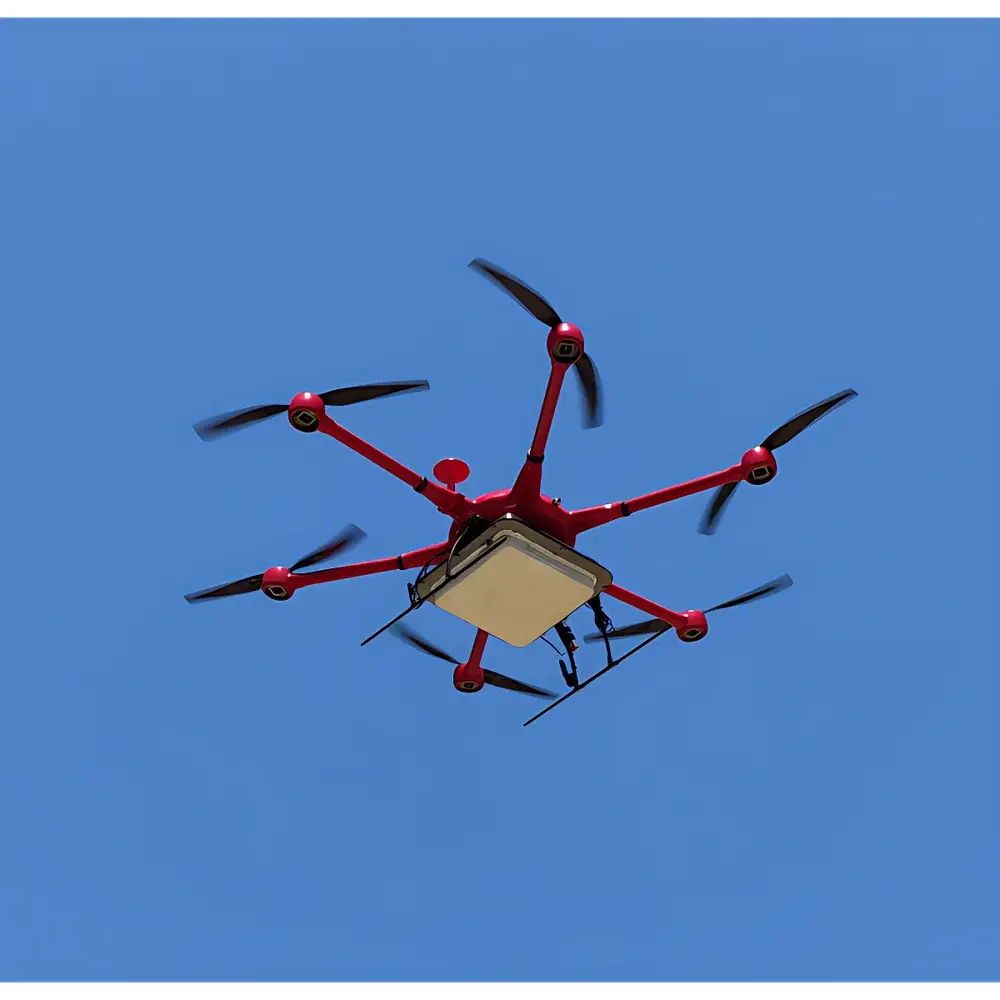
| Platform Compatibility | Fixed-wing aircraft, multirotor & VTOL UAVs, ground vehicles, sleds |
Overview
The AERO ARIEL L-Band Microwave Radiometer is a high-stability, dual-polarized passive remote sensing instrument engineered for quantitative retrieval of land surface parameters—primarily soil moisture and vegetation optical depth—under diverse deployment configurations. Operating at the protected 1.413 GHz frequency band (ITU-R RS.1861), the ARIEL leverages the physical sensitivity of L-band microwave emissions to dielectric properties of near-surface media, enabling all-weather, day/night observation with minimal atmospheric attenuation. Its radiometric architecture follows the Dicke-switched design principle, ensuring robust calibration stability against thermal drift and platform-induced noise. The system integrates a low-noise front-end receiver, programmable digital backend, and embedded GNSS timing synchronization to support georeferenced radiometric mapping at sub-kelvin resolution. Designed for operational flexibility, ARIEL supports three primary deployment modes—ground-based stationary or mobile, unmanned aerial vehicle (UAV)-mounted, and fixed-wing airborne—with mechanically optimized antenna beamwidths (37° for surface platforms, 22° for aircraft) and platform-specific thermal management.
Key Features
- Dual-polarization (H + V) radiometric acquisition enabling Stokes parameter derivation and polarization difference analysis for improved vegetation correction
- Modular electronics architecture with field-replaceable RF and digital modules, supporting rapid reconfiguration across platforms without recalibration
- Integrated multi-constellation GNSS receiver (GPS, GLONASS, BeiDou) delivering synchronized position, velocity, and time (PVT) data at 10 Hz with WGS84 (EPSG:4326) compliance
- Web-based configuration interface accessible via Ethernet, allowing real-time parameter adjustment, firmware updates, and health monitoring without proprietary software dependencies
- Onboard storage and Ethernet streaming capability for raw brightness temperature (TB) data in NetCDF-4 format with embedded geotags and metadata per CF-1.8 conventions
- Optional calibrated Red/NIR photodiode module for simultaneous spectral reflectance acquisition, facilitating synergistic TB–optical fusion algorithms
- Passive thermal control and configurable heater circuitry (1 A for ground/UAV, 4 A for airborne) maintaining stable RF front-end temperature across ambient ranges from −20 °C to +50 °C
Sample Compatibility & Compliance
The ARIEL is validated for continuous operation over natural terrestrial surfaces including agricultural croplands, grasslands, tundra, and snow-covered terrain. Its 1-m ground sampling distance (GSD) and 0.02-K radiometric resolution meet the spatial and sensitivity requirements specified in ESA’s SMOS mission validation protocols and NASA’s Soil Moisture Active Passive (SMAP) Level 1 algorithm documentation. All hardware and firmware comply with CE EN 61326-1 (EMC for measurement equipment) and EN 55032 (EMI emission limits). Data provenance adheres to ISO 19115-2 metadata standards, and optional processing workflows—including TB-to-soil moisture inversion using τ–ω or Qp models—support traceable uncertainty propagation per ISO/IEC 17025 guidelines. The system is compatible with FAO’s WaPOR framework and EU Copernicus Land Monitoring Service input specifications.
Software & Data Management
ARIEL delivers raw brightness temperature data in self-describing NetCDF-4 files containing calibrated TB values, antenna pointing vectors, GNSS timestamps, and ancillary sensor logs. The included web UI provides real-time telemetry visualization and configuration export/import. For post-processing, AERO supplies an open-API Python toolkit (ARIEL-SDK) supporting reprojection, geocoding, and atmospheric correction (e.g., oxygen absorption modeling at 1.413 GHz). Optional licensed software includes the TB2SM inversion suite, which implements iterative dielectric mixing models constrained by in situ soil texture and temperature inputs. All software modules generate audit trails compliant with FDA 21 CFR Part 11 requirements when deployed in GLP-certified environmental monitoring programs. Data exports support GeoTIFF, CSV, and OGC SensorML formats for integration into GIS platforms such as QGIS and ArcGIS Pro.
Applications
- High-resolution soil moisture mapping for irrigation scheduling and drought early-warning systems
- Calibration/validation of satellite-based L-band missions (e.g., SMOS, SMAP, CIMR)
- Permafrost thaw monitoring through temporal TB anomaly detection in Arctic tundra
- Wetland hydrology studies integrating TB dynamics with SAR backscatter time series
- Forest canopy water content estimation via polarization ratio (V/H) analysis
- Urban heat island research correlating surface emissivity anomalies with land cover classification
- Field-scale validation of land surface models (e.g., Noah-MP, CLM5) under heterogeneous terrain
FAQ
What is the minimum integration time required to achieve ±0.2 K precision?
The ARIEL achieves its specified ±0.2 K absolute accuracy with a 1-second integration time under nominal thermal conditions; shorter integrations (down to 100 ms) are supported but increase radiometric uncertainty proportionally.
Can ARIEL operate simultaneously with active radar systems on the same platform?
Yes—its narrow 20-MHz bandwidth and sharp RF filtering minimize susceptibility to out-of-band interference; co-location with C-band or X-band SAR systems has been verified in multiple UAV campaigns.
Is the brightness temperature data traceable to SI units?
Yes—each ARIEL unit undergoes factory calibration against NIST-traceable blackbody references at 290 K and 320 K, with full uncertainty budgets documented per ISO/IEC 17025 Annex A.
Does the system support real-time data downlink over cellular or satellite links?
Raw TB data streaming is supported via Ethernet-to-USB-C adapters; for telemetry-limited platforms, optional lightweight UDP packetization firmware enables loss-tolerant transmission to ground stations.
How is antenna pointing accuracy ensured during UAV flight?
The integrated GNSS/INS module (optional) provides attitude-quaternion outputs at 100 Hz; combined with mechanical mounting alignment verification, pointing uncertainty remains below ±0.5° RMS in all axes.


