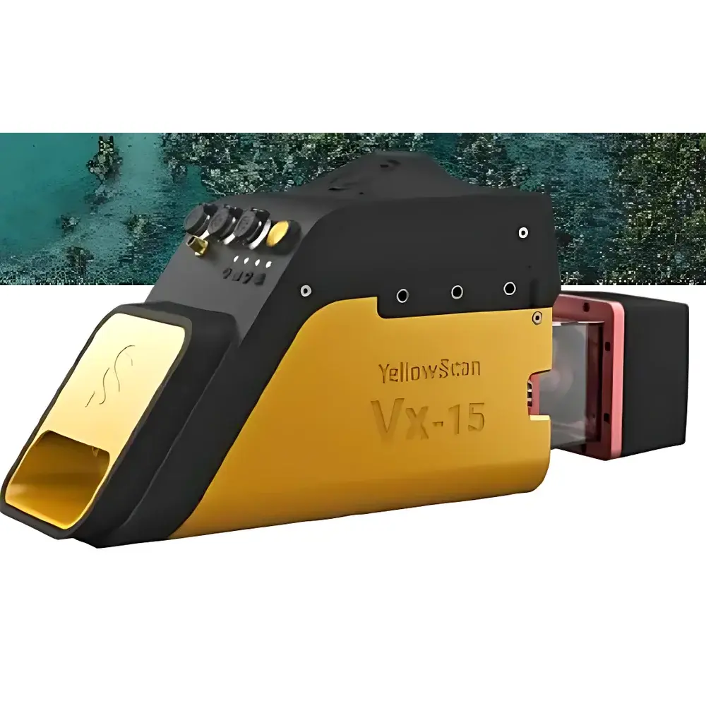
YellowScan Vx15 Series UAV-Mounted LiDAR System
| Origin | Beijing, China |
|---|---|
| Manufacturer Type | Distributor |
| Origin Category | Domestic (China) |
| Model | YellowScan Vx15 |
| Pricing | Upon Request |
| Core Payload | Riegl miniVUX-1UAV LiDAR Scanner |
| Inertial Navigation System | Applanix APX-15 UAV |
| Platform Compatibility | Ecodrone® UAS-8 |
| Typical Endurance | >30 min |
| Point Cloud Accuracy | Sub-decimeter horizontal / vertical (typical in GNSS-RTK enabled conditions) |
| Intensity Calibration | Factory-calibrated radiometric intensity output |
| System Integration | Pre-integrated with hyperspectral, thermal infrared, and multispectral sensor options |
Overview
The YellowScan Vx15 Series is a lightweight, turnkey UAV-mounted LiDAR system engineered for high-accuracy geospatial data acquisition in demanding environmental and ecological survey applications. Built around the RIEGL miniVUX-1UAV time-of-flight (TOF) scanning LiDAR sensor—known for its high pulse repetition frequency (up to 500 kHz), multi-target capability (up to 5 returns per pulse), and robust performance in variable ambient light—the Vx15 integrates seamlessly with the Applanix APX-15 UAV inertial navigation system (INS). This INS provides real-time kinematic (RTK)-enabled positioning and high-fidelity attitude estimation (roll/pitch/yaw) via tightly coupled GNSS/IMU fusion, enabling direct georeferencing of point clouds without post-mission ground control point (GCP) dependency under optimal signal conditions. Designed explicitly for integration with the Ecodrone® UAS-8 unmanned aerial platform, the Vx15 achieves operational endurance exceeding 30 minutes per flight, supporting efficient coverage of large-area survey zones across heterogeneous terrain.
Key Features
- Ultra-lightweight integration: Total system mass optimized for Class III UAV platforms, minimizing payload-induced aerodynamic drag and maximizing flight time efficiency.
- Factory-calibrated intensity values: Radiometrically corrected return intensities enable quantitative surface reflectance analysis—critical for land cover classification, vegetation structure modeling, and material discrimination.
- Sub-decimeter absolute accuracy: Achieves ≤10 cm horizontal and ≤15 cm vertical accuracy (1σ, under RTK-GNSS + Applanix INS conditions) in open-sky environments per ASTM E2847-22 guidelines for airborne LiDAR system performance verification.
- Multi-sensor interoperability: Mechanical and electrical interfaces conform to standard UAV avionics protocols (e.g., MAVLink, PPS sync, UART/USB-C), allowing synchronized operation with co-mounted hyperspectral imagers (e.g., Headwall Nano-Hyperspec), thermal infrared cameras (e.g., FLIR Tau2), and RGB-NIR multispectral arrays.
- Ruggedized enclosure: IP54-rated housing ensures reliable operation in dust-prone field environments and light precipitation typical of ecological monitoring campaigns.
Sample Compatibility & Compliance
The Vx15 is validated for deployment across diverse environmental sampling scenarios—including forest canopy penetration, agricultural crop height profiling, riparian zone topography mapping, and open-pit mine volume calculation. Its low-altitude flight capability (300 pts/m² at 60 m altitude) support fine-scale structural analysis compliant with ISO 19115-2:2019 metadata standards and FAO’s Global Forest Resources Assessment (FRA) remote sensing protocols. All firmware and embedded INS calibration procedures adhere to ISO/IEC 17025:2017 requirements for measurement traceability. Data outputs comply with ASPRS LAS 1.4 specification and are compatible with industry-standard processing pipelines (e.g., LAStools, OPALS, ENVI LiDAR).
Software & Data Management
Data acquisition is managed via YellowScan’s proprietary GeoTagger software, which supports real-time preview, mission planning with no-fly zone constraints, and automatic onboard storage redundancy (dual SD card logging). Post-processing leverages Applanix POSPac UAV software for precise trajectory reconstruction and RIEGL’s RiPROCESS suite for radiometric correction, noise filtering, and classification (ground/non-ground, vegetation, building). Export formats include LAS/LAZ, ASCII XYZI, and GeoTIFF rasters. Audit trails, user authentication logs, and version-controlled processing parameters satisfy GLP-compliant workflows and FDA 21 CFR Part 11 requirements where applicable in regulated environmental impact assessment reporting.
Applications
- Forest structure quantification: Canopy height model (CHM) derivation, biomass estimation, and species-level segmentation using intensity + geometric features.
- Agricultural phenotyping: Plot-level plant height dynamics, lodging detection, and yield proxy modeling via temporal LiDAR differencing.
- Environmental change monitoring: Shoreline evolution tracking, landslide displacement analysis, and wetland inundation mapping.
- Infrastructure inspection: Power line corridor clearance analysis, transmission tower deformation assessment, and pipeline route corridor modeling.
- Cultural heritage documentation: High-resolution 3D reconstruction of archaeological sites and historical terrain features beneath vegetation canopy.
FAQ
What GNSS correction services are supported for real-time kinematic operation?
The APX-15 UAV supports RTCM 3.x input from local base stations, NTRIP-caster networks (e.g., CORS), and satellite-based augmentation systems (SBAS) such as WAAS and EGNOS.
Is the system compatible with non-Ecodrone UAV platforms?
Yes—mechanical mounting brackets and electrical interface documentation are provided for integration with DJI Matrice 300 RTK, Freefly Alta X, and other UAVs meeting payload capacity (>1.2 kg), power (24–36 V DC), and vibration isolation specifications.
How is radiometric intensity calibrated, and can it be validated in-field?
Intensity values are factory-calibrated against Lambertian reference targets; users may perform periodic validation using certified spectral reflectance panels (e.g., Labsphere Spectralon) under controlled illumination conditions.
Does the system support simultaneous acquisition with third-party sensors?
Yes—hardware-trigger synchronization (via TTL pulse) and time-stamp alignment (PPS + UTC) ensure sub-millisecond temporal registration between LiDAR points and co-mounted imagery.
What is the recommended workflow for generating DEMs and CHMs?
Standard practice involves ground point classification (using morphological filters or machine learning classifiers), followed by interpolation using inverse distance weighting (IDW) or triangulated irregular network (TIN) methods in QGIS, ArcGIS, or CloudCompare—fully documented in YellowScan’s Application Note AN-VX15-03.
Related Products


