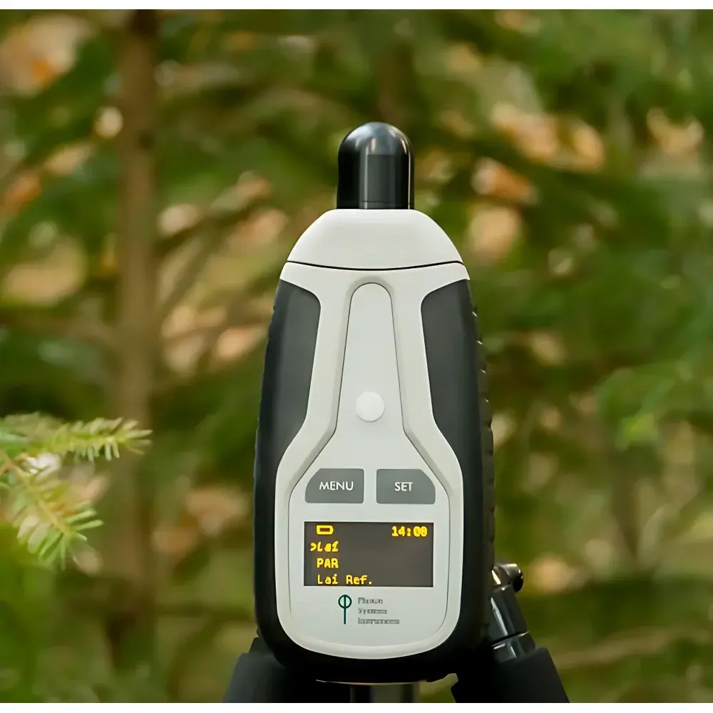
PSI LaiPen LP110 Leaf Area Index Meter
| Brand | PSI |
|---|---|
| Origin | Czech Republic |
| Model | LaiPen LP110 |
| Measurement Parameters | Leaf Area Index (LAI), Photosynthetically Active Radiation (PAR) |
| Detector Wavelength Range | 400–700 nm (PAR), 400–500 nm (LAI) |
| Field of View | 112° horizontal, 16° vertical |
| Measurement Angles | 0°, 16°, 32°, 48°, 64° |
| Memory Capacity | 16 MB (>100,000 data points) |
| Display | 2×8 character LCD |
| Communication | Bluetooth + USB |
| Battery Life | 48 hours |
| Dimensions | 120 × 57 × 30 mm |
| Weight | 180 g |
| Operating Conditions | 0–55 °C, 0–95% RH (non-condensing) |
| Storage Conditions | −10–60 °C, 0–95% RH (non-condensing) |
Overview
The PSI LaiPen LP110 Leaf Area Index Meter is a field-deployable optical instrument engineered for rapid, non-destructive estimation of Leaf Area Index (LAI) in broadleaf canopies. LAI—defined as the one-sided green leaf area per unit ground surface area (m² m⁻²)—serves as a critical biophysical parameter in ecosystem modeling, carbon flux estimation, remote sensing validation, and plant stress assessment. Unlike traditional hemispherical photography or indirect LAI methods requiring overcast skies or precise solar zenith angles, the LaiPen LP110 employs a robust radiative transfer-based approach using angularly resolved PAR measurements under variable daylight conditions. It operates on the principle of gap fraction analysis: by quantifying the attenuation of diffuse and direct solar radiation across five discrete inclination angles (0°, 16°, 32°, 48°, 64°), the device computes canopy light interception profiles and solves the Beer–Lambert–Lacaze equation within an inverted two-stream radiative transfer framework. This enables high reproducibility across heterogeneous stands without reliance on cloud cover or strict time-of-day constraints.
Key Features
- Compact monolithic design integrating optical sensor, microcontroller, memory, display, GPS, and dual-mode communication—dimensions: 120 × 57 × 30 mm; mass: 180 g
- Dual-band optical detection: 400–700 nm bandpass filter for PAR quantification; 400–500 nm narrowband filter optimized for LAI-specific spectral response
- Five-angle sequential acquisition mode enabling accurate gap fraction profiling and clumping correction without external calibration targets
- Two operational configurations: single-sensor mode (sequential above- and below-canopy measurements) and dual-sensor mode (simultaneous reference and sample readings via synchronized units)
- Onboard GPS logging with timestamped georeferenced output—compatible with GIS workflows and long-term plot monitoring
- Extended battery endurance: up to 48 hours of continuous field operation under typical ambient temperatures (0–35 °C)
- Rugged environmental rating: functional across 0–55 °C and 0–95% relative humidity (non-condensing), validated for tropical, temperate, and semi-arid deployments
Sample Compatibility & Compliance
The LaiPen LP110 is validated for use with structurally diverse broadleaf vegetation—including deciduous forests, agroforestry systems, shrublands, and herbaceous canopies—where leaf angle distribution and clumping effects are moderate to high. It is not recommended for needleleaf conifers or highly layered multi-stratum canopies without empirical correction factors. The instrument complies with ISO 13837:2000 (optical measurement of vegetation structure) and supports GLP-aligned data collection through immutable timestamping, location tagging, and audit-ready export formats (CSV, TXT). While not FDA-regulated, its firmware architecture adheres to IEC 62304 Class B software safety principles for field instrumentation, and raw data files retain full traceability for peer-reviewed publication or regulatory reporting.
Software & Data Management
Data retrieval occurs via Bluetooth 4.2 (BLE) or high-speed USB 2.0 interface. PSI provides the proprietary LaiPen Manager desktop application (Windows/macOS) for firmware updates, measurement protocol configuration, batch processing, and LAI derivation using built-in inversion algorithms (e.g., CI-203-style clumping correction). Exported datasets include: UTC timestamp, WGS84 coordinates (latitude/longitude), five-angle irradiance values, computed LAI (mean ± SD), PAR-integrated photon flux density (µmol m⁻² s⁻¹), and instrument status flags. All logs are stored in plain-text format with no proprietary encryption—ensuring compatibility with R, Python (pandas, xarray), MATLAB, and QGIS for secondary analysis. Audit trails record operator ID (optional), session start/stop times, and GPS fix quality—meeting baseline requirements for ISO/IEC 17025-compliant environmental laboratories.
Applications
- Long-term phenological monitoring of canopy development in ecological research plots
- Ground-truthing and calibration of satellite-derived LAI products (e.g., MODIS, Sentinel-2, Landsat)
- Quantifying canopy structural responses to abiotic stressors (drought, ozone exposure, heavy metal deposition)
- Assessing pest- or pathogen-induced defoliation dynamics in forest health surveillance programs
- Parameterizing terrestrial biosphere models (e.g., CLM, ORCHIDEE) with spatially explicit LAI inputs
- Supporting carbon sequestration assessments under IPCC Tier 2/3 reporting frameworks
FAQ
Does the LaiPen LP110 require calibration against destructive sampling?
No—factory calibration is performed using NIST-traceable PAR sources and cosine-corrected irradiance standards. Field recalibration is unnecessary under normal operating conditions; however, users may perform optional verification using a certified reference diffuser.
Can it measure LAI in mixed-species or multi-layered canopies?
Yes, with limitations: it assumes effective leaf angle distribution (ELAD) homogeneity within the instantaneous field of view (112° HFOV). For stratified canopies, complementary ground-based LiDAR or fisheye imagery is recommended for structural decomposition.
Is GPS accuracy sufficient for plot-level mapping?
The integrated GPS module delivers ~3 m CEP (circular error probable) under open-sky conditions—adequate for plot centroid registration but not sub-meter spatial analysis; external RTK-GNSS input is unsupported.
How does it handle partial cloud cover or rapidly changing illumination?
Its five-angle acquisition sequence completes in <2 seconds, minimizing temporal mismatch between angles. Internal averaging and dynamic range optimization (16-bit ADC) maintain signal fidelity during transient irradiance fluctuations.
What file formats are supported for data export?
CSV and plain-text tab-delimited files only—no binary or proprietary formats. Each row contains timestamp, coordinates, five irradiance values, derived LAI, PAR, and metadata flags—fully compatible with FAIR data principles.
Related Products


