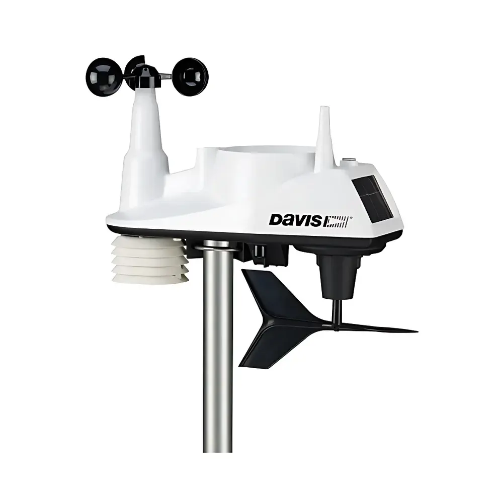

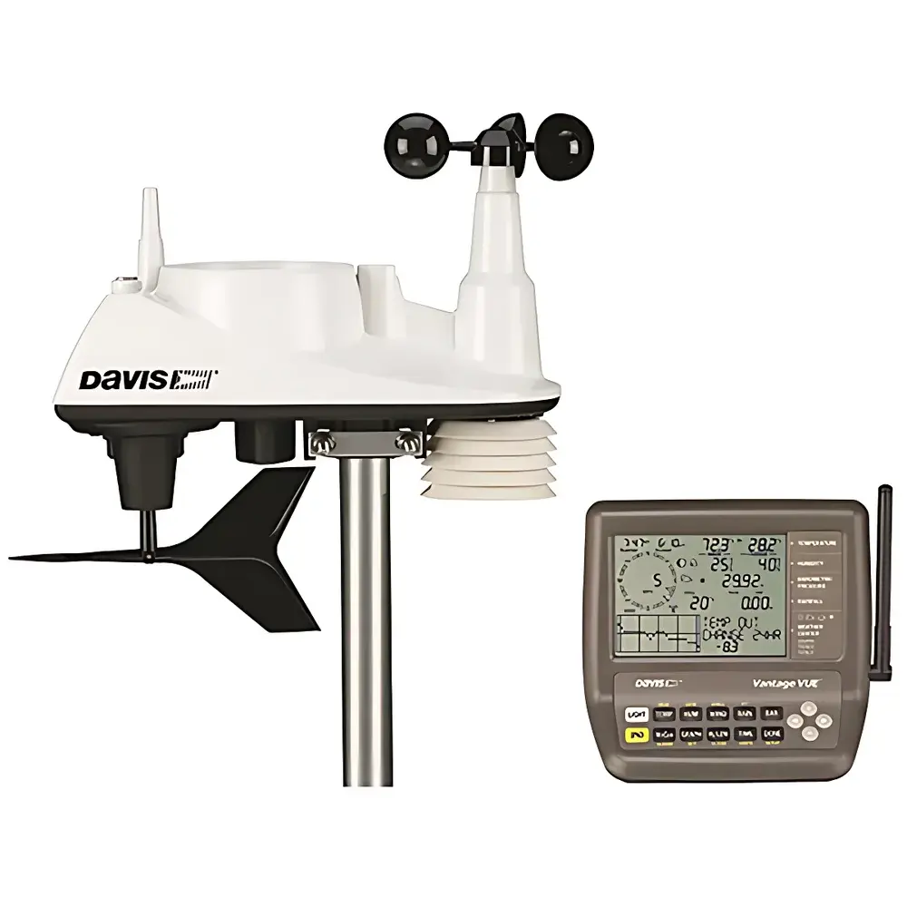
Davis Vantage Vue 6250 Wireless Automatic Weather Station
| Brand | Davis |
|---|---|
| Origin | USA |
| Model | Vantage Vue 6250 |
| Instrument Type | Portable Weather Station |
| Wireless Transmission Range | 300 m |
| Data Update Interval | 2.5–24 s (sensor-dependent) |
| Operating Temperature (ISS) | -40 to +65 °C |
| Power Source | Solar panel (0.5 W) + CR123A lithium battery (8-month backup) |
| Compliance | WMO observational standards |
Overview
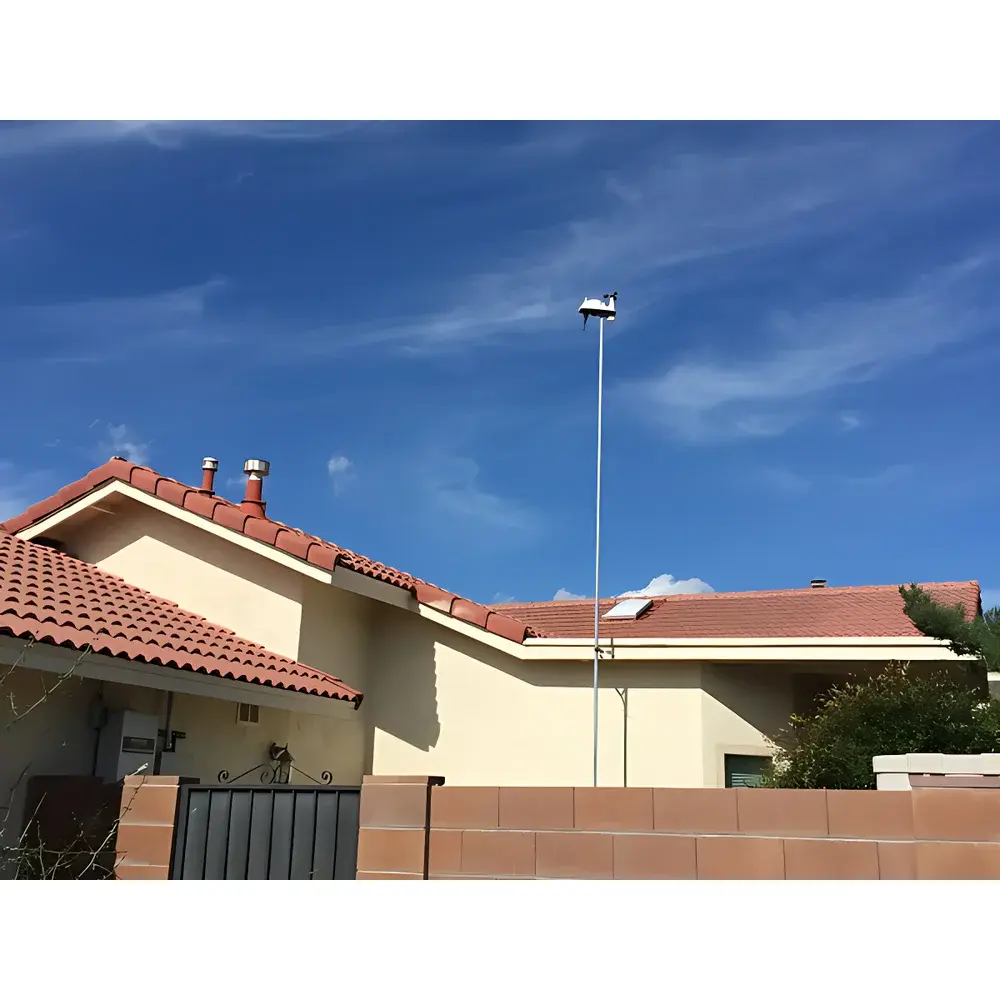
The Davis Vantage Vue 6250 Wireless Automatic Weather Station is a compact, integrated environmental monitoring system engineered for high-reliability field deployment in meteorological research, agricultural microclimate studies, educational institutions, and municipal environmental observation networks. Built upon Davis Instruments’ proven sensor architecture, the system employs a single Integrated Sensor Suite (ISS) housing co-located anemometer, wind vane, thermistor-based temperature/humidity sensors, tipping-bucket rain gauge, and barometric pressure transducer — all calibrated to meet World Meteorological Organization (WMO) Class II observational specifications. Unlike modular stations requiring separate mounting and cabling, the Vantage Vue 6250’s monolithic ISS design eliminates inter-sensor spatial error and thermal lag, ensuring synchronized, time-aligned measurements across all parameters. Data transmission utilizes proprietary spread-spectrum 902–928 MHz RF technology, delivering robust 300-meter line-of-sight wireless communication with low latency (2.5-second wind updates) and immunity to common 2.4 GHz band interference. The console features a backlit LCD display with graphical trend visualization, real-time parameter overlays, and on-device NOAA-compliant report generation — enabling autonomous operation without continuous PC connectivity.
Key Features
- Integrated Sensor Suite (ISS): All core meteorological sensors — cup anemometer (0–89 m/s), magnetic-wind-vane (1–360°), silicon diode temperature sensor (±0.5°C above –7°C), thin-film capacitive humidity sensor (±2% RH), 0.2 mm resolution tipping-bucket rain collector (116 cm² orifice), and piezoresistive barometer (540–1100 hPa) — housed in a single UV-stabilized ABS/ASA enclosure.
- High-Fidelity Temporal Resolution: Wind speed and direction updated every 2.5–3 seconds; temperature/humidity sampled every 10–12 seconds; rainfall accumulation reported every 20–24 seconds; barometric pressure logged every 60 seconds — supporting both instantaneous analysis and statistical aggregation (e.g., 10-minute wind averages).
- Energy-Autonomous Operation: Powered by a 0.5 W monocrystalline solar panel and rechargeable CR123A 3V lithium battery, rated for 8 months of continuous operation without sunlight and up to 2 years under typical insolation conditions.
- WMO-Compliant Accuracy & Stability: Temperature accuracy ±0.5°C (–7°C to +65°C), humidity drift <0.25% per year, barometric resolution 0.1 hPa, and rain gauge calibration traceable to NIST-standardized precipitation simulators.
- Console Ergonomics & Local Intelligence: 105 × 76 mm LCD with LED backlight, user-configurable 12/24-hour clock and date format, built-in moon phase calculation (±38 min accuracy), sunrise/sunset prediction (±1 min), and derived indices including heat index, wind chill, and dew point — all computed onboard without external software.
Sample Compatibility & Compliance
The Vantage Vue 6250 is designed for unattended outdoor exposure across diverse climatic zones, from arctic tundra (–40°C operational limit) to subtropical coastal regions (65°C max). Its UV-resistant polymer housing, corrosion-inhibiting internal coatings, and sealed sensor apertures ensure long-term stability in high-humidity, saline, or particulate-laden environments. All measurements conform to WMO Guide to Meteorological Instruments and Observing Methods (CIMO Guide, 2022 edition) for Class II surface stations — particularly relevant for non-regulatory but scientifically valid applications in academic research, precision agriculture, and environmental impact assessments. While not certified for aviation or national weather service primary networks (which require Class I hardware), its data integrity supports GLP-aligned field studies and ISO 17025-compliant laboratory environmental monitoring when paired with documented calibration records.
Software & Data Management
Data logging is supported via optional WeatherLink USB (6510USB) or RS-232 (6510SER) interface modules, enabling direct connection to Windows/macOS systems. The WeatherLink desktop application provides timestamped CSV export, NOAA-formatted summary reports (daily/monthly/yearly), multi-parameter trend charts with customizable time windows, and automated FTP/SFTP upload for remote server synchronization. Audit trails include full metadata (sensor ID, firmware version, battery voltage, solar charge status), satisfying basic requirements for data traceability under FDA 21 CFR Part 11 Annex 11 when deployed in regulated environmental monitoring contexts (e.g., pharmaceutical warehouse ambient condition verification). No cloud subscription is required for local data acquisition; raw binary logs are fully readable using open-source parsing libraries.
Applications
- Agricultural Microclimate Monitoring: Real-time tracking of vapor pressure deficit (VPD), growing degree days (GDD), and irrigation-triggering rainfall thresholds across orchards, vineyards, and greenhouse perimeters.
- University Atmospheric Science Labs: Teaching platform for boundary-layer meteorology, sensor error propagation analysis, and validation of numerical weather prediction (NWP) model outputs at mesoscale resolution.
- Renewable Energy Site Assessment: Long-term wind resource profiling (including turbulence intensity estimation from 2.5-second gust sampling) and solar irradiance proxy via correlated temperature/pressure trends.
- Municipal Environmental Health Programs: Deployment in urban heat island (UHI) studies, air quality correlation campaigns (paired with PM2.5/NO₂ sensors), and public-facing real-time weather dashboards.
- Disaster Preparedness Infrastructure: Standalone early-warning capability for flash flood risk (via rapid rainfall rate detection >50 mm/h) and windstorm onset (sustained >20 m/s over 3-minute window).
FAQ
What is the maximum recommended distance between the ISS and console?
The specified line-of-sight range is 300 meters; actual performance depends on terrain, foliage density, and building materials. For extended deployments, the optional 7626 Wireless Repeater extends effective range up to 900 meters.
Does the station support NTP or GPS time synchronization?
No — internal RTC maintains ±8 seconds per month accuracy; time is set manually or via WeatherLink software sync during PC connection.
Can rainfall data be corrected for wind-induced undercatch?
The tipping-bucket design follows WMO-recommended geometry (116 cm² orifice, 0.2 mm resolution); correction factors must be applied post-acquisition using site-specific wind speed histograms per WMO TR-128 guidelines.
Is the barometric pressure reading sea-level adjusted?
Yes — console automatically applies elevation-compensated sea-level pressure (SLP) calculation using user-input altitude (–600 to +4570 m); raw station pressure is also accessible via WeatherLink export.
What maintenance intervals are recommended for long-term accuracy?
Biannual visual inspection of rain collector funnel and anemometer cups; annual recalibration of temperature/humidity sensors against NIST-traceable references is advised for research-grade data continuity.