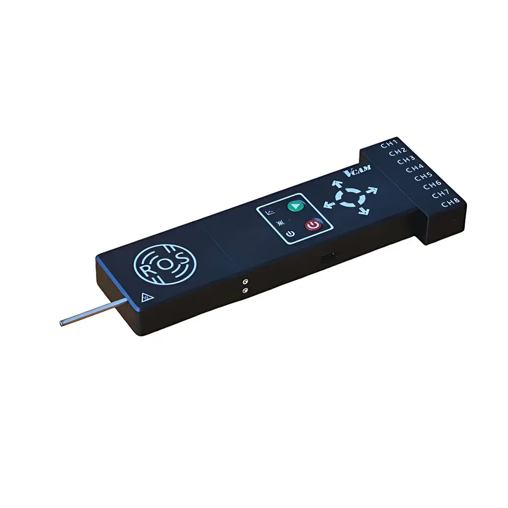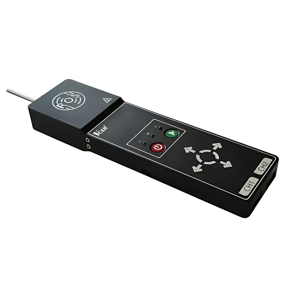
Auniontech PoLRa L-Band Microwave Radiometer
| Brand | Auniontech |
|---|---|
| Origin | Shanghai, China |
| Manufacturer Type | Authorized Distributor |
| Product Category | Domestic |
| Model | PoLRa (Passive L-Band Remote Sensing Radiometer) |
| Pricing | Upon Request |
Overview
The Auniontech PoLRa L-Band Microwave Radiometer is a ground- and platform-deployable passive remote sensing instrument engineered for high-fidelity measurement of natural microwave emission in the 1.40–1.427 GHz frequency band (L-band). Operating on the principle of radiometric brightness temperature (TB) detection, PoLRa leverages the inherent sensitivity of L-band microwaves to liquid water content in soil and vegetation—enabling quantitative retrieval of soil moisture (SM) and L-band Vegetation Optical Depth (L-VOD) without external illumination. Its design directly inherits calibration methodologies and observational geometry principles validated by spaceborne missions including ESA’s Soil Moisture and Ocean Salinity (SMOS) satellite and NASA’s Soil Moisture Active Passive (SMAP) mission. Unlike optical or thermal sensors, PoLRa functions day/night and under all weather conditions—including cloud cover, rain, and dense canopy—due to the long wavelength’s low atmospheric attenuation and high penetration depth into vegetated and frozen media.
Key Features
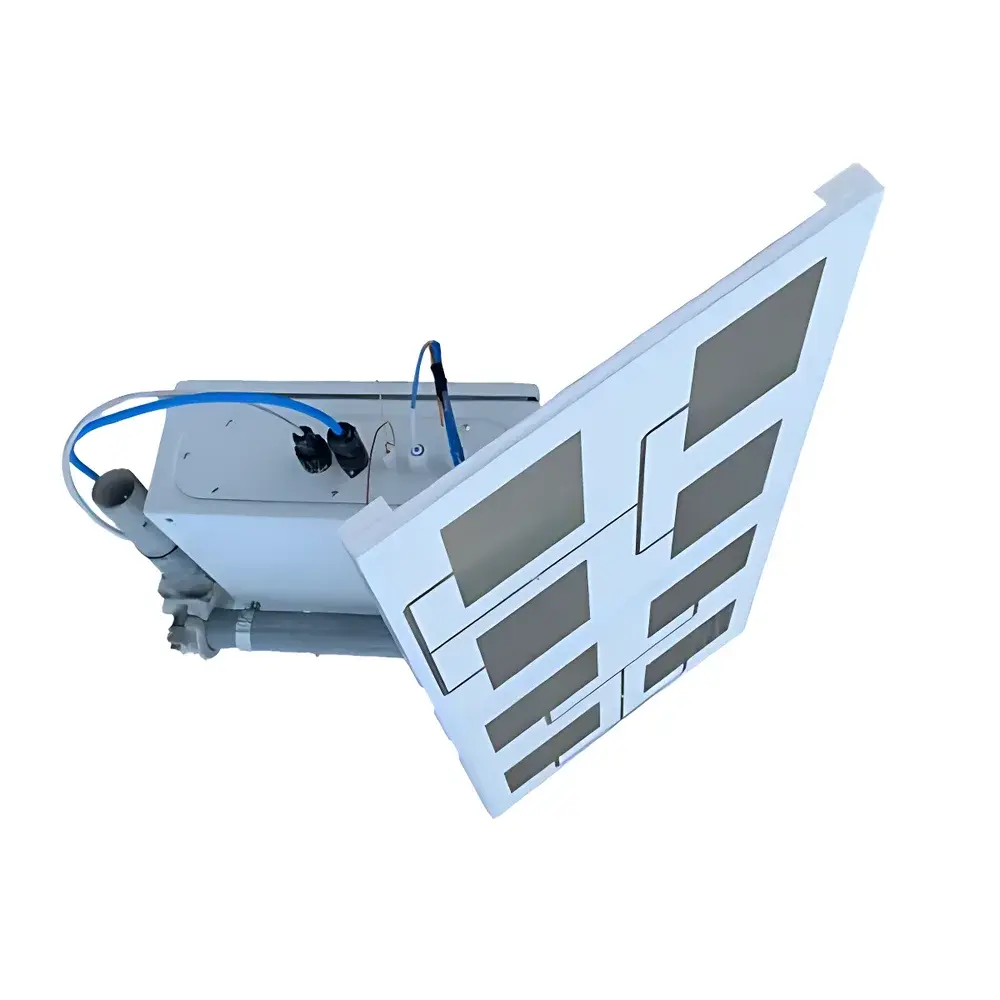
- Dual-polarization (H/V) antenna array enabling simultaneous, co-located acquisition of horizontally and vertically polarized brightness temperatures
- System noise equivalent delta temperature (NEΔT) ≤ 0.15 K at 1-second integration time
- Absolute radiometric calibration accuracy ±1.5 K traceable to blackbody references and ambient load standards
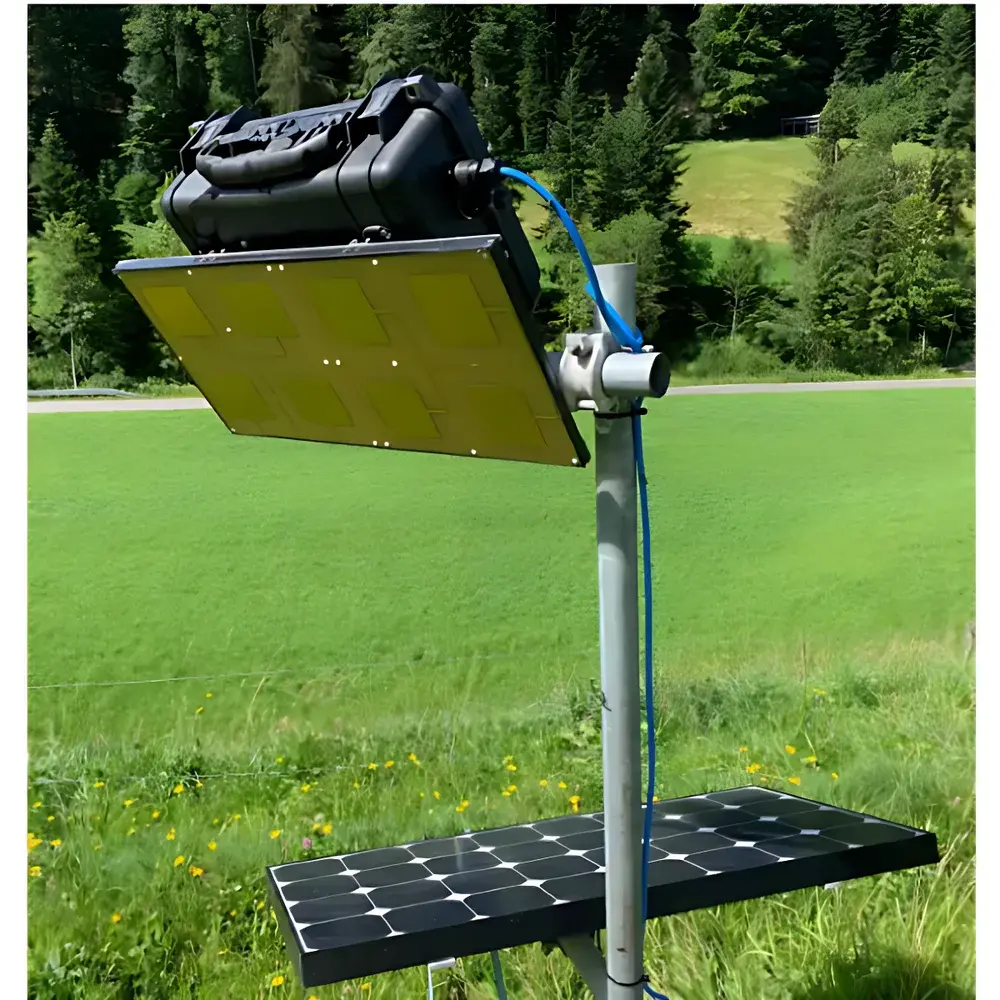
- Low power consumption (< 5 W), enabling autonomous operation via solar-charged battery systems in off-grid environments
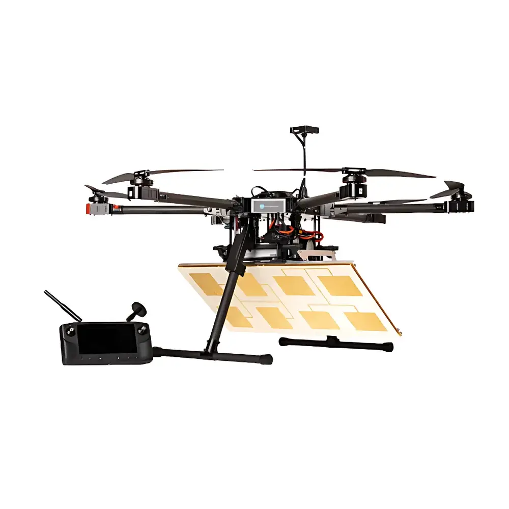
- Compact form factor: 30 cm × 60 cm planar antenna panel; total instrument mass ≤ 2.5 kg (drone variant)
- 36° full-width half-maximum (FWHM) antenna beamwidth, supporting spatial sampling resolutions down to ~6 m at 10 m altitude (UAV deployment)
- Modular mechanical design compatible with UAVs (DJI Matrice 600 Pro, Aurelia X6 Standard, FreeFly ALTA X), vehicle mounts, tower installations, and fixed mast deployments
Sample Compatibility & Compliance
PoLRa supports continuous, unattended operation across diverse terrestrial biomes—from agricultural croplands and semi-arid rangelands to boreal forests and seasonal snowpacks. Its passive architecture complies with ITU-R RS.1861 spectral mask requirements for Earth exploration-satellite service (EESS) in the protected 1.40–1.427 GHz band. All firmware and data acquisition protocols adhere to CCSDS Space Link Extension (SLE) telemetry framing conventions, ensuring interoperability with ground segment infrastructure used in satellite validation campaigns. The system meets IEC 61000-6-2 (immunity) and IEC 61000-6-4 (emission) electromagnetic compatibility standards. For field-deployed configurations, PoLRa supports GLP-compliant metadata tagging—including GPS-stamped timestamps, sensor orientation (pitch/roll/yaw), and environmental thermistor readings—to facilitate traceable QA/QC in SMOS/SMAP ground truth networks.
Software & Data Management
The PoLRa software suite includes calibrated TB processing, georeferenced gridding, and physics-based retrieval modules for soil moisture and L-VOD using the τ–ω model framework. Raw data are stored in NetCDF-4 format compliant with CF-1.8 metadata conventions, enabling direct ingestion into NASA’s Land Surface Hydrology Group (LSHG) and ESA’s Climate Change Initiative (CCI) processing pipelines. Time-series analysis tools support automated detection of freeze/thaw transitions, melt onset timing, and snow wetness events. All software binaries include audit trails per FDA 21 CFR Part 11 requirements, with role-based access control, electronic signatures, and immutable log files for regulatory-grade validation. Optional API integration enables real-time streaming to cloud platforms (e.g., AWS S3, Google Cloud Storage) via MQTT or HTTPS POST.
Applications
- Agricultural monitoring: Simultaneous mapping of surface soil moisture (0–5 cm depth) and L-VOD-derived crop water content across heterogeneous fields; supports irrigation scheduling, yield forecasting, and harvest timing optimization
- Cryosphere studies: Detection of liquid water within snowpacks and glaciers; estimation of snow density, wet snow extent, and sea ice thickness through dielectric contrast modeling
- Satellite validation: Ground-truth reference for SMOS, SMAP, and upcoming CIMR and ROSE-L missions; provides pixel-scale validation under varying vegetation density and surface roughness conditions
- Carbon cycle research: Long-term L-VOD time series for biomass estimation in tropical forests and peatlands; improves satellite-based carbon stock modeling and flux inversion
- Hydrological modeling: Assimilation-ready SM and L-VOD products for land surface models (e.g., Noah-MP, CLM5) to enhance flood forecasting and drought early warning systems
FAQ
What is the primary measurement principle of the PoLRa radiometer?
PoLRa measures naturally emitted microwave radiation (brightness temperature) at L-band frequencies (1.40–1.427 GHz) using a calibrated, dual-polarized antenna system.
Can PoLRa operate autonomously in remote locations?
Yes—its <5 W power draw allows continuous operation via solar panels and lithium-iron-phosphate battery banks, with onboard data logging and scheduled telemetry transmission.
How does PoLRa differ from optical or radar-based soil moisture sensors?
Unlike active radar or optical indices (e.g., NDVI), PoLRa is passive and unaffected by clouds, darkness, or canopy closure; it directly senses subsurface liquid water content rather than inferring it indirectly.
Is PoLRa suitable for validation of SMAP or SMOS satellite data?
Yes—its frequency band, polarization scheme, and calibration methodology align with SMAP/SMOS specifications, making it a Tier-1 ground validation instrument per CEOS WGCV protocols.
Does the system provide absolute calibration traceability?
Yes—factory calibration uses NIST-traceable blackbody sources and ambient load measurements, with in-field recalibration supported via dual-load (hot/cold) reference cycles.
Related Products