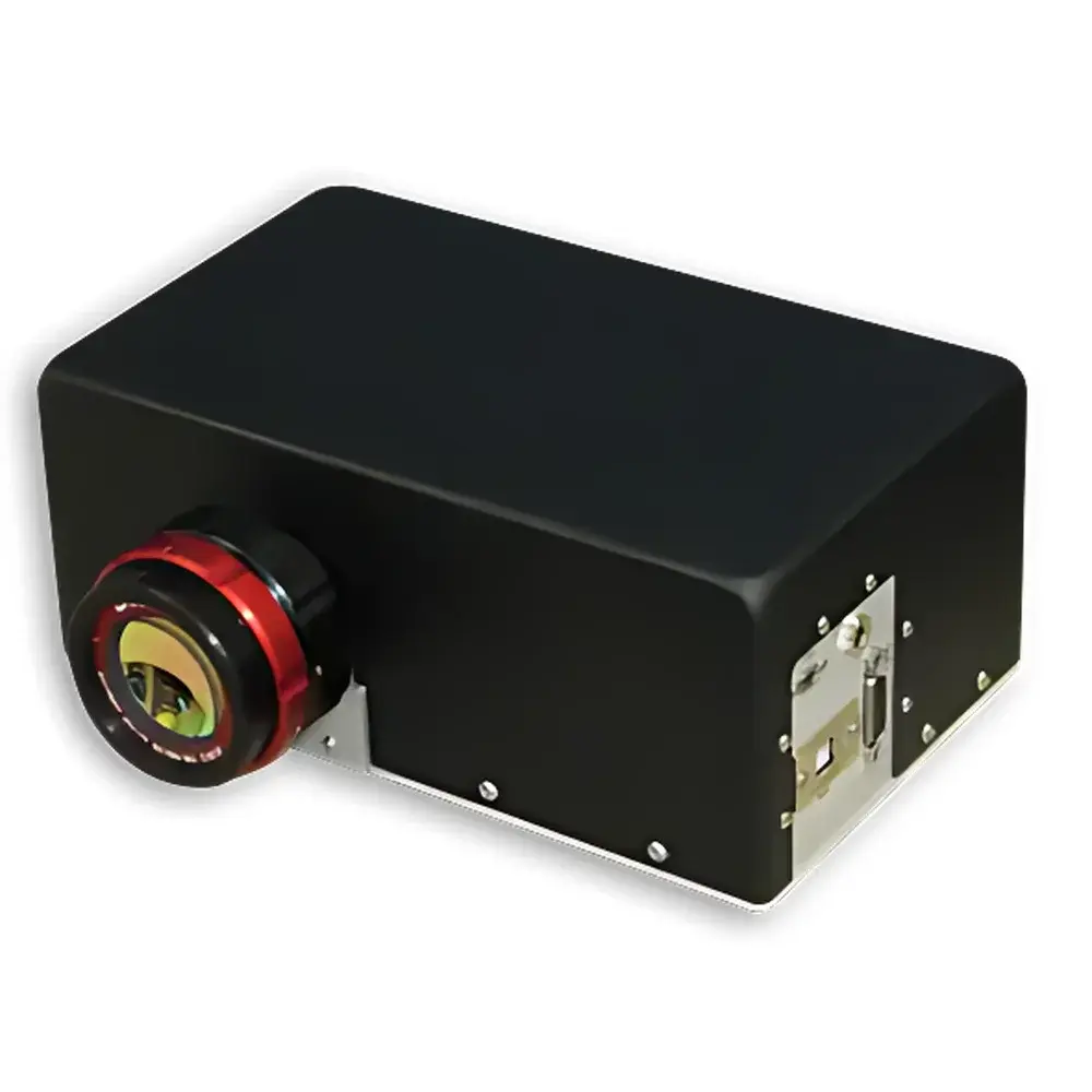

Corning 425 Full-Spectrum Hyperspectral Imaging System
| Brand | Corning |
|---|---|
| Origin | USA |
| Model | 425 |
| Operating Principle | Push-broom |
| Imaging Method | Dispersive |
| Platform Compatibility | Ground-based & Airborne |
| Spectral Range | 480–2500 nm |
| Spectral Resolution | ≤8 nm |
| Spatial Resolution (IFOV) | 4.1 mrad |
| Field of View (TFOV) | 5° |
| Image Resolution | 640 × 468 pixels |
| Frame Rate | 125 Hz |
| Detector | Stirling-cooled HgCdTe FPA |
| Pixel Size | 15 µm |
| Aperture | f/3.3 |
| Dynamic Range | 16-bit |
| Power Consumption | 30 W @ 12 VDC |
| Dimensions | 9.4 × 18 × 26.7 cm |
| Weight | 3.5 kg (imager only) |
| Onboard Storage | 1 TB SSD |
| Integrated INS | MEMS-based GPS/IMU (optional) |
| Data Output | Raw and radiometrically calibrated data with embedded IGM geolocation metadata |
Overview
The Corning 425 Full-Spectrum Hyperspectral Imaging System is a commercially engineered, single-detector push-broom imager designed for high-fidelity spectral-spatial data acquisition across the complete visible-to-shortwave infrared (Vis-NIR-SWIR) spectrum—from 480 nm to 2500 nm. Unlike dual-detector or multi-instrument fused systems, the 425 employs a monolithic optical architecture: one lens, one dispersive element, and a single Stirling-cooled mercury cadmium telluride (HgCdTe) focal plane array (FPA). This unified design eliminates inter-sensor alignment drift, spectral registration errors, and post-acquisition data co-registration complexity—significantly improving measurement reproducibility and reducing calibration overhead. The system operates on the principle of spatial scanning combined with spectral dispersion, where each line of the 640 × 468 pixel FPA captures a full spectral slice at high temporal fidelity (125 Hz frame rate), enabling robust motion-compensated imaging from both ground-based tripods and airborne platforms.
Key Features
- Single-optical-path, single-FPA architecture ensures intrinsic spectral-spatial registration and long-term radiometric stability
- Stirling-cooled HgCdTe detector with 15 µm pixel pitch, delivering high quantum efficiency (>70% across 480–2500 nm) and low dark current performance
- Integrated optical short-pass filter (OSF) at the FPA entrance to maintain uniform throughput and minimize out-of-band ghosting
- f/3.3 aperture optimized for light throughput without sacrificing spatial resolution (IFOV = 4.1 mrad)
- Four operational modes: continuous acquisition, region-of-interest (ROI) triggered capture, flight-line synchronized acquisition, and start/stop point-based collection—each governed by real-time INS-derived position and attitude cues
- Embedded 16-bit data acquisition engine with onboard 1 TB SSD storage and configurable data compression
- Ethernet-based API interface compliant with RESTful conventions for OEM integration and remote orchestration
Sample Compatibility & Compliance
The Corning 425 is engineered for field-deployable operation under variable environmental conditions (−20 °C to +50 °C ambient, IP54-rated enclosure). Its compact form factor (≤5.0 kg fully integrated) and low power draw (30 W @ 12 VDC) make it suitable for integration into Class I–III UAVs, manned light aircraft, terrestrial mobile mapping rigs, and fixed-lab spectroscopic workstations. While not certified to specific regulatory standards (e.g., FAA DO-160, MIL-STD-810), the system adheres to electromagnetic compatibility (EMC) guidelines per FCC Part 15 Subpart B and CE EN 61326-1. All radiometric calibration procedures follow NIST-traceable protocols; raw and calibrated datasets comply with HDF5 and GeoTIFF container formats—enabling seamless ingestion into ISO/IEC 17025-accredited analytical workflows. Optional INS integration supports post-processing alignment to DEMs sourced from NASA Earthdata, facilitating orthorectification in accordance with ASPRS Positional Accuracy Standards for Digital Orthophotos.
Software & Data Management
The 425 features a browser-native, Java-enabled web GUI accessible via any modern HTML5-compliant browser (Firefox, Chrome, Edge)—eliminating local software installation requirements. Users configure acquisition parameters, define spectral subsets, and initiate missions through an intuitive dashboard. The system generates two primary data products per acquisition: (1) raw digital numbers (DN) with full 16-bit depth, and (2) optionally radiometrically calibrated reflectance/radiance cubes. Each pixel is tagged with geospatial metadata stored in an Image Geometry Metadata (IGM) file—containing latitude, longitude, elevation, and viewing geometry per pixel—formatted for direct import into ENVI, PCI Geomatica, QGIS, or custom Python-based processing pipelines (e.g., using GDAL, scikit-image, or PyRadiomics). The embedded processor executes real-time navigation fusion (GPS + MEMS IMU) and supports external time synchronization via PPS input. All system logs, calibration history, and state transitions are recorded with timestamped audit trails, supporting GLP/GMP-aligned data integrity practices.
Applications
- Environmental Remote Sensing: Quantitative chlorophyll-a estimation, canopy water content mapping, soil organic carbon profiling, and wetland boundary delineation
- Precision Agriculture: Early stress detection (nutrient deficiency, pathogen onset), yield prediction modeling, and variable-rate application guidance
- Geological & Mineral Exploration: Identification of hydroxyl-bearing minerals (e.g., clays, micas), carbonate mapping, and hydrocarbon seepage anomaly detection
- Forestry & Biomass Assessment: Species classification, LAI estimation, fire fuel load quantification, and post-disturbance recovery monitoring
- Urban Material Mapping: Roof material discrimination, impervious surface analysis, and thermal emissivity characterization (via SWIR absorption features)
- OEM Integration: Embedded hyperspectral sensing for autonomous inspection robots, industrial inline quality control systems, and planetary analog field instrumentation
FAQ
Does the Corning 425 support radiometric calibration in-flight?
Yes—the system includes onboard non-uniformity correction (NUC) and optional vicarious calibration routines that leverage pre-loaded reference panels or atmospheric models. Radiometric calibration coefficients are applied in real time or during post-processing.
Can I acquire only selected spectral bands to conserve storage?
Absolutely. Users may define arbitrary band subsets (e.g., 10–20 bands within the 480–2500 nm range) via the web GUI or API, reducing file size by up to 85% while preserving mission-critical spectral signatures.
Is the IGM file compatible with ENVI 5.6+ and ArcGIS Pro?
Yes—the IGM is delivered as a text-based ASCII table with header metadata conforming to ENVI’s “.hdr” specification and supports GDAL-based georeferencing in ArcGIS Pro via raster registration tools.
What level of INS accuracy is achievable with the optional MEMS unit?
The integrated MEMS IMU provides <1° heading uncertainty and <0.05° roll/pitch RMS error over 10-minute intervals under nominal vibration conditions—sufficient for sub-pixel geolocation accuracy when coupled with DEM-assisted orthorectification.
How is firmware updated and system health monitored?
Firmware updates are performed over Ethernet using signed binary packages; system diagnostics—including detector temperature, voltage rails, storage health, and INS status—are exposed via JSON-RPC endpoints and logged continuously to internal flash memory.