EcoDrone-Aisa UAV-Based Hyperspectral Remote Sensing System
| Origin | Beijing |
|---|---|
| Manufacturer Type | Distributor |
| Origin Category | Domestic |
| Model | EcoDrone-Aisa |
| Price | Upon Request |
Overview
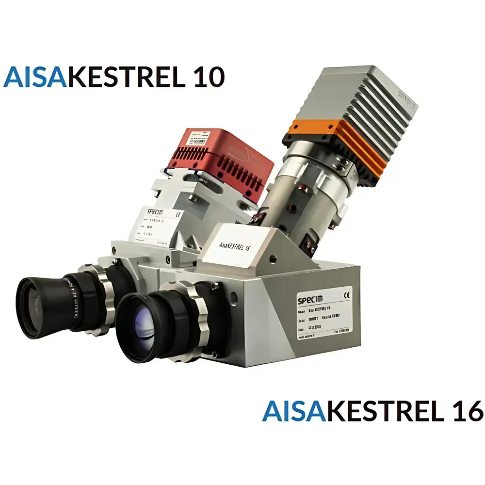
The EcoDrone-Aisa UAV-Based Hyperspectral Remote Sensing System is a fully integrated, research-grade aerial platform engineered for quantitative ecological and environmental monitoring. It combines a heavy-lift, long-endurance octocopter airframe—designed in-house with structural redundancy and mission-critical flight stability—with the AISAKestrel 10 hyperspectral imaging sensor, a push-broom spectrometer calibrated for scientific field deployment. The system operates on the principle of spatially resolved spectral reflectance measurement across contiguous narrow bands, enabling pixel-level spectral signature extraction for vegetation biochemistry, soil composition analysis, water quality assessment, and land-cover classification. Unlike multispectral systems, it delivers continuous spectral data cubes (x, y, λ) with up to 204 spectral bands, supporting advanced algorithms such as spectral unmixing, derivative analysis, and machine learning–driven classification. Its GNSS/IMU-integrated architecture eliminates the need for external gimbals while ensuring georeferencing accuracy ≤0.2 m vertical / ≤0.5 m horizontal (RTK-enabled), making it suitable for repeat-pass time-series studies compliant with ISO 19130-2 (geographic information — imagery sensor models) and ASTM E2796 (standard practice for airborne remote sensing data acquisition).
Key Features
- Heavy-lift UAV platform: Symmetric motor baseline of 1500 mm; max payload capacity 15 kg; sustained hover time ≥12 min at full load.
- Structural integrity: Carbon fiber–aluminum hybrid airframe; foldable Y-wing configuration; retractable landing gear; IP43-rated enclosure for operation in light rain (not recommended during precipitation).
- Flight control & navigation: Open-source Pixhawk autopilot; dual-frequency GNSS (GPS + GLONASS + BeiDou); 8 km nominal telemetry range (extendable to 15 km); real-time HD video downlink via HDMI/SDI/USB.
- Hyperspectral sensor integration: AISAKestrel 10 push-broom imager with dual-band options—VIS-NIR (400–1000 nm, 2040-pixel detector) or SWIR (600–1640 nm, 640-pixel detector); spectral sampling resolution down to 1.75 nm; F/2.4 aperture; <0.5-pixel optical dispersion.
- Modular payload compatibility: Simultaneous mounting of two independent sensors (e.g., hyperspectral + thermal IR or LiDAR); standardized mechanical/electrical interfaces per STANAG 4671 (UAV interoperability).
- Onboard data handling: 480 GB SSD storage; CameraLink 12-/14-bit interface; frame rates up to 170 Hz (VIS-NIR) or 100 Hz (SWIR); programmable integration time per frame.
Sample Compatibility & Compliance
The EcoDrone-Aisa system supports non-contact, area-scale spectral acquisition over heterogeneous natural surfaces—including forest canopies, agricultural fields, wetlands, coastal zones, and urban green infrastructure—without ground disturbance. It complies with EU Regulation (EU) No 2019/947 on unmanned aircraft operations and adheres to ICAO Annex 2 (Rules of the Air) for VLOS/BVLOS flight planning. Sensor calibration traceability follows NIST-traceable standards; radiometric calibration certificates are provided with each AISAKestrel unit. Data acquisition workflows support FAIR principles (Findable, Accessible, Interoperable, Reusable), and metadata embedding conforms to ISO 19115-3 (XML schema for geospatial metadata). For regulatory reporting (e.g., EU CAP monitoring, national forest inventory), outputs are compatible with QGIS, ENVI, and ESA SNAP processing chains.
Software & Data Management
Data acquisition is managed through EcoDrone Ground Control Station (GCS) software, featuring mission planning with automated grid/waypoint generation, real-time telemetry overlay, and synchronized sensor triggering. Raw hyperspectral data are stored in standard BSQ/BIL formats with embedded ENVI header files. Post-processing leverages proprietary EcoDrone Spectral Toolkit (EST), which includes atmospheric correction (QUAC, FLAASH-compatible), geometric rectification (using GNSS/IMU-derived exterior orientation), spectral library matching (USGS, ECOSTRESS), and NDVI/EVI/CIred-edge derivation. All software modules log audit trails meeting GLP requirements; user access controls and electronic signatures align with FDA 21 CFR Part 11 for regulated environmental monitoring applications.
Applications
- Agricultural phenotyping: Quantitative estimation of chlorophyll content, nitrogen status, water stress indices (NDWI, PRI), and early disease detection via spectral anomaly mapping.
- Forestry inventory: Species discrimination, canopy LAI estimation, post-fire regeneration assessment, and invasive species mapping using SWIR-based lignin/cellulose absorption features.
- Wetland & aquatic ecosystem monitoring: Chlorophyll-a concentration, suspended sediment load, CDOM (colored dissolved organic matter), and macrophyte community composition.
- Soil degradation assessment: Organic carbon estimation, salinity mapping, and heavy metal contamination screening via diagnostic absorption features near 900 nm and 1400 nm.
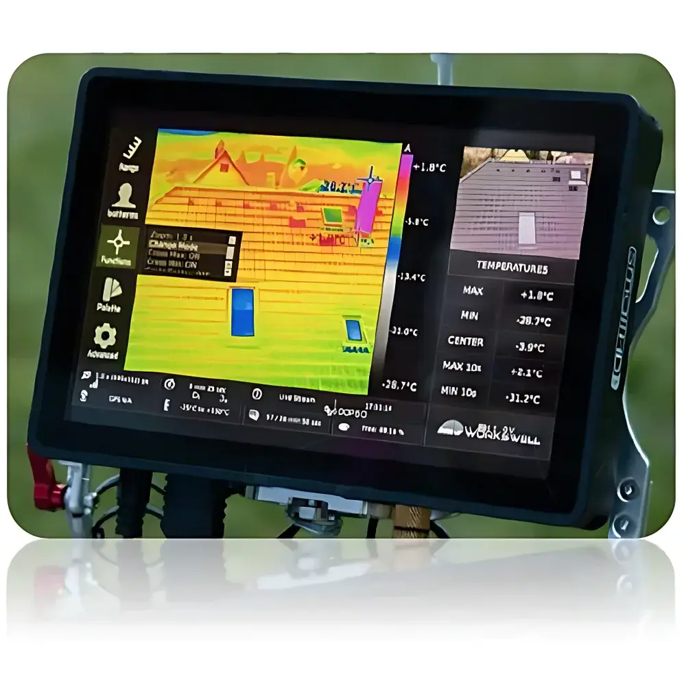
- Urban environmental auditing: Surface temperature profiling (when paired with optional thermal camera), impervious surface quantification, and green space health evaluation.
- Climate change research: Long-term spectral time series for albedo trend analysis, permafrost thaw detection, and tundra vegetation shift tracking.
FAQ
Is the EcoDrone-Aisa system certified for commercial operation in EASA member states?
Yes—the airframe and operational procedures comply with EASA UAS Class Identification Label C2 requirements; operator training follows EASA AMC/GM to Part-UAS.
Can raw hyperspectral data be exported in ENVI or HDF5 format for third-party analysis?
Yes—data are natively exported in ENVI-compatible BSQ/BIL with full header metadata; HDF5 conversion is supported via EST Python API.
What level of radiometric calibration is performed before delivery?
Each AISAKestrel 10 unit undergoes factory radiometric calibration using NIST-traceable integrating sphere sources; certificate of calibration is included.
Does the system support RTK/PPK positioning for sub-decimeter geolocation accuracy?
Yes—integrated dual-frequency GNSS/IMU enables PPK post-processing achieving ≤5 cm horizontal accuracy when combined with base station data.
Are firmware updates and software maintenance included in the purchase agreement?
Standard 24-month software support package includes firmware patches, EST version upgrades, and technical documentation revisions.
Related Products