Iris IRIS Airborne Integrated LiDAR-Hyperspectral Imaging System
| Brand | Iris |
|---|---|
| Origin | Beijing, China |
| Model | IRIS Airborne Integrated LiDAR-Hyperspectral Imaging System |
| Spectral Range | 400–1000 nm |
| Spectral Resolution | 2.7 nm |
| Sampling Interval | 2.1 nm |
| Spectral Bands | 561 (binned: 281) |
| Spatial Pixels per Line | 1364 |
| Max Frame Rate | 249 fps |
| LiDAR Scan Rate | 320,000 pts/sec |
| Max Range | 150 m |
| Horizontal Accuracy | ±2 cm (1σ) |
| Vertical Accuracy | ±1 cm (1σ) |
| IMU Attitude RMS (Pitch/Roll) | 0.04° (PPK-enabled) |
| GNSS Compatibility | BeiDou, GPS, GLONASS + RTK |
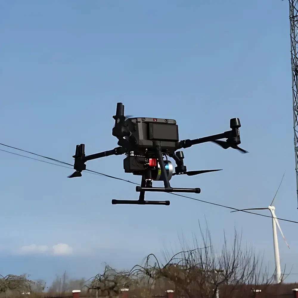
| System Weight | 2.4 kg |
Overview
The Iris IRIS Airborne Integrated LiDAR-Hyperspectral Imaging System is a rigorously engineered remote sensing platform designed for synchronized acquisition of spatially registered, radiometrically calibrated hyperspectral imagery and high-fidelity topographic point clouds. Unlike conventional frame-based or separately mounted sensor configurations, the IRIS system implements a rigid-body integration architecture—where a push-broom hyperspectral imager and a line-scanning LiDAR share a common inertial measurement unit (IMU), dual-frequency GNSS receiver (supporting BeiDou, GPS, GLONASS, and RTK), and thermal-stable optical bench. This co-location eliminates iterative georeferencing dependencies on external digital elevation models (DEMs), thereby removing coordinate transformation uncertainties inherent in post-processed fusion workflows. The system operates on the principle of simultaneous spectral–geometric data capture: the hyperspectral module acquires contiguous reflectance spectra across 561 narrow bands (2.7 nm resolution, 2.1 nm sampling interval) from 400–1000 nm, while the LiDAR delivers dense, sub-centimeter vertical accuracy point clouds at up to 320,000 points per second. This intrinsic synchronization enables pixel-level spectral–elevation correlation—critical for vegetation structure–function analysis, urban material classification, and precision environmental monitoring under GLP-aligned field protocols.
Key Features
- Rigid-body sensor integration ensures geometric congruence between LiDAR point clouds and hyperspectral pixels without DEM-dependent orthorectification.
- Push-broom hyperspectral acquisition delivers true spectral continuity—avoiding spectral misregistration artifacts common in snapshot or whiskbroom systems.
- LiDAR vertical accuracy of ±1 cm (1σ) and horizontal accuracy of ±2 cm (1σ) meet ASTM E2847–22 requirements for topographic survey-grade mapping.
- Shared high-stability IMU/GNSS subsystem (PPK-capable, 0.04° pitch/roll RMS) guarantees sub-pixel geolocation consistency across all modalities.
- Real-time onboard synchronization logic maintains temporal alignment between LiDAR return timestamps and hyperspectral line exposures—enabling precise motion compensation.
- Modular payload design supports optional co-mounting of RGB and uncooled microbolometer thermal imagers for multi-spectral tri-modality (VIS-NIR, SWIR, TIR).
- Lightweight airframe integration (2.4 kg total mass) complies with Class I UAV operational limits per EASA UAS Regulation (EU) 2019/947 Annex I.
Sample Compatibility & Compliance
The IRIS system is validated for deployment over heterogeneous natural and anthropogenic surfaces—including forest canopies, agricultural fields, urban infrastructure, and coastal zones—without requiring ground control points (GCPs) for basic ortho-mosaic generation. Its spectral calibration traceability follows ISO/IEC 17025–compliant procedures performed at the manufacturer’s Beijing metrology laboratory. Radiometric calibration is NIST-traceable via onboard quartz-halogen and diffuse reflectance standards. Geometric performance adheres to ISO 19157:2013 (Geographic Information – Data Quality) and satisfies QA/QC thresholds for USGS Level 2A product generation. The system’s GNSS firmware supports SBAS and PPP corrections, ensuring compatibility with national CORS networks in China (CMONOC), the EU (EUREF), and North America (NTRIP). All firmware and embedded software comply with IEC 62443-4-2 for secure device development lifecycle management.
Software & Data Management
Data acquisition is managed through Iris’ proprietary IRIS Flight Control Suite (v4.3+), which provides real-time telemetry overlay, automated mission scripting, and synchronized raw data logging (HDF5-compliant binary format). Post-processing leverages the IRIS GeoSpectral Fusion Engine—a Python- and C++-based toolkit supporting ENVI, ArcGIS Pro, and QGIS via GDAL/OGR drivers. The engine performs integrated atmospheric correction (using MODTRAN-based lookup tables), LiDAR-driven orthorectification, and spectral–elevation feature extraction (e.g., canopy height model–normalized difference vegetation index composites). Audit trails, user access logs, and version-controlled processing scripts are maintained per FDA 21 CFR Part 11 requirements for regulated environmental studies. Raw datasets include embedded metadata compliant with ISO 19115-2:2019 and NASA’s PDS4 label schema.
Applications
- Forest structural phenotyping: Deriving leaf area index (LAI), fractional canopy cover, and vertical foliage profile from fused hyperspectral reflectance and LiDAR-derived CHM.
- Agricultural stress detection: Discriminating nitrogen deficiency, water stress, and pathogen presence via red-edge shift analysis correlated with canopy height variability.
- Urban material mapping: Classifying roofing materials, pavement types, and façade compositions using spectral absorption features constrained by 3D geometry.
- Wetland biogeochemical monitoring: Quantifying chlorophyll-a, suspended sediment concentration, and dissolved organic carbon via inversion models trained on co-located spectral–elevation response surfaces.
- Post-wildfire recovery assessment: Tracking regrowth dynamics through time-series NDVI–canopy closure covariance metrics derived from repeat IRIS surveys.
- Carbon stock estimation: Integrating species-specific spectral signatures with LiDAR-derived aboveground biomass proxies for IPCC Tier 2 reporting frameworks.
FAQ
Does the IRIS system require ground control points (GCPs) for georeferencing?
No—its tightly coupled IMU/GNSS/LiDAR/hyperspectral architecture enables direct georeferencing at ≤5 cm CE90 without GCPs under RTK/PPK conditions.
Can hyperspectral and LiDAR data be processed independently?
Yes; raw data streams are stored in separate but time-synchronized files, allowing standalone processing in third-party software (e.g., Optech LMS, SPECIM IQ Software).
Is the system compatible with DJI Matrice 300 RTK and Autel EVO Max 4T platforms?
Yes—mechanical and electrical interfaces conform to STANAG 4671 payload mounting standards and provide CAN bus, UART, and Ethernet connectivity.
What spectral calibration stability is guaranteed over a 2-hour flight?
Radiometric drift remains within ±1.2% (k=2) across the full 400–1000 nm range when operated within −10°C to +45°C ambient conditions.
How is data security ensured during field operations?
All data transfers use AES-256 encryption; onboard storage employs FIPS 140-2 Level 2–certified SSD modules with write-once-read-many (WORM) mode for audit integrity.
Related Products


