TriOS RPMS Free-Fall Profiling Radiometric Measurement System
| Brand | TriOS |
|---|---|
| Origin | Germany |
| Manufacturer Type | Authorized Distributor |
| Import Status | Imported |
| Model | RPMS |
| Pricing | Upon Request |
| Maximum Operating Depth | 300 m |
| Descent Speed Range | 0.1–1.0 m/s |
| Power Supply | 8–12 VDC (±3%) |
| Power Consumption | ≤ 0.85 W |
| Housing Material | Stainless Steel (1.4571/1.4404) or Titanium Alloy (3.7035) |
| IP Rating | IP68 |
| Operating Temperature | +2 to +40 °C |
| Storage Temperature | −20 to +80 °C |
| Calibration Interval | 24 months |
| Data Interface | RS-232 (TriOS Protocol) |
| Sensor Options | RAMSES-ACC (UV/VIS Cosine Irradiance), RAMSES-ARC (Radiance), RAMSES-ASC (Spherical Irradiance) |
| Spectral Ranges | ACC-UV (280–500 nm), ACC-VIS / ARC / ASC (320–950 nm) |
| Detector | 256-channel silicon photodiode array |
| Spectral Sampling | 2.2–3.3 nm/pixel |
| Spectral Accuracy | ±0.2–0.3 nm |
| Typical NEI (8 s integration) | 0.25–0.8 µW·m⁻²·nm⁻¹ (irradiance), 0.25–0.8 µW·m⁻²·nm⁻¹·sr⁻¹ (radiance) |
| Cosine Error | <6–10% (wavelength-dependent) |
| Radiance FOV (air) | 7° |
| Spherical Collector Coverage | 2π sr |
| T₁₀₀ Response Time | ≤10 s (pulse mode) |
| Measurement Interval | ≤8 s (pulse mode) |
Overview
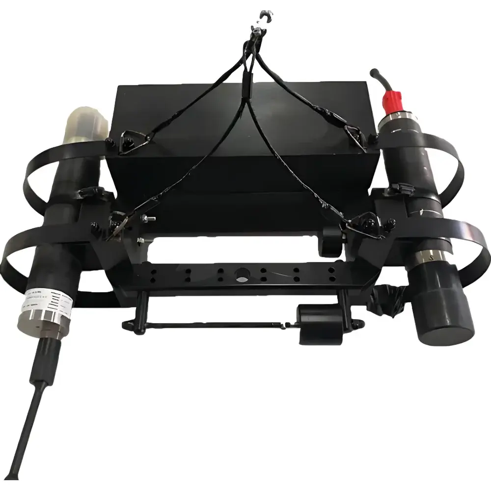
The TriOS RPMS Free-Fall Profiling Radiometric Measurement System is a field-deployable, autonomous optical profiling platform engineered for high-fidelity in situ measurement of underwater light fields in marine and inland aquatic environments. Based on free-fall deployment from surface vessels, the RPMS eliminates ship-induced shadow artifacts—particularly critical in shallow, nearshore, or turbid waters—by decoupling sensor descent from vessel motion and hull geometry. Its core measurement principle relies on calibrated hyperspectral radiometry using TriOS’s proven RAMSES spectroradiometer modules, which operate on absolute quantum detection principles with traceable NIST-calibrated responsivity. The system captures concurrent downwelling spectral irradiance (Ed(λ)), upwelling spectral radiance (Lu(λ)), and optionally spherical irradiance (E0(λ)) across UV–VIS–NIR bands (280–950 nm), enabling derivation of apparent optical properties (AOPs) including diffuse attenuation coefficient (Kd(λ)), remote-sensing reflectance (Rrs(λ)), normalized water-leaving radiance (nLw(λ)), and photosynthetically active radiation (PAR). Designed for compliance with IOCCG Protocols and CEOS/Cal/Val requirements, the RPMS supports rigorous satellite ocean color validation, biogeochemical modeling, and long-term ecological observatory programs.
Key Features
- Free-fall profiling architecture with adjustable descent velocity (0.1–1.0 m/s) ensures consistent vertical sampling resolution and minimizes flow-induced perturbation of optical measurements.
- Modular sensor configuration: Interchangeable RAMSES modules (ACC, ARC, ASC) allow user-defined combinations of cosine-corrected irradiance, narrow-FOV radiance, and 2π spherical irradiance sensors—each factory-calibrated to ISO/IEC 17025-accredited standards.
- Nanocoated optical surfaces mitigate biofouling and particulate adhesion during extended deployments, maintaining spectral fidelity over multi-week missions in eutrophic or estuarine conditions.
- Pressure-resistant housing (300 m depth rating) constructed from marine-grade stainless steel (1.4571) or titanium alloy (3.7035), certified to IP68 ingress protection and compliant with ASTM D6471-17 for submersible instrumentation.
- Low-power operation (≤0.85 W at 12 VDC) enables integration with battery-powered winch systems or autonomous surface vehicles (ASVs), supporting unattended profiling in remote or logistically constrained locations.
- Real-time telemetry via RS-232 interface provides synchronized depth, pitch/roll attitude (via integrated inclinometer), pressure, and raw spectral data—enabling immediate quality assessment prior to recovery.
Sample Compatibility & Compliance
The RPMS is validated for use across optically diverse water types—from oligotrophic open-ocean regimes (Kd(490) 100 mg·L⁻¹, CDOM absorption at 355 nm > 5 m⁻¹). Its spectral response and angular acceptance meet the performance criteria outlined in IOCCG Report No. 10 (“In Situ Optical Sensors for Ocean Color Validation”) and NASA’s Ocean Biology Processing Group (OBPG) in situ protocol v6.2. All RAMSES modules undergo biennial recalibration traceable to PTB (Physikalisch-Technische Bundesanstalt) reference standards. System-level validation includes side-by-side intercomparison with Biospherical Instruments’ C-OPS radiometric profiler under identical sea state and solar zenith conditions—demonstrating agreement within ±3% for Ed(λ) and ±5% for Lu(λ) across 400–700 nm. Data output formats comply with SeaDataNet NetCDF templates and adhere to ISO 19115 metadata conventions for interoperability with ERDDAP and THREDDS servers.
Software & Data Management
TriOS WinControl software provides real-time visualization of depth-resolved spectral profiles, dynamic adjustment of integration time (4 ms–8 s), and on-the-fly computation of AOPs including Kd(λ), Rrs(λ), nLw(λ), and PAR-integrated Ed. Raw data are stored in binary format with embedded timestamps, pressure, temperature, and orientation metadata. Post-processing tools support application of immersion factor corrections, stray-light subtraction (using TriOS’s proprietary algorithm), and atmospheric correction for above-water reference measurements. Export options include CSV, HDF5, and NASA OBPG-compliant ASCII formats. Software audit trails, user access logs, and electronic signatures satisfy FDA 21 CFR Part 11 requirements for regulated environmental monitoring applications. Firmware updates are delivered via secure HTTPS channel with SHA-256 signature verification.
Applications
- Satellite ocean color product validation: Matchup analysis for Sentinel-3 OLCI, Landsat-9 OLI-2, and PACE HARP data, particularly in optically complex coastal zones where atmospheric correction uncertainties dominate error budgets.
- Biogeochemical process studies: Quantification of phytoplankton photoacclimation dynamics via spectral Kd gradients; estimation of euphotic zone depth (Zeu) and compensation depth (Zc) using PAR profiles.
- Harmful algal bloom (HAB) monitoring: Detection of phycocyanin and phycoerythrin fluorescence peaks via derivative analysis of Rrs(λ); correlation of CDOM spectral slope (S275–295) with terrestrial runoff events.
- Optical closure experiments: Integration with inherent optical property (IOP) measurements (e.g., absorption by ac-9, scattering by LISST) to test radiative transfer models such as Hydrolight and EcoLight-S.
- Climate-relevant light field characterization: Assessment of snow/ice albedo feedbacks in polar regions; quantification of solar heating rates in stratified shelf seas impacted by offshore wind infrastructure.
- Regulatory compliance monitoring: Support for EU MSFD Descriptor 1 (Biological Diversity) and US EPA Clean Water Act Sec. 404(c) assessments requiring spectrally resolved light climate data.
FAQ
What depth range is supported, and how is pressure tolerance verified?
The RPMS operates to 300 m depth. Pressure housings are hydrostatically tested to 1.5× rated pressure (450 bar) per DIN EN ISO 6892-1, with full certification documentation provided with each unit.
Can the system be deployed from an unmanned surface vehicle (USV)?
Yes—the low mass (~0.7–0.9 kg), compact form factor (≤300 mm length), and RS-232 command protocol enable seamless integration with USV telemetry stacks and mission control software (e.g., ROS-based navigation frameworks).
How frequently must sensors be recalibrated, and what documentation accompanies calibration?
TriOS recommends recalibration every 24 months. Each service includes a PTB-traceable certificate detailing spectral responsivity, cosine error characterization, and dark current stability metrics—archivable as part of GLP/GMP audit packages.
Is real-time GPS synchronization supported for georeferenced profiles?
While the RPMS does not embed GNSS, it accepts external 1PPS and NMEA 0183 GGA messages via auxiliary TTL input, enabling sub-decimeter spatial tagging when deployed from GPS-equipped platforms.
What spectral post-processing algorithms are embedded in WinControl?
WinControl implements TriOS’s proprietary stray-light correction matrix, immersion factor lookup tables (based on measured refractive index), and iterative inversion for Kd(λ) using the Bouguer-Lambert law with depth-smoothed derivatives—fully documented in the user manual (Rev. 4.2, Section 7.3).


