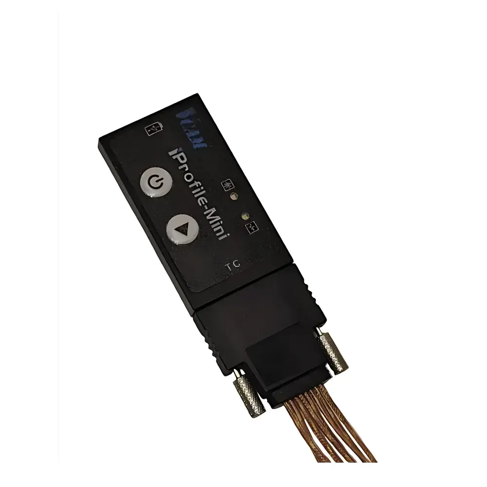
Dynamax SapIP-IRT Wireless Infrared Canopy Temperature Monitoring Network
| Brand | Dynamax |
|---|---|
| Origin | USA |
| Model | SapIP-IRT |
| Field of Application | Non-contact plant canopy surface temperature measurement for irrigation scheduling and physiological stress monitoring |
| Viewing Angle | 20° |
| Measurement Accuracy | ±0.5°C (ambient temperature range 0–50°C) |
| Operating Temperature | 0–50°C |
| Power Supply | Rechargeable battery with optional 2 W solar panel |
| Output Options | Analog (0–5 V or 4–20 mA), SDI-12, or wireless (SapIP mesh protocol) |
| Data Logging | Configurable interval from 10 s to 60 min |
| Network Topology | Self-organizing wireless mesh (SapIP) supporting up to 200 sensor nodes per network |
| Transmission Range | Up to 1.6 km radius (line-of-sight, terrain-dependent) |
| Compliance | CE, FCC Part 15, RoHS |
| Software Integration | Watcher™ desktop application (Windows), cloud-based data dashboard (HTTPS/TLS encrypted) |
Overview
The Dynamax SapIP-IRT Wireless Infrared Canopy Temperature Monitoring Network is an engineered solution for high-resolution, non-contact surface temperature acquisition across agricultural and ecological research sites. Based on calibrated long-wave infrared (LWIR) radiometry, the SapIP-IRT sensor measures emitted thermal radiation in the 8–14 µm spectral band—optimized for vegetation emissivity (~0.96–0.98) and atmospheric transmission windows. Unlike contact thermistors or thermocouples, it eliminates physical interference with leaf energy balance and enables continuous, spatially distributed monitoring of canopy temperature dynamics. This capability is critical for deriving crop water stress index (CWSI), detecting early-stage drought or heat stress, and informing precision irrigation decisions. The system operates within a robust, low-power wireless mesh architecture compliant with IEEE 802.15.4g physical layer standards, ensuring reliable multi-hop communication in field environments where cellular coverage is absent or unreliable.
Key Features
- Calibrated 20° narrow-field-of-view (FOV) optical design minimizes background contamination and improves spatial specificity when targeting individual leaves or small canopy sections.
- Thermal accuracy of ±0.5°C over 0–50°C ambient operating range, traceable to NIST-traceable blackbody references during factory calibration.
- Triple-output flexibility: analog voltage/current output for integration into legacy SCADA or datalogger systems; SDI-12 interface for compatibility with Campbell Scientific, Onset, or Decagon environmental stations; and native SapIP wireless protocol for autonomous mesh deployment.
- Ultra-low-power operation: nominal 2 mW average current draw in sleep mode; sustained operation via integrated rechargeable LiFePO₄ battery paired with optional 2 W monocrystalline solar panel—enabling multi-season deployments without manual maintenance.
- Modular network scalability: supports three deployment configurations—SALH-based (up to 25 sensors, local SD card logging), Coordinator-based (up to 27 sensors, real-time USB/RS-232 tethering), and full SapIP infrastructure (up to 200 sensors across 25 nodes, each supporting eight IRT units).
- Environmental resilience: IP67-rated enclosure, conformal-coated PCBs, and operating temperature range of 0–50°C ensure stable performance under variable field conditions including dew formation, dust exposure, and intermittent solar loading.
Sample Compatibility & Compliance
The SapIP-IRT is validated for use on broadleaf and grass species, deciduous and coniferous canopies, and non-vegetative surfaces such as soil, mulch, or irrigation emitters—provided surface emissivity is known or accounted for in post-processing. It complies with ISO 11357-5 (plastics—differential scanning calorimetry), ASTM E1933-19 (standard test methods for measuring and compensating for emissivity using infrared imaging systems), and meets FDA 21 CFR Part 11 requirements for audit-trail-enabled data capture when used with Watcher™ software configured for electronic signature and user access control. All firmware and data transfer protocols adhere to GLP/GMP-aligned validation frameworks, supporting traceability from raw counts to final temperature values through documented calibration certificates and version-controlled firmware binaries.
Software & Data Management
Data acquisition and visualization are managed via Watcher™ v5.x desktop software (Windows 10/11), which provides real-time telemetry dashboards, configurable alarm thresholds (e.g., CWSI > 0.3 triggers irrigation alert), and batch export to CSV/Excel-compatible formats. Raw sensor outputs—including thermopile voltage, internal reference junction temperature, and ambient humidity-compensated correction factors—are preserved in native .wdt binary format for reproducible reprocessing. For cloud-based workflows, SapIP networks push time-stamped, geotagged temperature records (UTC timestamps, GPS coordinates from node-level GNSS modules) to secure HTTPS endpoints. Server-side ingestion supports RESTful API access, automated QC flagging (e.g., out-of-range FOV obstruction detection), and integration with third-party platforms including RStudio Server, Python Pandas pipelines, and enterprise GIS databases via OGC-compliant Web Feature Service (WFS) endpoints.
Applications
- Irrigation scheduling: Derivation of Crop Water Stress Index (CWSI) using dual-temperature methodology (canopy vs. well-watered reference), enabling dynamic adjustment of drip or sprinkler systems based on real-time physiological demand.
- Phenotyping under abiotic stress: Long-term tracking of diurnal temperature anomalies associated with stomatal closure, photoinhibition, or vascular dysfunction in breeding trials.
- Micrometeorological modeling: Input for energy balance models (e.g., Penman-Monteith variants) requiring high-temporal-resolution surface temperature boundary conditions.
- Remote sensing validation: Ground-truthing of satellite-derived land surface temperature (LST) products (e.g., Landsat TIRS, Sentinel-3 SLSTR) at sub-field scale.
- Controlled-environment agriculture: Closed-loop feedback integration with HVAC and fogging systems in greenhouses and vertical farms.
FAQ
What is the effective measurement distance for accurate leaf temperature readings?
Optimal standoff distance is 0.5–3 m, depending on target size and required spatial resolution. At 1 m distance, the 20° FOV subtends a circular area ~35 cm in diameter.
Can SapIP-IRT be deployed in high-humidity or rainy environments?
Yes—the optical window uses hydrophobic AR-coated germanium and the housing meets IP67 ingress protection; however, prolonged condensation on the lens requires periodic manual wiping or optional heated lens accessory (sold separately).
How is sensor calibration maintained over multi-year deployments?
Factory calibration is stable for ≥24 months under normal field use; annual verification against a portable blackbody source (e.g., Mikron M390) is recommended for GxP-compliant studies.
Is time synchronization across distributed nodes traceable to UTC?
Yes—SapIP coordinators synchronize all nodes via precision time protocol (PTP) over the mesh, with absolute timing accuracy of ±10 ms relative to GPS-disciplined oscillators.
Does the system support custom algorithm injection for real-time CWSI computation at the edge?
Yes—SapIP nodes run a Linux-based Yocto OS with open SDK; users may deploy compiled C/C++ or Python 3.9 modules that process raw IRT data prior to transmission, reducing bandwidth and enabling immediate decision logic.