AZUP AZCW VTOL Fixed-Wing UAV System for Ecological and Environmental Remote Sensing
| Brand | AZUP |
|---|---|
| Origin | Beijing, China |
| Manufacturer | Yes |
| Country of Origin | China |
| Model | AZCW |
| Pricing | Upon Request |
Overview
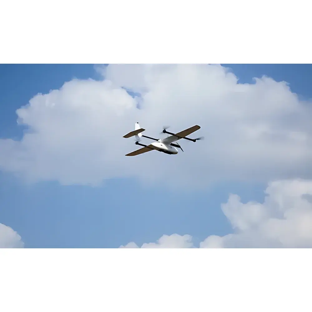
The AZUP AZCW VTOL Fixed-Wing UAV System is an industrial-grade unmanned aerial platform engineered for high-efficiency, all-terrain ecological and environmental remote sensing. It employs a hybrid aerodynamic configuration—integrating fixed-wing lift generation with quadrotor vertical takeoff and landing (VTOL) capability—to reconcile the extended endurance, high cruise speed (up to 12 m/s), and long-range operational capacity of fixed-wing aircraft with the zero-runway flexibility of multirotor systems. This architecture enables autonomous mission execution across geographically constrained or infrastructure-limited environments—including mountainous terrain, forested zones, riverine corridors, urban canyons, and coastal wetlands—where conventional fixed-wing platforms require prepared runways and rotary-wing systems face coverage or endurance limitations. The system operates under a deterministic flight control framework, incorporating redundant inertial measurement units (IMUs), dual GNSS receivers (RTK/PPK capable), and adaptive total-energy flight control algorithms validated in wind tunnel testing. Its primary function is to serve as a stable, repeatable airborne platform for calibrated remote sensing payloads, supporting quantitative data acquisition aligned with ISO 19130-2 (geographic information — imagery sensor models) and ASTM E2847 (standard practice for calibration of hyperspectral imaging systems).
Key Features
- True VTOL capability: Eliminates dependency on launch rails, catapults, or parachute recovery; enables operations from confined or unprepared surfaces (e.g., rooftops, forest clearings, riverbanks)
- Full-autonomy flight stack: Pre-programmed mission execution—including transition between hover and forward flight, precision landing within ±10 cm vertical error—without real-time RC input
- Dual-mode GNSS positioning: Simultaneous real-time kinematic (RTK) and post-processed kinematic (PPK) support; RTK ensures centimeter-level vertical landing accuracy, while PPK delivers georeferenced POS (Position and Orientation System) data with sub-decimeter horizontal accuracy
- High-payload versatility: Modular payload interface accommodates industry-standard electro-optical sensors—including S185 push-broom hyperspectral imagers (400–1000 nm, 270+ bands), K6 multispectral cameras (RGB+NIR+Red Edge), WiRiS Pro thermal infrared modules (7.5–13.5 µm), oblique photogrammetry rigs, and custom OEM payloads
- Aeromechanical stability: Wind-tunnel-optimized airframe geometry combined with total-energy adaptive control ensures consistent attitude (<0.5° roll/pitch deviation during cruise), critical for orthorectification and digital surface model (DSM) generation
- Sub-10 ms exposure synchronization: Hardware-level shutter triggering synchronized with GNSS PPS signal minimizes geolocation uncertainty in frame-based imaging
- Triple-redundant navigation architecture: Dual independent GPS/GNSS receivers + dual magnetometer suite (internal + external gimbal-mounted), enabling seamless failover without flight interruption
- Rapid field deployment: Tool-free modular assembly/disassembly via standardized quick-release pins, latches, and self-locking fasteners; full system breakdown/reassembly in <8 minutes
Sample Compatibility & Compliance
The AZCW platform is designed for integration with calibrated scientific imaging payloads used in environmental monitoring workflows compliant with EPA Method 1221 (aerial remote sensing for land cover classification), ISO 18437-2 (vibration and shock testing of airborne equipment), and IEC 60068-2-64 (random vibration testing). Payload interfaces conform to STANAG 4609-compliant metadata embedding (e.g., embedded IMU/GNSS timestamps, exposure parameters, lens distortion coefficients). The system’s flight control firmware supports GLP-aligned audit trails for mission logs, including timestamped telemetry, battery health metrics, and sensor status flags—enabling traceability per FDA 21 CFR Part 11 requirements where applicable in regulated environmental assessment contexts.
Software & Data Management
Ground control is executed via AZUP’s proprietary Mission Planner software (Windows/Linux), which supports mission planning with KML/KMZ import, no-fly zone enforcement, automated flight path optimization based on terrain elevation (SRTM/DEM-aware), and real-time telemetry overlay (battery voltage, GNSS fix quality, IMU health). Raw sensor data is recorded with embedded PPK-compatible RINEX 3.x logs and EXIF/XMP metadata compliant with OGC SensorML schema. Post-mission processing leverages standard photogrammetric toolchains (e.g., Pix4Dmapper, Agisoft Metashape, ENVI for hyperspectral analysis) and supports direct ingestion into GIS platforms (ArcGIS Pro, QGIS) via GeoTIFF, Cloud Optimized GeoTIFF (COG), and LAS/LAZ point cloud formats. All firmware updates undergo cryptographic signature verification to ensure integrity and compliance with NIST SP 800-193 (cybersecurity guidelines for IoT devices).
Applications
- Wildfire risk assessment: Canopy-level thermal mapping over forested slopes using WiRiS Pro to detect subsurface heat anomalies and fuel moisture gradients
- Biodiversity inventory: Hyperspectral-derived vegetation indices (e.g., NDVI, PRI, MCARI) for species-level classification and phenological stage mapping in fragmented habitats
- Wetland hydrology monitoring: Multispectral time-series analysis of chlorophyll-a, suspended sediment, and CDOM concentrations in lacustrine and fluvial systems
- Urban environmental auditing: High-resolution DSM generation for impervious surface mapping, UHI (urban heat island) intensity quantification, and green infrastructure performance evaluation
- Post-disaster rapid assessment: Oblique photogrammetry for 3D reconstruction of landslide-affected terrain or flood-damaged infrastructure
- Regulatory compliance reporting: Generation of georeferenced, auditable datasets for submissions to national environmental agencies (e.g., China MEE, US EPA, EU EEA) under frameworks such as the EU INSPIRE Directive or China’s Ecological Protection Red Line policy
FAQ
What payload interfaces does the AZCW support?
The system features standardized mechanical and electrical interfaces compatible with common gimbal mounts (e.g., DJI Ronin-MX footprint), CAN bus and UART telemetry channels, and GPIO-triggered exposure control. Payload power delivery is regulated at 12 V DC ±5%, with peak current support up to 15 A.
Is PPK processing supported out-of-the-box?
Yes—the onboard dual-frequency GNSS module records raw L1/L2 observations in RINEX 3.03 format, and AZUP provides a validated PPK post-processing workflow using open-source tools (RTKLIB) and commercial alternatives (NovAtel Inertial Explorer).
How is flight safety ensured in GPS-denied environments?
While GNSS is primary, the system retains dead reckoning capability via tightly coupled IMU-GNSS fusion; visual-inertial odometry (VIO) add-on modules are available for short-duration GPS-outage scenarios in canyon or dense canopy conditions.
Does the system comply with civil aviation regulations for BVLOS operations?
The AZCW meets China CAAC Class II UAV airworthiness requirements (CCAR-92) and includes built-in ADS-B In/Out transponders and remote ID modules. Export configurations support EASA UAS class identification labels (C2/C3) upon customer-requested certification bridge testing.
Can third-party flight control firmware be installed?
No—firmware is locked to AZUP’s certified stack to maintain DO-178C-aligned software assurance levels required for industrial environmental monitoring deployments. Custom sensor integration is supported via documented API endpoints, not low-level firmware modification.
Related Products