Davis 6345 Wireless Soil Temperature and Humidity Monitoring Station
| Brand | Davis |
|---|---|
| Model | 6345 |
| Origin | USA |
| Instrument Type | Wireless Soil Moisture and Temperature Monitoring System |
| Operating Temperature (Host) | −40 °C to +65 °C |
| Storage Temperature | −45 °C to +70 °C |
| Power Supply | CR123A 3 V Li battery + 0.5 W solar panel |
| Battery Life | 8 months (no sun), up to 2 years (typical insolation) |
| Wireless Range | up to 300 m (line-of-sight), 75–150 m (obstructed) |
| Radio Frequency | 868.0–868.6 MHz, 8 channels, ~8 mW output |
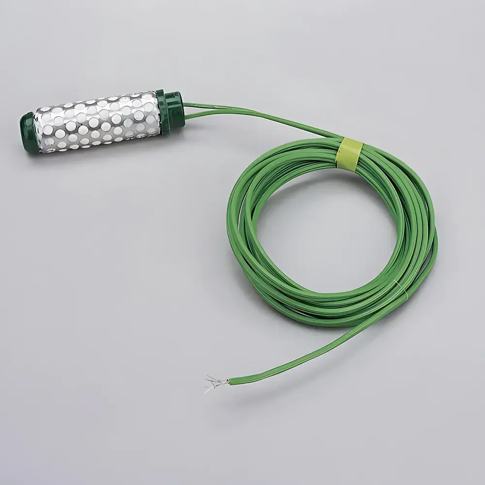
| Soil Moisture Sensor (6440) | Resistive type, 0–200 cbar range, 1 cbar resolution, 4.6 m standard cable (extendable to 30 m) |
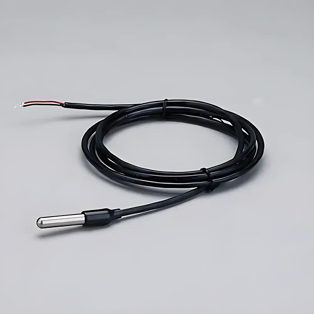
| Soil Temperature Sensor (6470) | Thermistor-based, −40 °C to +65 °C, ±0.5 °C accuracy, 1 °C resolution, 4.6 m standard cable (extendable to 244 m on 22 AWG) |
| Data Logging | Non-volatile RAM + optional SD card storage |
| Display | Backlit LCD console (151 × 86 mm active area) |
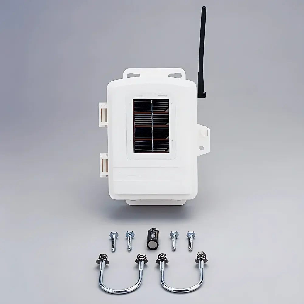
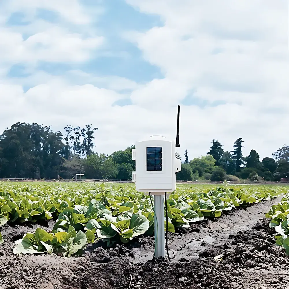
| Mounting Mast | 1 m galvanized steel tube, Ø33 mm |
| Host Dimensions | 158.75 × 57.15 × 200 mm |
| Host Weight | 0.49 kg (battery included, sensors excluded) |
| Console Dimensions | 270 × 156 × 41 mm |
| Console Weight | 0.85 kg (with batteries) |
| Software | WeatherLink v6.x (Windows/macOS), supports CSV export, time-series plotting, alarm thresholds, and multi-station aggregation |
Overview
The Davis 6345 Wireless Soil Temperature and Humidity Monitoring Station is a field-deployable environmental sensing system engineered for long-term, unattended measurement of soil water potential (matric potential) and temperature in agricultural, horticultural, ecological, and hydrological research applications. It operates on the principle of resistive soil moisture sensing—where electrical resistance across two electrodes correlates with soil water tension (cbar)—and thermistor-based temperature detection calibrated to ASTM E1112 and ISO 9001 traceable standards. Unlike capacitive or TDR-based systems, the 6440 resistive sensor provides stable, low-drift readings across diverse soil textures without requiring frequent recalibration, making it particularly suitable for seasonal monitoring of root-zone dynamics. The station integrates a solar-recharged host unit with an embedded 868 MHz ISM-band radio transceiver, enabling robust wireless telemetry under variable terrain and vegetative cover. Its architecture conforms to IEC 60529 IP65-rated enclosure specifications for outdoor electronics and is designed for continuous operation across extreme ambient conditions (−40 °C to +65 °C), supporting deployment in USDA plant hardiness zones 1–13.
Key Features
- Modular sensor configuration: Supports up to four Davis 6470 thermistor-based soil temperature probes and four Davis 6440 resistive soil moisture sensors per station—enabling vertical profile analysis or spatial replication.
- Hybrid power management: Dual-source energy system combining a 0.5 W monocrystalline solar panel and CR123A lithium primary battery ensures >2 years of maintenance-free operation under typical mid-latitude insolation (≥3.5 kWh/m²/day).
- Regulatory-compliant wireless transmission: Operates within the EU’s 868 MHz SRD band (ETSI EN 300 220-1), with 8 selectable channels and adaptive duty-cycle control to minimize interference in multi-node deployments.
- Onboard non-volatile memory: 128 KB flash RAM retains >12 months of 15-minute interval data (timestamped, CRC-verified) even during extended power loss; optional microSD expansion supports archival-grade logging.
- WeatherLink software integration: Enables automated synchronization, metadata tagging (sensor ID, depth, soil type), statistical summary (min/max/avg/std dev), and export to compliant formats (CSV, XML) for LIMS or ELN ingestion.
- Ruggedized mechanical design: UV-stabilized PVC housing (UL 94 V-0 rated), galvanized mast mount (1 m height, Ø33 mm), and industrial-grade 18 AWG shielded cabling meet NEMA 4X requirements for outdoor instrumentation.
Sample Compatibility & Compliance
The 6345 station is validated for use in mineral soils (sand to clay loam), organic substrates (peat, compost), and containerized growing media. Sensor insertion depth is configurable from 5 cm to 100 cm, with optimal performance observed at 15–30 cm for agronomic root-zone monitoring. All sensors comply with RoHS 2011/65/EU and REACH SVHC regulations. Data acquisition protocols align with ISO 11274 (soil water retention curves) and ASTM D4959 (soil moisture content by electrical resistance). When deployed in GLP or GMP-regulated trials (e.g., pesticide dissipation studies), the system supports audit-ready metadata logging—including operator ID, calibration date, sensor serial number, and environmental context tags—via WeatherLink’s secure user-access controls.
Software & Data Management
WeatherLink v6.5+ provides full lifecycle data governance: encrypted local storage, role-based access control (RBAC), and configurable alarm triggers (e.g., moisture <15 cbar for drought stress alerts). Raw sensor values are stored with 16-bit precision and annotated with hardware timestamps synchronized to UTC via NTP upon console connection. The software generates ISO/IEC 17025-aligned calibration reports when paired with Davis-certified reference standards. Export modules support direct ingestion into MATLAB, R, Python (pandas), and commercial platforms including SAS JMP and LabArchives. For FDA 21 CFR Part 11 compliance, optional electronic signature modules enable audit trails, user authentication logs, and immutable record archiving.
Applications
- Irrigation scheduling in precision agriculture: Real-time cbar data informs deficit irrigation strategies aligned with FAO-56 crop coefficient models.
- Soil physics research: Long-term matric potential profiling supports vadose zone modeling (HYDRUS-1D input), evapotranspiration partitioning, and infiltration rate estimation.
- Nursery and greenhouse management: Continuous monitoring of substrate moisture prevents overwatering-induced root hypoxia in container-grown perennials.
- Ecological restoration monitoring: Tracks rehydration kinetics in post-fire or post-mining soils to evaluate revegetation success metrics.
- Climate station networks: Scalable mesh topology allows integration with Davis Vantage Pro2 air weather stations for coupled energy–water balance analysis.
FAQ
What is the maximum recommended burial depth for the 6440 soil moisture sensor?
The 6440 is rated for continuous burial up to 1 m depth; however, optimal signal stability is achieved at 15–60 cm, where soil texture homogeneity minimizes contact resistance variability.
Can the 6345 host log data independently if the console is offline?
Yes—the host unit maintains full autonomous logging in non-volatile RAM and microSD (if installed); data syncs automatically upon console reconnection.
Is the 6470 temperature sensor suitable for water immersion?
Yes—the stainless-steel probe (316 SS) and waterproof cable junction meet IP68 specifications for continuous submersion up to 10 m depth.
How does the system handle radio interference in dense sensor networks?
Channel-hopping firmware and adjustable transmission intervals (62.5–75 s default) reduce packet collision; ETSI-compliant spectral scanning enables dynamic channel selection.
Does WeatherLink support automated report generation for regulatory submissions?
Yes—customizable templates generate PDF reports with embedded metadata, digital signatures, and version-controlled revision history per ISO/IEC 17025 clause 7.8.2.