LICA 300-TC Airborne Hyperspectral Imaging System
| Brand | LICA |
|---|---|
| Origin | Beijing, China |
| Model | 300-TC |
| Spectral Range | 400–1000 nm |
| Spectral Bands | 300 |
| Spatial Pixels per Line | 1200 |
| Max Frame Rate | 300 Hz |
| IMU Accuracy (Pitch/Roll) | <0.03° |
| IMU Accuracy (Heading) | <0.1° |
| IMU Output Rate | 1000 Hz |
| Weight | 400 g |
| Dimensions (L×W×H, w/o lens) | 110 × 75 × 70 mm |
| Power Consumption | 15 W |
| Platform Compatibility | DJI M300/M350 RTK drones with X-Port gimbal |
| Mounting Mass (system + gimbal) | ≤710 g |
Overview
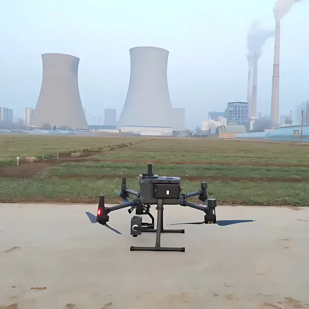
The LICA 300-TC Airborne Hyperspectral Imaging System is a compact, UAV-integrated push-broom spectrometer engineered for high-fidelity remote sensing in environmental monitoring, precision agriculture, mineral exploration, and ecological research. Based on reflective optical design and linear array CMOS detection, the system captures contiguous spectral data across the visible to near-infrared (VNIR) domain (400–1000 nm) at 300 discrete spectral bands with 1200 spatial pixels per scan line. Its core architecture integrates an imaging spectrometer, calibrated optics, a high-accuracy MEMS-based inertial measurement unit (IMU), GNSS receiver, and embedded flight control logic—enabling synchronized georeferenced data acquisition without external synchronization hardware. Designed specifically for integration with DJI Matrice 300/350 RTK platforms via the X-Port gimbal interface, the 300-TC operates as a fully self-contained payload with deterministic timing alignment between spectral capture, position, and attitude telemetry.
Key Features
- Ultra-lightweight payload: Total system mass of 400 g; integrated gimbal mass ≤710 g—compliant with DJI M300/M350 dual-sensor mounting constraints.
- High-density spectral sampling: 300 spectral channels across 400–1000 nm with <1.5 nm effective spectral resolution (FWHM), optimized for pigment, moisture, and mineral absorption feature detection.
- Real-time geometric stabilization: Onboard GPS + MEMS IMU with Kalman filtering delivers pitch/roll accuracy <0.03° and heading accuracy <0.1° at 1000 Hz output rate—critical for pixel-level geolocation fidelity in dynamic flight conditions.
- Robust thermal and mechanical design: Sealed aluminum housing rated for operation between −10°C and +50°C; shock-resistant mounting compliant with MIL-STD-810G vibration profiles typical of multirotor UAVs.
- Dual-sensor interoperability: Native support for simultaneous operation with DJI Zenmuse L1, P1, or third-party payloads via M300’s dual gimbal interface—enabling fused LiDAR/hyperspectral or RGB/hyperspectral analysis workflows.
- Low-power operation: 15 W nominal power draw compatible with M300’s auxiliary power distribution unit (PDU), minimizing impact on total mission endurance.
Sample Compatibility & Compliance
The 300-TC is designed exclusively for aerial deployment and does not support benchtop or ground-based static measurements. It complies with IEC 60950-1 for electrical safety and meets CE marking requirements for electromagnetic compatibility (EMC) under Directive 2014/30/EU. All firmware and data acquisition protocols adhere to ISO 19115 metadata standards for geospatial datasets. The system supports export-controlled spectral data formats (ENVI .hdr/.bin, GeoTIFF with embedded RPCs) and is compatible with processing pipelines aligned with USGS ESPA and ESA SNAP standards. While not certified for aviation regulatory approval (e.g., FAA Part 107 or EASA UAS operational authorization), it is intended for use only by operators holding appropriate national UAV operating permits.
Software & Data Management
Mega Cube software provides end-to-end processing for 300-TC raw data, supporting automated radiometric calibration using factory-derived spectral response curves and dark current compensation. Geometric correction includes both flat-Earth orthorectification (requiring no DEM) and high-precision DEM-driven orthorectification with sub-pixel resampling (bilinear and cubic convolution). Reflectance retrieval is enabled via two validated methods: (1) field spectrometer–guided spectral matching with temporal synchronization <1 ms, ensuring robustness under variable solar irradiance; and (2) ground calibration target–based normalization using multiple reflectance panels (e.g., Spectralon® 20%, 50%, 99%) across overlapping flight lines. Batch processing supports automated radiometric calibration, geometric correction, orthorectification, and reflectance conversion in a single workflow—exporting to ENVI, ArcGIS, or Python-compatible HDF5 formats. Audit trails and processing parameter logs are retained per dataset, satisfying GLP-aligned documentation requirements for environmental monitoring programs.
Applications
- Precision agriculture: Detection of nitrogen stress, chlorophyll content, water status, and early disease onset via spectral indices (e.g., NDVI, PRI, MCARI) derived from calibrated reflectance cubes.
- Environmental monitoring: Mapping invasive species (e.g., Tamarix, Phragmites), wetland vegetation zonation, and post-fire succession dynamics using spectral unmixing and classification algorithms.
- Geological surveying: Identification of clay minerals (kaolinite, smectite), iron oxides, and hydroxides through diagnostic absorption features near 700 nm, 900 nm, and 1400 nm.
- Urban material mapping: Differentiation of roofing materials, pavement types, and building façade coatings based on spectral library matching (USGS, ECOSTRESS, or custom libraries).
- Coastal and inland water quality: Estimation of chlorophyll-a concentration, suspended sediment load, and CDOM absorption using semi-empirical and machine learning regression models trained on in situ measurements.
FAQ
Is the 300-TC compatible with non-DJI UAV platforms?
The system is mechanically and electrically optimized for DJI Matrice 300/350 RTK via the X-Port gimbal interface. Integration with other airframes requires custom mechanical mounting, power regulation, and MAVLink/SDK-level telemetry bridging—not supported out-of-the-box.
Does the system include factory spectral calibration certificates?
Yes—each unit ships with NIST-traceable radiometric calibration files (including relative spectral response, dark current map, and non-uniformity correction coefficients) valid for two years from date of manufacture.
Can Mega Cube process data from other hyperspectral sensors?
Mega Cube natively supports only LICA 300-TC raw data formats. Support for third-party sensors (e.g., Headwall Nano-Hyperspec, Specim FX10) requires format conversion and manual parameter injection—outside standard warranty coverage.
What is the recommended ground sampling distance (GSD) for optimal data quality?
At 100 m AGL with default 25 mm focal length lens, GSD is ~3.5 cm/pixel. For quantitative analysis, we recommend maintaining GSD ≤5 cm/pixel and forward overlap ≥80% to ensure sufficient SNR and stereo redundancy for orthomosaic generation.
Is remote firmware update capability available?
Firmware updates are performed via USB-C connection using LICA’s certified desktop utility. Over-the-air (OTA) updates are not implemented due to aviation safety restrictions on wireless firmware modification during flight operations.
")